Advertisement
If you have a new account but are having problems posting or verifying your account, please email us on hello@boards.ie for help. Thanks :)
Hello all! Please ensure that you are posting a new thread or question in the appropriate forum. The Feedback forum is overwhelmed with questions that are having to be moved elsewhere. If you need help to verify your account contact hello@boards.ie

Possible Storm / Strong winds 26th to 28th October 2013 ?

Options
13468912

Comments

  • Registered Users Posts: 12,778 ✭✭✭✭ninebeanrows


    Latest NAE has it missing most of England!

    Would be serious fun and games in the UK if it missed.

    The thing has already been hyped up to such a level that even if the most severe
    charts we've seen hit them, it would be below their expectations. But a complete miss and i'd fear for the MetO!

    13102806_2606.gif


  • Registered Users Posts: 7,119 ✭✭✭pad199207


    Id laugh if it did! Netweather would go into meltdown for all the wrong reasons.


  • Registered Users Posts: 3,495 ✭✭✭Pa ElGrande


    Net Zero means we are paying for the destruction of our economy and society in pursuit of an unachievable and pointless policy.


  • Closed Accounts Posts: 510 ✭✭✭dopolahpec


    The English have lost the run of themselves with regards this low. '48 hour mega storm' lol. The very far southern coasts of England look like getting clipped with storm force winds. That's it.


  • Registered Users Posts: 11,134 ✭✭✭✭maquiladora


    dopolahpec wrote: »
    The English have lost the run of themselves with regards this low. '48 hour mega storm' lol. The very far southern coasts of England look like getting clipped with storm force winds. That's it.

    You're making the mistake of listening to the media about the weather instead of looking at the charts. The media is in the business of making money, and in their business the bigger the headline the bigger the money.

    As for how bad it will be, it's too early to tell. The most extreme solution this morning would be the GEM run which has a deepening low of 962mb in the middle of the country with sustained winds of 40-45 knots right in the midlands. With a possible sting jet gusts would be up to ~100 mph if that came off.

    It's not the most likely outcome now I think, but still possible.

    UV_PN_UU_VV_054_12000.gif


  • Advertisement
  • Moderators, Category Moderators, Computer Games Moderators, Society & Culture Moderators Posts: 8,463 CMod ✭✭✭✭Sierra Oscar


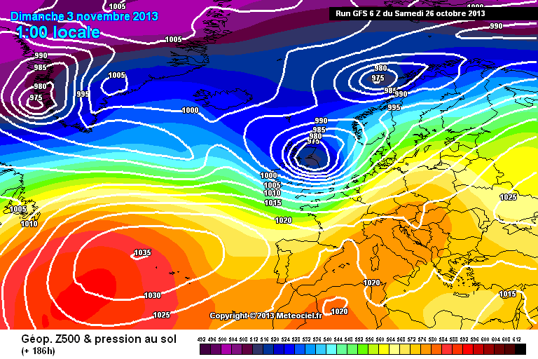
    The models are starting to hint at another intense wind storm next weekend that would impact on Ireland. Still way too far out to say for certain if it will even happen though.

    gfs-0-183-3h_dzv3.png

    gfs-0-186.png?6


  • Registered Users Posts: 2,677 ✭✭✭kit3


    As things stand, how are things looking for Dublin on Monday morning ?


  • Closed Accounts Posts: 3,047 ✭✭✭Clonmel1000


    Cause the Irish never hype up weather events......


  • Registered Users Posts: 7,138 ✭✭✭snaps


    A lovely picture of the depression winding up to the NW. The front can be seen clearly over East Ireland. Just starting to get dark here now (South East Poland) as you can see on the right of the picture. Beautiful day here yet again, 21c, blue skies. I moved from Ireland at the start of September, so 7 weeks in and only had 5 wet days.

    277749.jpg


  • Registered Users Posts: 11,134 ✭✭✭✭maquiladora


    Notice that this has been added by Met Eireann this evening :
    Outlook is for some very disturbed weather.

    A storm depression is expected to track to the southeast of Ireland overnight Sunday and in to Monday bringing the very worst conditions in over Wales and England. However we can expect some nasty conditions also with some very heavy rain in many areas and local flooding: the potential of some very severe winds also on parts of the east and southeast coasts for a time.

    The reason for this is the 12Z HIRLAM has really ramped up Monday's low into a 960mb depression crossing the UK with strong gales along southeast and east coasts here, touching storm force at times, with violent storm force at times in the Irish Sea and hurricane force winds shown around the coast of southwest England and Wales. Potential for a serious windstorm for those areas in the UK if that came off even if there wasn't a sting jet or strong convective gusts.

    It's only one model, but HIRLAM at 48 hours is usually pretty good.


  • Advertisement
  • Registered Users Posts: 2,271 ✭✭✭TireeTerror


    The Met office in the UK has said there were hopes this would along the channel, however they are certain the UK will feel the full force of the hurricane on Sunday morning.


  • Closed Accounts Posts: 70 ✭✭Mesut Ozil


    The Met office in the UK has said there were hopes this would along the channel, however they are certain the UK will feel the full force of the hurricane on Sunday morning.

    What hurricane?


  • Registered Users Posts: 2,271 ✭✭✭TireeTerror


    umm I mean storm! :D Subconsciously I must be getting excited for this event!


  • Moderators, Recreation & Hobbies Moderators Posts: 3,922 Mod ✭✭✭✭Planet X


    The Met office in the UK has said there were hopes this would along the channel, however they are certain the UK will feel the full force of the hurricane on Sunday morning.

    ......or Monday morning?


  • Registered Users Posts: 2,271 ✭✭✭TireeTerror


    Thats it, Im getting the noose.....


  • Moderators, Home & Garden Moderators, Science, Health & Environment Moderators Posts: 17,720 Mod ✭✭✭✭DOCARCH


    Thats it, Im getting the noose.....

    :eek:


  • Registered Users Posts: 8,720 ✭✭✭Hal1


    Maybe he meant moose? moose hearder possibly?


  • Registered Users Posts: 191 ✭✭ElizaT33


    The latest Satellite pic makes it look like its headed straight for us .....:eek:. I've a LOT of old trees around my house .......


  • Registered Users Posts: 14,338 ✭✭✭✭M.T. Cranium


    Have a look at this recent satellite picture. The "primary" low is the small circular feature west of Donegal and this one will be responsible for just some moderately strong wind gusts in Ireland tonight and tomorrow.

    The large expanse of cloud in the middle of the Atlantic northwest of the Azores and about due south of the east coast of Greenland is the developing "secondary" low. At this point in time, ship reports indicate that there is no strong circulation yet, winds are only 20-30 knots. This is the storm in its infant stages. You can also see what's left of former Tropical Storm Lorenzo as a patch of orange in the warm sector of this storm. There again, winds with that cloud mass are probably around 20-30 knots. In the Azores right now it's cloudy, misty or drizzly for some locations and very mild for time of day (20-22 C) and a light south wind is reported.

    So not to worry about "the storm" heading right for Ireland, that's the lesser of two evils and it's going to weaken gradually overnight and tomorrow as it passes to the north. The secondary will keep moving along in the jet stream and won't begin to develop much (according to most models) until it gets off the south coast of Ireland around 9 p.m. Sunday, then by about 0300h it will be explosively deepening somewhere between Wexford and Bristol. In that phase, winds could still be quite calm on the northern flank but eventually the strong circulation will pull in the air mass you can see on the satellite image flowing away from Greenland, that will have crossed the Atlantic so it won't be all that cold any more, maybe 7-9 C but it will be rather unstable so it is likely to fill up with bands of showers. The radar over Ireland is likely to show these by mid-day Monday.

    I'm still thinking this storm will track into southern England and agree it could be somewhat over-hyped in some quarters but I do expect some minor damage at least, and gusts that could reach 70 knots in well exposed locations. Really to be very frank, nobody knows within 10-15 knots how strong this could become, the guidance is well scattered and not every single factor you look for in severe wind forecasting is at a 10/10 checkpoint, the jet stream could be a bit stronger, and the wind shear is only moderate. On the other hand, sea surface and air mass temperatures are anomalously high giving plenty of energy potential. I think we have to take a compromise of all guidance at this point and say moderately strong likely, very strong possible.

    It will make for a very interesting day of weather watching on Monday, but the chances of severe wind gusts in Ireland from this storm are very low, the peak gusts will come before this storm arrives and then again well after it passes. It would not be surprising if some places were almost calm when the thing goes by to the southeast on Sunday night.


  • Registered Users Posts: 1,462 ✭✭✭vickers209


    Met Have a yellow warning out for tonight and tomorrow morning

    National Weather Warnings

    STATUS YELLOW

    Wind Warning for Ireland

    Strong to gale force southwest to westerly winds will gust 80 to 90 km/h., at times during Sunday. Winds may occasionally gust up to 100km/h., along parts of the West and Northwest Coasts.
    Issued:
    Saturday 26 October 2013 19:00
    Valid:
    Sunday 27 October 2013 06:00 to Sunday 27 October 2013 15:00


  • Advertisement
  • Moderators, Category Moderators, Computer Games Moderators, Society & Culture Moderators Posts: 8,463 CMod ✭✭✭✭Sierra Oscar


    Latest GFS doesn't show much of a storm impact on England at all. In fact the storm has essentially disappeared on the latest run.

    ukwind.png

    All eyes on the next run ...


  • Closed Accounts Posts: 510 ✭✭✭dopolahpec


    Feck all storm on the GFS 18Z


  • Registered Users Posts: 14,338 ✭✭✭✭M.T. Cranium


    18z GFS not always the best guidance and nobody in the business would change a forecast just on its input alone, I'm sure it has prompted some concern but most will wait for the 00z models before assuming too much here.


  • Registered Users Posts: 33,729 ✭✭✭✭RobertKK


    The express has done a storm damage report, says the storm will cost the UK £1 billion.
    Mystic Meg must be very busy working for the Daily Express.


  • Registered Users Posts: 35,696 ✭✭✭✭BorneTobyWilde


    Can someone explain how this storm will ''batter UK'', yet hit Ireland as a breeze seeing as it hits Ireland first


  • Registered Users Posts: 35,696 ✭✭✭✭BorneTobyWilde


    Sky News act like Ireland does not exist, ''storm will hit west coast of UK'
    Hello Ireland is in the way !


  • Closed Accounts Posts: 1,635 ✭✭✭loubian


    Can someone explain how this storm will ''batter UK'', yet hit Ireland as a breeze seeing as it hits Ireland first

    When we had the heatwave the UK issued a national energency because it was 31/32 eegrees Celsius! They want drama!!


  • Registered Users Posts: 6,668 ✭✭✭Wanderer2010


    Any idea will this affect any flights from Cork to London next week, I have one on Thursday afternoon, never flew from Cork before dont know their record for cancellations etc, I hope its not that bad..


  • Closed Accounts Posts: 485 ✭✭Play To Kill


    Sky News act like Ireland does not exist, ''storm will hit west coast of UK'
    Hello Ireland is in the way !

    It doesn't have to hit Ireland first

    alt_IMG.jpg


  • Advertisement
  • Registered Users Posts: 6,316 ✭✭✭sunbabe08


    Sky News act like Ireland does not exist, ''storm will hit west coast of UK'
    Hello Ireland is in the way !

    pffft nothing new there. we're lucky that have us on the map at all. bbc completely ignore us.


Advertisement