Advertisement
If you have a new account but are having problems posting or verifying your account, please email us on hello@boards.ie for help. Thanks :)
Hello all! Please ensure that you are posting a new thread or question in the appropriate forum. The Feedback forum is overwhelmed with questions that are having to be moved elsewhere. If you need help to verify your account contact hello@boards.ie

Ex Katia storm thread - TECHNICAL DISCUSSION, FORECASTS AND OBSERVATIONS ONLY!

Options
12829303133

Comments

  • Registered Users Posts: 5,565 ✭✭✭Pangea


    I'd say I am getting the strongest winds at the moment here.


  • Registered Users Posts: 5,112 ✭✭✭John mac


    still blowing a gale here (foxford) we have had loads of rain and mist all day


  • Closed Accounts Posts: 1,634 ✭✭✭Mayo Exile


    Image around 1.40 PM BST today.

    174134.jpg


  • Registered Users Posts: 515 ✭✭✭martic


    A video I made of Ex Katia as it passes through Donegal from 8.30AM until 4.30PM. Wind was at it worst between 10 and 12


  • Closed Accounts Posts: 6,466 ✭✭✭Lumi


    Harps wrote: »
    its more the duration than the strength thats notable, still no sign of it letting up here

    Capture-3.jpg

    Exactly, we've had reasonably consistent mean wind speeds since 5am with the strongest gusts between 8.00-9.30am ish

    It's starting to ease a little now but still gusting up to 33mph

    www.galwaycityweather.com


  • Advertisement
  • Registered Users Posts: 614 ✭✭✭Saaron


    Has been windy here in Ballsbridge all day yet nothing more than a strong wind that we get every year. It was even sunny and pretty warm too. Was hoping for a more exciting storm, ah well!


  • Registered Users Posts: 5,112 ✭✭✭John mac


    Saaron wrote: »
    Has been windy here in Ballsbridge all day yet nothing more than a strong wind that we get every year. It was even sunny and pretty warm too. Was hoping for a more exciting storm, ah well!

    you need to move to the west coast :D

    Wind easing off here now , (foxford, for those who have new fangled interweb on mobile phones )


  • Registered Users Posts: 1,508 ✭✭✭Ayla


    It's been blustery all day here (south Donegal) although it's hard to tell if it's been anything worse then what we'd get on a typical autumnal day. Some leaves blowing around but no branches. If I hadn't gotten into the excitement of this thread I'd have hardly passed any notice of the day's weather.

    Still quite blustery now & a bit of rain passing through.


  • Closed Accounts Posts: 454 ✭✭irishdub14


    Well that was a nice day, bit breezy but nice. Was expecting Hurricane Irene scenes....


  • Registered Users Posts: 10,509 ✭✭✭✭dsmythy


    116 km/h gust recorded at Glasgow Airport

    irishdub14 wrote: »
    Well that was a nice day, bit breezy but nice. Was expecting Hurricane Irene scenes....

    I guess you should have looked at the forecasts then.


  • Advertisement
  • Registered Users Posts: 1,379 ✭✭✭snow ghost


    I knew when I saw the crows back early this morning that it wasn't going to be anything special, but I said nothing hoping the crows had got it all wrong... but no the sneaky bastards were right on the button. :mad:


  • Registered Users Posts: 15,849 ✭✭✭✭Discodog


    More Rover reports (second dogwalk)

    The Sky is odd - really angry looking low cloud but no precip. It still feels very warm, almost balmy even though the wind is WSW. The wind had died down a lot but their are still 30 mph gusts lurking in there.

    The sea is not very high but the tide is very odd. It is trying to go out but it's being pushed back by the wind & swell. So a wave rolls up the beach & appears to almost hang there before slowly rolling back.


  • Registered Users Posts: 5,565 ✭✭✭Pangea


    I'm surprised at the duration of strong winds here. Trees are still shaking away and there is some very strong gusts.


  • Registered Users Posts: 5,495 ✭✭✭bb1234567


    so is the hurrican gone now..because I hardly noticed any difference to the weather in dublin today. Blustery and strong winds at times and a few light showers but mostly sunny and warm today..dissapointing hurricane :rolleyes: oh and ive been hearing that theres is another hurricane 'maria' coming and thats is supposed to be really strong or something is there another hurrican actually coming and how strong will it be? I'd love a big powerful storm:D


  • Closed Accounts Posts: 6,388 ✭✭✭gbee


    snow ghost wrote: »
    . but no the sneaky bastards were right on the button. :mad:

    I know, woken at 3am with a huge gust that was confirmed by my WS, went out the back about 10am and was surrounded by Starlings looking for food!


  • Closed Accounts Posts: 5,550 ✭✭✭Min


    Tropical storm Katia slams into Ireland, Britain

    Associated Press, on my twitter feed.
    DUBLIN (AP) -- Tropical Storm Katia shut down roads and power and led to one death Monday in Ireland and Britain, where residents braced for the strongest wind gusts in 15 years.
    Forecasters in both countries said Monday's gusts topped 80 mph (125 kph) as the storm - previously a hurricane as it roared across the Atlantic - made driving, shipfaring and even walking dangerous in broad swathes of Ireland, Scotland and northern England.
    In northeast England's County Durham, a driver died after a tree fell on a car on the highway, Durham police said. Officers later warned all drivers to be careful driving through the high winds.

    Full story at http://hosted.ap.org/dynamic/stories/E/EU_EUROPE_TROPICAL_STORM?SITE=AP&SECTION=HOME&TEMPLATE=DEFAULT&CTIME=2011-09-12-16-12-44

    Someone should have told AP we don't get tropical storms in Ireland.


  • Registered Users Posts: 11,303 ✭✭✭✭Frank Bullitt


    Much calmer here now in Dublin 3, nowhere near as bad as earlier, good few downed trees about.


  • Registered Users Posts: 45,863 ✭✭✭✭muffler


    What do we talk about next? :confused: :pac:


  • Registered Users Posts: 763 ✭✭✭H2UMrsRobinson


    muffler wrote: »
    What do we talk about next? :confused: :pac:
    I know I feel so deflated, I wasn't expecting Katiageddon - experience has taught me otherwise, but even so you can't help but wish for a bit more excitement from an impending weather system !


  • Registered Users Posts: 10,085 ✭✭✭✭Oscar Bravo


    Anyone living near Shannon Airport?? Met Reports at 2200 show 24mm of rain for the hour.(edit,i looked at it around 2230 and it said 24.0mm's,has now been amended)


  • Advertisement
  • Registered Users Posts: 5,565 ✭✭✭Pangea


    Gusts of 50 Knots in Malin on latest reports.


  • Registered Users Posts: 9,233 ✭✭✭sdanseo


    Min wrote: »
    Tropical storm Katia slams into Ireland, Britain

    Associated Press, on my twitter feed.


    Full story at http://hosted.ap.org/dynamic/stories/E/EU_EUROPE_TROPICAL_STORM?SITE=AP&SECTION=HOME&TEMPLATE=DEFAULT&CTIME=2011-09-12-16-12-44

    Someone should have told AP we don't get tropical storms in Ireland.

    No, but to all intents and pruposes it was one.

    It has mean windspeed above 39mph, and it a cyclone. Only for the fact that it is not in the tropics, it would be officially called a tropical storm. As is, it's a post-tropical or extra-tropical depresson that is no longer named, but that was, at one stage, named Katia. It's the same system, therefore I see no reason why it can;t be still referred to as same.


  • Registered Users Posts: 10,509 ✭✭✭✭dsmythy


    sdeire wrote: »
    No, but to all intents and pruposes it was one.

    It has mean windspeed above 39mph, and it a cyclone. Only for the fact that it is not in the tropics, it would be officially called a tropical storm. As is, it's a post-tropical or extra-tropical depresson that is no longer named, but that was, at one stage, named Katia. It's the same system, therefore I see no reason why it can;t be still referred to as same.

    The fact that it is not warm-core seals it's fate for me personally. Ex-(former name of system) seems the best short hand description imo.


  • Registered Users Posts: 14,366 ✭✭✭✭M.T. Cranium


    Post-storm thoughts ...

    Good thing that the storm did not reach sub-960 mb central pressures as some models had depicted around 48-72h, on the track it followed, that would have increased wind gusts by 10 knots or more. I say good thing from the public perspective, not the forum perspective.

    After all the slight twists and turns in the models, the track and the timing were close to the 5d consensus and every consensus thereafter. So on the whole the models had a good handle on the storm.

    There was not very much development of the frontal zone late overnight, this was probably due to the extremely stable parameters of the warm sector and the limited mixing before the zone moved east away from Ireland. Many comments on here pointed to how the westerly flow felt mild, even though temperatures had fallen off 3-5 degrees from highs reached around 0300h, but with autumn storms (as some commented) you get a more unstable polar air stream blasting around the centre and this is generally much colder than the ocean. In this case, the "cold" air was from a westerly origin and it was about the same temperature as the ocean, so it remained rather stable too.

    Some of the media hype on this storm was borderline unfathomable, especially the UK newspaper story about a storm as bad as 1987. Even on the tip of Malin Head or near the summit of Snowdon in Wales, this storm was nowhere near as windy as the squall line of the October 1987 storm which produced recorded gusts between 90 and 110 knots, as well as probable tornadic streaks. I thought the general idea in this and the chat thread, saying that the storm was about midway between the May and last November (Carmen) storms, was about right (from the numbers, obviously I'm not there, my maximum gust today was about 20 knots !!).

    Thanks to all who gave valuable insights into forecast potential as we approached this storm, I would not want to start naming people because the list is extensive and I'd forget one or two.

    Now it's on to the next big weather story ... which does not appear too imminent. It seems that if May and September can cough up fairly impressive windstorms, we should be in for some special events in the prime storm season still ahead.


  • Registered Users Posts: 293 ✭✭eilejh


    Lots of brilliance on this Board


  • Registered Users Posts: 5,272 ✭✭✭Deedsie


    From the daily forecast thread... SATURDAY ... Becoming rather windy with blustery showers especially across the north and west, winds WNW 30-50 mph, lows near 7 C and highs near 14.

    Is there any scope for that weather to change? I have a 90 k cycle Saturday heading up to Galway from North Tipp. With the weather like that it will be very tough. Any chance of a change? What time will the winds reach 30-50 on Saturday? The cycle is at 9am


  • Closed Accounts Posts: 4,279 ✭✭✭Su Campu


    sdeire wrote: »
    No, but to all intents and pruposes it was one.

    It has mean windspeed above 39mph, and it a cyclone. Only for the fact that it is not in the tropics, it would be officially called a tropical storm. As is, it's a post-tropical or extra-tropical depresson that is no longer named, but that was, at one stage, named Katia. It's the same system, therefore I see no reason why it can;t be still referred to as same.

    If that storm were in the tropics it wouldn't be called a tropical storm as it's totally different structurally. Actually, you wouldn't get it in the tropics, the same way we don't get tropical storms - as per definition - in these latitudes. Katia WAS a tropical storm and hurricane, but had transitioned into an extra-tropical storm - with associated fronts and windfield - by the time it reached us.

    Don't go to the newspapers for educational purposes.....
    Tropical Storm:A tropical cyclone in which the maximum sustained surface wind speed (using the U.S. 1-minute average) ranges from 34 kt (39 mph or 63 km/hr) to 63 kt (73 mph or 118 km/hr).
    Tropical Cyclone:A warm-core non-frontal synoptic-scale cyclone, originating over tropical or subtropical waters, with organized deep convection and a closed surface wind circulation about a well-defined center. Once formed, a tropical cyclone is maintained by the extraction of heat energy from the ocean at high temperature and heat export at the low temperatures of the upper troposphere. In this they differ from extratropical cyclones, which derive their energy from horizontal temperature contrasts in the atmosphere (baroclinic effects).


  • Registered Users Posts: 16,660 ✭✭✭✭nacho libre


    Now it's on to the next big weather story ... which does not appear too imminent. It seems that if May and September can cough up fairly impressive windstorms, we should be in for some special events in the prime storm season still ahead.

    I get the feeling some of us are not going to like your winter forecast. Still if we can't get a sustained freeze, a major storm or two would be a good compromise.


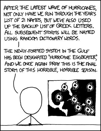
  • Registered Users Posts: 1,572 ✭✭✭DominoDub


    hurricane_names.png


  • Advertisement
  • Registered Users Posts: 4,219 ✭✭✭Poochie05


    I found this thread extremely informative, thanks to the knowledgeable contributors and I too was a little disappointed with the 'event' despite knowing the forecasts weren't predicting anything too dramatic and also being tucked away in the SE. I came across some interesting historical data in this paper on the impact of hurricanes on the weather of Western Europe which might interest some of you:
    http://www.intechopen.com/source/pdfs/15321/InTech-The_impact_of_hurricanes_on_the_weather_of_western_europe.pdf

    The paper refers to the highest recorded value of 182km/hr from Debbie in 1961 at Malin Head and Debbie also generated the highest values for sustained winds.


Advertisement