Advertisement
If you have a new account but are having problems posting or verifying your account, please email us on hello@boards.ie for help. Thanks :)
Hello all! Please ensure that you are posting a new thread or question in the appropriate forum. The Feedback forum is overwhelmed with questions that are having to be moved elsewhere. If you need help to verify your account contact hello@boards.ie

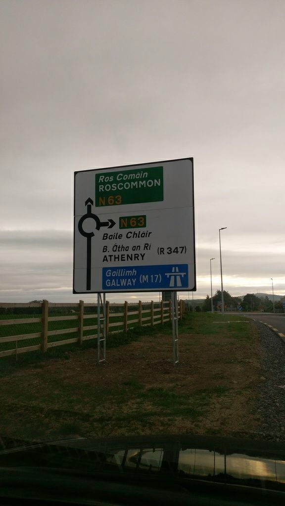
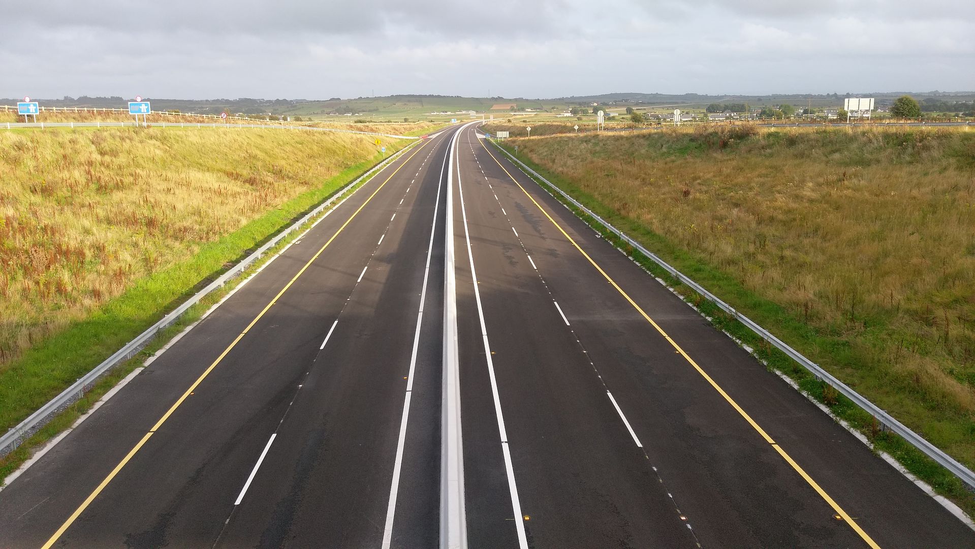
M17/M18 - Gort to Tuam [open to traffic]

Options
1221222224226227319

Comments

  • Registered Users Posts: 5,543 ✭✭✭veryangryman


    I'm checking the maps now with regard to the N5.

    Should Dublin->Westport now be done via the N5 (and signposted as such)? It looks much more efficient to do m4->m6->m17->n17->Rwhatever to the town.


  • Registered Users Posts: 19,396 ✭✭✭✭road_high


    I'm checking the maps now with regard to the N5.

    Should Dublin->Westport now be done via the N5 (and signposted as such)? It looks much more efficient to do m4->m6->m17->n17->Rwhatever to the town.

    I asked the same a while back and was told it's still considerably longer via that route. The N5 will remain the main route from Dublin/east


  • Registered Users Posts: 4,322 ✭✭✭m17


    Panda wrote: »
    I drive that road every day and I noticed when we had a few days of heavy rain recently (around 2 weeks ago maybe) the large reservoir area beside the road filled up nicely. (The light grey/yellow area in the middle of this pic: http://connachttribune.ie/wp-content/uploads/2016/07/kiltiernan-interchange.jpg )

    The road stayed above water but it's hard to say what would happen if there was a week or two of sustained rain in winter.

    It's hard to see any drainage route from the area. It seems like the water has mainly just evaporated since...

    Where are you going with that pic that's over 18 months old I think this is the pic your looking forIMAG2739_zpsit57wico.jpg


  • Posts: 0 [Deleted User]


    Anyone out cycling the new road, if you could capture the GPS of your trip and send me the gpx file, I can use it to refine the drawings on openstreetmap.

    Alternatively, upload them straight to osm and just give me a shout

    Also, anyone with drones, I would really appreciate some shots of the junctions and their connections, taken from directly over head.


  • Registered Users Posts: 988 ✭✭✭Benbecul97


    m17 wrote: »
    Where are you going with that pic that's over 18 months old I think this is the pic your looking for

    Its irrelevant if the picture is 18 months old - what is relevant / worrying is that the large reservoir area beside the road filled up....it's hard to say what would happen if there was a week or two of sustained rain in winter.


  • Advertisement
  • Registered Users Posts: 14,309 ✭✭✭✭wotzgoingon


    I wonder when google will update their maps to show the M17/M18? I wonder if they will be really efficient and do it straight away after it opens or will they drag their feet and not bother updating.


  • Registered Users Posts: 459 ✭✭Czhornet


    Benbecul97 wrote: »
    Its irrelevant if the picture is 18 months old - what is relevant / worrying is that the large reservoir area beside the road filled up....it's hard to say what would happen if there was a week or two of sustained rain in winter.

    There is an overflow from these settlement ponds to a watercourse. They will never get much higher than the road in the middle of the pond or the zig-zag water break feature in the 1st pond.


  • Moderators, Science, Health & Environment Moderators Posts: 4,977 Mod ✭✭✭✭spacetweek


    m17 wrote: »
    Annagh hill 18/05/162017-08-16_10-53-50_zpsju0fhuaq.jpg18/08/17IMAG2084_zpslqa7g79t.jpgthe tii must have money to burn
    I'm mystified why that sign needed to be changed. Looked right the first time.


  • Registered Users Posts: 1,686 ✭✭✭muddle84


    road_high wrote: »
    I'm checking the maps now with regard to the N5.

    Should Dublin->Westport now be done via the N5 (and signposted as such)?  It looks much more efficient to do m4->m6->m17->n17->Rwhatever to the town.

    I asked the same a while back and was told it's still considerably longer via that route. The N5 will remain the main route from Dublin/east
    Its an option but once you get to Tuam heading for Westport its a pretty bad road. With the direct route from Tuam it will still be in the region of 20km longer than the Longford route. If you went Via Claremorris and Castlebar from Tuam ( this would be a better road) that adds another 10km to the route. I think the Longford route will be faster.


  • Registered Users Posts: 14,309 ✭✭✭✭wotzgoingon


    spacetweek wrote: »
    I'm mystified why that sign needed to be changed. Looked right the first time.

    I was like that a good number of years ago when all the signs got changed from a single ticker round bar to those thinner double with cross beam strengtheners that are in those pictures above. Anyone remember that. The signs were there for years with the thicker bar never fell down and some muppet with money to burn says lets change all signs.


  • Advertisement
  • Registered Users Posts: 1,686 ✭✭✭muddle84


    paul2013 wrote: »
    I don't want any smart remarks for my comments anymore, Thank you.

    Just after cycling the new M18 from Gort to Athenry, I intend cycling the M17 from Athenry to Tuam later on today. It's a beautiful road. Does anyone know if they addressed the problems with the flooding in Kiltartan on the existing N18?
    Is that directed at me? I didn't make any smart comments thus the reason for me asking??


  • Registered Users Posts: 1,015 ✭✭✭Kevwoody


    I was like that a good number of years ago when all the signs got changed from a single ticker round bar to those thinner double with cross beam strengtheners that are in those pictures above. Anyone remember that. The signs were there for years with the thicker bar never fell down and some muppet with money to burn says lets change all signs.


    Any pole bigger than 89mm thick which was in a 100km/h zone was changed to the above type of support, which is called a dynamast, or changed to a pole known as a Jerol Pole, which is made from plastic and is designed to shear off at ground level following an impact.
    The reason bigger poles were replaced with these supports was to minimise damage to vehicles upon impact, and therefore save lives.

    But sure hey, it was probably only to "burn" money as you say.


  • Moderators, Entertainment Moderators, Science, Health & Environment Moderators Posts: 14,361 Mod ✭✭✭✭marno21


    spacetweek wrote: »
    I'm mystified why that sign needed to be changed. Looked right the first time.

    Second sign is 100% correct.

    First sign could be made correct by removing the N63 and replacing it with (R354) in black text on white background.


  • Registered Users Posts: 98 ✭✭paul2013


    muddle84 wrote: »
    Is that directed at me? I didn't make any smart comments thus the reason for me asking??

    No I'm not directing anything at you, Its someone else who keeps mocking me over a previous job I had collecting milk and meeting traffic at the bridge in Kilcreest (Soon to be defunct N66) before I got accepted into the Gardaí


  • Registered Users Posts: 98 ✭✭paul2013


    Anyone know where the N66 route will end up? when the road is going to be downgraded once the new M18 opens up


  • Closed Accounts Posts: 772 ✭✭✭the dark phantom


    paul2013 wrote: »
    Anyone know where the N66 route will end up? when the road is going to be downgraded once the new M18 opens up

    Going to be with the N79 in the grave.


  • Registered Users Posts: 1,824 ✭✭✭godskitchen


    I'm checking the maps now with regard to the N5.

    Should Dublin->Westport now be done via the N5 (and signposted as such)? It looks much more efficient to do m4->m6->m17->n17->Rwhatever to the town.

    I'll be taking the m4->m6->m17->n17 route for any Dublin to castlebar /westport runs. It could be 60km longer and it would still be quicker once opened.

    The rest of ye can stay on the n5 stuck behind a tractor outside Frenchpark.


  • Moderators, Entertainment Moderators, Science, Health & Environment Moderators Posts: 14,361 Mod ✭✭✭✭marno21


    paul2013 wrote: »
    Anyone know where the N66 route will end up? when the road is going to be downgraded once the new M18 opens up
    The entire N66 route as it is at present will just become the R380 with 80km/h limit.

    The cantilever at the junction northbound will require changing as well which will probably mean a temporary road closure.


  • Registered Users Posts: 4,322 ✭✭✭m17


    The m17 at sheeaunpark looking towards tuam 17/08/17IMAG2088_zpsk2jg0qso.jpg
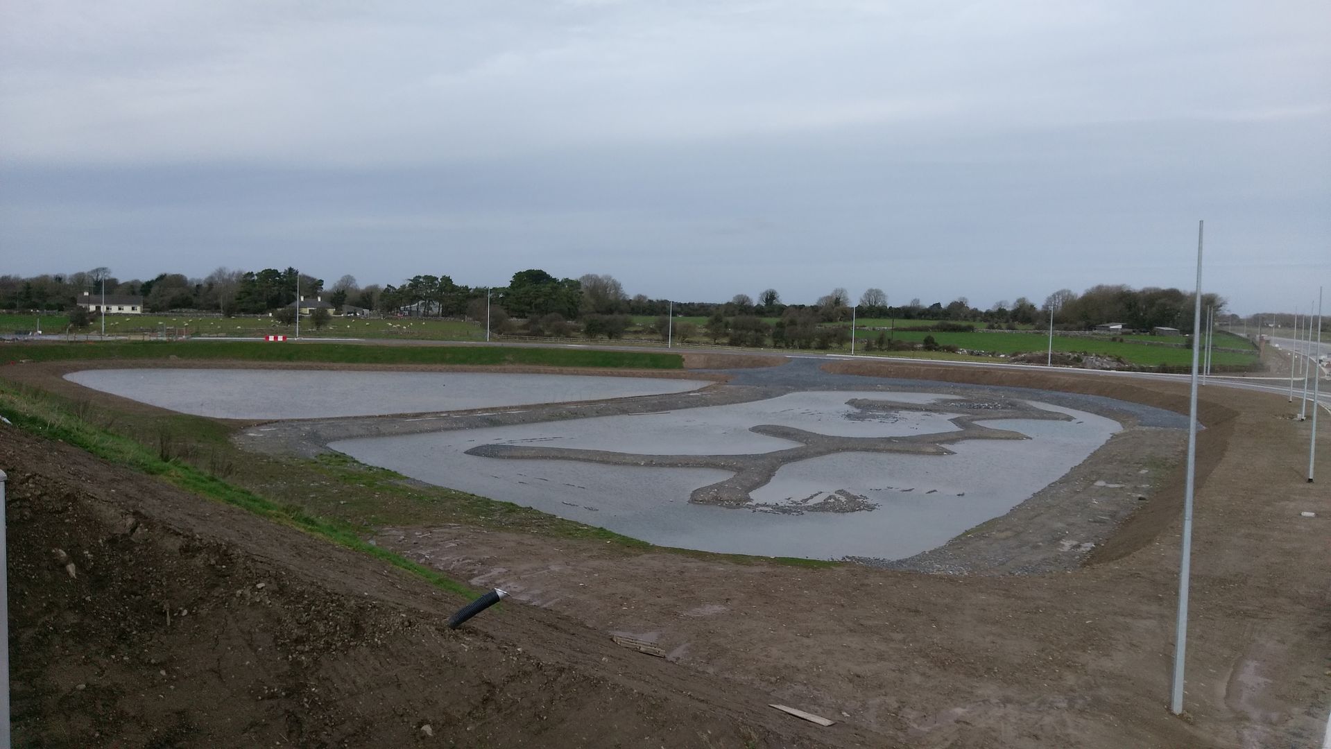
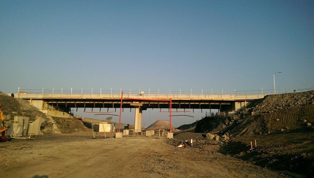
sheeaunpark looking towards rathmorrissy
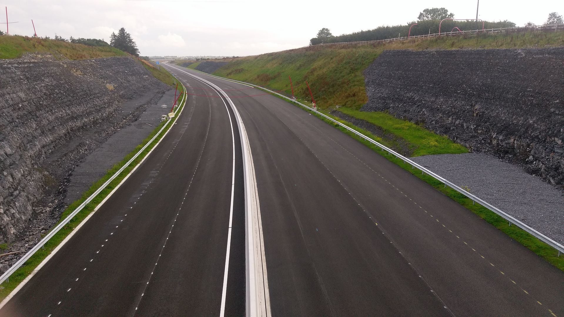
IMAG2089_zpshjbjgoyt.jpg


  • Registered Users Posts: 4,322 ✭✭✭m17


    The flyover at annagh hill 16/03/162017-07-15_10-42-01_zpsgvw5zfec.jpg17/08/17IMAG1734_zpsx5g1vhtg.jpg


  • Advertisement
  • Registered Users Posts: 5,543 ✭✭✭veryangryman


    I'll be taking the m4->m6->m17->n17 route for any Dublin to castlebar /westport runs. It could be 60km longer and it would still be quicker once opened.

    The rest of ye can stay on the n5 stuck behind a tractor outside Frenchpark.

    Amen


  • Registered Users Posts: 2,278 ✭✭✭mackerski


    Anyone out cycling the new road, if you could capture the GPS of your trip and send me the gpx file, I can use it to refine the drawings on openstreetmap.

    I flew 2 drone missions recently, one covering Rathmorissy, the other Annagh Hill. I produced rectified Geotiffs from each using OpenDroneMap and updated OSM in each location. I'll find a way to hook you up with the tiffs.

    On the same journey I also did some conventional remapping of the side roads around the Tuam Bypass.


  • Registered Users Posts: 1,686 ✭✭✭muddle84


    paul2013 wrote: »
    muddle84 wrote: »
    Is that directed at me? I didn't make any smart comments thus the reason for me asking??

    No I'm not directing anything at you, Its someone else who keeps mocking me over a previous job I had collecting milk and meeting traffic at the bridge in Kilcreest (Soon to be defunct N66) before I got accepted into the Gardaí
    Fair enough Paul. Apologies for taking you up wrong.


  • Registered Users Posts: 19,396 ✭✭✭✭road_high


    I'll be taking the m4->m6->m17->n17 route for any Dublin to castlebar /westport runs. It could be 60km longer and it would still be quicker once opened.

    The rest of ye can stay on the n5 stuck behind a tractor outside Frenchpark.

    60 km longer? There's no way it'll be faster than the N5 then (much of which is high quality 100 kmh single carriageway).


  • Registered Users Posts: 333 ✭✭jj72


    pretty sure it wont be 60km longer either, closer to half that


  • Registered Users Posts: 4,322 ✭✭✭m17


    M17 junction19 annagh hill looking towards rathmorrissy 17/08/17IMAG2090_zpsbpfgsjxj.jpg
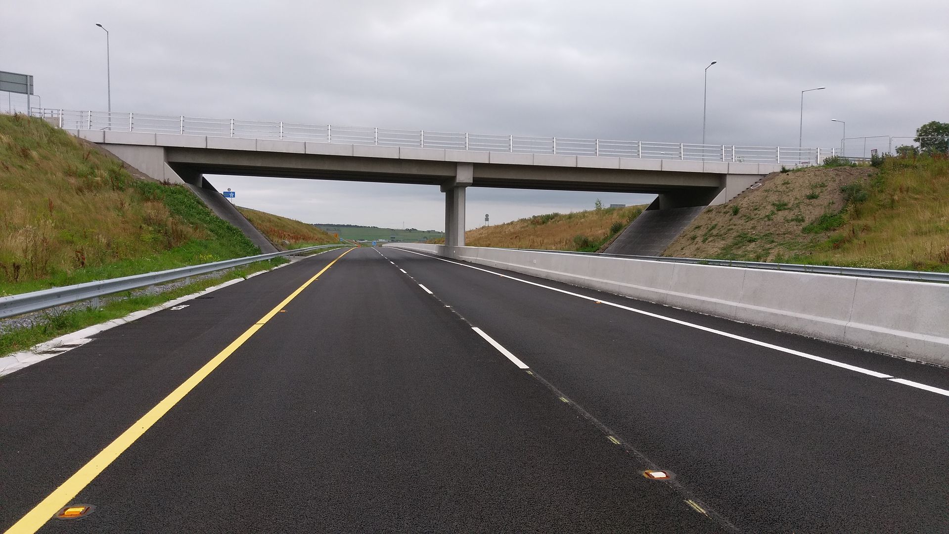
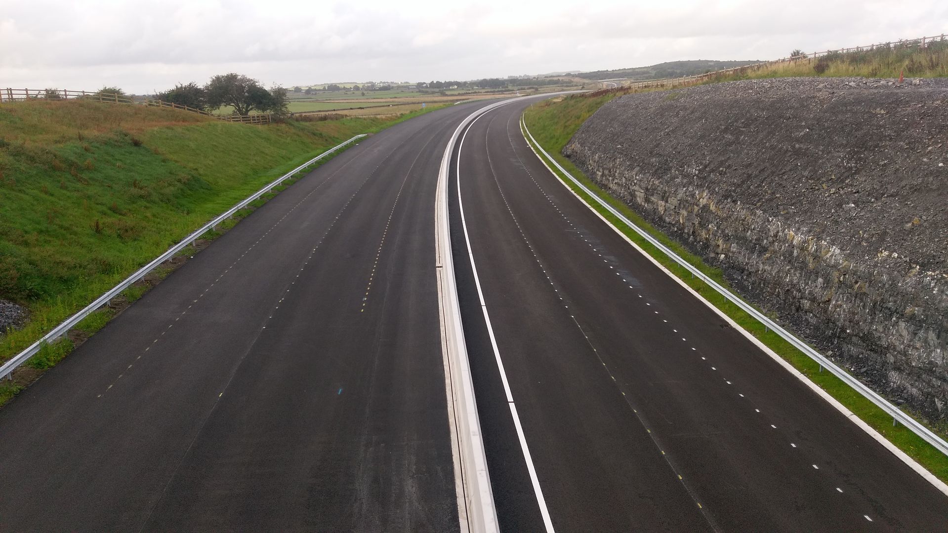
annagh hill looking towards tuam
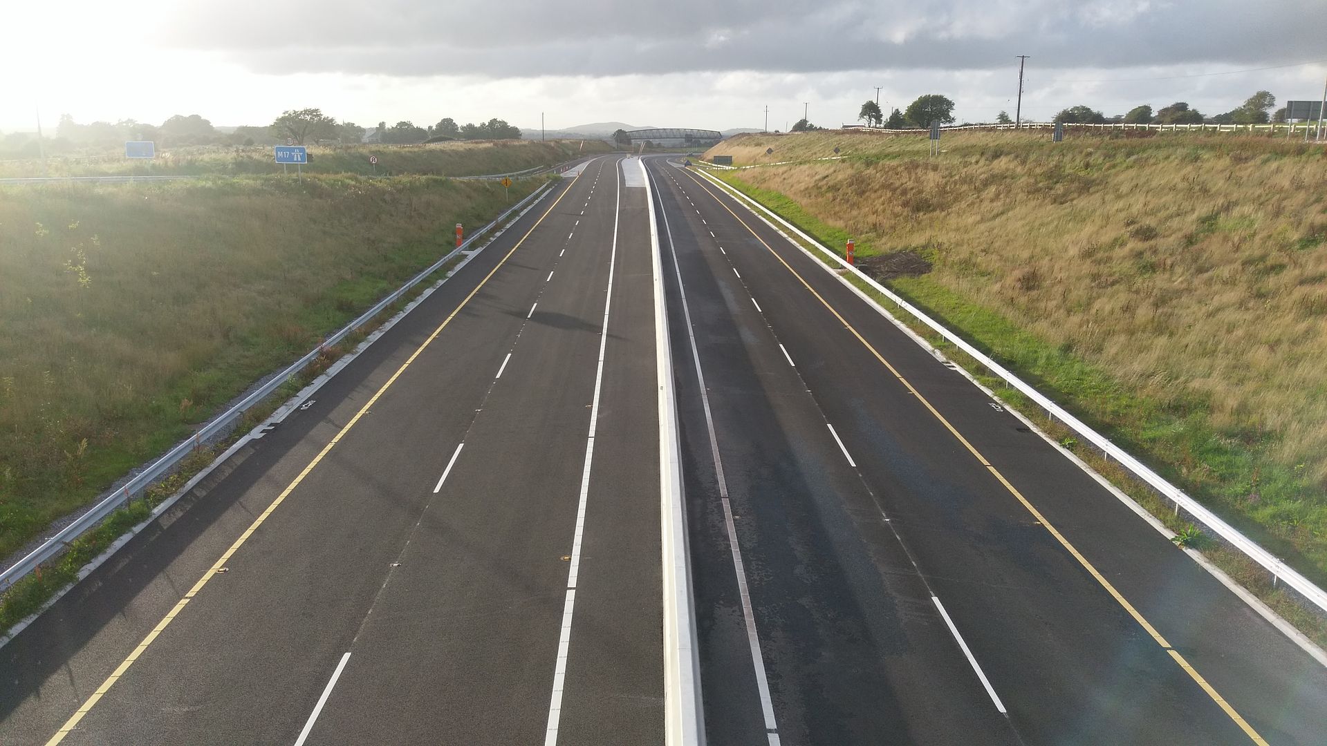
IMAG2091_zpsnez99lqt.jpg


  • Registered Users Posts: 1,824 ✭✭✭godskitchen


    Lads, I was saying even if it was 60km longer, which it isn't, I would still be faster taking the Galway route.

    As I said, you are all welcome to continue using the n5 through Ballanagare.


  • Registered Users Posts: 19,396 ✭✭✭✭road_high


    jj72 wrote: »
    pretty sure it wont be 60km longer either, closer to half that

    I think the OP meant 30km each way on a return journey via the M17/M6 vs N5/4.


  • Registered Users Posts: 4,676 ✭✭✭serfboard


    Deedsie wrote: »
    Its an additional 45 km to go via rathmorrissy interchange
    ViaMichelin gives the following numbers currently:

    251km (59km of Motorway) using the M4->N4->N5.
    296km (185km of Motorway) using the M4->M6->N18->N17->N60->N5.

    It'll be well over 200 km on Motorway when the M17 opens up, and you'll have Dual Carriageway to North of Tuam so I'd guess it'd be a safer, easier (albeit longer) drive.


  • Advertisement
  • Registered Users Posts: 1,824 ✭✭✭godskitchen


    road_high wrote: »
    I think the OP meant 30km each way on a return journey via the M17/M6 vs N5/4.

    Nope, I was making the point, seemingly badly, that even if it was 60km longer I would still take that route


Advertisement