Advertisement
If you have a new account but are having problems posting or verifying your account, please email us on hello@boards.ie for help. Thanks :)
Hello all! Please ensure that you are posting a new thread or question in the appropriate forum. The Feedback forum is overwhelmed with questions that are having to be moved elsewhere. If you need help to verify your account contact hello@boards.ie

N69/N22/N70 Tralee Bypass

Options
1343537394048

Comments

  • Registered Users Posts: 1,015 ✭✭✭Kevwoody


    mackerski wrote: »
    That's excellent - I've change the map accordingly


    Right - for now I've downgraded the rump of the old N21 to a road of unknown number, and I'll stand by for new intelligence.

    The N70, I suppose, still continues inside the bypass in order to connect to the N86. But: where does one become the other? At the same roundabout as currently depicted? Also, it will surely be correct to downgrade the N70 north of this roundabout, do you think?


    The N70 now starts at the newly constructed roundabout beside Lidl, and the N86 also starts here heading the opposite direction.


  • Closed Accounts Posts: 3,010 ✭✭✭Tech3


    Great stuff carchaeologist, I haven't been looking at road construction for a while but your photos and informative updates have been great. I might give this a drive over the weekend.


  • Registered Users Posts: 2,455 ✭✭✭dmeehan


    Good work there!
    Looking at the Map, it looks like the N70 continues too far, as far as I know it terminates at the Killerisk junction/roundabout, with everything west of this being the N86, though im open to correction on this. The N70 continuing is as far as Boherbee is definatly wrong I would think?

    looks like OpenStreetMap.org has been overloaded with Tralee Bypass updates as it's down now :-)


    Update: Spoke too soon, its back up now


  • Registered Users Posts: 2,172 ✭✭✭xxyyzz


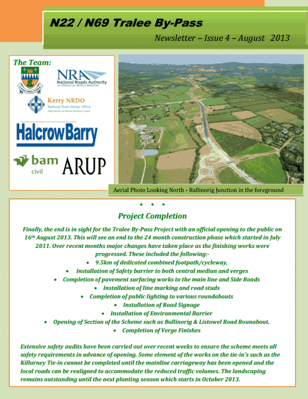
    Newsletter issue 4.
    BAMNEWSLETTER41_zps4455c8f4.png

    Pardon my ignorance, but in the last paragraph, what do they mean by tie-in's?


  • Registered Users Posts: 11,318 ✭✭✭✭carchaeologist


    xxyyzz wrote: »
    Pardon my ignorance, but in the last paragraph, what do they mean by tie-in's?

    By that they mean, like for example, where the old N22 meets the new, there will be some realignment of roads there to accommodate the new junction layouts, some of this needing road closures and other measures to complete.


  • Advertisement
  • Registered Users Posts: 1,599 ✭✭✭adam88


    [

    Just remember, if you see these photos anywhere else other than here, our good friend has been stealing again..:rolleyes:[/quote]

    Why did you not watermark the pictures


  • Moderators, Regional South Moderators Posts: 5,742 Mod ✭✭✭✭Quackster


    Kevwoody wrote: »
    The N70 now starts at the newly constructed roundabout beside Lidl, and the N86 also starts here heading the opposite direction.

    That's not quite correct. As I've mentioned here before the N70 now begins at the new Killarney Road RAB on the bypass which means the last stretch of the bypass from here to the Killorglin Road RAB is designated N70. The N86 begins at the Killorglin Road RAB.

    The stretch of the bypass between the Killarney Road and Castleisland Road RABs is the N21 northbound but the N22 southbound. However, the eagle-eyed may notice that one of the signs on this section currently has it mislabeled as the N69! The N69 actually begins at the Castleisland Road RAB.

    And again as I've mentioned before, in line with current NRA policy all former national roads within the bypass/N86 ring are now detrunked.


  • Registered Users Posts: 11,318 ✭✭✭✭carchaeologist


    And the road is now officially open!

    Gentlemen(and ladies), start your engines!!


  • Registered Users Posts: 2,276 ✭✭✭mackerski


    Quackster wrote: »
    That's not quite correct. As I've mentioned here before the N70 now begins at the new Killarney Road RAB on the bypass which means the last stretch of the bypass from here to the Killorglin Road RAB is designated N70. The N86 begins at the Killorglin Road RAB.

    Thanks for this correction. That makes a bit more sense, since otherwise we would have had the N21 dead-ending onto national secondary routes. I've updated this on OSM.
    Quackster wrote: »
    The stretch of the bypass between the Killarney Road and Castleisland Road RABs is the N21 northbound but the N22 southbound. However, the eagle-eyed may notice that one of the signs on this section currently has it mislabeled as the N69! The N69 actually begins at the Castleisland Road RAB.

    It's almost certainly only one of these routes in both directions, with the signage making it confusing. I vote for N21, which would seem to best match the original routes handled by the roads. I've noticed that, as you approach the end of any route, the signs tend not to identify the route you are on, but instead the route you are about to hit. In this instance I would have expected brackets to be used to make this clearer, but this is Ireland...

    It would be useful to see some examples of the signs to see if my interpretation makes sense.
    Quackster wrote: »
    And again as I've mentioned before, in line with current NRA policy all former national roads within the bypass/N86 ring are now detrunked.

    Already sorted, but I still need to know the new number for the old town section of N70.


  • Moderators, Regional South Moderators Posts: 5,742 Mod ✭✭✭✭Quackster


    <quote>It's almost certainly only one of these routes in both directions, with the signage making it confusing. I vote for N21, which would seem to best match the original routes handled by the roads. I've noticed that, as you approach the end of any route, the signs tend not to identify the route you are on, but instead the route you are about to hit. In this instance I would have expected brackets to be used to make this clearer, but this is Ireland...

    It would be useful to see some examples of the signs to see if my interpretation makes sense.</quote>


    Yep, legally it's the N21 as far as I remember off the top of my head but as far as any road-user on the ground is concerned it's as I explained. It's signed N21 northbound and N22 southbound entering onto this section. The reason is one of clarity, not to be unnecessarily confusing road-users with unnecessary extra layers of road-numbering and bracketing.


  • Advertisement
  • Registered Users Posts: 31 MacLondon


    Obviously given the importance of tourism to Kerry, there's no way that any inaccuracies on Google Maps (as used on Kerry County Council website etc) would be allowed to lead tourists astray for long... especially when it's so easy to use the 'Report a problem' on Google Maps to inform them of inaccuracies:
    http://www.irishexaminer.com/ireland/cwmhsnqlcwoj/

    Saying that, I'm surprised to see that Google Maps have already added a (very) rough sketch of the new roads south of the Ballygarry roundabout. Several inaccuracies, mind you, including the new roads being coloured as minor roads. The new N69 hasn't made its appearance on there yet though.


  • Posts: 0 [Deleted User]


    Hey guys,

    Great news about the bypass. Tell me, if I am traveling from Limerick towards the Ballyheiuge direction, can I now bypass Tralee? Does it go in that general direction? Cheers


  • Moderators, Regional South Moderators Posts: 5,742 Mod ✭✭✭✭Quackster


    Hey guys,

    Great news about the bypass. Tell me, if I am traveling from Limerick towards the Ballyheiuge direction, can I now bypass Tralee? Does it go in that general direction? Cheers

    You can, to an extent. If coming via the N21, take the bypass north towards Listowel from where the N21 meets the bypass to the next roundabout. Then take the first exit left past the ITT, turning left again at the next roundabout at Forge Cross towards Oakpark. Then you must follow the existing road network to the Braker O'Regan Road and onwards to Ballyheigue.


    If coming via the N69, it won't make any difference unless you choose to use the first section of the bypass from Leith, turning right at the next roundabout, again past the ITT, instead of using the old road from Leith to Forge Cross.


  • Registered Users Posts: 807 ✭✭✭groovie


    I l
    Hey guys,

    Great news about the bypass. Tell me, if I am traveling from Limerick towards the Ballyheiuge direction, can I now bypass Tralee? Does it go in that general direction? Cheers

    No lad, you will still need to come down the Listowel Road as far as the first set of traffic lights, then right, then straight thru the next roundabout, then left at the roundabout after that, taking you out the Ardfert road.

    Safe driving.

    You could take in a section of the new road by going left at the new roundabout at Leith, and then taking the third exit at the next round about bringing you past the new IT. Then continue left at the next roundabout, bringing you down the Listowel Road towards town.


  • Closed Accounts Posts: 26 Leithman


    No complaints about the general signage or the road surface , lack of road markings in some sections will make for some interesting driving though .
    Referring here to the Leith end .. on my two my trips today both lanes of traffic coming off the bypass onto the N69 and heading for Listowel were turning right going into the roundabout .. and onto a single lane road .
    Surely road signage is needed here , esp for the unfamiliar , LH lane for Tralee .. RH lane for Listowel etc .
    Cycle lane surface looks dog rough btw .

    Would like to thank my neighbour Carch on his outstanding contribution to this most interesting thread .. well done boss .. your amazing photo archive and informative comment is greatly appreciated , enjoy festival 2013 sir ;) .. same goes for all the other posters , well done all.

    Have to add my condemnation of the photo plagiarism of this thread by other(s) :mad: .


  • Registered Users Posts: 2,276 ✭✭✭mackerski


    Leithman wrote: »
    Referring here to the Leith end .. on my two my trips today both lanes of traffic coming off the bypass onto the N69 and heading for Listowel were turning right going into the roundabout .. and onto a single lane road .

    It's not rocket science that you can't turn right when you enter a roundabout in the left lane. So the markings shouldn't be needed, but adding them seems like a smart and cheap option. A similar issue arises at the Pace junction on the M3, with even less justification.


  • Registered Users Posts: 24 conjollins


    And the road is now officially open!

    Gentlemen(and ladies), start your engines!!

    Rumour has it the idiot boyracers already started their engines last night and ploughed into the opening commemorative plaque!!!!

    As an old English teacher of mine used to say "Empty vessels make the most noise"


  • Closed Accounts Posts: 26 Leithman


    mackerski wrote: »
    It's not rocket science that you can't turn right when you enter a roundabout in the left lane. So the markings shouldn't be needed, but adding them seems like a smart and cheap option. A similar issue arises at the Pace junction on the M3, with even less justification.

    I was commenting on what i have seen 2 times today already ... explain rocket science ???


  • Registered Users Posts: 2,172 ✭✭✭xxyyzz


    Leithman wrote: »
    I was commenting on what i have seen 2 times today already ... explain rocket science ???

    People in Ireland have a mental block using the lanes on roundabouts correctly, every little helps. As for indicating on roundabouts..... Forget about it.


  • Registered Users Posts: 2,276 ✭✭✭mackerski


    Leithman wrote: »
    I was commenting on what i have seen 2 times today already ... explain rocket science ???

    I may have phrased that badly, because I agree with you. I'm saying that it's well known that you may not (usually) turn right if you approach a roundabout in the left lane. Painting arrows to labour the point is a good idea, but don't be surprised if the eejits don't get the message.


  • Advertisement
  • Registered Users Posts: 2,006 ✭✭✭Southern Dandy


    I now see why the old farmers bridge road could not be used, as it pretty much is no longer there. I thought going by description it was just blocked by boulders but there is a significant chunk missing by the looks of it.


  • Registered Users Posts: 11,318 ✭✭✭✭carchaeologist


    I now see why the old farmers bridge road could not be used, as it pretty much is no longer there. I thought going by description it was just blocked by boulders but there is a significant chunk missing by the looks of it.

    The new entrance/exit is off the new Killarney road. The old road from Skehanagh in is now a cul de sac to Mitchells new pitch.

    This thread has had over 2000 hits today alone?!:eek:


  • Registered Users Posts: 11,318 ✭✭✭✭carchaeologist


    The Bypass was officially opened today at 12pm by Jimmy Deenihan, Minister for Arts, Heritage and the Gaeltacht.
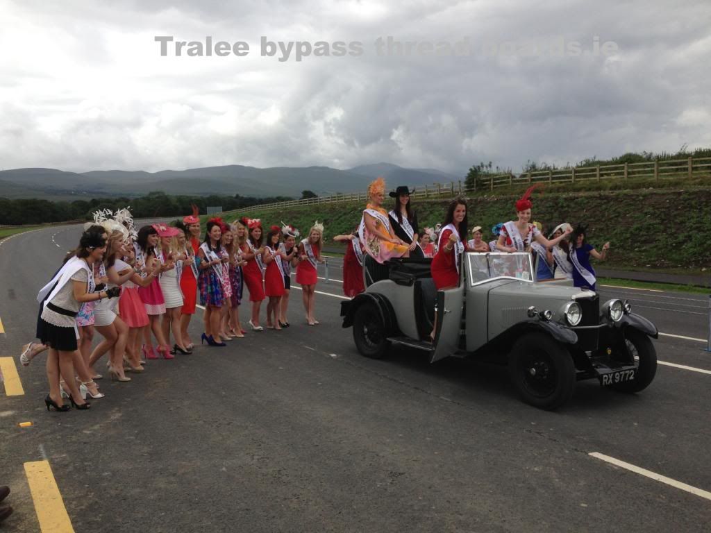
    Besides a large public attendance, many local Councillors, Politicians and other Dignitaries were also in attendance along with a busload of this years Rose contestants who had just arrived in town at the same time for this years Festival, coincidence, or just good PR.. ;).
    Members of the Kingdom Veteran, Vintage and Classic Car club(KVV&CCC) brought along a few vintage cars for the occasion, the star of the show being a 1932 Riley 9 Convertible, which was practically overwhelmed with Roses and politicians at one stage! I think the owner was sweating a bit!

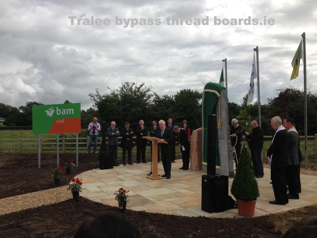
    There were a number of speeches given prior to the opening including from Tom Curran the County Manager, Mayor of Kerry Séamus Cosaí­ Fitzgerald, BAM representatives among others, this is a shot of Jimmy speaking.
    29ba1299-4cc2-4d22-a0ad-b7cd6103fca8_zpsd5a40c52.jpg

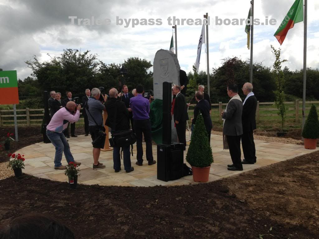
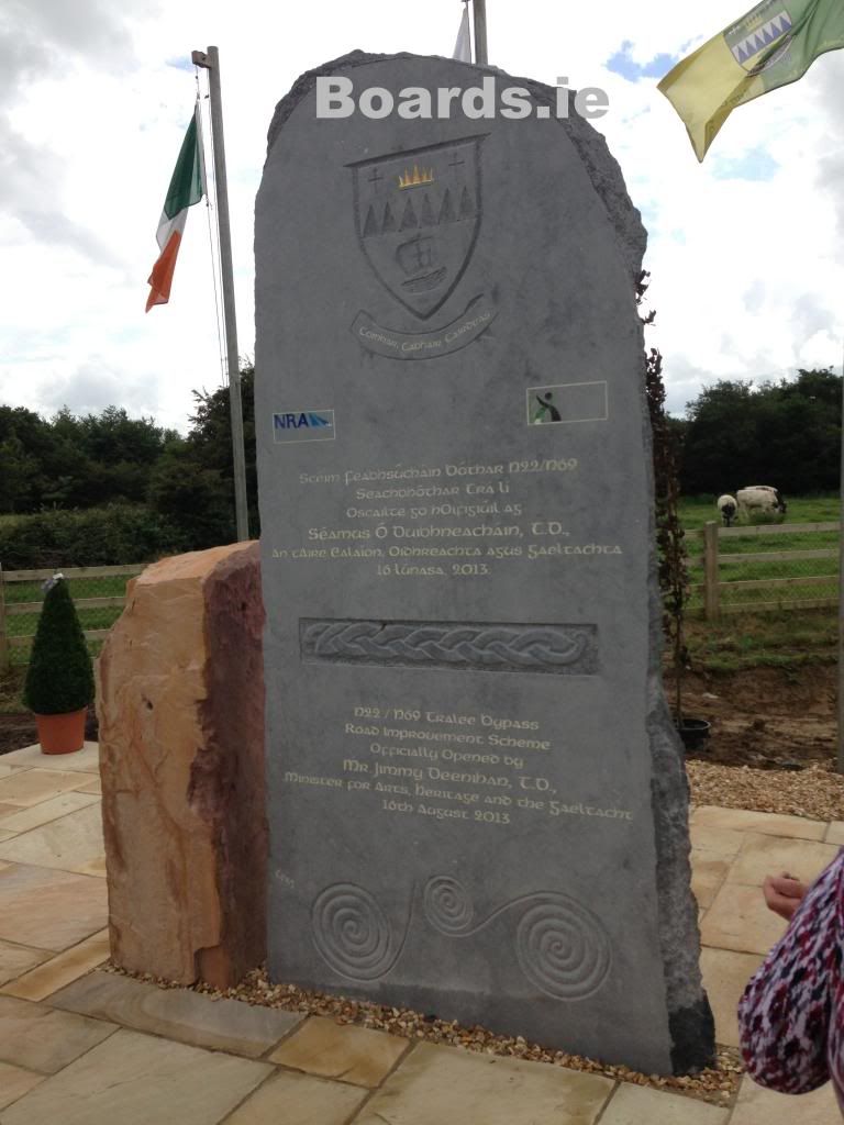
    The unveiling of the stone monument which fittingly is made of limestone.
    4b093a36-163c-428e-b21d-9a8d3d118fac_zpsa2a2f0a8.jpg

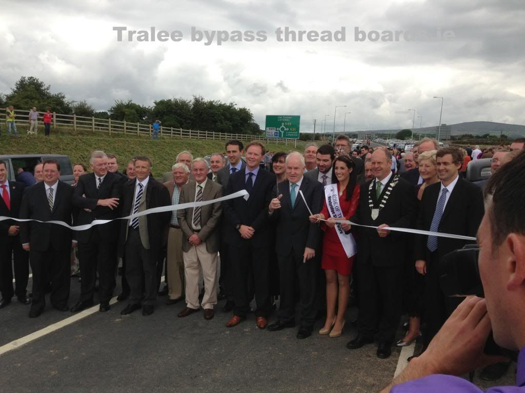
    The official ceremonial ribbon cutting, again performed by Jimmy Deenihan. Snip!
    79946127-dbd7-47df-bab4-c606d456cdec_zpsd2116e8a.jpg

    And a photo shoot of all this years Rose of Tralee contestants with the '32 Riley 9 in centre stage.
    2c01394f-29bb-429c-8a56-18c6e03562ce_zpsb8034a54.jpg

    The Monument as unveiled.
    3bd3742a-92ad-4595-9545-feba934335dd_zps903c3c0d.jpg


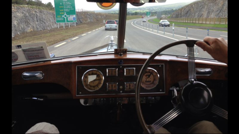
    Coming down through the Quarry post opening inside a 1954 Riley RME 1.5.
    IMG_9873_zps7700d7d1.png


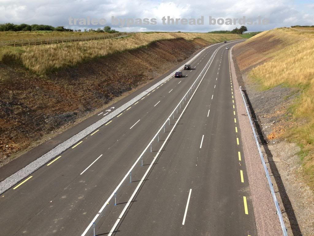
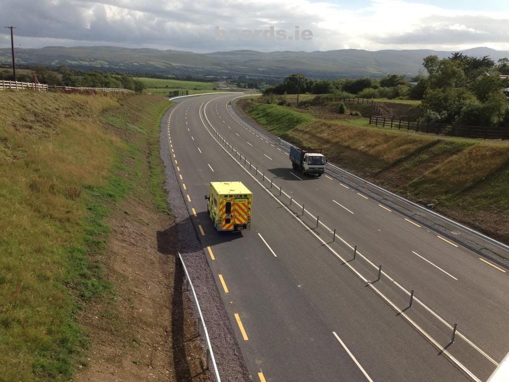
    View North from Knockwaddra bridge with Traffic finally running after 24 months of work. Long time coming, and a good few photos taken off here in those months too!
    61d382bc-aa3e-4f6b-b7b4-8dbfbc3b0f0a_zpscc514a25.jpg

    And South..
    2b8bb0f9-a497-4e7a-999d-3f18cecc1173_zps64d3a05d.jpg

    A few other facts on the road..
    The new road required 225 acres of land belonging to 78 landowners.
    The road surface is designed to last 40 years.
    The bridges have a design life of 120 years.

    It was a great thing to finally drive the entire route properly after so many months of watching and waiting for it all to come to fruition.


  • Registered Users Posts: 2,006 ✭✭✭Southern Dandy


    Why are there merging arrows like you would have at the end of dual carriage on the oncoming side?.


  • Registered Users Posts: 2 Lozza71


    Good question Southern Dandy. Nearly lost my life yesterday when I saw arrows coming towards me. Car in front of me nearly stopped dead as well. Could seriously cause an accident I think! Hope it is sorted soon as wouldn't like to see how a tourist would react when they are already trying to concentrate on driving on the wrong side of the road here. Great job done on the road though :)


  • Registered Users Posts: 11,318 ✭✭✭✭carchaeologist


    Why are there merging arrows like you would have at the end of dual carriage on the oncoming side?.

    Indeed, its a no overtaking thing or something I think.
    Can't say I like it as an idea though, it does give you the fear when you see it.


  • Registered Users Posts: 3,669 ✭✭✭DeepBlue


    The Monument as unveiled.
    3bd3742a-92ad-4595-9545-feba934335dd_zps903c3c0d.jpg
    I'm disappointed to see no mention of carchaeologist on the monument. Surely some mistake after all his hard work on this thread? :D


  • Registered Users Posts: 11,318 ✭✭✭✭carchaeologist


    DeepBlue wrote: »
    I'm disappointed to see no mention of carchaeologist on the monument. Surely some mistake after all his hard work on this thread? :D

    I asked them to take my name off it.
    They put in Jimmy Deenihans instead.


  • Closed Accounts Posts: 11 TheNileEffect


    Followed this thread throughout developments, worth signing up to boards just to thank carchaeologist for the pictures and information he posted. So Thanks, fine job you did :)


  • Advertisement
  • Registered Users Posts: 11,318 ✭✭✭✭carchaeologist


    Followed this thread throughout developments, worth signing up to boards just to thank carchaeologist for the pictures and information he posted. So Thanks, fine job you did :)

    Thank you Sir, and you even spelt my handle right!
    Thread isn't finished up just yet, there's still some work to be done.


Advertisement