Advertisement
If you have a new account but are having problems posting or verifying your account, please email us on hello@boards.ie for help. Thanks :)
Hello all! Please ensure that you are posting a new thread or question in the appropriate forum. The Feedback forum is overwhelmed with questions that are having to be moved elsewhere. If you need help to verify your account contact hello@boards.ie

N69/N22/N70 Tralee Bypass

Options
1333436383948

Comments

  • Registered Users Posts: 11,318 ✭✭✭✭carchaeologist


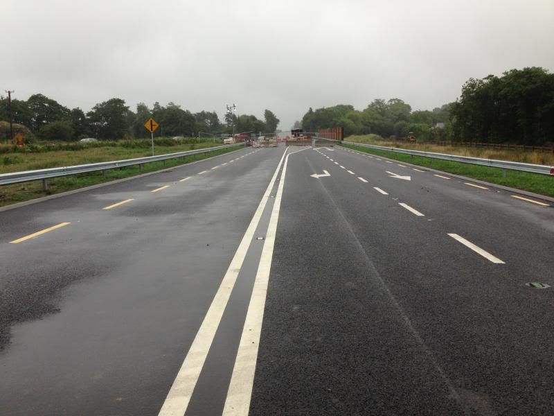
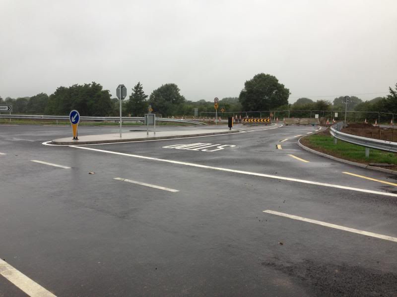
    Can someone clarify if you can join the bypass from the clash road or is it that you can only exit the bypass on to the clash road?? Drove past new roundabout in Ballinorig yesterday and it would appear the latter is the case!

    Exit only to Clash off the bypass from Ballinorig roundabout/overpass.
    You can go to Ballinorig from Clash but not onto the bypass from there.


  • Registered Users Posts: 143 ✭✭Mrs Dempsey


    ........can join the bypass from the clash road or is it that you can only exit the bypass on to the clash road?? Drove past new roundabout in Ballinorig yesterday and it would appear the latter is the case!

    The latter is the case (exit to clash only) but exclusively while heading northwards. If heading south it will be necessary to continue to the next roundabout & then head north.


  • Moderators, Science, Health & Environment Moderators Posts: 4,973 Mod ✭✭✭✭spacetweek


    Yeah saw that, there's a few around the Skehanagh roundabout which have been like that for the last month.I did think it was vandalism but then i spotted another sign on the way into Tralee on the Listowel road today and wondered was it done by someone working for BAM.
    It would have been BAM, yea, as part of their traffic control measures.
    In the USA and Germany they use red gaffa tape to make an X over the parts of the sign that aren't open yet. Problem is, signs are coated with reflective layers that could be ripped by pulling the red tape off. Not sure if that's a problem.


  • Registered Users Posts: 815 ✭✭✭Quaderno


    spacetweek wrote: »
    In the USA and Germany they use red gaffa tape to make an X over the parts of the sign that aren't open yet.

    In Germany they don't do that anymore. There is now a much more sophisticated device in use which is called "mobile Auskreuzvorrichtung". It consists of a red metal cross which is mounted in front of the sign in question and looks like that:

    180854796.jpgTypP.jpg


  • Registered Users Posts: 55 ✭✭Morebypasses


    Exit only to Clash off the bypass from Ballinorig roundabout/overpass.
    You can go to Ballinorig from Clash but not onto the bypass from there.


    What engineer planned that? Heavy goods vehicles coming fromCork/Limerick etc can exit bypass to factories in clash area but must leave town via Rath and roundabout at county buildings. Daft!!!


  • Advertisement
  • Registered Users Posts: 11,318 ✭✭✭✭carchaeologist


    What engineer planned that? Heavy goods vehicles coming fromCork/Limerick etc can exit bypass to factories in clash area but must leave town via Rath and roundabout at county buildings. Daft!!!

    Or drive up to Ballybeggan roundabout!
    There will be a serious amount of new routes available around town when this is open.

    Theres a bit of dissent about the Ballybeggan roundabout from people living outside that area because of the new road layout bringing them up into the college area instead of straight down clash as it was.


  • Registered Users Posts: 31 MacLondon


    What engineer planned that? Heavy goods vehicles coming fromCork/Limerick etc can exit bypass to factories in clash area but must leave town via Rath and roundabout at county buildings. Daft!!!
    The exit road at Ballinorig was actually an 'added extra', a deviation from the original plan.


  • Registered Users Posts: 55 ✭✭Morebypasses


    Or drive up to Ballybeggan roundabout!
    There will be a serious amount of new routes available around town when this is open.

    Theres a bit of dissent about the Ballybeggan roundabout from people living outside that area because of the new road layout bringing them up into the college area instead of straight down clash as it was.

    Thanks for your response. I don’t mean to be overly negativeabout something that is so positive for the town. It will open up so many new routes but it remains to be seen what impact it will have on traffic, particularlyin the Manor area. How much of the Killarney road traffic will end up coming back towards the Ballygarry Hotel when they find that the “mini” roundabout nearBallymullen can’t cope with the increased volume of traffic.

    I also believe that the new road from Ballybeggan to Leith was totally unnecessary given the road that now exists from Ballybeggan to theForge cross. The money could have been spent elsewhere on improving existing roads in the town. Anyway great to see it opening at last.


  • Registered Users Posts: 1,599 ✭✭✭adam88


    Thanks for your response. I don’t mean to be overly negativeabout something that is so positive for the town. It will open up so many newroutes but it remains to be seen what impact it will have on traffic, particularlyin the Manor area. How much of the Killarney road traffic will end up coming back towards the Ballygarry Hotel when they find that the “mini” roundabout nearBallymullen can’t cope with the increased volume of traffic.

    I also believe that the new road from Ballybeggan to Leith was totally unnecessary given the road that now exists from Ballybeggan to theForge cross. The money could have been spent elsewhere on improving existing roads in the town. Anyway great to see it opening at last.

    Disagree with you there. That road is a night mare in the mornings and evening. The length of time it used to take me to get to work in killarney from listowel was a complete joke. Now I won't even have to come next to near the college.

    Also a lot of traffic heads up to clash and the itt from killarney limerick direction. This is now taken away from the mano area making it easier for those that have to approach the town through manor I.e hospital council offices etc


  • Registered Users Posts: 11,318 ✭✭✭✭carchaeologist


    Thanks for your response. I don’t mean to be overly negative about something that is so positive for the town. It will open up so many new routes but it remains to be seen what impact it will have on traffic, particularly in the Manor area. How much of the Killarney road traffic will end up coming back towards the Ballygarry Hotel when they find that the “mini” roundabout near Ballymullen can’t cope with the increased volume of traffic.

    Well, theres the thing, not all Killarney traffic is intending to come though the town, where as at the moment it has to to go any where else, apart from Castleisland and Limerick.
    With the new layout incoming traffic can split right or left at the new roundabout on the bypass, either towards Ballygarry roundabout and Limerick or Listowel direction, or towards the N70 roundabout for Kilorglin, Dingle etc.

    As it is now all Killarney Cork and Limerick traffic entering the town comes in the same road towards the Mile height. With the bypass in operation, traffic on that road should be greatly reduced as everything that doesn't need to be in town can drive around the outside of it to whatever road they wish to get to.

    I will agree though that that roundabout in Ballymullen is a bit on the tight side, it can get awkward there at times. Not so long ago that it was a T junction, now that was a horrible place to drive through.

    I also believe that the new road from Ballybeggan to Leith was totally unnecessary given the road that now exists from Ballybeggan to the Forge cross. The money could have been spent elsewhere on improving existing roads in the town. Anyway great to see it opening at last.
    It has been mentioned earlier in this thread that the intention was to run the bypass down to Forge cross but the amount of housing in the area precluded it, due to the need for a dual carriageway and therefore the extention out to Leith was a later addition to the original plans.

    It is still quite amazing that this project actually got built at all considering the greater need for bypasses in Adare and Macroom, but im not complaining one bit...:D


  • Advertisement
  • Registered Users Posts: 834 ✭✭✭kingdumb


    I was at a talk last year where one of the engineers boasted proudly that the new bypass was going to have great cycle path just like the on the Castleisland bypass.

    You are right about these combination cycle/foot path being dangerous, especially on the hilly sections, and as I said before on here it is nuts that cyclist are encouraged to cycle on a footpath on the bypass, but then you turn a corner and it is pure evil and must be outlawed.
    A1 Dan wrote: »
    We cycled the entire new road last evening. It's great.
    But..
    I must say I'm disappointed at how narrow the two way pedestrian/cycle lane is. In my opinion it is dangerous and will cause problems, forcing most cyclists to use the roadway. Not a good idea.
    First the cobbled cycle lane on the fat mile and now a head to head between cyclists and pedestrians on the new bypass - someone in Kerry Co.Co. does not like bikes!!!

    Not totally true there, the are 5 public bike rack in Tannery Square ! That all that I know of in town, and this being the town with the highest percentage of commuter cyclists in the country.
    A1 Dan wrote: »
    (P.S. not a single official place to park a bike in all of Tralee, a.f.a.i.k.
    Rant over!)


  • Registered Users Posts: 2,178 ✭✭✭xxyyzz


    It has been mentioned earlier in this thread that the intention was to run the bypass down to Forge cross but the amount of housing in the area precluded it, due to the need for a dual carriageway and therefore the extention out to Leith was a later addition to the original plans.

    It took quite a few posts to get this through Amadáin's thick skull for some reason. :D

    Was he subsequently banned? Is he back? ;)


  • Registered Users Posts: 11,318 ✭✭✭✭carchaeologist


    Theres a two page spread of ariel photos of the various junctions on the bypass in the Kerry's eye.


  • Registered Users Posts: 807 ✭✭✭groovie


    Theres a two page spread of ariel photos of the various junctions on the bypass in the Kerry's eye.

    Did the bypass open tonight (unofficially) ?


  • Registered Users Posts: 2,455 ✭✭✭dmeehan


    groovie wrote: »
    Did the bypass open tonight (unofficially) ?
    wasnt open at 5:30 anyway


  • Closed Accounts Posts: 209 ✭✭traleespud


    dmeehan wrote: »
    wasnt open at 5:30 anyway

    Might open yet they were still working at 10PM last night!!!


  • Registered Users Posts: 11,318 ✭✭✭✭carchaeologist


    groovie wrote: »
    Did the bypass open tonight (unofficially) ?

    No, not untill 2pm tomorrow, although the official opening is around 12.

    I had a personal tour and general technical rundown of the entire route with Liam Beausang tonight, very interesting and informative, lots of fine details along the way that I'd never have spotted without being shown. And I though I was well informed on it up untill then!
    Very much appreciated that he took the time out to get in contact with me and to show an amatuer blogger around the site.
    I took some photos, but the computer is not playing ball.

    Hopefully the weather will be favourable tomorrow for the ribbon cutting.


  • Registered Users Posts: 96 ✭✭Hoof Hearted


    I'm predicting going into town in the mornings from the new N22 Killarney road will be quick and straight forward as the Kilorglin inbound traffic will have to yield to you on the roundabout.
    For those that need to head outbound in the evening toward Castleisland, they could head out on the Kilorglin Rd and take a left at the new bypass roundabout which would bring them to the N21 roundabout where the outbound N21 traffic coming from Manor will have to yield to them on that roundabout. One could be smart about his if they think in terms of time (and fuel) saved and not the shortest distance between two points. The biggest winners will be any one needing to the travel from the N21 or N22 toward the N69 and the Tralee Institute of Technology.

    Who knows for sure how it will all pan out, will 10,000 that went through Tralee before really be diverted away from Tralee, after all they probably headed towards Tralee because they wanted to go to Tralee, God Bless their hearts.


  • Registered Users Posts: 2,278 ✭✭✭mackerski


    Guys,

    I can see that somebody has opened the road a little early on OpenStreetMap. But I'm having difficulty with some of the road numbering and I hope that those of you who have been on the road can help resolve the confusion.

    Note how the N22, a primary route, is shown to terminate on the N69, a secondary route. This is unexpected and almost certainly wrong. My assumption is that the section currently marked as N69 that proceeds east and north to the N21 should also carry the number N22. Anybody know?

    The second point is a bit more awkward. The N21 and N70 are shown to still enter the town centre and connect to each other near the station. Since the bypass will now be the preferred way of making this connection, I would expect these central sections to be downgraded to regional or local roads. There just might be some new signs at the bypass end that will hint at this. Has anybody seen any?

    Thanks for any help!


  • Registered Users Posts: 11,318 ✭✭✭✭carchaeologist


    mackerski wrote: »
    Guys,

    I can see that somebody has opened the road a little early on OpenStreetMap. But I'm having difficulty with some of the road numbering and I hope that those of you who have been on the road can help resolve the confusion.

    Note how the N22, a primary route, is shown to terminate on the N69, a secondary route. This is unexpected and almost certainly wrong. My assumption is that the section currently marked as N69 that proceeds east and north to the N21 should also carry the number N22. Anybody know?
    The Map is indeed wrong, the new realingned N69 terminates at the Ballygarry roundabout, with the lower section from there to the N70 being designated as the N21 with the N22 terminating onto this at the new roundabout half way along it.
    mackerski wrote: »
    The second point is a bit more awkward. The N21 and N70 are shown to still enter the town centre and connect to each other near the station. Since the bypass will now be the preferred way of making this connection, I would expect these central sections to be downgraded to regional or local roads. There just might be some new signs at the bypass end that will hint at this. Has anybody seen any?
    You are correct on this assumption too, but I cant say right now what the new local road designations will be. Will look into it tomorrow, if no one else has clarified it in the mean time. The old N69 from the new Leith roundabout into Oakpark has been redesignated as a local road also.


  • Advertisement
  • Registered Users Posts: 2,278 ✭✭✭mackerski


    The Map is indeed wrong, the new realingned N69 terminates at the Ballygarry roundabout, with the lower section from there to the N70 being designated as the N21 with the N22 terminating onto this at the new roundabout half way along it.

    That's excellent - I've change the map accordingly
    You are correct on this assumption too, but I cant say right now what the new local road designations will be. Will look into it tomorrow, if no one else has clarified it in the mean time. The old N69 from the new Leith roundabout into Oakpark has been redesignated as a local road also.

    Right - for now I've downgraded the rump of the old N21 to a road of unknown number, and I'll stand by for new intelligence.

    The N70, I suppose, still continues inside the bypass in order to connect to the N86. But: where does one become the other? At the same roundabout as currently depicted? Also, it will surely be correct to downgrade the N70 north of this roundabout, do you think?


  • Registered Users Posts: 11,318 ✭✭✭✭carchaeologist


    Some of the shots from this evenings tour...

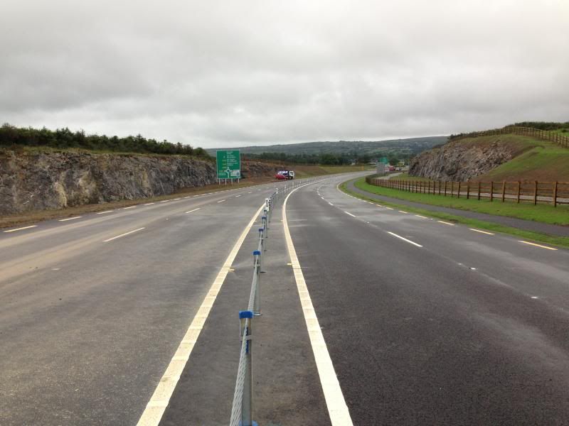
    Long view down into what was the quarry from just beside where the concrete and tar plant used to be. View looking towards Ballygarry.
    IMG_9797_zps2cb2c13f.jpg

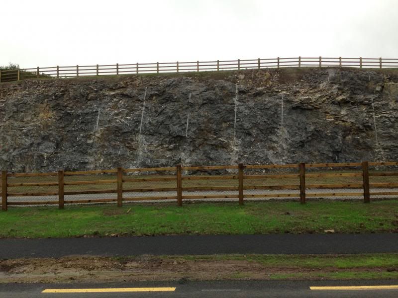
    Boreholes from the blasting still visible in the rock in the quarry section, these have been left as a feature on both sides, a nice touch I think? Landscaping in the quarry section is great, it looks fantastic to drive through, hard to believe that the road surface is 6 meters above what was the base of the quarry at the height of the digging.
    IMG_9799_zps8c98abcc.jpg

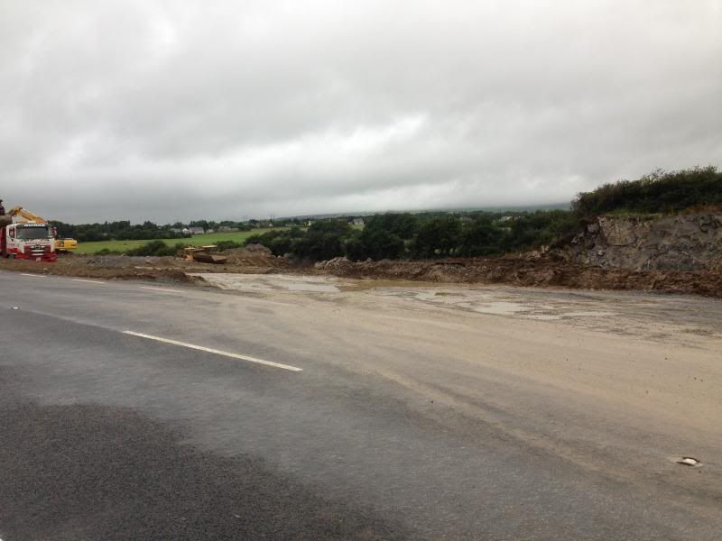
    This is where the tar plant and concrete plant was, now being landscaped. View lookin North.
    IMG_9798_zps5de8a66e.jpg

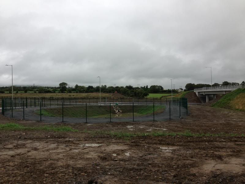
    Attenuation pond inside the exit road at the Ballinorig roundabout.
    IMG_9796_zps28b84a08.jpg
    I had previously thought these were Petrochemical collector ponds, but Liam explained this evening that these attenuation ponds are designed to slow the passage of water from surface run-off to the ground/drainage system. It does this by storing the run-off during times of peak flow i.e. heavy rainfall, and slowly releasing it at a controlled rate after the peak flow has passed, as the inlet pipe is much larger than the exit pipe. A very simple system when explained!

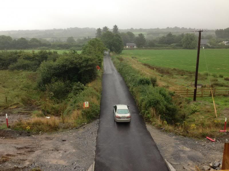
    Point of intersection with the exisiting N22 looking towards Killarney.
    IMG_9785_zpsc0963b60.jpg

    New junction from the new N22 to what will become the old N22. Further work will be done here when the new road is open to properly tie in the two roads.
    IMG_9786_zps5cef1562.jpg

    View looking towards Killarney from the top of the Ballyseedy over pass
    IMG_9791_zps7494fc19.jpg

    View towards Tralee from the same place
    IMG_9790_zps4a43ae1c.jpg

    And a shot looking south from the top of the overpass
    IMG_9789_zps1b910e7c.jpg

    Just remember, if you see these photos anywhere else other than here, our good friend has been stealing again..:rolleyes:


  • Registered Users Posts: 11,318 ✭✭✭✭carchaeologist


    mackerski wrote: »
    That's excellent - I've change the map accordingly


    Right - for now I've downgraded the rump of the old N21 to a road of unknown number, and I'll stand by for new intelligence.

    The N70, I suppose, still continues inside the bypass in order to connect to the N86. But: where does one become the other? At the same roundabout as currently depicted? Also, it will surely be correct to downgrade the N70 north of this roundabout, do you think?

    Good work there!
    Looking at the Map, it looks like the N70 continues too far, as far as I know it terminates at the Killerisk junction/roundabout, with everything west of this being the N86, though im open to correction on this. The N70 continuing is as far as Boherbee is definatly wrong I would think?


  • Registered Users Posts: 2,278 ✭✭✭mackerski


    Some of the shots from this evenings tour...

    OK, the first of those pics solves one riddle, that of what the old N21 inside the bypass has become (R875). I've updated the map.

    One other pic shows a partial road number. Is that taken at this spot? And is that the complete number I can see (minus "L") or is there one more digit?

    Thanks!


  • Registered Users Posts: 2,278 ✭✭✭mackerski


    Good work there!
    Looking at the Map, it looks like the N70 continues too far, as far as I know it terminates at the Killerisk junction/roundabout, with everything west of this being the N86, though im open to correction on this. The N70 continuing is as far as Boherbee is definatly wrong I would think?

    I agree that the section to Boherbee should be downgraded and I will do so. But I'll need help to work out what its new number should be.

    As to where N70 becomes N86, the legal docs seem to suggest the transition is as shown on OSM, and indeed, the N70 would have to have continued this far west to reach Boherbee in the first place.

    But: the bypass means that all bets are off. It might seem tidy to termintate the N70 at the same roundabout as the N21 ends, with the rest becoming N86. So again, let's see if the signs can help us.

    Thanks again!


  • Registered Users Posts: 11,318 ✭✭✭✭carchaeologist


    mackerski wrote: »
    OK, the first of those pics solves one riddle, that of what the old N21 inside the bypass has become (R875). I've updated the map.!
    I was just googling that based on my picture too! You beat me too it.:D

    mackerski wrote: »
    One other pic shows a partial road number. Is that taken at this spot? And is that the complete number I can see (minus "L") or is there one more digit?

    Yes, that picture was taken there, that would be the soon to become old N22.
    L2057 I think?

    Heres the regional road finder Wiki for all you other road perverts.
    http://en.wikipedia.org/wiki/Regional_road#R801.E2.80.94R899


  • Registered Users Posts: 2,278 ✭✭✭mackerski


    Yes, that picture was taken there, that would be the soon to become old N22.
    L2057 I think?

    OK, L2057 tagged on the old road. One last thing to check here is the speed limit, which will likely be left at the new default of 80. If the signs change to 80, please let me know so I can update OSM.


  • Registered Users Posts: 11,318 ✭✭✭✭carchaeologist


    mackerski wrote: »
    OK, L2057 tagged on the old road. One last thing to check here is the speed limit, which will likely be left at the new default of 80. If the signs change to 80, please let me know so I can update OSM.
    Yes, they will all default to 80kph being Local roads. The signs on the exit from the Leith roundabout to the R878 is 80kph, with the signs on the other side leaving Tralee are still 100kph, but are due to be changed to 80kph ones in the near future.


  • Closed Accounts Posts: 320 ✭✭stevielenihan


    Carch Im afraid Im not the one stealing those photos.


  • Advertisement
  • Registered Users Posts: 11,318 ✭✭✭✭carchaeologist


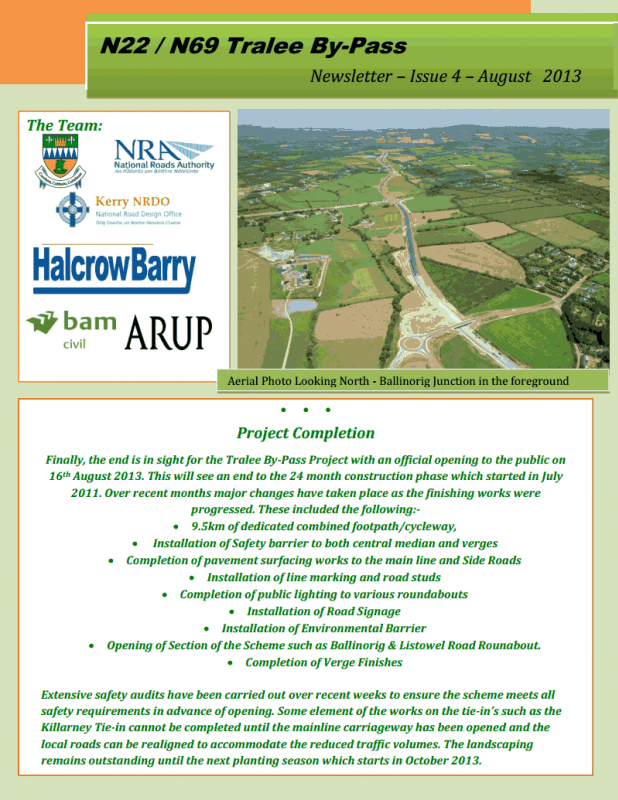
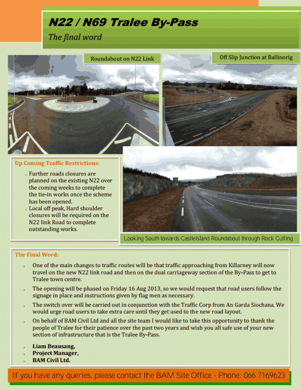
    Newsletter issue 4.
    BAMNEWSLETTER41_zps4455c8f4.png

    BAMNEWSLETTER42_zps731a3d35.png


Advertisement