Advertisement
If you have a new account but are having problems posting or verifying your account, please email us on hello@boards.ie for help. Thanks :)
Hello all! Please ensure that you are posting a new thread or question in the appropriate forum. The Feedback forum is overwhelmed with questions that are having to be moved elsewhere. If you need help to verify your account contact hello@boards.ie

Interesting Maps

Options
16364666869235

Comments

  • Registered Users Posts: 24,278 ✭✭✭✭lawred2


    Bambi wrote: »
    GAA pitch or GAA club? I'm pretty sure its not accurate either way, but note the darklands above in Mordor

    :D


  • Moderators, Recreation & Hobbies Moderators, Science, Health & Environment Moderators, Technology & Internet Moderators Posts: 90,728 Mod ✭✭✭✭Capt'n Midnight


    France and the Netherlands share a border.
    https://www.st-maarten.com/index.php/island/history-overview-st-maarten-st-martin/border-legend-sxm
    Legend has it that over 350 years ago, the Dutch and the French wished to draw a border on the island in a civilized manner. It was decided that a race should be held to determine how much land each nation could claim.

    The French competitor had to follow the coastline to the North, the Dutchman had to walk South. Once they circumnavigated the island and met again, a line would be drawn between the starting point and the meeting point to define the border.

    Both men choose beverages according to their culture: the Frenchmen a bottle of Red Wine, the Dutch a bottle of Genever (Dutch Gin). Obviously, quenching one's thirst with Gin will have a more significant negative impact on one's athletic performance than sipping some wine. The Dutch soldier discovered this when he met his more sober French competitor again: His gin induced slow-down cost the Dutch quite some territory. French St. Martin covers now two thirds of the 37 square mile island.

    No matter what the legend, the 'Treaty of Concordia' is a reality and the oldest, still enforced international treaty


  • Registered Users Posts: 266 ✭✭stopthevoting


    KevRossi wrote: »
    Euro surely?
    No, that wasn't a typo. It was intended to read as guilders.
    https://en.wikipedia.org/wiki/Netherlands_Antillean_guilder


  • Registered Users Posts: 78,252 ✭✭✭✭Victor


    St James Gate in Dublin is named after the starting point of the pilgrimage Camino de Santiago leading to the shrine of the apostle Saint James the Great in the cathedral of Santiago de Compostela in Galicia.
    Are there was me thinking it was named after the former city gate, on James Street (about where the Bank of Ireland is now) in the parish of St. James, whose church is now a distillery, which in turn was named for one of about 10 people known as St James.

    536765.png


  • Registered Users Posts: 18,921 ✭✭✭✭BonnieSituation


    Bambi wrote: »
    GAA pitch or GAA club? I'm pretty sure its not accurate either way, but note the darklands above in Mordor

    Meath has plenty of pitches


  • Advertisement
  • Moderators, Recreation & Hobbies Moderators, Science, Health & Environment Moderators, Technology & Internet Moderators Posts: 90,728 Mod ✭✭✭✭Capt'n Midnight


    t5yr4CS.jpg


    mt2dryo.jpg


  • Registered Users Posts: 19,714 ✭✭✭✭cnocbui


    A doctor once told me that alcohol can be quickly absorbed and turned to sugars, and so can quickly provide energy, so The level of impairment must have been the deciding factor, as the gin might have provided a boost, in moderation.


  • Banned (with Prison Access) Posts: 9,078 ✭✭✭IAMAMORON


    The " Ireland Way" walking trail. It has crossed my mind and is on the bucket list.
    05589f51f9e76c820eb9c9cf483b607f.png


  • Registered Users Posts: 1,178 ✭✭✭MY BAD


    A lot of that "trail" is public roads. Its not that suitable for walking in many places in my opinion.


  • Registered Users Posts: 19,714 ✭✭✭✭cnocbui


    MY BAD wrote: »
    A lot of that "trail" is public roads. Its not that suitable for walking in many places in my opinion.

    Personally, I wouldn't want to walk that sort of distance in wellies, with a pair of wire cutters, which is the alternative.


  • Advertisement
  • Banned (with Prison Access) Posts: 9,078 ✭✭✭IAMAMORON


    MY BAD wrote: »
    A lot of that "trail" is public roads. Its not that suitable for walking in many places in my opinion.
    cnocbui wrote: »
    Personally, I wouldn't want to walk that sort of distance in wellies, with a pair of wire cutters, which is the alternative.

    I hike a lot. There is always roads as in Ireland access laws are prohibitive.

    It is no biggie and would certainly not get in my way of attempting the walk. It essentially comprises many existing national walking trails.

    Most walking trails which include main public roads are in the back arse of nowhere, you would be lucky to meet a tractor - never mind a car.


  • Registered Users Posts: 5,644 ✭✭✭storker


    cdeb wrote: »
    American geography not my strong point, but I think Maryland and Kansas are two. And is there two Dakotas? They're both missing.

    Edit - actually, Maryland is top right (MD); I just didn't know where it is. Don't see Delaware though.

    New Mexico is missing.


  • Moderators, Social & Fun Moderators Posts: 12,582 Mod ✭✭✭✭JupiterKid


    Direct to scale comparison between the built up areas of Tokyo and London.

    Notice how much more consolidated the pattern of urban development in Tokyo is compared to London, largely a function of land use planning policy, topography and cultural differences between Japan and the UK.

    11417_fcrl08f2h8ppcnih.jpeg


  • Registered Users Posts: 3,592 ✭✭✭chooseusername


    JupiterKid wrote: »
    Direct to scale comparison between the built up areas of Tokyo and London.

    Notice how much more consolidated the pattern of urban development in Tokyo is compared to London, largely a function of land use planning policy, topography and cultural differences between Japan and the UK.

    When you consider the population of Tokyo is about four times that of London
    you realise how crowded Tokyo is.


  • Registered Users Posts: 40,154 ✭✭✭✭ohnonotgmail


    Generate your own street maps of any city. Uses OpenStreetMap data

    https://anvaka.github.io/city-roads/


  • Moderators, Politics Moderators Posts: 38,883 Mod ✭✭✭✭Seth Brundle


  • Moderators, Politics Moderators Posts: 38,883 Mod ✭✭✭✭Seth Brundle


  • Moderators, Politics Moderators Posts: 38,883 Mod ✭✭✭✭Seth Brundle


  • Moderators, Politics Moderators Posts: 38,883 Mod ✭✭✭✭Seth Brundle


  • Registered Users Posts: 1,474 ✭✭✭Mimon


  • Advertisement
  • Registered Users Posts: 40,154 ✭✭✭✭ohnonotgmail


    a map of poland post ww2. None of the countries bordering it exist today

    main-qimg-21f99868ac8252392ea539e8d6f54c6a


  • Registered Users Posts: 2,382 ✭✭✭1874


    Lithuania, Germany?


  • Registered Users Posts: 3,271 ✭✭✭Barna77


    1874 wrote: »
    Lithuania, Germany?

    Soviet Union, East Germany and Czechoslovakia.
    All gone


  • Banned (with Prison Access) Posts: 9,078 ✭✭✭IAMAMORON


    Map of Kings County
    offaly-map-1.jpg

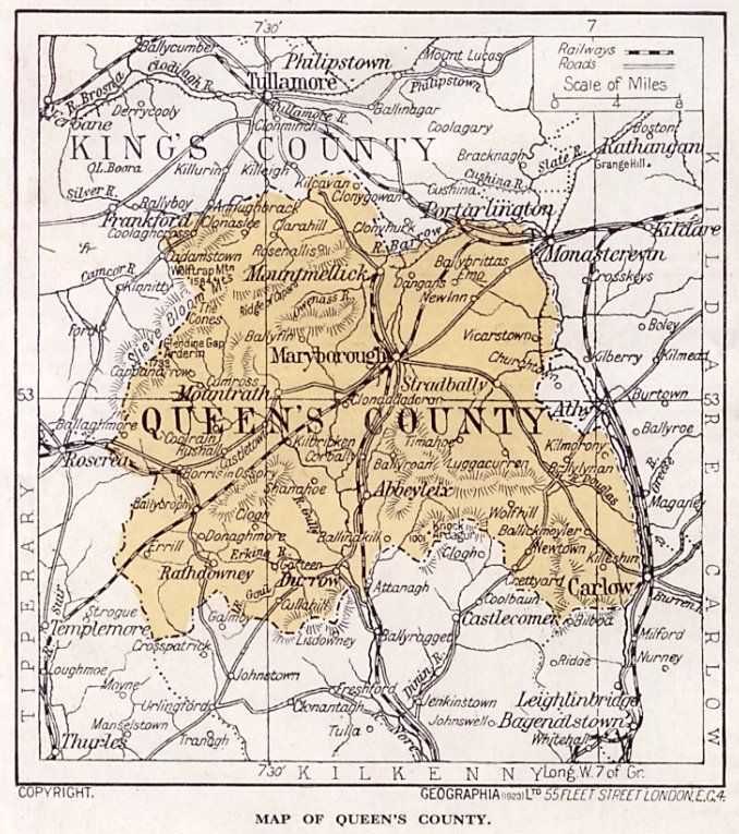
    Queens County
    queenscomap.jpg


  • Registered Users Posts: 5,466 ✭✭✭Charles Babbage


    1874 wrote: »
    Lithuania, Germany?


    These did not exist in 1945, they were the USSR and DDR.


  • Banned (with Prison Access) Posts: 9,078 ✭✭✭IAMAMORON


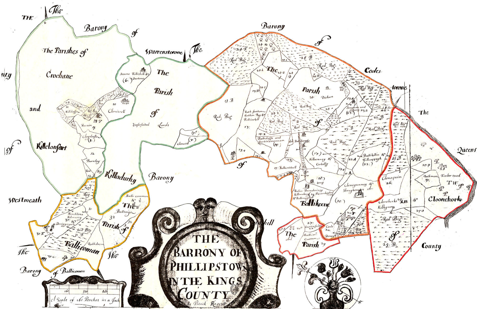
    The Barony of Philipstown

    Phillipstown.jpg


  • Registered Users Posts: 18,921 ✭✭✭✭BonnieSituation


    IAMAMORON wrote: »
    Map of Kings County
    offaly-map-1.jpg

    Queens County
    queenscomap.jpg

    Ah Philipstown and Maryborough...:D


  • Registered Users Posts: 25,420 ✭✭✭✭sligojoek


    IAMAMORON wrote: »
    Map of Kings County

    Queens County

    You wouldn't have one of Tipperary by any chance?


  • Registered Users Posts: 1,835 ✭✭✭dennyire


    sligojoek wrote: »
    You wouldn't have one of Tipperary by any chance?

    Or of Kerry?


  • Advertisement
  • Banned (with Prison Access) Posts: 9,078 ✭✭✭IAMAMORON


    sligojoek wrote: »
    You wouldn't have one of Tipperary by any chance?
    dennyire wrote: »
    Or of Kerry?

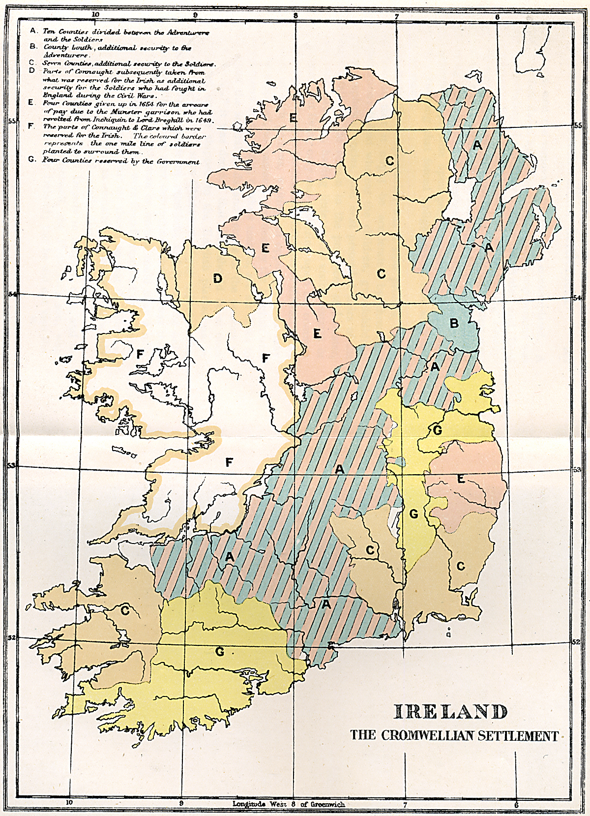
    I am doing a personal study of the Cromwellian invasion and I came across them then. I am also looking for a town plan of Banagher before and after if possible, the search continues.

    cromwellian_map.jpgproducts-Ax01690.jpg?v=1598432801


Advertisement