Advertisement
If you have a new account but are having problems posting or verifying your account, please email us on hello@boards.ie for help. Thanks :)
Hello all! Please ensure that you are posting a new thread or question in the appropriate forum. The Feedback forum is overwhelmed with questions that are having to be moved elsewhere. If you need help to verify your account contact hello@boards.ie

Interesting Maps

Options
14142444647235

Comments

  • Registered Users Posts: 736 ✭✭✭Das Reich


    Map of Italian regions by number of non Italian tourists. They are clever to keep the best regions like Puglia, Sardinia, Liguria, Abruzzo and Calabria for themselves.


  • Moderators, Recreation & Hobbies Moderators Posts: 11,089 Mod ✭✭✭✭igCorcaigh


  • Registered Users Posts: 71,799 ✭✭✭✭Ted_YNWA


    Cartoon Map of Europe, 1914

    27e289200571486e875299c7c1a5c99c.jpg


  • Registered Users Posts: 8,170 ✭✭✭Quantum Erasure


  • Banned (with Prison Access) Posts: 9,078 ✭✭✭IAMAMORON


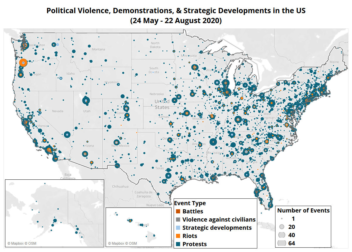
    I would love to know what all the beef is about in Alaska.

    " Battles " :o holy phuckeroonies :o


  • Advertisement
  • Registered Users Posts: 8,913 ✭✭✭Gregor Samsa


    IAMAMORON wrote: »
    I would love to know what all the beef is about in Alaska.

    " Battles " :o holy phuckeroonies :o

    There’s a few protests against police brutality going in up there, but Anchorage also has one against housing homeless people in an ice hockey arena. Oh, and another one protesting against a law that banned homosexual “conversion therapy”.

    Just surprised there isn’t more bear protests up there.

    images?q=tbn%3AANd9GcRQz-Iw-9MP2tm7989cII4Mk-4fsmunBPvMVg&usqp=CAU


  • Registered Users Posts: 4,390 ✭✭✭KevRossi


    Map showing the shortest distance from every townland in Ireland to Dublin (O'Connell Bridge). Some body of work, not sure if it's auto generated, or done piece by piece.

    Reddit thread here: https://www.reddit.com/r/dataisbeautiful/comments/ilsoyk/every_road_to_dublin_ireland_oc/g3u5j37/

    https://i.imgur.com/SxLh5tH.png

    SxLh5tH.png


  • Registered Users Posts: 71,799 ✭✭✭✭Ted_YNWA


    Or the fastest way to get out of there


  • Registered Users Posts: 19,727 ✭✭✭✭cnocbui


    Makes me appreciate even more, having a car that corners well.


  • Registered Users Posts: 78,257 ✭✭✭✭Victor


    KevRossi wrote: »
    Map showing the shortest distance from every townland in Ireland to Dublin (O'Connell Bridge). Some body of work, not sure if it's auto generated, or done piece by piece.

    Reddit thread here: https://www.reddit.com/r/dataisbeautiful/comments/ilsoyk/every_road_to_dublin_ireland_oc/g3u5j37/

    https://i.imgur.com/SxLh5tH.png

    https://i.imgur.com/SxLh5tH.png
    Based on the M17 and M40, it is at least partially based on speed limits. While www.openstreetmap.org has speed limits for most main roads, it won't have them for many minor roads.

    The processing was done by GraphHopper and other software: https://medium.com/@tjukanov/animated-routes-with-qgis-9377c1f16021


  • Advertisement
  • Registered Users Posts: 5,467 ✭✭✭Charles Babbage


    KevRossi wrote: »
    Map showing the shortest distance from every townland in Ireland to Dublin (O'Connell Bridge). Some body of work, not sure if it's auto generated, or done piece by piece.


    While most flows are logical along main routes, there is a rather strange flow ending in South Armagh between the N1 and N2. A data error perhaps?
    Perhaps it is distorted by all NI roads having a 60Mph speed limit although you would be unwise to approach that speed on many of them.


  • Registered Users Posts: 5,467 ✭✭✭Charles Babbage


    Height in Europe and basketball wins

    main-qimg-10fda366e96b76eabbf9cf11193043c5


  • Moderators, Recreation & Hobbies Moderators, Science, Health & Environment Moderators, Technology & Internet Moderators Posts: 90,733 Mod ✭✭✭✭Capt'n Midnight


    Victor wrote: »
    Based on the M17 and M40, it is at least partially based on speed limits. While www.openstreetmap.org has speed limits for most main roads, it won't have them for many minor roads.


    shutterstock_9011104-390x285.jpg

    But all minor roads are 80Kph :cool:


  • Registered Users Posts: 10,301 ✭✭✭✭gerrybbadd


    Another interesting map


  • Registered Users Posts: 249 ✭✭SixtaWalthers


    See the states of peace map :D

    13104da92504b57c5be2634b68b8a336.png


  • Registered Users Posts: 6,171 ✭✭✭1huge1


    gerrybbadd wrote: »
    Another interesting map

    Theres so much going on in that, but two things jump out at me.

    All the Baltic States trying their best to hold back the advance of Russia while Finland is just having a few beers and using Russia to rest its arm on? :D:D

    As for Ireland, old tiger needs work? thought we were at full employment (pre covid).

    Really interesting map


  • Registered Users Posts: 78,257 ✭✭✭✭Victor


    1huge1 wrote: »
    As for Ireland, old tiger needs work? thought we were at full employment (pre covid).
    2016 map.


  • Registered Users Posts: 4,390 ✭✭✭KevRossi


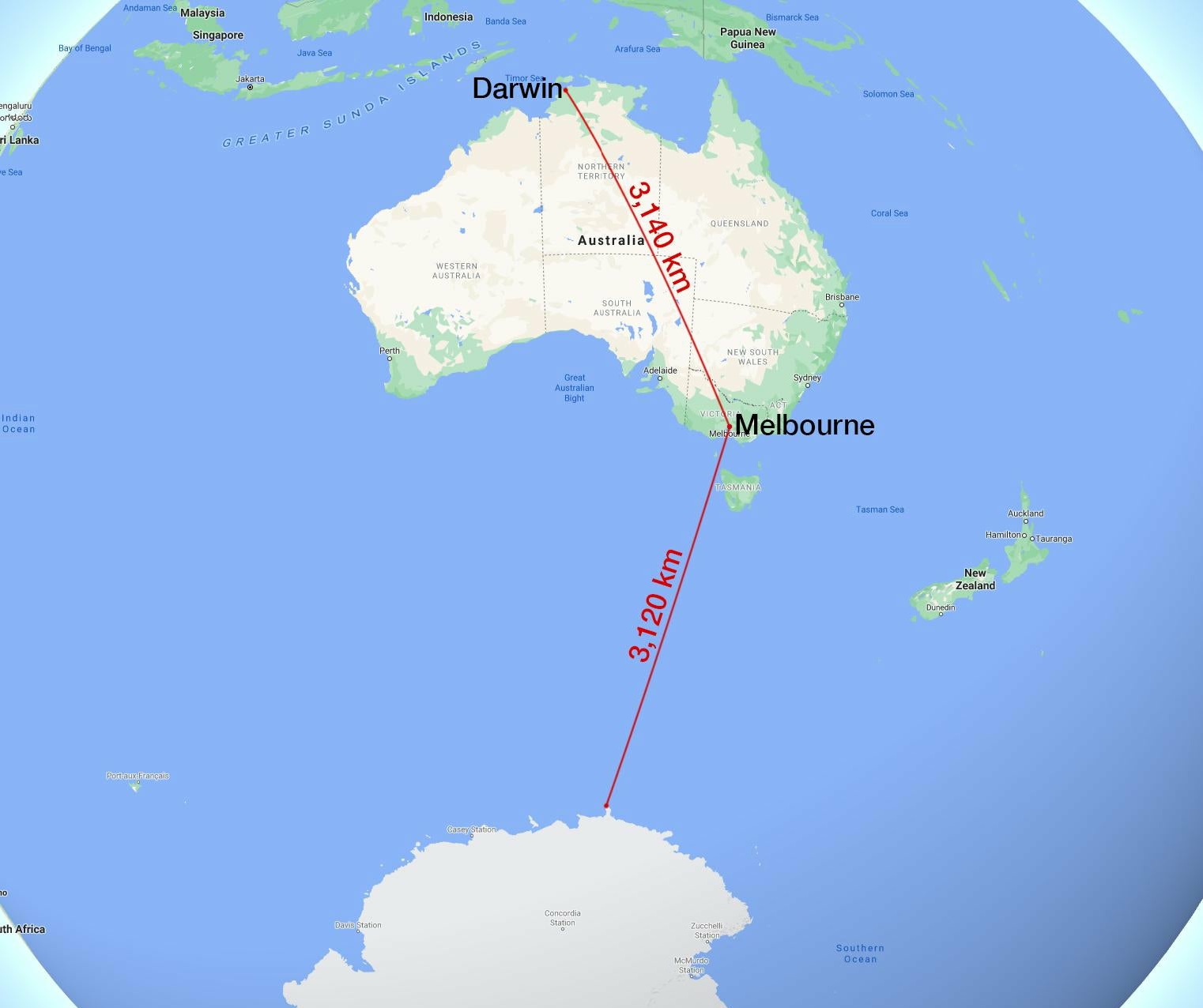
    Melbourne is nearer to Antarctica than it is to Darwin.

    Ehq9noOXgAA_U22?format=jpg&name=large


  • Registered Users Posts: 4,390 ✭✭✭KevRossi


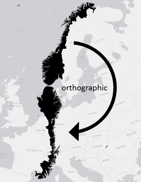
    Swivel Norway on it's southernmost point and the top will reach Barcelona or Rome.

    blog2.jpg


  • Registered Users Posts: 17,819 ✭✭✭✭peasant


    KevRossi wrote: »
    Map showing the shortest distance from every townland in Ireland to Dublin (O'Connell Bridge).

    Very interesting details on this map.

    In the circle is the area just outside Sligo where neighbours divide between driving through the North or the Republic to get to Dublin

    526100.JPG


  • Advertisement
  • Banned (with Prison Access) Posts: 9,078 ✭✭✭IAMAMORON


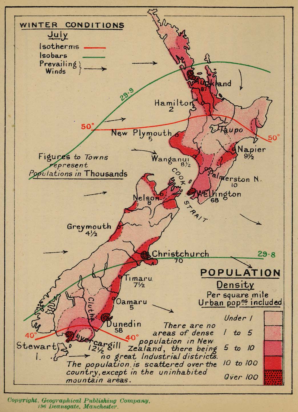
    Look at that map of Australasia, New Zealand really is in the middle of nowhere. I reckon that's where they are all hiding away, how could you know? Look where Dunedin is. I would say you could do you want down there if you had half a clue.

    Q5EHAL3VRVGKHHAG6YJHZRIME4.pngpopulation-map-of-new-zealand_2.png

    I reckon there are clowns there that have never even been to the other island yet, it just seems like that type of place really.

    new_zealand_pop_density_1918.jpg


  • Registered Users Posts: 21,129 ✭✭✭✭Water John


    Actually New Zealanders do move around quite a bit. They have no problem hopping in the car and driving 5/6 hours. The two ferries between the two islands do massive business. Maybe the poor in each city don't move that much. But every family has an old car and in NZ they are old.


  • Banned (with Prison Access) Posts: 9,078 ✭✭✭IAMAMORON


    Water John wrote: »
    Actually New Zealanders do move around quite a bit. They have no problem hopping in the car and driving 5/6 hours. The two ferries between the two islands do massive business. Maybe the poor in each city don't move that much. But every family has an old car and in NZ they are old.

    i would love to read about ancient north south rivalries, I mean ancient ones now, not just the Scottish plantation stuff.

    IwiMap.png2d2e8adefe4b35668d05a67fcbe69c67.jpgmain-qimg-b534535592173406fad850241538a545-c

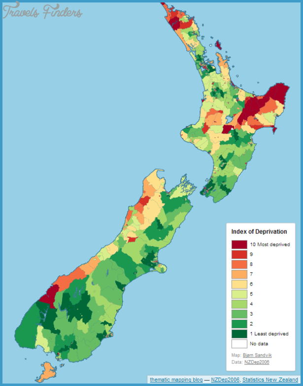
    Seems peculiar that there is more tribal activity on the north island as opposed the south island?


  • Registered Users Posts: 21,129 ✭✭✭✭Water John


    Don't know the back history but the south would fairly mountainous and difficult to travel over. The earliest inhabitation of NZ they believe was around 1250 AD.


  • Registered Users Posts: 16,459 ✭✭✭✭astrofool


    KevRossi wrote: »
    Swivel Norway on it's southernmost point and the top will reach Barcelona or Rome.

    blog2.jpg

    Billy Connolly said it was Morocco!

    https://vimeo.com/24340940


  • Registered Users Posts: 13,641 ✭✭✭✭josip


    IAMAMORON wrote: »
    Seems peculiar that there is more tribal activity on the north island as opposed the south island?


    They're fairly different climates.
    I don't have any facts , but just from living there, and driving from Cape Reinga to Bluff, once you go south of Picton it just gets colder and more upland.
    On the West coast it's incredibly wet and the midges would eat ya.
    The bottom of the South is bleak and depressing.
    One of the dourest people I ever met was from Invercargill.


  • Registered Users Posts: 40,156 ✭✭✭✭ohnonotgmail


    Water John wrote: »
    Don't know the back history but the south would fairly mountainous and difficult to travel over. The earliest inhabitation of NZ they believe was around 1250 AD.

    the migration to the south island is much later. Late 17th century or thereabouts.


  • Registered Users Posts: 21,129 ✭✭✭✭Water John


    The top of the South Island is very pleasant and sheltered, moreso than Wellington, (the windiest capital in the world). This is where the fruit and wines comes from. As Josip says gets fairly unforgiving south of that.


  • Banned (with Prison Access) Posts: 9,078 ✭✭✭IAMAMORON


    josip wrote: »
    One of the dourest people I ever met was from Invercargill.

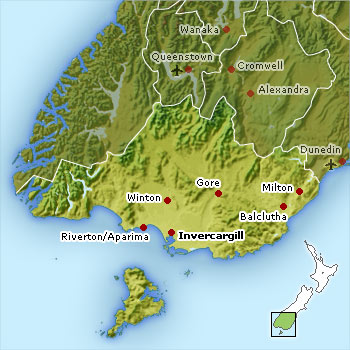
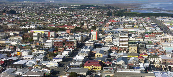
    Street plan of alleged most dourest corner of New Zealand.

    best-western-colonial-motel-map.gifresizess_4e5de956593354e5de9567801c4e5de956a73d7Southland%20Map.jpgInvercargill-banner-560x250.jpg

    Thanks for the heads up btw, always good to know what to take off the bucket list.

    Be some craic if they had a secret monster living in a lake nearby.


  • Advertisement
  • Moderators, Recreation & Hobbies Moderators, Science, Health & Environment Moderators, Technology & Internet Moderators Posts: 90,733 Mod ✭✭✭✭Capt'n Midnight


    70a872522bca6ce92c46f58f1fad67df.jpg


Advertisement