Advertisement
If you have a new account but are having problems posting or verifying your account, please email us on hello@boards.ie for help. Thanks :)
Hello all! Please ensure that you are posting a new thread or question in the appropriate forum. The Feedback forum is overwhelmed with questions that are having to be moved elsewhere. If you need help to verify your account contact hello@boards.ie

Car park wins. Car ban on Bachelors Walk reversed. Bikes on Benburb st too.

Options
245678

Comments

  • Registered Users Posts: 9,276 ✭✭✭cgcsb


    lxflyer wrote: »
    Until proper high capacity rail solutions are put in place in this city, retaining some car access is going to be a fact of life in the city centre.

    However there is going to have to be heavy bus priority in future with double bus lanes on both the north and south quays between O'Connell Bridge and Capel Street Bridge - otherwise the bus service will completely collapse given the changes to the network that are likely as a result of LUAS BXD becoming operational in 2017.

    This is going to limit the number of lanes available to cars to one lane on each set of Quays, which is going to cause serious traffic issues unless people start to change their behaviour.

    With a double cycle lane going in the North quays I don't see how a double bus lane will get in with space for a car lane.


  • Registered Users Posts: 17,553 ✭✭✭✭LXFlyer


    cgcsb wrote: »
    With a double cycle lane going in the North quays I don't see how a double bus lane will get in with space for a car lane.

    The plan is most definitely for a double bus lane and rightly so.

    Bear in mind that the inside lane will be one long line of bus stops to serve all the diverted bus routes. There will have to be a bus outside that for buses to move along.

    The plans are detailed in today's Irish Times and they confirm double bus lanes on both sides of the river along with an additional contra-flow bus lane on Winetavern St.

    Finally the penny seems to have dropped with DCC that providing proper bus priority measures is essential to keeping the bus network moving, which is some good news given the numbers of passengers that they carry.


  • Registered Users Posts: 9,276 ✭✭✭cgcsb


    It doesn't really say that:

    http://www.irishtimes.com/news/environment/transport-authority-rows-back-on-liffey-quays-car-ban-1.2658060

    afterall that physically couldn't be the case with a 2 way cycle route


  • Registered Users Posts: 17,553 ✭✭✭✭LXFlyer


    cgcsb wrote: »
    It doesn't really say that:

    http://www.irishtimes.com/news/environment/transport-authority-rows-back-on-liffey-quays-car-ban-1.2658060

    afterall that physically couldn't be the case with a 2 way cycle route

    I'm sorry but it does in the printed edition.

    There's a map underneath that article and details for each section outlined, and it says for both the North Quays and the South Quays "additional bus lane and bus stops".

    That has to happen - otherwise there will be a constant line of buses going nowhere.


  • Registered Users Posts: 5,969 ✭✭✭hardCopy


    newacc2015 wrote: »
    What about the hundreds of businesses who rely on their customers having parking? Multi-storey car parks exist, as there is a demand for them in the first place. If there is no where for customers to park in the city, people will shop in the suburbs where parking is available. There is a sizeable minority who wont use public transport. If car parks are gone, they wont take the bus, but instead go to Dundrum or Liffey Valley

    If we want to reduce traffic in the city. Get rid of car spaces for civil servants in the city. Any new office block in the city has a handful of car spaces, but hundreds for bikes. Why would a civil servant have a car space paid for by the tax payer, when only really senior executives in private sector have the luxury of driving to work

    The Arnott's car park doesn't support any businesses that can't be supported by the car parks on Parnell Street, Jervis Street x 2 and Marlborough Street. And yet it's seemingly vital to maintain car access to a totally inappropriate laneway entrance on what's currently our main civic space.


  • Advertisement
  • Registered Users Posts: 9,276 ✭✭✭cgcsb


    I just seen it there, yes you are right it does say that. It must be mistaken though, there is physically no room if you're going to maintain car access. Also it simply wouldn't work, the car lane would be on the extreme right and ALL car traffic would be forced to turn left on O'Connell Street, Meaning that both bus lanes will just be filled with left turning cars anyway.


  • Registered Users Posts: 17,553 ✭✭✭✭LXFlyer


    cgcsb wrote: »
    I just seen it there, yes you are right it does say that. It must be mistaken though, there is physically no room if you're going to maintain car access. Also it simply wouldn't work, the car lane would be on the extreme right and ALL car traffic would be forced to turn left on O'Connell Street, Meaning that both bus lanes will just be filled with left turning cars anyway.

    Well without a double bus lane, the primary element of our public transport system, the bus service, which carries far more people than any other mode to, from and through the city centre will grind to a halt.

    That may not suit your perspective but it is a reality.


  • Registered Users Posts: 8,779 ✭✭✭Carawaystick


    lxflyer wrote: »
    Well without a double bus lane, the primary element of our public transport system, the bus service, which carries far more people than any other mode to, from and through the city centre will grind to a halt.

    That may not suit your perspective but it is a reality.

    So there will be 2 bus lanes, a car lane and a 2 way bike lane?


  • Registered Users Posts: 17,553 ✭✭✭✭LXFlyer


    So there will be 2 bus lanes, a car lane and a 2 way bike lane?

    We will have to wait and see the detailed plans tomorrow!


  • Registered Users Posts: 17,553 ✭✭✭✭LXFlyer


    cgcsb wrote: »
    I just seen it there, yes you are right it does say that. It must be mistaken though, there is physically no room if you're going to maintain car access. Also it simply wouldn't work, the car lane would be on the extreme right and ALL car traffic would be forced to turn left on O'Connell Street, Meaning that both bus lanes will just be filled with left turning cars anyway.

    You would have to have a bus gate to allow the buses out, with the car traffic being held short of the junction with O'Connell Street.

    You are aware of exactly how many extra buses are planned to be funnelled down the Quays? If the plan for College Green goes ahead as outlined the number of buses will more than double on the Quays.

    Now how do you fit that in?


  • Advertisement
  • Registered Users Posts: 9,276 ✭✭✭cgcsb


    lxflyer wrote: »
    Well without a double bus lane, the primary element of our public transport system, the bus service, which carries far more people than any other mode to, from and through the city centre will grind to a halt.

    That may not suit your perspective but it is a reality.

    It's not my perspective, it's simply not a physical possibility to get 2 bus lanes, a car lane and a double bike lane down Bachelor's walk. It must be some sort of a mistake by the times or DCC.


  • Registered Users Posts: 9,276 ✭✭✭cgcsb


    lxflyer wrote: »
    You would have to have a bus gate to allow the buses out, with the car traffic being held short of the junction with O'Connell Street.

    You are aware of exactly how many extra buses are planned to be funnelled down the Quays? If the plan for College Green goes ahead as outlined the number of buses will more than double on the Quays.

    Now how do you fit that in?

    I don't know, I would have said you're just going to have to ban cars and divert them to Jervis car park


  • Registered Users Posts: 14,228 ✭✭✭✭Cienciano


    Chivito550 wrote: »
    Cities on the continent seem to cope just fine. People happily travel into their very vibrant city centres by public transport, and the shops are buzzing. Are we that incapable of giving up our cars? It's sort of like trying to take a toy off a child. Pathetic.
    Mopeds are really popular in lots of big European cities too. They're not really accommodated for here and high insurance prices put people off.
    I'd like to see more mopeds.


  • Registered Users Posts: 5,860 ✭✭✭trellheim


    with a double bus lane how are you going to fit cycle lane(s) the north end of trinity is not too bad as there are few stops on it but this is a who new ballgame.

    Where's the actual plans here ? DCC not releasing ?


  • Moderators, Motoring & Transport Moderators Posts: 11,587 Mod ✭✭✭✭devnull


    Chivito550 wrote: »
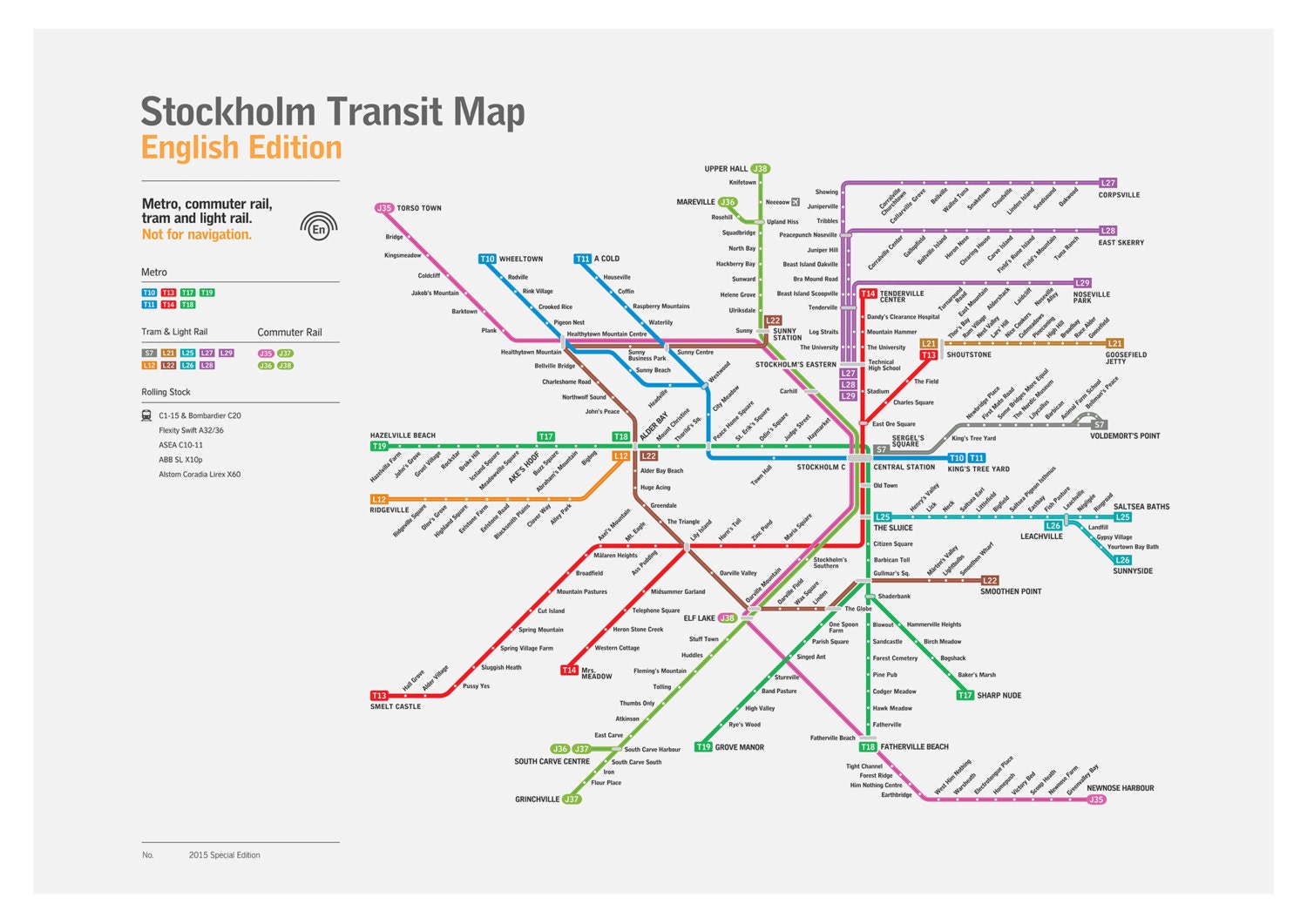
    This city truly is such a mess when it comes to transport. It's only when you've visited places like below that you truly appreciate what an utter farce we have made of our city.

    il_fullxfull.858581193_dahf.jpg

    To be fare, at the price of everything in Stockholm, you'd want to have a damn good service.


  • Registered Users Posts: 17,553 ✭✭✭✭LXFlyer


    trellheim wrote: »
    with a double bus lane how are you going to fit cycle lane(s) the north end of trinity is not too bad as there are few stops on it but this is a who new ballgame.

    Where's the actual plans here ? DCC not releasing ?

    They are apparently being presented to councillors tomorrow at a meeting of the Transportation Strategic Policy Committee.

    That's when we should find out exactly what is planned.

    The meeting is at 3pm and will be streamed online:
    http://www.dublincity.public-i.tv/core/portal/webcast_interactive/226785

    The agenda for the meeting is:

    1. Minutes of meeting of 10th February, 2016

    2. Letter from NTA re use of rubber in-fills, Luas tracks

    3. City Centre Transport Study

    4. College Green - public consultation

    5. Liffey Cycle Route - emerging preferred option

    6. Coca Cola Zero dublinbikes - revenue generation options to facilitate expansion

    7. Proposed Dublin City Council Special Speed Limit Bye-Laws 2016

    8. Parking Appeals Officer’s Annual Report 2015

    9. Regulation of Rickshaws

    10. 5+ axle vehicles, Cordon Area

    11. Provision of cycle training school in St Anne’s Park

    12. Cycling and Walking Promotion – proposed work programme

    13. Minutes of Cycling and Walking Sub-Committee meeting held on 2nd December, 2015

    14. Luas Cross City works

    15. Canal Cordon count 2015

    16. Motion in the name of Councillor Paddy Smyth: ....... to 'future proof' all new Luas rolling stock so that it is capable of being fitted with self driving software"........

    17. Motion in the name of Councillor Ciarán Cuffe: That the Roads and Traffic Department pilot the removal of a left turn slip lane in the city centre by replacement with tighter corner radii .........


  • Registered Users Posts: 17,553 ✭✭✭✭LXFlyer


    Just to put this into context - this is the plan in terms of bus routes to operate along the Quays between Capel Street Bridge and O'Connell Bridge:

    Existing:
    25, 25a, 25b, 26, 37, 39, 39a, 66, 66a, 66b, 67, 70, 90, 145,151

    Additional:
    9, 13, 16, 27, 40, 56a, 77a, 65, 65b, 68, 68a, 69, 122, 123

    Removed:
    83, 83a

    Of those additional routes, at least eight of them are what would be termed high frequency routes.


  • Registered Users Posts: 10,515 ✭✭✭✭MJohnston


    I just don't see how the council expect the plaza plan to be successful without the Batchelor's Walk ban. So frustrating how private interests can overrule sense for councillors.


  • Registered Users Posts: 2,145 ✭✭✭dazberry


    lxflyer wrote: »
    Existing:
    25, 25a, 25b, 26, 37, 39, 39a, 66, 66a, 66b, 67, 70, 90, 145,151

    Additional:
    9, 13, 16, 27, 40, 56a, 77a, 65, 65b, 68, 68a, 69, 122, 123

    Removed:
    83, 83a

    Of those additional routes, at least eight of them are what would be termed high frequency routes.

    The DCC document was also missing the 747, Dublin bus posted a list of all route that would/will be effected by the changes - but I can only now find it on their mobile site here.
    747

    From Dublin Airport To Heuston Station
    Normal route to O’Connell Bridge then right to Aston Quay to Wellington Quay, Parliament Street, Lord Edward Street and back on to normal route.

    From Heuston Station To Dublin Airport
    Normal Route to Lord Edward Street then left to Parliament Street, Grattan Bridge, Ormond Quay, Bachelors Walk to O’Connell Bridge and back on to normal route.

    D.


  • Registered Users Posts: 9,276 ✭✭✭cgcsb


    Has anybody discovered any more detail on the bachelor's walk proposal? it'll be interesting if there is any truth in the double bus lane proposal and how that could possibly work.


  • Advertisement
  • Registered Users Posts: 8,779 ✭✭✭Carawaystick


    lxflyer wrote: »
    Just to put this into context - this is the plan in terms of bus routes to operate along the Quays between Capel Street Bridge and O'Connell Bridge:

    Existing:
    25, 25a, 25b, 26, 37, 39, 39a, 66, 66a, 66b, 67, 70, 90, 145,151

    Additional:
    9, 13, 16, 27, 40, 56a, 77a, 65, 65b, 68, 68a, 69, 122, 123

    Removed:
    83, 83a

    Of those additional routes, at least eight of them are what would be termed high frequency routes.
    And that's just DB routes,
    add in coaches, both scheduled and unscheduled on top of this.


  • Moderators, Category Moderators, Arts Moderators, Sports Moderators Posts: 48,448 CMod ✭✭✭✭magicbastarder


    stupid question, but if the buses are operating between capel street bridge and o'connell bridge, how do they get to capel street bridge? via parliament street or capel street?


  • Registered Users Posts: 9,276 ✭✭✭cgcsb


    stupid question, but if the buses are operating between capel street bridge and o'connell bridge, how do they get to capel street bridge? via parliament street or capel street?

    basically buses that currently use George's st and turn right towards College Green will have to instead turn left towards Christchurch and then turn right onto Parliament st and continue via the quays.


  • Registered Users Posts: 17,553 ✭✭✭✭LXFlyer


    The DCC transport committee accepted the new route for the Liffey Cycleway this afternoon, rejecting a last minute proposal from irishcycle.com (which would push buses onto Benburb St and for them to access the Quays by making a right/left turn at Queen St).

    Bus users thankfully do seem to be the main winners in this - buses will continue to use the bus lanes on the Quays without any of the daft diversions that were planned.


  • Registered Users Posts: 17,553 ✭✭✭✭LXFlyer


    The final draft of the City Centre Transport Study can be obtained here (thanks to irishcycle.com):
    https://drive.google.com/file/d/0B-qTnMoHhp0lWTNvUER2ZmwyMlA3Z2xpcDVkN1VseURMTUk0/view?usp=sharing

    Unfortunately it does not include any detailed drawings for city centre streets and how everything might fit.

    Good article on it on irishcycle.com:
    http://irishcycle.com/2016/05/25/cars-to-be-allowed-on-quays-up-to-oconnell-street/


  • Registered Users Posts: 17,553 ✭✭✭✭LXFlyer


    Deedsie wrote: »
    Ya just a daft cycle route that will be completely ignored as the cyclists, as is their right, will continue to use the bus lane along the quays. It's a shame but I suppose the council are in a tough position. Public transport should be the priority.

    What the cyclists choose to do is up to them, but as a bus user I'm relieved that the proposals that would have had buses and coaches (which carry far more passengers than any other mode) making difficult right/left turns at signalled junctions which would inevitably involved increased journey times, rather than taking the current direct fully prioritised route have been rejected.


  • Closed Accounts Posts: 22,651 ✭✭✭✭beauf


    Have to say I never found cycling into town on the north side quays that much of a problem.

    The southside quays is much busier, faster, and nastier pinch points. The road surface is much worse too.


  • Registered Users Posts: 17,553 ✭✭✭✭LXFlyer


    beauf wrote: »
    Have to say I never found cycling into town on the north side quays that much of a problem.

    The southside quays is much busier, faster, and nastier pinch points. The road surface is much worse too.

    I think the cycle route is an important addition to the city, but in much the same way as the plans for College Green are doing, it makes no sense to provide these facilities at a cost of delaying a much greater number of bus passengers.

    If there were appropriate high capacity and high frequency rail alternatives then we would have a different situation, but we don't. As such plans are being prepared that just don't seem to acknowledge the importance the bus network plays in keeping this city moving.


  • Registered Users Posts: 10,515 ✭✭✭✭MJohnston


    Its desperate that the same city council that created the Grand Canal cycle path from Grand Canal Street, a great wee bit of cycling infrastructure that is clear, simple, safe, and spacious, can't even approach replicating that elsewhere. Maybe they just accidentally stumbled into that one.


  • Advertisement
  • Registered Users Posts: 961 ✭✭✭aliveandkicking


    cgcsb wrote: »
    Has anybody discovered any more detail on the bachelor's walk proposal? it'll be interesting if there is any truth in the double bus lane proposal and how that could possibly work.

    No mention of double bus lane on Bachelors Walk in the relevant section of the new DCC document (taken from irishcycle.com).
    10.2.7 The North Quays – Bachelors Walk / Eden Quay / Custom House Quay

    The Quays currently form a major traffic artery through the central city area for eastbound and westbound traffic movements. Because the primary function of the Quays is to facilitate vehicular traffic movement, it causes a high degree of severance for north-south pedestrian movement. The busiest pedestrian link in the city is the link from O’Connell Street to Westmoreland Street, crossing Bachelors Walk and Aston Quay. The vehicular traffic flow along Bachelors Walk is a significant barrier to pedestrian flow on this link, with large volumes of pedestrians frequently crowding, often in an unsafe manner, on either footpath, awaiting the pedestrian signal phase.

    From a public transport perspective, Bachelors Walk is a frequent source of delay to bus services. Buses turning southwards towards D’Olier Street have to leave the bus lane on the north side of the street and traverse two lanes of general traffic, frequently congested, to go southwards. In addition, the need to cater for general traffic means that footpath widths and bus stopping arrangements along this section are significantly below the optimal provision. Notwithstanding its current traffic focus, Bachelors Walk is a very prominent location in the city centre. Its position, directly adjacent to O’Connell Street means it forms an integral part of the urban framework of the city centre.
    The major construction elements of Luas Cross City, and the commencement of passenger services at the end of 2017, will require significant changes to junction arrangements in the City Centre including at O’Connell Street. In addition, the vehicular capacity at various junctions along the Luas Cross City corridor, particularly on either side of O’Connell Bridge, will be significantly reduced in order to cater for the Luas service.

    Proposals are also now in place to develop the Liffey Cycle Route, connecting from Heuston Station in the west to the Point in the east. As it is proposed to provide this as a segregated two-way cycle track along the entire length of the river in the City Centre, this will impact upon the current road layout on Bachelors Walk, requiring a reallocation of road space.

    It is proposed that left turning general traffic will be allowed to access Bachelors Walk as far as O’Connell Bridge. This will facilitate access to car parks and deliveries into the O’Connell Street, Henry Street and Abbey Street areas. It is also intended to remove general vehicular traffic from Eden Quay at O’Connell Bridge and to reconfigure Eden Quay as far as Marlborough Street as a public transport, cycling and pedestrian only link. Eden Quay is likely to consist of two eastbound bus lanes (one for buses stopping) on the north side of the road and a taxi rank on the river side. The right turn from Bachelors Walk onto O’Connell Bridge will be removed. This will remove through traffic from the area, and encourage traffic onto the orbital routes for access to the city centre. It will also have the ancillary effect of reducing traffic on Bachelors Walk, with only cars wishing to turn left onto O’Connell Street remaining on this section. Buses will be able to make right turns at the recently constructed Rosie Hackett Bridge.

    The removal of significant levels of through general traffic from sections of the north quays, together with corresponding changes on the south quays, set out below, will allow a more integrated central city area to develop, with a greater level of connection between areas north and south of the river.


    As you pointed out yourself there physically isn't the space for a double bus lane, a left turning general traffic lane, a two way Liffey cycle route and two footpaths on Bachelors Walk. The interesting bit for me that hasn't been picked up in the media as of yet is making Eden Quay public transport only. This will massively reduce the amount of private traffic on Bachelors Walk and the north quays in general.


This discussion has been closed.
Advertisement