Advertisement
If you have a new account but are having problems posting or verifying your account, please email us on hello@boards.ie for help. Thanks :)
Hello all! Please ensure that you are posting a new thread or question in the appropriate forum. The Feedback forum is overwhelmed with questions that are having to be moved elsewhere. If you need help to verify your account contact hello@boards.ie
Hi all! We have been experiencing an issue on site where threads have been missing the latest postings. The platform host Vanilla are working on this issue. A workaround that has been used by some is to navigate back from 1 to 10+ pages to re-sync the thread and this will then show the latest posts. Thanks, Mike.
Hi there,
There is an issue with role permissions that is being worked on at the moment.
If you are having trouble with access or permissions on regional forums please post here to get access: https://www.boards.ie/discussion/2058365403/you-do-not-have-permission-for-that#latest

N5 - Westport to Turlough [open to traffic]

191012141529

Comments

  • Registered Users, Registered Users 2 Posts: 1,753 ✭✭✭KrisW1001


    The roundabouts on N5 are 80 m diameter, the Tullamore bypass roundabouts are only 40 m in size, with the exception of the large one at the northern end.


  • Registered Users Posts: 829 ✭✭✭DumbBrunette


    If you look at the traffic counter data, the busiest approach roads to Castlebar at the moment are N5 east, N5 west, N60 and N84, in that order, so the two busiest roads are getting roundabouts while the other two national roads aren't (which is at least logical).

    The key difference between the Castlebar west junction and the N60 and N84 junctions is the amount of traffic expected to enter and leave the dual carriageway. The N60 and N84 are very busy but most traffic is expected to be heading straight in/out of Castlebar, not turning on/off the DC.

    At Castlebar west, 3,000 vehicles a day travelling between Castlebar town centre and Westport are expected to enter and leave the DC at this junction (see below) which per the TII standards would be a very high flow for a compact GSJ, hence they opted for a roundabout. The design report states that a GSJ was considered but rejected on the basis that a roundabout would be better for traffic flow.

    553649.jpg
    Pete_Cavan wrote: »
    I get the idea behind having a roundabouts at gateways into the major towns where "heavier turning movement flows are likely". What I dont get is why Castlebar west is considered to be the junction which requires the roundabout. Traffic coming from east or south of the town, likely to be the vast majority of the traffic, is going to use one of the other junctions. It is only really traffic coming from Westport which would use that western junction, and even then some of that will continue round to use one of the other junctions if travelling to the centre or eastern side of Castlebar.


  • Registered Users, Registered Users 2 Posts: 7,036 ✭✭✭Pete_Cavan


    If you look at the traffic counter data, the busiest approach roads to Castlebar at the moment are N5 east, N5 west, N60 and N84, in that order, so the two busiest roads are getting roundabouts while the other two national roads aren't (which is at least logical).

    The key difference between the Castlebar west junction and the N60 and N84 junctions is the amount of traffic expected to enter and leave the dual carriageway. The N60 and N84 are very busy but most traffic is expected to be heading straight in/out of Castlebar, not turning on/off the DC.

    At Castlebar west, 3,000 vehicles a day travelling between Castlebar town centre and Westport are expected to enter and leave the DC at this junction (see below) which per the TII standards would be a very high flow for a compact GSJ, hence they opted for a roundabout. The design report states that a GSJ was considered but rejected on the basis that a roundabout would be better for traffic flow.

    Of course the National Primary route sees the most traffic, and at present all that traffic has to continue through the town as there is no suitable route around it. Everyone coming from Westport or adjacent areas going to anywhere in Castlebar has to do so via N5 west, there's no other option. When the bypass is in place, much of that traffic will likely continue around the bypass and use one of the other junctions. Looking at the layout of the town and the locations of the junctions, its hard to see how N5 west will continue to see as much traffic. Using it to access Castlebar would have you driving on poorer quality roads for longer, and having to pass through the town to get to anywhere that isn't the west side of the town. Most of the employment and large retail in Castlebar is on the eastern side of the town, much easier accessed from the N60 junction. Any point in the town centre is going to be 1.5km further from the new N5 west roundabout, than from the N84 junction.


  • Registered Users, Registered Users 2 Posts: 4,037 ✭✭✭Cosmo Kramer


    I'd be really surprised if many people travelling into Castlebar town centre from the west decided to go around to the N84 junction to access the town. If you know the layout of the town then it doesn't make sense - if you go in via the old N5 from Westport you have very easy access to the town centre, the newer shopping area around Tesco and Dunnes, as well as the hospital and GMIT.

    Whereas if you go around to the Ballinrobe Road access you'll then have to wind your way in through Saleen, past the railway station, Spencer Park, Spencer Street and then around the Mall to get into the town - that route also includes two sets of lights compared to none on the current route. Next to nobody is going to choose to go that way.

    Some will go for the Breaffy Road access to get to that end of town, the industrial parks, out of town retail and McHale Park on match days, but the vast majority will come off at Derrylea and just go in the old road because it's the easiest way in.


  • Registered Users, Registered Users 2 Posts: 4,720 ✭✭✭serfboard


    At Castlebar west, 3,000 vehicles a day travelling between Castlebar town centre and Westport are expected to enter and leave the DC at this junction (see below) which per the TII standards would be a very high flow for a compact GSJ, hence they opted for a roundabout. The design report states that a GSJ was considered but rejected on the basis that a roundabout would be better for traffic flow.
    Let's think about the traffic movements. What is the probability that someone travelling West on the N5 will access Castlebar from the Castlebar West junction? Zero, or vanishingly small.

    Equally, what is the likelihood that someone from the Western side of Castlebar, will use the Castlebar West junction to travel East? Again, zero or vanishingly small.

    Therefore, the only two movements needed are Eastbound traffic on the DC heading into Castlebar, and Castlebar traffic heading Westbound. The former simply needs a slip lane.

    The latter needs a bridge and a slip, which I accept is more expensive, but not compared to the two junctions that are being built at the N84 & N60. This, in my view, would constitute doing it properly.

    As I said before, I've no issue with the roundabouts at Castlebar East and Westport East, but forcing traffic to come to a complete stop in the middle of a dual carriageway is ridiculous, unnecessary and a less-safe approach then the one outlined above.

    There are logical arguments given as to why a roundabout was better, but should some form of GSJ have been chosen, there are plenty of logical arguments that could be wheeled out in favour of that approach. As I said, the end result is something that has all the hallmarks of a political decision, but which seeks to back up that political decision with engineering or logical arguments.

    And if anyone here thinks that businesses in Castlebar did not lobby to get a roundabout put in here, then that would make Castlebar one of the few (only) towns in Ireland that didn't. And remember, at the time that this was being designed, Castlebar had the most powerful politician in the country as their local TD.


  • Registered Users, Registered Users 2 Posts: 1,753 ✭✭✭KrisW1001


    serfboard wrote: »
    As I said before, I've no issue with the roundabouts at Castlebar East and Westport East, but forcing traffic to come to a complete stop in the middle of a dual carriageway is ridiculous, unnecessary and a less-safe approach then the one outlined above.
    Roundabouts do not require traffic to come to a complete stop.

    What's more, the roundabout is achieving the very thing you are asking for: it evens up the priority of traffic flows such that traffic leaving Castlebar and wishing to head West is not starved of access by traffic on the mainline (Eastbound traffic is not an issue regardless of junction type, as it's a simple sliproad in either case).

    The only type of GSJ that would be allowed under the project budget would require joining traffic to yield to drivers already on the mainline, but at this point, there's actually as much traffic joining the mainline as going through it. A full free-flow GSJ with long merging lanes would be prohibitive in terms of land take and costs.

    But really: go back and look at those traffic counts that DumbBrunette posted: we are not talking about a busy motorway interchange here - it's a moderately trafficked rural road. The 2+2 road type is already far above the capacity needed, and has been chosen primarily for safety reasons. The roundabout is not going to delay you.

    Speaking personally, I would want to fire any transport authority that would approve an extra twenty million euro just so a few drivers can get through a quiet junction 30 seconds faster, and anything better than this roundabout would cost at least that.


  • Registered Users, Registered Users 2 Posts: 2,466 ✭✭✭mayo.mick


    Some dashcam from yesterday on the N5 junction.


  • Registered Users Posts: 829 ✭✭✭DumbBrunette


    Embankment for the bridge over the Lodge Road in Westport, looking east toward the future Knockranny North roundabout. This area is very boggy and a lot of rock went in before the embankment started. Still a few more meters to go before it's topped out.

    553777.jpg


  • Registered Users, Registered Users 2 Posts: 9,527 ✭✭✭irishgeo


    Embankment for the bridge over the Lodge Road in Westport, looking east toward the future Knockranny North roundabout. This area is very boggy and a lot of rock went in before the embankment started. Still a few more meters to go before it's topped out.

    553777.jpg

    What the plan for the great western Greenway in this area?


  • Registered Users Posts: 829 ✭✭✭DumbBrunette


    ABP actually required Mayo Co Co to make some significant changes to their original plans in order to better facilitate the Greenway and bicycle traffic in general in this area, including a fully grade separated crossing of the Westport relief road.

    553820.jpg
    irishgeo wrote: »
    What the plan for the great western Greenway in this area?


  • Advertisement
  • Registered Users Posts: 829 ✭✭✭DumbBrunette


    Great aerial shot of the works to bypass the bends at Barleyhill on the N59. The Great Western Greenway runs through the trees in the foreground.

    553851.jpg

    Pic courtesy of Jack Walsh drone photography.


  • Registered Users, Registered Users 2 Posts: 5,963 ✭✭✭Chris_5339762


    Those really are some terrible bends. Fair play to whoever in authority insisted on bundling them with this scheme


  • Registered Users, Registered Users 2 Posts: 4,037 ✭✭✭Cosmo Kramer


    Michael Ring would be my guess there.


  • Posts: 0 [Deleted User]


    Where will Newport-Westport traffic go while they're building this stretch of road? Will the N59 along this road be closed completely and traffic diverted to the Newport-Castlebar Road?


  • Registered Users, Registered Users 2 Posts: 18,779 ✭✭✭✭kippy


    Where will Newport-Westport traffic go while they're building this stretch of road? Will the N59 along this road be closed completely and traffic diverted to the Newport-Castlebar Road?

    They can build most of the new road without impacting existing. May need to be closed (small diversion to the right across a new part) while it is finished.
    I don't think it's a big deal tbh


  • Registered Users Posts: 829 ✭✭✭DumbBrunette


    New aerial shot showing the realigned N59, the N5/N59 roundabout and the Westport relief road stretching into the distance.

    553971.jpg

    Link: https://m.facebook.com/photo.php?fbid=2916224038704968&id=2224058757921503&set=pcb.2916224135371625&source=49&refid=13&__tn__=%2B%3D


  • Moderators, Science, Health & Environment Moderators Posts: 5,144 Mod ✭✭✭✭spacetweek


    ABP actually required Mayo Co Co to make some significant changes to their original plans in order to better facilitate the Greenway and bicycle traffic in general in this area, including a fully grade separated crossing of the Westport relief road.
    It’s not yet clear to me how the GWG will end up but I hope the above changes eliminate the very steep hill at the start of the greenway north of Westport. This hill forces cyclists to dismount and walk their bikes up the hill and should not have been part of the design. A grade change is unavoidable but it must be done gently.


  • Registered Users Posts: 41 thomas385


    spacetweek wrote: »
    It’s not yet clear to me how the GWG will end up but I hope the above changes eliminate the very steep hill at the start of the greenway north of Westport. This hill forces cyclists to dismount and walk their bikes up the hill and should not have been part of the design. A grade change is unavoidable but it must be done gently.

    As far as I can remember from the plans, that steep hill will become an access road from the Allergan roundabout to the houses on the hill. The Greenway will be rerouted, so as you follow the road down the Allergan Road, where previously you had to go up the steep hill, you will now continue flat along by one of the old railway gate houses, behind the back of the GAA pitch, under the new road, and then conencting with the Greenway as present.


  • Registered Users, Registered Users 2 Posts: 492 ✭✭elchupanebrey


    thomas385 wrote: »
    As far as I can remember from the plans, that steep hill will become an access road from the Allergan roundabout to the houses on the hill. The Greenway will be rerouted, so as you follow the road down the Allergan Road, where previously you had to go up the steep hill, you will now continue flat along by one of the old railway gate houses, behind the back of the GAA pitch, under the new road, and then conencting with the Greenway as present.

    That steep hill part of the greenaway is now closed until the project is completed as far as I know, so the alternative access to the greenway, via the Newport rd will have to be used in the mean time.


  • Advertisement
  • Registered Users Posts: 829 ✭✭✭DumbBrunette


  • Registered Users, Registered Users 2 Posts: 2,381 ✭✭✭Westernyelp


    Rapid progress clearly visible on all sections, and it appears the bridge decks on the railway underbridges are at least partially in place.


    Yep. You can see the bridge in place from the Derrywash level crossing


  • Registered Users Posts: 829 ✭✭✭DumbBrunette


  • Registered Users Posts: 829 ✭✭✭DumbBrunette


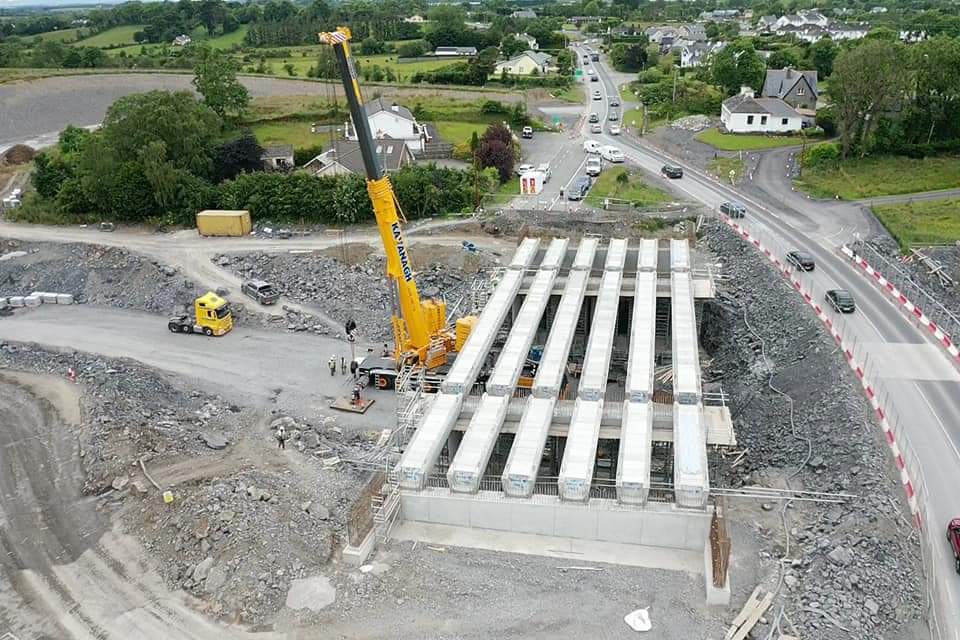
    Bridge deck concrete pour was completed last week at the N84 overbridge.

    555223.jpg

    Link: https://structive.ie/structure-305-ballinrobe-road-overbridge/


  • Registered Users, Registered Users 2 Posts: 7,625 ✭✭✭prunudo


    Bridge deck concrete pour was completed last week at the N84 overbridge.

    555223.jpg

    Link: https://structive.ie/structure-305-ballinrobe-road-overbridge/

    Thats a big bridge, are they futuring proofing it for 2+2?


  • Registered Users Posts: 667 ✭✭✭BelfastVanMan


    prunudo wrote: »
    Thats a big bridge, are they futuring proofing it for 2+2?

    Certainly looks that way.

    A rare win for common sense.


  • Advertisement
  • Registered Users, Registered Users 2 Posts: 69,537 ✭✭✭✭L1011


    We've generally been quite good at future proofing structures since the early 90s to be fair.


  • Registered Users Posts: 41 thomas385


    Could it be a possibility that they are adding in dedicated turning lanes on the bridge?


  • Registered Users, Registered Users 2 Posts: 7,036 ✭✭✭Pete_Cavan


    Preparing the N84 for future 2+2 would not be future proofing, it would be madness.


  • Registered Users, Registered Users 2 Posts: 4,037 ✭✭✭Cosmo Kramer


    Yes, if they were ever going to dual Castlebar to Galway they'd presumably do the N60 to Claremorris and link it to the M/N17. Would be amazed if there was ever a need to significantly upgrade the N84 beyond widening stretches and taking out a few bad bends.

    The wide bridge must be for slip road turning lanes or something. Which might be no harm as for some older, more local users of this road that don't travel far it will be their first experience of junctions and slip roads and I can see a few hairy moments in the early days after this opens - people heading the wrong way down slip roads in tractors etc.


  • Registered Users, Registered Users 2 Posts: 7,625 ✭✭✭prunudo


    thomas385 wrote: »
    Could it be a possibility that they are adding in dedicated turning lanes on the bridge?

    Actually that makes more sense, certainly is a wide structure whatever the reasoning is.


  • Advertisement
  • Registered Users, Registered Users 2 Posts: 5,963 ✭✭✭Chris_5339762


    L1011 wrote: »
    We've generally been quite good at future proofing structures since the early 90s to be fair.


    Generally!


    Good -> M6 from Athenry to Galway future proofed for D3.
    Bad -> M8 Portlaoise to M7/8 split not future proofed. Unlikely to be needed for a while but this 15km section not being future proofed when all the way to Naas is... well it seems silly.


  • Registered Users Posts: 5 WBEngineer


    prunudo wrote: »
    Thats a big bridge, are they futuring proofing it for 2+2?

    No, there are two vehicle lanes with a third hatched lane for turning vehicles onto/off the western access road. There is also a footpath and then verges on either side.


  • Registered Users, Registered Users 2 Posts: 2,466 ✭✭✭mayo.mick


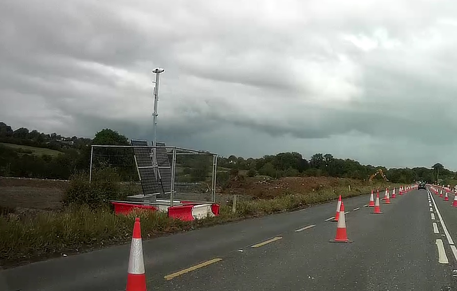
    Wonder what's the reason for these cameras on the N5 at the roundabout under construction for the new Turlough to Westport road?

    E4CHKIVUcAU6W2k?format=jpg&name=medium


  • Registered Users, Registered Users 2 Posts: 2,466 ✭✭✭mayo.mick


    Some more recent dashcam footage of the junction with the N5,


  • Registered Users Posts: 829 ✭✭✭DumbBrunette


    556298.jpg

    Islandeady overbridge looking towards Castlebar. The new access road to the local lake and cemetery is visible on the left. The original cemetery road, in the distance, will be severed when the bridge in the foreground is completed, which is due to take place in the coming weeks.

    Link: https://m.facebook.com/2224058757921503/photos/pcb.2935676703426368/2935676650093040/?type=3&source=49&__tn__=EH-R


  • Moderators, Home & Garden Moderators, Regional Midwest Moderators, Regional West Moderators Posts: 16,724 Mod ✭✭✭✭yop


    Islandeady road now closed for a number of weeks. Will be a interesting to see the layout when complete.

    I suspect the house on the left of the pic above will also have a new roadway into it.


  • Registered Users Posts: 829 ✭✭✭DumbBrunette


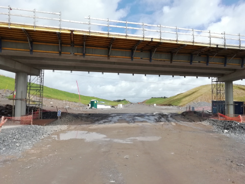
    Beam lift was completed at the N60 overbridge in early July. Pic from Structive civil engineering.


  • Registered Users, Registered Users 2 Posts: 2,381 ✭✭✭Westernyelp


    Another big bridge


  • Registered Users Posts: 829 ✭✭✭DumbBrunette


    Is the road at Islandeady open again? Is traffic using the new overbridge??


  • Registered Users Posts: 829 ✭✭✭DumbBrunette


    The railway bridge at Derrywash, outside Castlebar. The structures in the distance are a culvert and a farm underpass. Pic by Jack Walsh drone photography.


  • Advertisement
  • Registered Users Posts: 79 ✭✭drserious4


    What date are we likely to be driving this route?


  • Registered Users Posts: 79 ✭✭drserious4


  • Registered Users Posts: 829 ✭✭✭DumbBrunette


    Autumn next year if they stick to their timetable.


  • Registered Users, Registered Users 2 Posts: 1,541 ✭✭✭Dudda


    View in the other direction to DumbBrunette's post above with culvert and a farm underpass in the foreground.


  • Registered Users Posts: 829 ✭✭✭DumbBrunette


    Sheeaun road overbridge today. No activity at any of the work sites around Westport at the moment.


  • Registered Users, Registered Users 2 Posts: 2,466 ✭✭✭mayo.mick


    Some dashcam footage from a few days ago.


  • Registered Users Posts: 829 ✭✭✭DumbBrunette


    Some pics from Bank Holiday Monday. Islandeady overbridge looking towards Castlebar.


  • Registered Users Posts: 829 ✭✭✭DumbBrunette


    Islandeady overbridge looking towards Westport.


  • Registered Users Posts: 829 ✭✭✭DumbBrunette


    The cutting at Kilbree Lower, looking towards Westport.


  • Advertisement
  • Registered Users Posts: 829 ✭✭✭DumbBrunette


    The cutting at Kilbree Lower, looking towards Castlebar. The foundations for the future overbridge are visible in the foreground.


Advertisement