Advertisement
If you have a new account but are having problems posting or verifying your account, please email us on hello@boards.ie for help. Thanks :)
Hello all! Please ensure that you are posting a new thread or question in the appropriate forum. The Feedback forum is overwhelmed with questions that are having to be moved elsewhere. If you need help to verify your account contact hello@boards.ie
Hi all! We have been experiencing an issue on site where threads have been missing the latest postings. The platform host Vanilla are working on this issue. A workaround that has been used by some is to navigate back from 1 to 10+ pages to re-sync the thread and this will then show the latest posts. Thanks, Mike.
Hi there,
There is an issue with role permissions that is being worked on at the moment.
If you are having trouble with access or permissions on regional forums please post here to get access: https://www.boards.ie/discussion/2058365403/you-do-not-have-permission-for-that#latest

N/M18 (for discussing COMPLETED sections)

2

Comments

  • Closed Accounts Posts: 6,093 ✭✭✭Amtmann


    BluntGuy wrote: »
    The last bit of the table will need to be for "proposed junctions". I decided on a nice red colour for that, and I think it should become the norm. It's on the N20 page.

    Noticed that, good call.
    Those tables can be a bit of a nightmare, doing the new N11 page table was a painful experience. Updating the rest of them wasn't too bad.

    Well, frankly, it's beyond me. It may as well be quantum mechanics as far as I'm concerned!
    Also, we should slap up some of Tech2's great images onto the N20 and M18 pages, the only pictures on the N20 page atm are one of the current N20 DC (now M20 - of course, great stuff for a "history" section), and a rather dull looking snap taking by me at Mallow from the roadside (I was actually photographing a train at the time - but, whatever works heh).

    Agreed, there's no need for the M8 page to be that far ahead of all the others quality-wise. All the motorway pages should be of the same standard in terms of content and photos.


  • Closed Accounts Posts: 1,044 ✭✭✭AugustusMaximus


    BluntGuy wrote: »

    The last bit of the table will need to be for "proposed junctions". I decided on a nice red colour for that, and I think it should become the norm. It's on the N20 page.

    Nice touch.

    Blue - Motorway
    Green with yellow writing - National routes
    Red - In planning
    Orange - Under construction


  • Closed Accounts Posts: 2,468 ✭✭✭BluntGuy


    Furet wrote: »
    Well, frankly, it's beyond me. It may as well be quantum mechanics as far as I'm concerned!

    I spent years studying quantum mechanics, and believe me, the Wikipedia table system has it beat it in terms of complexity!

    Okay, maybe that is a bit of slight exaggeration. Doesn't change the fact they're incredibly user-unfriendly for most people.


  • Closed Accounts Posts: 3,010 ✭✭✭Tech3


    BluntGuy wrote: »
    I spent years studying quantum mechanics, and believe me, the Wikipedia table system has it beat it in terms of complexity!

    Okay, maybe that is a bit of slight exaggeration. Doesn't change the fact they're incredibly user-unfriendly for most people.

    This is about the only page I made on wikipedia related to roads R576 Road. Complexity to say the least and that was a small page! :confused:


  • Closed Accounts Posts: 1,044 ✭✭✭AugustusMaximus


    I've started the page at http://en.wikipedia.org/wiki/M18_motorway_(Ireland)

    I've done up a junction template with the junction numbers from openstreetmap.

    This leaves 8 junctions to be filled from Limerick to the start of the Ennis bypass section. I have no idea how many junctions there will be from the end of the Ennis bypass to Galway.


  • Banned (with Prison Access) Posts: 25,234 ✭✭✭✭Sponge Bob


    are they acttually numbered on a DC ....or only on a MW , this does not mean they don't have numbers reserved for them .

    I would personally expect the first to be numbered will be the Shannon town staggered pair as an a and b , sall we say 8a and 8b for them two at a guess ???

    What do you call the short road between Junction 8B and the roundabout at Ballycasey cross where it becomes the R471 ??

    8A will be the R471

    | Shannon Town ('''Short Stumpy Road N of Ballycasey Roundabout in Shannon with no name''')
    | <center>30px
    |colspan="2"| Shannon Town ('''Short Stumpy Road N of Ballycasey Roundabout in Shannon with no name' leading to R471''')
    |- align="center" bgcolor="0080d0" style="color: white;font-size:120%;"
    | colspan="4"| '''M18 motorway (28/8/09)'''
    |- align="center" bgcolor="000000" style="color: white"
    | Northbound Entrance and Nortthbound Exit

    | Shannon Town ('''R471''')
    | <center>30px
    |colspan="2"| Shannon Town ('''R671''')
    |- align="center" bgcolor="0080d0" style="color: white;font-size:120%;"
    | colspan="4"| '''M18 motorway (28/8/09)'''
    |- align="center" bgcolor="000000" style="color: white"
    | Southbound Entrance and Southbound Exit
    | Junction
    |colspan="2"| Southbound exit


  • Closed Accounts Posts: 1,044 ✭✭✭AugustusMaximus


    Sponge Bob wrote: »
    are they acttually numbered on a DC ....or only on a MW , this does not mean they don't have numbers reserved for them .

    I would personally expect the first to be numbered will be the Shannon town staggered pair as an a and b , sall we say 8a and 8b for them two at a guess ???

    What do you call the short road between Junction 8B and the roundabout at Ballycasey cross where it becomes the R471 ??

    8A will be the R471

    | Shannon Town ('''Short Stumpy Road N of Ballycasey Roundabout in Shannon with no name''')
    | <center>30px
    |colspan="2"| Shannon Town ('''Short Stumpy Road N of Ballycasey Roundabout in Shannon with no name' leading to R471''')
    |- align="center" bgcolor="0080d0" style="color: white;font-size:120%;"
    | colspan="4"| '''M18 motorway (28/8/09)'''
    |- align="center" bgcolor="000000" style="color: white"
    | Northbound Entrance and Nortthbound Exit

    | Shannon Town ('''R471''')
    | <center>30px
    |colspan="2"| Shannon Town ('''R671''')
    |- align="center" bgcolor="0080d0" style="color: white;font-size:120%;"
    | colspan="4"| '''M18 motorway (28/8/09)'''
    |- align="center" bgcolor="000000" style="color: white"
    | Southbound Entrance and Southbound Exit
    | Junction
    |colspan="2"| Southbound exit


    I would imagine that those two junction would be 7 and 8. Having 8A and 8B is only something you'd do if you ****ed up with the junction numbering. Although as you say, these mightn't be actual junctions at all and junctions 1 to 8 might be junctions left for a completely new motorway to be completed some time in the future.


    BTW, after looking at the maps, providing an alternative route to the Limerick to Shannon piece wouldn't be all that difficult with an alternative route already existing for a lot of it. Would take maybe 4 or 5 miles of new single carriageway road at max. A bit of straightening on the dc stretch and not much else.


  • Closed Accounts Posts: 6,093 ✭✭✭Amtmann


    I've started to expand the article. More to follow. Tech2, it would be great if you could upload a few of your photos and maybe write something about the route from south to north.


  • Closed Accounts Posts: 3,010 ✭✭✭Tech3


    This leaves 8 junctions to be filled from Limerick to the start of the Ennis bypass section. I have no idea how many junctions there will be from the end of the Ennis bypass to Galway.

    There is two junctions on the Gort-Crusheen scheme under construction. These are the Crusheen interchange and the Gort Interchange. I'm starting to upload some photos onto the M18 wiki page now.


  • Advertisement
  • Closed Accounts Posts: 1,044 ✭✭✭AugustusMaximus


    tech2 wrote: »
    There is two junctions on the Gort-Crusheen scheme under construction. These are the Crusheen interchange and the Gort Interchange. I'm starting to upload some photos onto the M18 wiki page now.

    Are these the only two junctions on this scheme ?


  • Closed Accounts Posts: 3,010 ✭✭✭Tech3


    Are these the only two junctions on this scheme ?

    Yeah just those two. I'm not sure about Gort-Oranmore would need to check the map


  • Closed Accounts Posts: 3,010 ✭✭✭Tech3


    AFAIK Gort - Oranmore has one at Kiltiernan and then the Stack at Rathmorrisey.

    Cheers Chris the NRA road scheme activity page doesn't seem to be working for the last week or so.

    Yeah the R458 or current N18 will be the link to those junctions.


  • Registered Users, Registered Users 2 Posts: 1,098 ✭✭✭glineli


    tech2 wrote: »
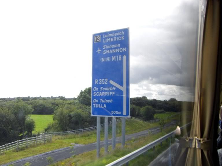
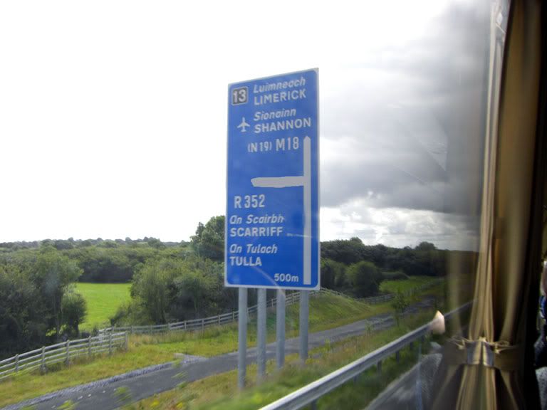
    Junction 13 is for Scariff one of the LILO's on the route. I guess when all the motorway signs are up it will give us a confirmation of the junction numbers. That junction 13 was taken is on the southbound carriageway therefore Crusheen GSJ and Gort GSJ would be junctions 14 and 15 respectively I guess.

    I might have a look into this further tonight.

    Junction 14 is barefield i believe, saw the sign last night, 15 will be crusheen


  • Registered Users, Registered Users 2 Posts: 3,110 ✭✭✭KevR


    *ROADWORKS* *N18/CLARE* Rolling lane closures are in place on the N18/Ennis Bypass southbound from the Barefield jct to Dromoland jct until 7pm. This is for motorway reclassification works. The left lane and the hard shoulder will be affected.
    ..


  • Registered Users, Registered Users 2 Posts: 1,098 ✭✭✭glineli


    KevR wrote: »
    ..


    Yesterday evening they were taking up the cats eyes on the hard shoulder. It looks like they will be putting down new lines.


  • Advertisement
  • Registered Users, Registered Users 2 Posts: 3,110 ✭✭✭KevR


    I'll be driving down to Shannon Airport tomorrow, will be interesting to see the progress they have made with the redesignation since I last drove it a couple of weeks ago. Won't get any pictures though; I'm currently cameraless!


  • Closed Accounts Posts: 3,010 ✭✭✭Tech3


    I have updated the route section on the M18 motorway wikipedia page temporarily until I find further information.

    Is there any source where I can find historic info on sections of the route such as the Newmarket-on-Fergus bypass? It would be ideal to have every motorway page brought up to the same standard as the M8 one.


  • Closed Accounts Posts: 3,010 ✭✭✭Tech3


    I intend on adding a similar pic like this one I took a few months ago of this section to the M18 wiki page when the sign in the background is in blue. For me it is the nicest part of the N18 northbound. Of course there might be better pics to come on the Gort-Crusheen scheme

    DSC01843.jpg


  • Registered Users Posts: 1,639 ✭✭✭Zoney


    tech2: that's my favorite section too (although there are many nice points along that route - even the older N18 DC bits are nice). If you get a clearer photo when the M18 sign goes up, you should submit it to SABRE photo of the month. It would work well on the banner.


  • Closed Accounts Posts: 3,010 ✭✭✭Tech3


    Zoney wrote: »
    tech2: that's my favorite section too (although there are many nice points along that route - even the older N18 DC bits are nice). If you get a clearer photo when the M18 sign goes up, you should submit it to SABRE photo of the month. It would work well on the banner.

    I took one today and it came out too fuzzy :mad. The sign is up but its a next exit sign on it. Still I will try and get a shot when the continuous yellow line is down. Also to note most of the new catseyes have been installed and the older ones removed. There are on the right side of the yellow line.

    Btw Anyone approaching Limerick at busy hours on the N18 that there was a massive tailback today as both north and southbound have been reduced to one lane near the N7/N18 bridge.

    Gort-Crusheen update: Not much work done on anything since I've been through last the R460 overbridge is getting more advanced though.


  • Advertisement
  • Closed Accounts Posts: 3,010 ✭✭✭Tech3


    Another new motorway sign on the M18. I was taking this one for potential wikipedia upload. Nearly all southbound signs have been changed over.

    DSC02544.jpg


  • Registered Users Posts: 203 ✭✭bacon&cabbage


    tech2 wrote: »
    Btw Anyone approaching Limerick at busy hours on the N18 that there was a massive tailback today as both north and southbound have been reduced to one lane near the N7/N18 bridge.

    I reckon they're going to open the slip road between N7/N20 so they can do some more work on the N7/N18 interchange - but I'm only guessing


  • Closed Accounts Posts: 6,093 ✭✭✭Amtmann


    It does have wiki potential. I'd crop it slightly first, though. A little less sky for instance! That page is looking a lot better now for all your photos Tech2.


  • Closed Accounts Posts: 3,010 ✭✭✭Tech3


    Furet wrote: »
    It does have wiki potential. I'd crop it slightly first, though. A little less sky for instance! That page is looking a lot better now for all your photos Tech2.

    Yeah I've been trying to do something with that photo but most of the time it comes out awful. Some of the photos are really temporary as I would like to get some better shots on the overbridges too. I would like to find some information regarding all the phases of the N18 too like the Newmarket-on-Fergus bypass and the Shannon section so I can expand the M18 page further.


  • Closed Accounts Posts: 6,093 ✭✭✭Amtmann


    More from the concerned locals adjacent to the Ennis Bypass: http://www.irishtimes.com/newspaper/ireland/2009/0825/1224253194826.html

    Someone needs their head examined.


  • Banned (with Prison Access) Posts: 25,234 ✭✭✭✭Sponge Bob


    Furet wrote: »
    Someone needs their head examined.

    They do have a point but are not entitled to make a bloody circus of it :(

    One northbound exit around there ( Tulla or Barefield) is very tight but that is once you get OFF the Motorway .

    This can be dealt with as a signage issue , mainly by using a giant SLOW sign and some rumble strips on the slip road .

    Entering and merging northbound is sub optimal in smaller cars as there is a bit of a climb so close that and let them use the new Barefield NORTH entrance instead where they get a flyer down a ramp before they merge .

    The current arrangement ( incl Barefield north under construction) would have 5 entrances/exits from north of ennis to south of ennis , where they only actually need 3 maybe 4 being nice to them .

    The main carriageway is safe enough @ 120kph unlike that primitive Athlone bypass ......as I have often commented .


  • Registered Users Posts: 89 ✭✭Nath


    Furet wrote: »
    More from the concerned locals adjacent to the Ennis Bypass: http://www.irishtimes.com/newspaper/ireland/2009/0825/1224253194826.html

    Someone needs their head examined.


    No wonder there are collisions when some idiots have no idea how to drive on these roads, there really needs to be some form of motorway driving education promoted.


  • Closed Accounts Posts: 17,733 ✭✭✭✭corktina


    Furet wrote: »
    More from the concerned locals adjacent to the Ennis Bypass: http://www.irishtimes.com/newspaper/ireland/2009/0825/1224253194826.html

    Someone needs their head examined.

    thats just unbelievable!.Its a fine road and any idiot can see its perfectly safe as a Mway.....(and practically empty


  • Closed Accounts Posts: 3,010 ✭✭✭Tech3


    corktina wrote: »
    thats just unbelievable!.Its a fine road and any idiot can see its perfectly safe as a Mway.....(and practically empty

    Well in terms of the mainline it is perfectly ok sightlines are fine, it is the Tulla and Barefield junctions that are brought into question.

    The two junctions are LILO's but these are frequently seem on motorways all around Europe. If its an issue close off the bloody junctions altogether, no need for a junction between Ennis and Crusheen in the first place.


  • Registered Users, Registered Users 2 Posts: 19,031 ✭✭✭✭murphaph


    Those dopes should have their driving licences stripped from them if they can't stop crashing into slip road barriers.

    Typical irish attitude-always somebody else's fault and never the driver etc.

    The Ennis bypass is a fine road-the lads in SABRE would love roads like that connecting two places with the population of Limerick and Galway. They don't even have a motorway type road between Manchester and Sheffield (probably shorter, albeit across the Pennines), only ****ty S2 roads between 2 cities of a million people each!

    M18 it is and rightly so, given those numpties in Clare's tendency to build on any road available!


  • Advertisement
  • Closed Accounts Posts: 17,733 ✭✭✭✭corktina


    wassa LILO?

    if 120k is a problem on the slip roads, just move the derestriction board back to half way up the slip..or are you saying there isnt enough room on the slip to accelerate to c 120k?


  • Closed Accounts Posts: 3,010 ✭✭✭Tech3


    corktina wrote: »
    wassa LILO?

    if 120k is a problem on the slip roads, just move the derestriction board back to half way up the slip..or are you saying there isnt enough room on the slip to accelerate to c 120k?

    Left in, Left out. Its an at-grade junction. There absolutely no space to accelerate up to 120km on that junction. I have tested it myself it definitely needs more or a deceleration and acceleration lane. I cant wait to drive on the M18 though on Friday! :D

    This is the Tulla one which I took a few weeks ago:


    DSC02333.jpg


  • Registered Users, Registered Users 2 Posts: 19,031 ✭✭✭✭murphaph


    tech2 wrote: »
    Left in, Left out. Its an at-grade junction.
    It's not an at grade junction. It's a grade separated junction with short slips. An at grade junction is one with a gap in the median for turning right instead of a bridge to get you over there to turn left onto your desired carriagweay. ALL motorway junctions (in Ireland) are LEFT IN LEFT OUT, the only difference is the severity of the curve on the offslip. :)


  • Closed Accounts Posts: 3,010 ✭✭✭Tech3


    murphaph wrote: »
    It's not an at grade junction. It's a grade separated junction with short slips. An at grade junction is one with a gap in the median for turning right instead of a bridge to get you over there to turn left onto your desired carriagweay. ALL motorway junctions (in Ireland) are LEFT IN LEFT OUT, the only difference is the severity of the curve on the offslip. :)

    Nevertheless it is a severe curve no chance of reaching 80km/hr never mind 120km/hr. I have no problem with these junctions IF motorists pulled into the overtaking lane to let others merge from the junction. Unfortunately I see very little people with that mindset.


  • Registered Users, Registered Users 2 Posts: 19,031 ✭✭✭✭murphaph


    tech2 wrote: »
    Nevertheless it is a severe curve no chance of reaching 80km/hr never mind 120km/hr. I have no problem with these junctions IF motorists pulled into the overtaking lane to let others merge from the junction. Unfortunately I see very little people with that mindset.

    Yeah I wasn't making a comment either way about the difficulty/danger/otherwise of merging/exiting at these tight junctions, just pointing out that they are not at-grade junctions, rather fully grade-separated.

    The issue of acceleration and decelleration is easy to solve-just extend the road markings along the HS either side of the junction to give people more time to adjust their speed. The junctions themselves are well able to handle traffic to/from unrestricted sections of Autobahn so a lightly trafficked Ennis Bypass with 120km/h and excellent visibility either side of the exits should be no bother.

    What's the ADS for this junction look like? Is it a fork sign? If so, the fork arm should have a diamond warning patch layed over it like other countries where they warn of particularly sharp exits. It shouldn't require any modification to the junction itself. Drivers just need to learn to drive really.

    Edit: A patch like they have on the A57(M) and many other places in the UK warns drivers of a sharp slip road:
    Dsc00054_jpg.jpg


  • Registered Users, Registered Users 2 Posts: 3,110 ✭✭✭KevR


    The Roscommon exit Eastbound on the Athlone Bypass has a warning sign similar to this one:
    pd1368646.jpg

    Not sure about the Westbound exit for that junction or the Tuam junction, never took any notice.


  • Registered Users, Registered Users 2 Posts: 19,031 ✭✭✭✭murphaph


    Thanks kev, is it stuck on as a patch to the ADS or a dopey seperate sign? Please tell me it's included on the ADS as a patch on the fork arm.....pics?


  • Registered Users, Registered Users 2 Posts: 4,720 ✭✭✭serfboard


    Sponge Bob wrote: »
    The current arrangement ( incl Barefield north under construction) would have 5 entrances/exits from north of ennis to south of ennis , where they only actually need 3 maybe 4 being nice to them .

    Agree. The NRA should tell them: "Well lads, if the Tulla junction is a problem we can always close it off ..."

    That'd soon shut them up.


  • Closed Accounts Posts: 3,010 ✭✭✭Tech3


    murphaph wrote: »
    The issue of acceleration and decelleration is easy to solve-just extend the road markings along the HS either side of the junction to give people more time to adjust their speed. The junctions themselves are well able to handle traffic to/from unrestricted sections of Autobahn so a lightly trafficked Ennis Bypass with 120km/h and excellent visibility either side of the exits should be no bother.

    What's the ADS for this junction look like? Is it a fork sign? If so, the fork arm should have a diamond warning patch layed over it like other countries where they warn of particularly sharp exits. It shouldn't require any modification to the junction itself. Drivers just need to learn to drive really.

    It would be ideal if the acceleration and deceleration lanes were extended while working on the delineation. I wonder if the NRA planned this but I doubt it as a statement lately was issued which said there was no intention to carry out work on the junctions in question.

    Yeah the ADS is a fork sign. I like the idea of the patched diamond warning sign at the end of the fork. Here is the sign in question:

    DSC02330.jpg


  • Advertisement
  • Registered Users, Registered Users 2 Posts: 19,031 ✭✭✭✭murphaph


    Thanks, that ADS is quite misleading given the fact we have pretty much no such LILO junctions on our motorway network and I presume the sign it replaced was a stack type sign with a left arrow rather than a full fork style ADS?

    The sign should be patched to show the driver it's a particularly sharp left hand curve they are about to encounter IMO. People are used to a fork sign indicating a slip road on which they will be able to decellerate off the mainline. It's dangerous as it is tbh but could be sorted so easily.


  • Closed Accounts Posts: 3,010 ✭✭✭Tech3


    murphaph wrote: »
    Thanks, that ADS is quite misleading given the fact we have pretty much no such LILO junctions on our motorway network and I presume the sign it replaced was a stack type sign with a left arrow rather than a full fork style ADS?

    The sign should be patched to show the driver it's a particularly sharp left hand curve they are about to encounter IMO. People are used to a fork sign indicating a slip road on which they will be able to decellerate off the mainline. It's dangerous as it is tbh but could be sorted so easily.

    I'm cant think of what kind of sign was there beforehand. I have a short memory :pac:

    I agree a patching of the sign and extending the acceleration and develeration lanes would make a big difference to the safety of this section.


  • Closed Accounts Posts: 6,093 ✭✭✭Amtmann


    corktina wrote: »
    thats just unbelievable!.Its a fine road and any idiot can see its perfectly safe as a Mway.....(and practically empty

    What I find interesting is the fact that the road is reported as being designed for "80km/h" according to a former engineer. One wonders if there's another agenda at work here. Striking too is the paltry reportage of the NRA's rebuttal.


  • Banned (with Prison Access) Posts: 25,234 ✭✭✭✭Sponge Bob


    Furet wrote: »
    What I find interesting is the fact that the road is reported as being designed for "80km/h" according to a former engineer. .

    Arse , the speed limit was 100kph when it was designed and some of the slips were not EVEN designed for 80kph with curves like that .


  • Registered Users, Registered Users 2 Posts: 1,043 ✭✭✭2 Espressi


    Soo...

    M18 not mentioned on the news bulletins this morning (TodayFM), and 100kph signage still in place between Killow and Tulla Rd. junctions. Has the rug been pulled from under us?


  • Registered Users, Registered Users 2 Posts: 3,110 ✭✭✭KevR


    100kmh speed limit signs still on the M6 Athlone-Ballinasloe. I'm sure they'll be changed to 120kmh signs at some point soon on all routes.


  • Advertisement
  • Registered Users Posts: 1,639 ✭✭✭Zoney


    tech2 wrote: »
    Yes the wikipedia page is taking shape now but I it has been updated also by other boards members. I would like to gather more history particularly on the Shannon - Newmarket-on-Fergus stretch though.

    Official opening of Newmarket-on-Fergus bypass was 30 Sept 2002 (link).

    It was around the time of the Newmarket-on-Fergus bypass that the old Shannon Town junction was removed and just a single LILO on northbound remaining (with proper acceleration/deceleration lanes), both carriageways of the N18 DC rebuilt properly back to the end of the Bunratty bypass, and a new GSJ for Hurlers Cross put in (old at-grade crossing removed) also at that point. Also a parallel access road was built between the new N19 junction and the new Hurler's Cross junction.

    Here's a link of active road projects in 2001 and N18 is mentioned as "Hurler's Cross/Newmarket-on-Fergus bypass".

    Basically between the current (new) N19 junction and the Hurler's Cross GSJ was already dual carriageway before the Newmarket-on-Fergus bypass, but that section was entirely rebuilt.


  • Registered Users Posts: 89 ✭✭Nath


    2 Espressi wrote: »
    Soo...

    M18 not mentioned on the news bulletins this morning (TodayFM), and 100kph signage still in place between Killow and Tulla Rd. junctions. Has the rug been pulled from under us?

    Some links that may be of interest...

    http://www.rte.ie/news/2009/0828/roads.html

    http://www.transport.ie/pressRelease.aspx?Id=124


  • Registered Users, Registered Users 2 Posts: 19,031 ✭✭✭✭murphaph


    Fantastically accurate reporting from RTE as usual :rolleyes:
    The speed limits on these roads will be increased from 100 to 120km/ph, which will mean that learner drivers, certain types of agricultural vehicles and motorbikes will be banned.


  • Registered Users, Registered Users 2 Posts: 441 ✭✭Joey Joe-Joe Jr


    Not that I'd normally be one to jump to their defence murphaph but in this case I they got it okay if it's read as below. ;)
    murphaph wrote: »
    The speed limits on these roads will be increased from 100 to 120km/ph, which will mean that learner drivers, certain types of agricultural vehicles and [certain types of] motorbikes will be banned.


  • Moderators, Education Moderators Posts: 5,028 Mod ✭✭✭✭G_R


    RT&#201 wrote: »
    from 100 to 120km/ph

    do they know that means 120 kilometres per per hour?

    some of their journalists really are awful


  • Advertisement
Advertisement