Advertisement
Help Keep Boards Alive. Support us by going ad free today. See here: https://subscriptions.boards.ie/.
If we do not hit our goal we will be forced to close the site.

Current status: https://keepboardsalive.com/

Annual subs are best for most impact. If you are still undecided on going Ad Free - you can also donate using the Paypal Donate option. All contribution helps. Thank you.
https://www.boards.ie/group/1878-subscribers-forum

Private Group for paid up members of Boards.ie. Join the club.
Hi all, please see this major site announcement: https://www.boards.ie/discussion/2058427594/boards-ie-2026

Interesting Maps

1377378379380381383»

Comments

  • Moderators, Category Moderators, Arts Moderators, Sports Moderators, Paid Member Posts: 54,416 CMod ✭✭✭✭magicbastarder


    that map shows nine (or more) triple divides; would be an interesting task to visit each one. i suspect the easiest one to get to would be the one near Dijon.

    Edit: the latter one is somewhere around Langres

    https://en.wikipedia.org/wiki/Langres


  • Registered Users, Registered Users 2 Posts: 905 ✭✭✭minggatu


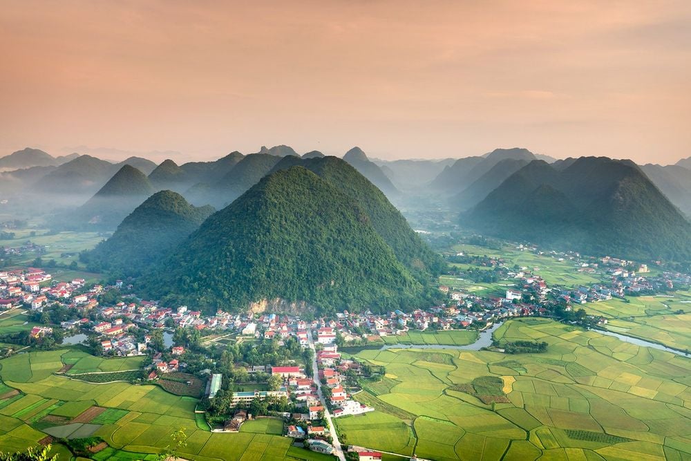
    Panoramic view of Bac Son valley from the top of Mount Na Lay in Bac Son district, Lang Son province, Vietnam

    large_bac-son-valley-top-vietnam-shutterstock_1157240827.jpg_e064ed163a.jpg

    https://www.roughguides.com/gallery/the-best-aerial-views-in-the-world/


  • Registered Users, Registered Users 2 Posts: 7,023 ✭✭✭Charles Babbage


  • Registered Users, Registered Users 2 Posts: 6,696 ✭✭✭yagan


    Gulf of Mexico? Never heard of it! 😉


  • Advertisement
  • Registered Users, Registered Users 2, Paid Member Posts: 219 ✭✭Tippman24


    A few years ago i was out in Canada and was in the general area where the rivers flow into three different oceans. Our guide did advise however that there is an ongoing debate about the Hudson Bay area and if it part of the Atlantic or Arctic .Oceans


  • Moderators, Category Moderators, Arts Moderators, Sports Moderators, Paid Member Posts: 54,416 CMod ✭✭✭✭magicbastarder


    i was in the same rough area (2003) - on the athabasca glacier; i think it was a six hour hike from there to the triple divide.


  • Registered Users, Registered Users 2 Posts: 7,023 ✭✭✭Charles Babbage


    The interesting thing about North America is how close to the Great Lakes the other basins go. There is nothing much flowing into the Great Lakes from the south or west. But this allowed navigation across large areas of the continent with minimum gaps, this is not true of Africa.


  • Registered Users, Registered Users 2 Posts: 905 ✭✭✭minggatu


    Literal translation of United States states and their capitals qoqs6d7ujv0g1.jpeg

    https://www.reddit.com/r/MapPorn/comments/1ove89x/literal_translation_of_united_states_states_and/


  • Registered Users, Registered Users 2 Posts: 905 ✭✭✭minggatu


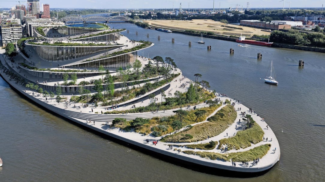
    Planned opera in Hamburg

    wide__1000x562__desktop__scale_2.jpg

    https://www.zeit.de/kultur/2025-11/hamburg-kuehne-oper-architekturwettbewerb-gewinner


  • Advertisement
  • Moderators, Social & Fun Moderators, Paid Member Posts: 14,058 Mod ✭✭✭✭JupiterKid


    3D effect relief map of the Cotswolds and Severn estuary in Britain

    3D_cotswold_way_2025_restored_20000px_lowres_1080x.jpg


  • Moderators, Social & Fun Moderators, Paid Member Posts: 14,058 Mod ✭✭✭✭JupiterKid


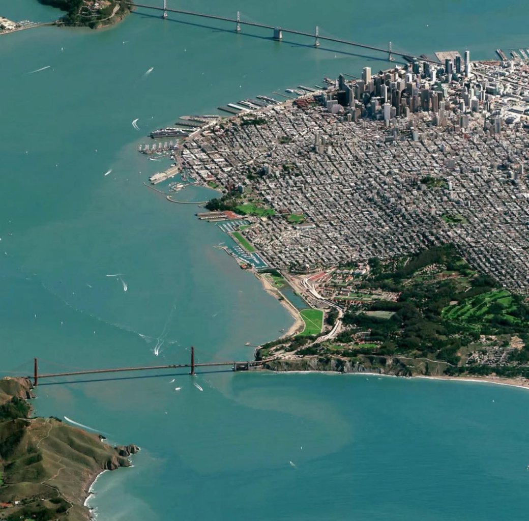
    Aerial photo of San Francisco looking east with the Golden Gate bridge in the lower part of the image

    FB_IMG_1763047694640.jpg


  • Moderators, Social & Fun Moderators, Paid Member Posts: 14,058 Mod ✭✭✭✭JupiterKid


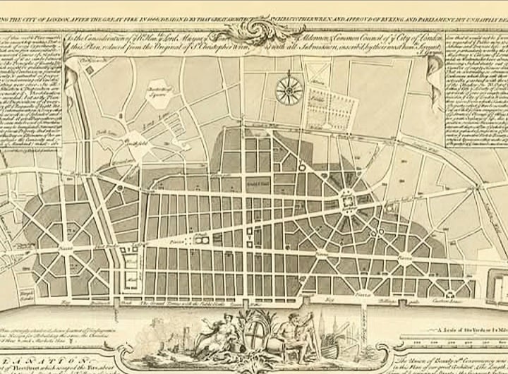
    John Glyn's map of the unbuilt plan for the reconstruction of the City of London from the 1670s, featuring Sir Christopher Wren's plans for a completely new street layout of the city.

    Screenshot_20251113_230433_Facebook.jpg


  • Registered Users, Registered Users 2 Posts: 905 ✭✭✭minggatu


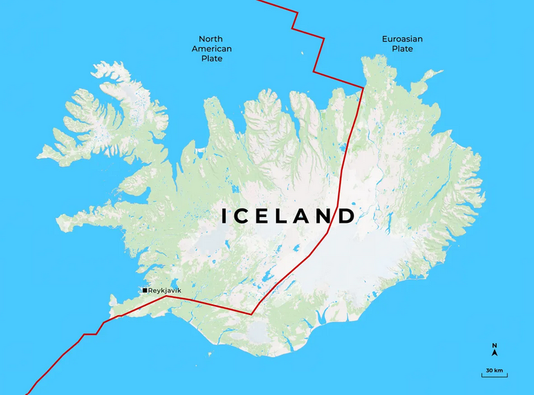
    Most Icelanders are Americans.

    G5qGHr4acAUB5WZ.png

    https://x.com/amazingmap/status/1989049654282186924/photo/1


Advertisement