Advertisement
If you have a new account but are having problems posting or verifying your account, please email us on hello@boards.ie for help. Thanks :)
Hello all! Please ensure that you are posting a new thread or question in the appropriate forum. The Feedback forum is overwhelmed with questions that are having to be moved elsewhere. If you need help to verify your account contact hello@boards.ie

Interesting Maps

Options
11617192122243

Comments

  • Registered Users Posts: 1,113 ✭✭✭Psychlops


    Completely erroneous to lump the north of Ireland in with the “UK” for the Coronavirus.

    Statistically it makes far more sense to report incidences for the island of Ireland.


    You are aware that the 6 counties that make up the North of Ireland are part of the UK & a different Country & jurisdiction with different laws & Government & services & everything else that is not in the 26 Counties of the Republic of Ireland arent you?


  • Registered Users Posts: 18,925 ✭✭✭✭BonnieSituation


    Psychlops wrote: »
    You are aware that the 6 counties that make up the North of Ireland are part of the UK & a different Country & jurisdiction with different laws & Government & services & everything else that is not in the 26 Counties of the Republic of Ireland arent you?

    From the pov of it being a viral outbreak, it very much makes sense to report the island as one. However, there are obvious issues surrounding that as you pointed out.

    When the COVID-19 case in Belfast was announced, the HSE had a press conference. The outbreak in the north is an Irish outbreak, and the containment of the virus is an all-island issue.

    I remember how Foot and Mouth was handled here in 2001. It was an all-island issue.

    Plus the cows are Irish...

    Anyway I digress...


  • Registered Users Posts: 18,925 ✭✭✭✭BonnieSituation


    NIMAN wrote: »
    Did anyone else look round the map to see if there was a 2nd?

    Just me then.

    I did after I read this.


  • Registered Users Posts: 3,863 ✭✭✭mikhail


    Completely missing the point but you’re sooooooo edgy.
    I'm sure it respects the Luxembourg boarder equally well. This is a stupid thing to get worked up over.


  • Banned (with Prison Access) Posts: 9,078 ✭✭✭IAMAMORON


    The Irish Sea, with St Georges Channel.

    AC1121.jpg


  • Advertisement
  • Registered Users Posts: 16,131 ✭✭✭✭Pherekydes


    NIMAN wrote: »
    Did anyone else look round the map to see if there was a 2nd?

    Just me then.

    I certainly double checked the USA. :pac:


  • Registered Users Posts: 7,202 ✭✭✭bobbysands81


    Psychlops wrote: »
    You are aware that the 6 counties that make up the North of Ireland are part of the UK & a different Country & jurisdiction with different laws & Government & services & everything else that is not in the 26 Counties of the Republic of Ireland arent you?

    How is any of that relevant to the spread of Coronavirus?

    You are aware that the Coronavirus doesn’t recognise that there’s a border on the island of Ireland? Therefore any response to the virus on the island should be done on a whole island approach in order to minimise the risk of further spreading. It’s a common sense approach, not a political one.

    If people in Finchley in England get it there’s a far less chance of people in Dublin getting it as a result then there is if someone in Belfast has it.


  • Registered Users Posts: 7,202 ✭✭✭bobbysands81


    From the pov of it being a viral outbreak, it very much makes sense to report the island as one. However, there are obvious issues surrounding that as you pointed out.

    When the COVID-19 case in Belfast was announced, the HSE had a press conference. The outbreak in the north is an Irish outbreak, and the containment of the virus is an all-island issue.

    I remember how Foot and Mouth was handled here in 2001. It was an all-island issue.

    Plus the cows are Irish...

    Anyway I digress...

    It’s common sense... but not to all.


  • Registered Users Posts: 5,570 ✭✭✭Charles Babbage


    Any know why there's such a high number in the Dundalk, Cooley, Newry area?


    Between the Pale and the Plantation. One of the last area of native speakers on the East coast, into the early 20th century in Omeath and upland South Armagh.


  • Registered Users Posts: 2,372 ✭✭✭Westernyelp


    How is any of that relevant to the spread of Coronavirus?

    You are aware that the Coronavirus doesn’t recognise that there’s a border on the island of Ireland? Therefore any response to the virus on the island should be done on a whole island approach in order to minimise the risk of further spreading. It’s a common sense approach, not a political one.

    If people in Finchley in England get it there’s a far less chance of people in Dublin getting it as a result then there is if someone in Belfast has it.

    FFS please do not infect another healthy thread with the Shaggin Corona virus


  • Advertisement
  • Registered Users Posts: 2,494 ✭✭✭ArnoldJRimmer


    fun-maps-2-4.jpg


  • Registered Users Posts: 25,420 ✭✭✭✭sligojoek


    More maps.. Less crap


  • Registered Users Posts: 5,733 ✭✭✭Duckworth_Luas


    sligojoek wrote: »
    More maps.. Less crap
    How about both?

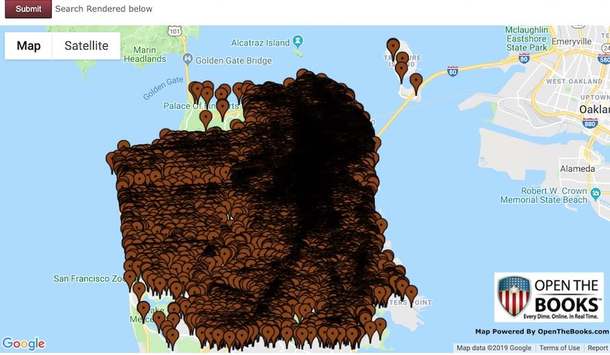
    All 120,000 reported instances of human public defecation in San Francisco 2011-2019 mapped.

    San_Fran_feces_map_c0-28-900-552_s885x516.jpg?d9f68fe0a5f919cc15450e1ebbf57c38cd611d03


  • Registered Users Posts: 22,080 ✭✭✭✭Big Nasty


    What a load of sh1t! :pac:


  • Posts: 7,712 ✭✭✭ [Deleted User]


    Completely erroneous to lump the north of Ireland in with the “UK” for the Coronavirus.

    Statistically it makes far more sense to report incidences for the island of Ireland.

    Last time I checked Switzerland wasn’t lumped in with Italy’s stats, despite them sharing a border.


  • Registered Users Posts: 2,494 ✭✭✭ArnoldJRimmer


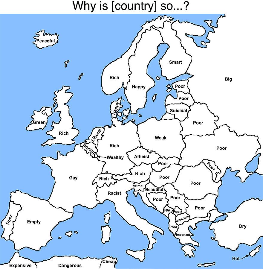
    Google autocomplete results per country in Europe

    fun-maps-2-16.jpg


  • Registered Users Posts: 19,943 ✭✭✭✭cnocbui


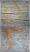
    Eastern-Europe-Escape-Map-2.jpg

    This is a WW2 escape map of Eastern Europe, printed on silk. I believe it was likely USAF. It's a composite image of both sides. I have enhanced the contrast a bit, the RL colours are a bit more muted. Click to enlarge - 5.8 MB.


  • Moderators, Politics Moderators Posts: 39,183 Mod ✭✭✭✭Seth Brundle


    Page from the book of Shannon Navigation Charts...

    P11.jpg


  • Moderators, Politics Moderators Posts: 39,183 Mod ✭✭✭✭Seth Brundle


    Ireland's Undersea Communication Cables:

    First cable between Valentia & Newfoundland in 1858
    Atlantic_cable_Map.jpg

    Now:
    505093.JPG


  • Moderators, Politics Moderators Posts: 39,183 Mod ✭✭✭✭Seth Brundle


  • Advertisement
  • Registered Users Posts: 22,260 ✭✭✭✭endacl


    Ireland Electrification Scheme - When was your area connected?
    I had a great uncle who lived and died as a bachelor farmer in a house with stone flag floors and no electricity. He was told when the electrification scheme was introduced that once everybody was connected, electricity would be free! Died in the mid 90s, in his mid 90s, still using parrafin lamps for light and making his tea on a range. Refused to connect to something he’d have to pay for.


  • Registered Users Posts: 3,386 ✭✭✭Ryath


  • Registered Users Posts: 441 ✭✭forgottenhills


    Ireland Electrification Scheme - When was your area connected?

    Thanks for that, very interesting.

    I was born into a house on a main N road within 50 miles of Dublin and those links show that the house and all the other houses in the area weren't connected to the grid until 1961. Literally within the lifetimes of many people who are still alive. And in those peoples lifetimes we have gone from houses lit by oil lamps to everyone having a device in their pocket which is both a powerful computer and a communications device that can communicate with almost everyone on the planet. Unbelievable change really in 60 years. I don't think that any future generation will see that amount of change in their lifetimes - unless some bright spark invents a time travel device.


  • Registered Users Posts: 21,524 ✭✭✭✭Tell me how


    Thanks for that, very interesting.

    I was born into a house on a main N road within 50 miles of Dublin and those links show that the house and all the other houses in the area weren't connected to the grid until 1961. Literally within the lifetimes of many people who are still alive. And in those peoples lifetimes we have gone from houses lit by oil lamps to everyone having a device in their pocket which is both a powerful computer and a communications device that can communicate with almost everyone on the planet. Unbelievable change really in 60 years. I don't think that any future generation will see that amount of change in their lifetimes - unless some bright spark invents a time travel device.

    In a similar vein, I often think about how controlled flight progressed. It took just 40 years from the first flight across the Atlantic to men walking on the moon. You could argue that since then, aviation has comparably stood still in terms of achievement while focusing on comfort, speed and safety.


  • Registered Users Posts: 4,095 ✭✭✭johndaman66


    And in those peoples lifetimes we have gone from houses lit by oil lamps to everyone having a device in their pocket which is both a powerful computer and a communications device that can communicate with almost everyone on the planet. Unbelievable change really in 60 years. I don't think that any future generation will see that amount of change in their lifetimes - unless some bright spark invents a time travel device.
    Quite a lot of people at the end of the 19th century believed that every modern convenience that could ever be invented had being invented at that stage. But even just look at was invented in that period from 1900 up to circa 1960. Sometimes your imagination really is the limit.


  • Hosted Moderators Posts: 11,362 ✭✭✭✭Scarinae


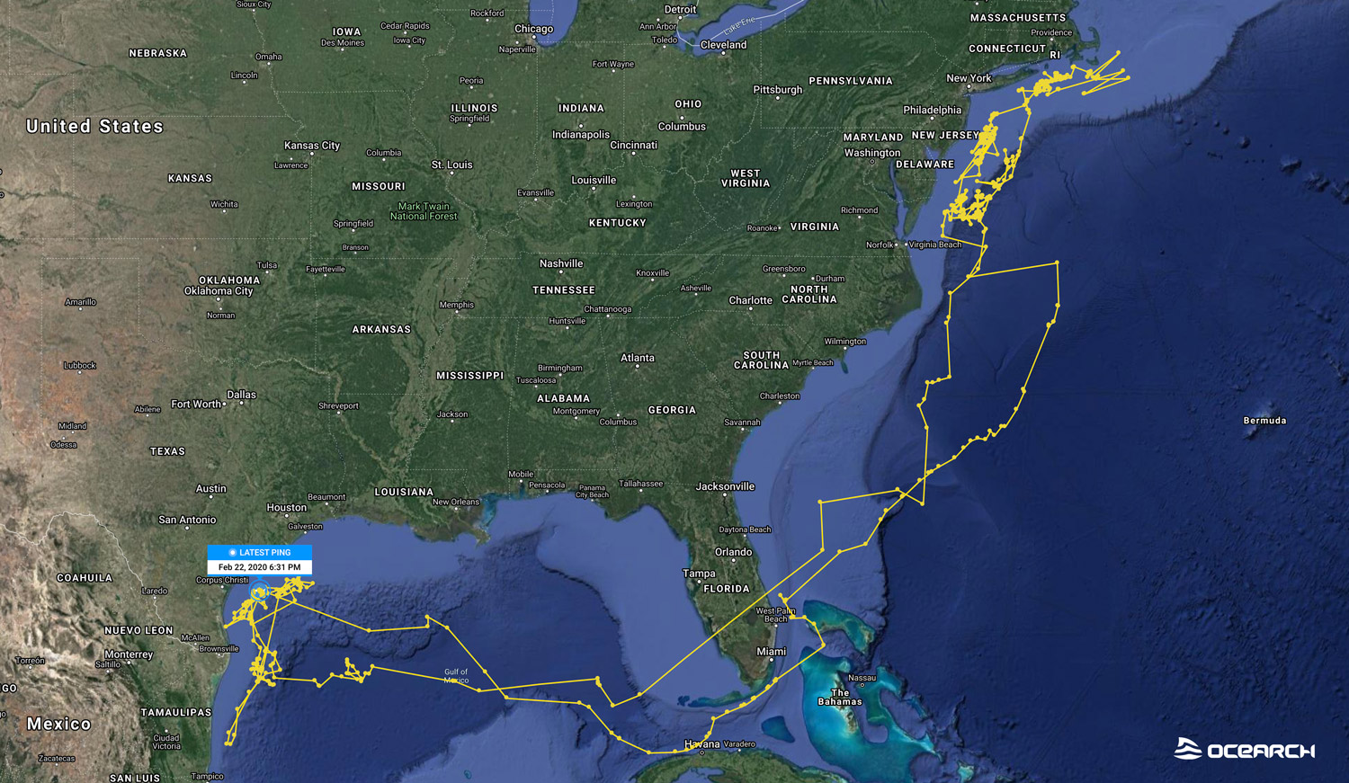
    Ocearch collects data on marine species such as sharks, dolphins and turtles and has an interactive map of that data here. The area with the most data is the Atlantic side of North America - there isn't a huge amount of data in Europe for example - but it is cool being able to track the movement of individual tagged sharks.

    For example, this map is from a mako shark called Pico:

    ERklTrPVUAAAECg?format=jpg&name=large


  • Moderators, Category Moderators, Music Moderators, Regional East Moderators, Regional Midlands Moderators, Regional Midwest Moderators, Regional Abroad Moderators, Regional North Mods, Regional West Moderators, Regional South East Moderators, Regional North East Moderators, Regional North West Moderators, Regional South Moderators Posts: 8,021 CMod ✭✭✭✭Gaspode


    Wow, Pico trekked across Florida, fair play thats some shark!


  • Registered Users Posts: 1,125 ✭✭✭dougm1970


    i found this fascinating...and sad too as i like trains / railways...


  • Registered Users Posts: 13,473 ✭✭✭✭Deja Boo


    Gaspode wrote: »
    Wow, Pico trekked across Florida, fair play thats some shark!

    Long jump :D


    Map explains the... shark alert at Corpus Christi, Texas :pac::pac::pac:

    .


  • Advertisement
  • Posts: 5,121 ✭✭✭ [Deleted User]


    IAMAMORON wrote: »
    Definitely a civil rights issue Robert, disgraceful.

    That virus wants political status.... right nie.
    It being a BBC map it divides the UK up between England/Wales/Scotland/Northern Ireland but then doesn't breakdown the cases - it applies the UK total number which is sloppy.

    Either don't show subdivisions and report the total or show subdivisions and break up the numbers.


Advertisement