Advertisement
If you have a new account but are having problems posting or verifying your account, please email us on hello@boards.ie for help. Thanks :)
Hello all! Please ensure that you are posting a new thread or question in the appropriate forum. The Feedback forum is overwhelmed with questions that are having to be moved elsewhere. If you need help to verify your account contact hello@boards.ie

Charts ( Up to T120 ) Spring 2024 ** READ MOD NOTE IN FIRST POST**

Options
  • 29-02-2024 1:48pm
    #1
    Moderators, Science, Health & Environment Moderators Posts: 16,710 Mod ✭✭✭✭


    Mod Note


    This thread is for posting/discussing/analyzing CHARTS in the shorter range timeframe up to T120 hours (next 5 days) for Spring 2024.


    If your post does not specifically relate to a chart then it doesn't belong here - Off topic posts will be moved


    Thanks


    ------------------------------------------------------------------------------------------------------------------------------------------------------------------------------

    Winter if over and done with and time to focus on Spring.

    After a mostly very mild, wet and windy winter Spring will begin on a chilly note with a showery north-westerly flow over the coming few days. Cold rain showers likely in many areas which may be wintry on Friday 1st of March, snow mostly over high ground and any accumulations will be very temporary over low lying areas. Showers mostly of cold rain from Saturday.

    Temperatures generally 3 to 6C on Friday afternoon.

    Over the coming few nights frost can be expected in places with temperatures getting down as low as -2 or -3 in places. daytime temperatures this weekend in mid single digits generally and feeling very raw at times. A big change on what we have experienced over the past month or more.

    Next week temperatures will slowly start to recover back to more average values but still may be slightly below average in places.

    It will remain unsettled with low pressure around Ireland much of the time delivering bands of rain or showers.

    From Wednesday it will become milder with winds up from the south or south-east. Temperatures getting back towards double figures from Wednesday onwards.

    Average amounts of rainfall over the coming week but above average rainfall in western areas.


«1

Comments

  • Registered Users Posts: 6,140 ✭✭✭highdef


    Latest run of the high resolution AROME model is an upgrade with regards to lying snow in many midland areas for tonight/early tomorrow.


  • Registered Users Posts: 911 ✭✭✭WolfeEire
    Clare (410ft asl)


    A much drier 10 days coming up with less than 10mm of rainfall forecast for parts of Ulster and Leinster. Only trace amounts for western Scotland and East Anglia. Quite a turnaround from a much wetter than average February.


    www.x.com/wolfeeire


  • Registered Users Posts: 5,543 ✭✭✭giveitholly


    No let up in the south or west of the country which seems to have got the wettest conditions certainly since Christmas anyway


  • Registered Users Posts: 911 ✭✭✭WolfeEire
    Clare (410ft asl)


    Still looks a lot drier than any of the last 4-6 10 day periods. Ground here in Clare is sodden.

    www.x.com/wolfeeire


  • Moderators, Science, Health & Environment Moderators Posts: 11,819 Mod ✭✭✭✭Meteorite58


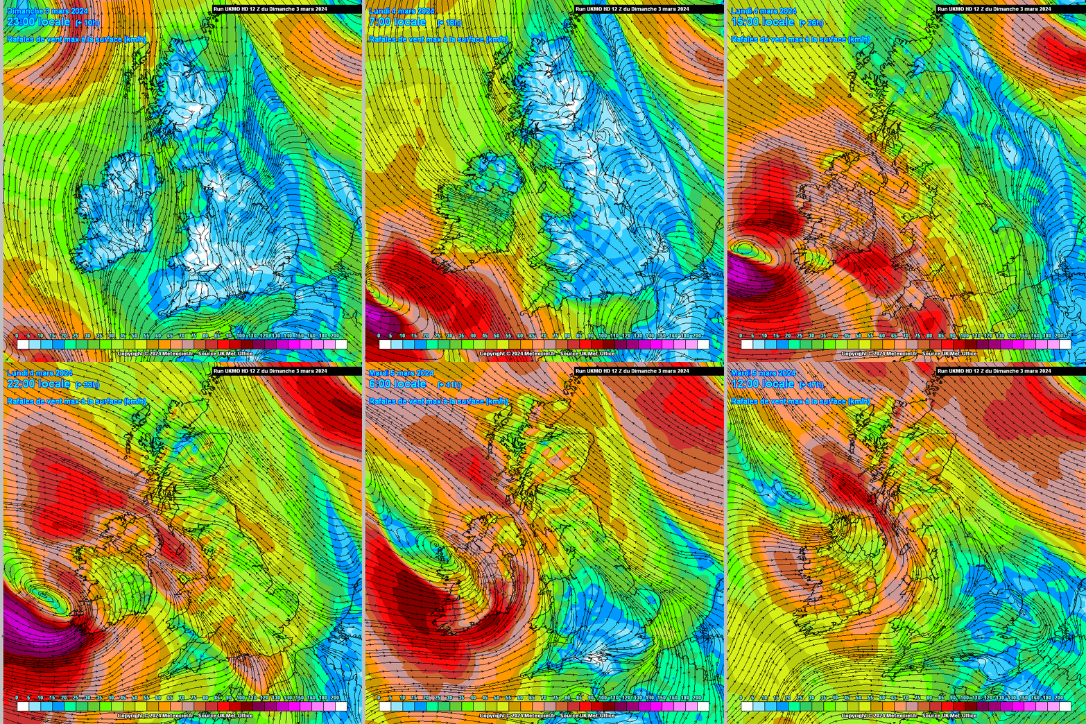
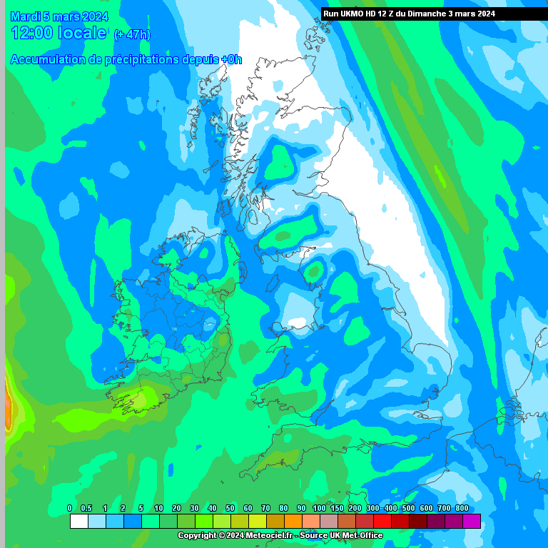
    Quite windy for Kerry and up along the Western coasts for a time later tomorrow into Tuesday. A deepening LP which has upped the speeds in the last couple of runs. Latest UKMO a way out on its own showing very strong stormy conditions ............too far ahead of the pack at this stage, will see what the next run brings out.


  • Advertisement
  • Moderators, Science, Health & Environment Moderators Posts: 11,819 Mod ✭✭✭✭Meteorite58


    Windier along the coastal areas in the SW on the latest ECM, Wetter also and cold mid level 850hpa temps possibly giving a bit of sleet on higher ground, parameters there also maybe for a few sparks over the water near the SW coast for a time tomorrow morning. Wind and rain sweeping up over he country tomorrow.

    UKMO has pared back the wind speeds quite a lot whereas the ECM has increased and both looking quite similar now. High end Yellow along the SW coastal fringes.


  • Registered Users Posts: 2,884 ✭✭✭JanuarySnowstor


    Looks like Orange territory for Cork and Kerry


  • Registered Users Posts: 2,884 ✭✭✭JanuarySnowstor


    Potential for Met Eireann to be caught out again tonight/tomorrow. Not far off stormy in the Southwest tonight and some very heavy rain across the South. Ground saturated etc


  • Registered Users Posts: 15,322 ✭✭✭✭Supercell


    Have to say,from an east coast perspective, the charts don't look the best for the next few days. Raw se/e winds, likelihood of cold showers and cloud, bring back mild westerlies.

    Have a weather station?, why not join the Ireland Weather Network - http://irelandweather.eu/


  • Registered Users Posts: 911 ✭✭✭WolfeEire
    Clare (410ft asl)


    The northwest is looking largely dry over the next 7 days. Southern counties clocking up about 25mm of rainfall. A much welcome reprieve after February saw 9 stations record over 150% of their February LTA rainfall and 2 stations record over 200% of their February LTA rainfall.


    www.x.com/wolfeeire


  • Advertisement
  • Registered Users Posts: 911 ✭✭✭WolfeEire
    Clare (410ft asl)


    The forecast (GFS) rainfall totals up to Sunday evening bring a much welcome reprieve for the Shannon River Basin and the sodden Mid-West and South-West. The Western Isles unusually are the driest spot in Ireland and the UK.]


    www.x.com/wolfeeire


  • Registered Users Posts: 1,490 ✭✭✭typhoony


    I don't why it is but a SE wind has the biggest effect on dropping water levels on the shannon. Weather could be quite pleasant in the run up to paddy weekend as the SE wind is replaced by a more SW wind


  • Registered Users Posts: 5,849 ✭✭✭Chris_5339762


    Those charts may be forecasting a reprieve, but for us in the south it'll basically be drizzle instead of rain. No letup and no sign of a decent two week spell of good weather.


  • Moderators, Science, Health & Environment Moderators Posts: 11,819 Mod ✭✭✭✭Meteorite58


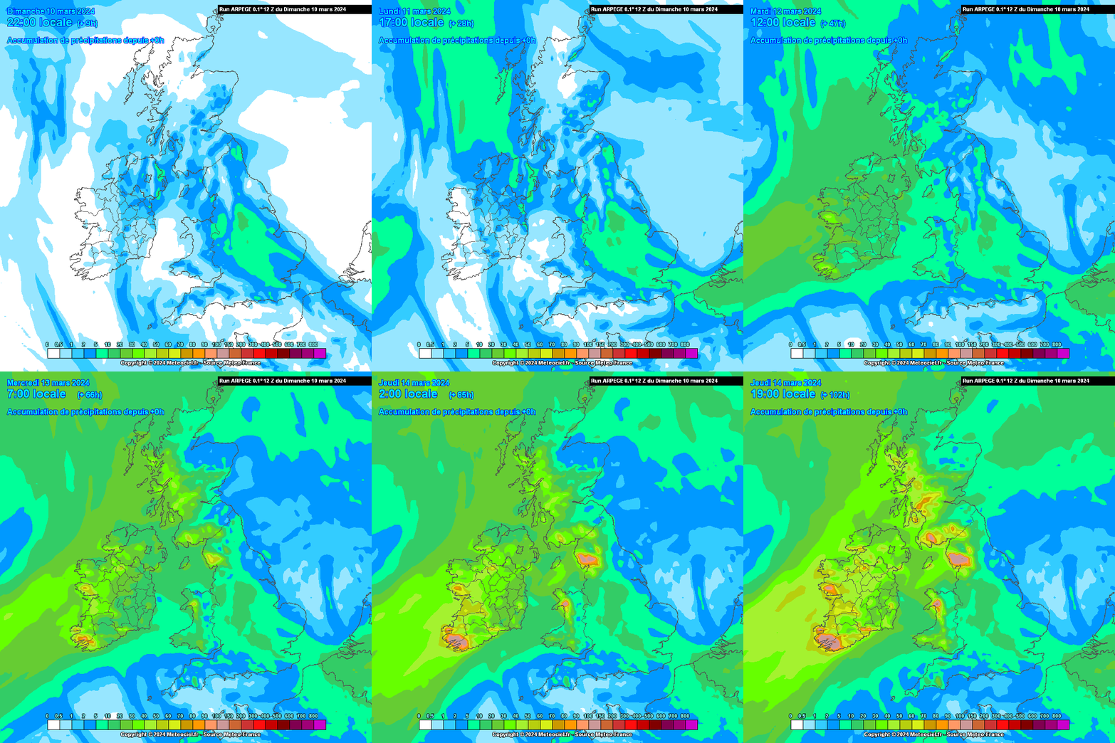
    Under the influence of LP for the week coming with rain spreading inland from the W tomorrow afternoon, very wet in the SW especially higher terrain . Bit milder in general for the next five days. Tues, Thurs , Fri and Sat could see temps up to 13 or 14C or so. Breezy at times, but nothing of note. No let up in the rain after this week with some big totals showing up in Atlantic coastal counties, not a good start for the farmers this spring especially the Western half of the country.


  • Registered Users Posts: 9,430 ✭✭✭weisses


    What is it with the MTC forecast stating "occasional light rain" for tonight, for tomorrow it states "rain tapering off to showers," and we are under an orange warning for rainfall, Are there different models used? Am I missing something here?


  • Registered Users Posts: 15,322 ✭✭✭✭Supercell


    Yeah I thought the same, the fax charts are dreadful for the next few days, unless you are a duck. From a Dublin perspective he isn't far off I suppose but even here I think its not going to be all plain sailing, or maybe it will! qwack qwack!

    Have a weather station?, why not join the Ireland Weather Network - http://irelandweather.eu/


  • Registered Users Posts: 6,879 ✭✭✭pauldry


    Don't think those totals will materialise. Maybe 80mm on the mountains of Kerry 40 to 60mm in other areas South and West over the period.


  • Registered Users Posts: 15,322 ✭✭✭✭Supercell


    Looks like MT was right, at least for here, far less rain than I thought we were going to get so far, just showery rain here really .

    Have a weather station?, why not join the Ireland Weather Network - http://irelandweather.eu/


  • Moderators, Science, Health & Environment Moderators Posts: 11,819 Mod ✭✭✭✭Meteorite58


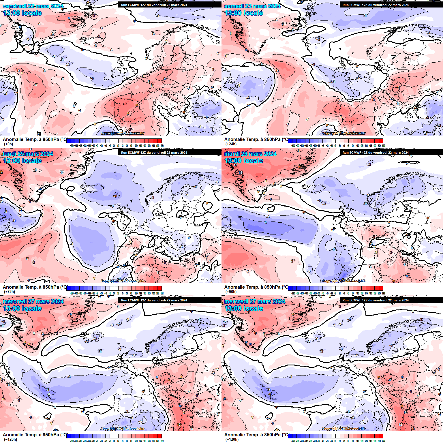
    Colder airmass on the way from Friday and back to some wintry showers with hail showers becoming a feature over the weekend, more wintry the Further up along the NW with perhaps some white mountain caps over the weekend, cooler by day and night over the weekend than recent days. Looks showery on Fri with good bright spells ,showers retreating to coasts by evening, more widespread on Sat with maybe some longer spells of rain but dry spells also, again retreating to coasts by evening, feeling very cold in the wind, Sunday looks like more widespread frontal rain.

    A bit breezy at time on Fri, more widespread windy conditions on Saturday. Sunday for now looks very wet in the S, SE with upwards of 25mm showing up in 24 hrs but will need to keep an eye on the track of the fronts closer to the time.

    Slow moving fairly narrow frontal band making its way across the country tomorrow, breezy and windy along Atlantic coasts, rainfall amounts not huge, the West getting the highest of maybe up around 10 or 15mm in places, weakening as it crosses the country.

    528dam line S of the country for a time over the weekend.


  • Registered Users Posts: 5,849 ✭✭✭Chris_5339762


    Nice week **** weekend. The absolutely miserable trend continues.


  • Advertisement
  • Moderators, Science, Health & Environment Moderators Posts: 11,819 Mod ✭✭✭✭Meteorite58


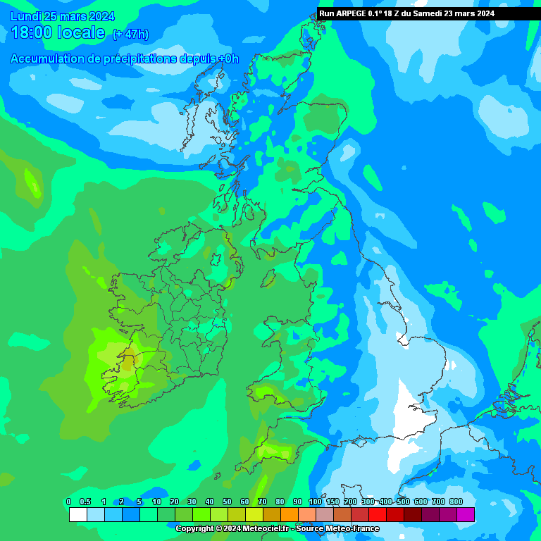
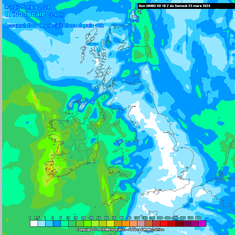
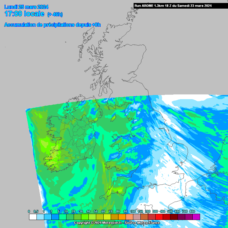
    Heaviest rain now more in the Western half of the country on Sun into Mon and heaviest nearer the coasts. Further East should remain dry until evening with rain spreading to all areas for a time. Quite an unsettled outlook with LP's dominant and well past 120hrs too, Temps remaining on the cool side.


  • Moderators, Recreation & Hobbies Moderators Posts: 11,079 Mod ✭✭✭✭igCorcaigh


    What about that potential storm, has that gone away?


  • Moderators, Science, Health & Environment Moderators Posts: 11,819 Mod ✭✭✭✭Meteorite58


  • Moderators, Recreation & Hobbies Moderators Posts: 11,079 Mod ✭✭✭✭igCorcaigh


    I think there was? Not manifesting anyway. Could have been FI stuff, not too sure. Apologies.


  • Moderators, Science, Health & Environment Moderators Posts: 11,819 Mod ✭✭✭✭Meteorite58


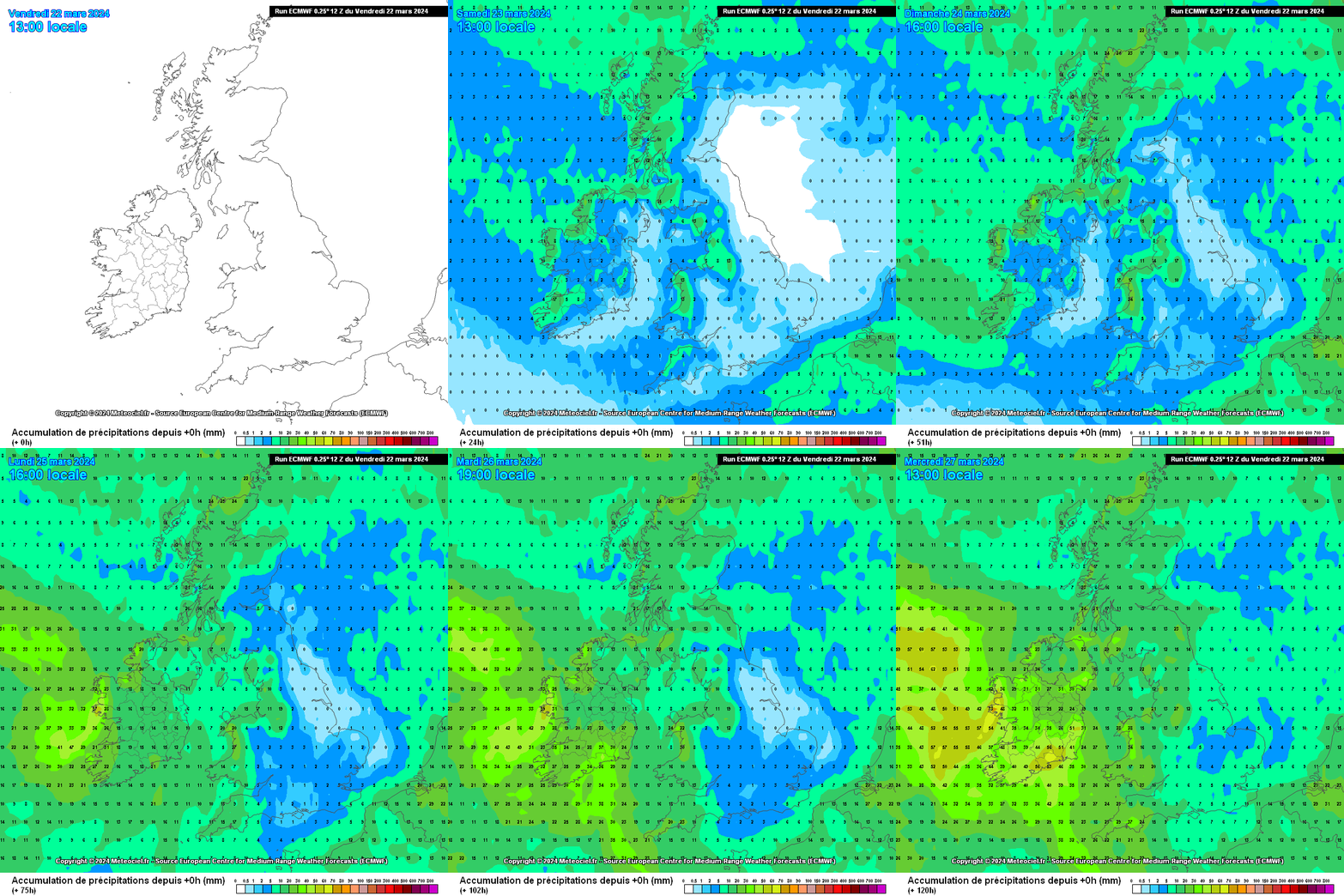
    Rainfall totals upgraded again on the ECM for the SW especially Kerry, most if the rain later Sun into Mon.


  • Registered Users Posts: 1,986 ✭✭✭mcburns07


    If it's not raining, it's blowing a gale. What a dreadful run of weather.


  • Moderators, Science, Health & Environment Moderators Posts: 11,819 Mod ✭✭✭✭Meteorite58


    Quite a high end Yellow warning now for Kerry going by the Euro models. With the saturated ground getting up to 50mm would cause local flooding, wouldn't take much more of an upgrade to make it an Orange warning, will see the mornings charts.

    Edit: included additional chart .


    Post edited by Meteorite58 on


  • Moderators, Science, Health & Environment Moderators Posts: 11,819 Mod ✭✭✭✭Meteorite58


    More a spread in the higher rainfall totals now as reflected in the wider area under Yellow warnings.


  • Moderators, Science, Health & Environment Moderators Posts: 11,819 Mod ✭✭✭✭Meteorite58


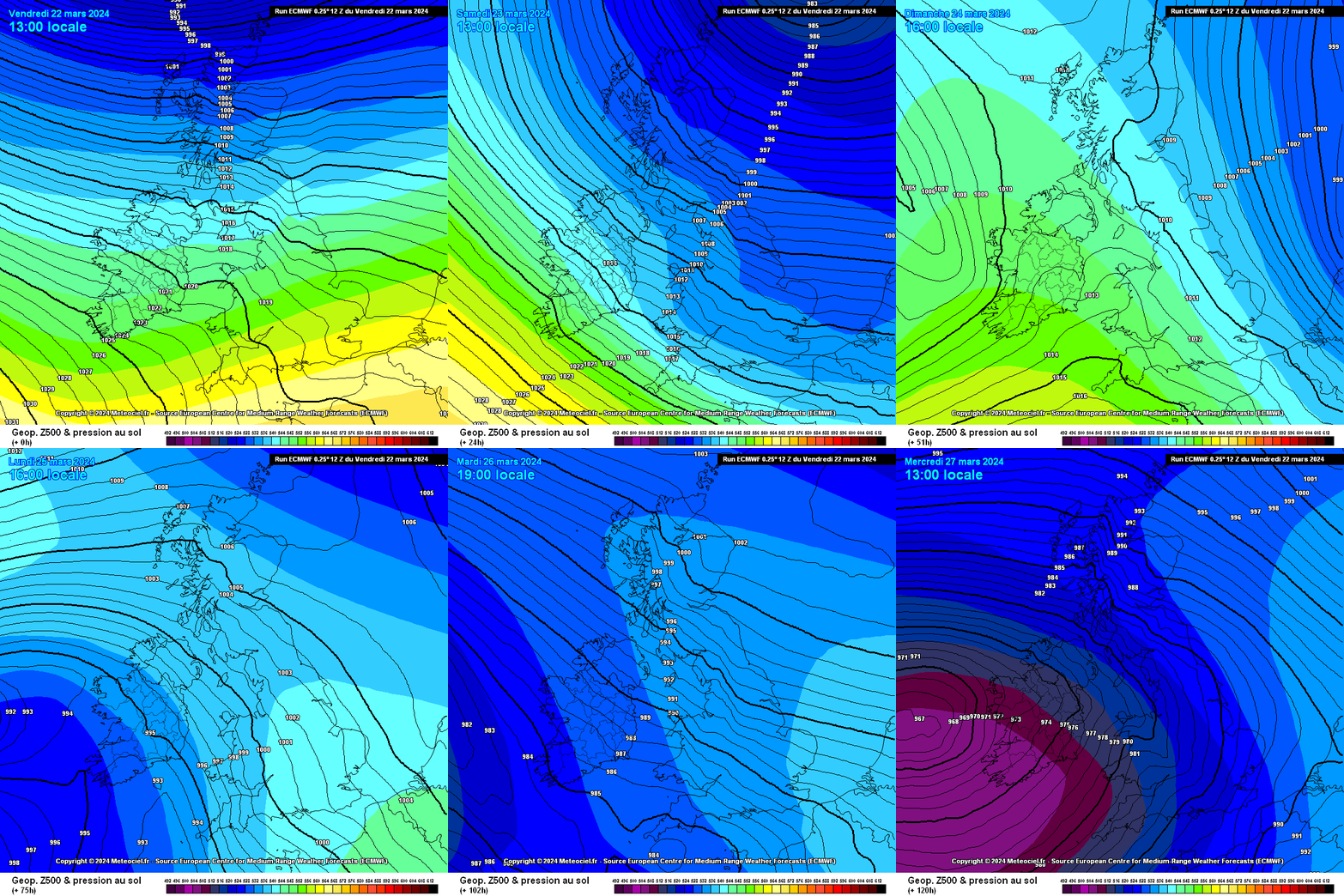
    Bit of a scatter in the model predictions from Fri through the weekend but some very windy to stormy charts showing up around Fri/ Sat and lot of frontal rain bands and showery conditions. Will see what the charts show tonight.


  • Advertisement
  • Registered Users Posts: 1,831 ✭✭✭adocholiday


    Indeed, a lot of model consensus already on a deep low to the West, UKMO has it going as deep as 947hPa with some fairly strong gusts showing. I expect it will moderate as we get closer to the weekend though, as has been the trend for most of the storms we've had of late.


Advertisement