Advertisement
If you have a new account but are having problems posting or verifying your account, please email us on hello@boards.ie for help. Thanks :)
Hello all! Please ensure that you are posting a new thread or question in the appropriate forum. The Feedback forum is overwhelmed with questions that are having to be moved elsewhere. If you need help to verify your account contact hello@boards.ie

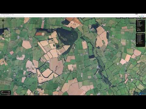
Clonmel to Thurles Greenway (Lets take Tipp off track)

Options
  • 31-05-2017 12:31am
    #1
    Posts: 0


    Hi folks.

    Ive set up a separate thread for this project as i feel such an ambitious project deserves its own thread and that i somewhat derailed the other thread.

    I suppose i'm passionate about this project because I love the railway. It is such a beautiful way of travelling and while i accept that the Thurles to Clonmel line was non viable at the time of closure, i think its a real shame that parts of the line have disappeared but hindsight has 20/20 vision and all that. There is real appetite for such a project to link the two towns. Ive set up the FB and twitter page which has been a success. Here they are again

    www.facebook.com/tippofftrack
    www.twitter.com/tippofftrack

    I think though in order to advance that we need to identify a group to lead the campaign for this project and combine expertise. Cllr Jim Ryan is fighting our corner in Council chambers but the Waterford Greenway founders setup a group way back in 2010 to examine the potential and i think we should do likewise.

    Id be happy for a couple of willing participants on boards to contribute with me in terms of meeting and generating ideas? I am conscious of the fact that you will probably have work and family commitments and may not have the time but there is alot of knowledge on the Tipperary thread which between us all we can achieve something historical, great, worthwhile and something we will always be proud of.


«13

Comments

  • Moderators, Recreation & Hobbies Moderators Posts: 10,911 Mod ✭✭✭✭Ponster


    With what you already know can you explain the overall steps involved in such a project once the group is formed? Is there lobbying to be done at a local/national level? Who actually owns the existing rails? How did Waterford raise the money to pay for the construction of their greenway?

    edit: Now that I think about it, I guess there has to be some sort of feasibly study carried out to determine how much existing track exists that could be reused. From a quick look on Google Earth there doesn't appear to be a lot left to work with (meaning having to buy land/acquire rights from land owners?).


  • Moderators, Recreation & Hobbies Moderators Posts: 10,911 Mod ✭✭✭✭Ponster


    Looking at this, it seems that a lot of rail has been scrubbed just south of Thurles (breaks highlighted in yellow).


    rail.jpg

    Click on the image to see the full version.

    A useful tool when doing historical research such as this is the Ordnance Survey Ireland site which allows you to superimpose the late 19th C and early 20th C maps with the more recent ones.

    http://www.gov.ie/services/explore-maps-using-the-osi-free-viewer/


    Select ORTHO 2000 on use the overlay slider to see exactly where they is and is no longer any railway.

    A quick Youtube video to demo. This is a section of rail just south of Fethard.


  • Posts: 0 [Deleted User]


    Ponster wrote: »
    Looking at this, it seems that a lot of rail has been scrubbed just south of Thurles (breaks highlighted in yellow).


    rail.jpg

    Click on the image to see the full version.

    A useful tool when doing historical research such as this is the Ordnance Survey Ireland site which allows you to superimpose the late 19th C and early 20th C maps with the more recent ones.

    http://www.gov.ie/services/explore-maps-using-the-osi-free-viewer/


    Select ORTHO 2000 on use the overlay slider to see exactly where they is and is no longer any railway.

    I used and linked osi on the other page the other day and i did notice that there appears to be quite alot of the line removed but i was unaware as to how the overlay slider works. Very handy thanks. Also there seems to be an industrial/business park build up around where it diverted north at Clonmel station. It seems that the train used come into clonmel from where Carrigeen business park stands in the present day.

    If a feasibility study goes ahead it will help all concerned to establish the facts and costs involved or if the project is feasible to go ahead at all.

    From our point of view, all we can do is create a voice but I think a core group is vital going forward in order to get our ideas and views across.


  • Registered Users Posts: 1,817 ✭✭✭marvin80


    If a feasibility study goes ahead it will help all concerned to establish the facts and costs involved or if the project is feasible to go ahead at all.

    From our point of view, all we can do is create a voice but I think a core group is vital going forward in order to get our ideas and views across.

    It looks like it's a daunting task with some barriers along the way (like Carrigeen business park) and land no longer owned by Irish Rail but when you see the likes of the Newport - Mulranny Greenway (https://www.greenway.ie/Trail-MN-01.html) they found a way.
    For example a designated path (similar to the one along the bypass in Clonmel) could be a solution.

    Anyway, that all forms part of the Feasibility study I'd assume.

    As regards forming a core group - I think this is a great project and will help in any way I can but unfortunately I no longer live in Tipperary and I'm only down that direction once every 6 weeks or so.
    Please let me know if I can help in some form though.


  • Posts: 0 [Deleted User]


    marvin80 wrote: »
    It looks like it's a daunting task with some barriers along the way (like Carrigeen business park) and land no longer owned by Irish Rail but when you see the likes of the Newport - Mulranny Greenway (https://www.greenway.ie/Trail-MN-01.html) they found a way.
    For example a designated path (similar to the one along the bypass in Clonmel) could be a solution.

    Anyway, that all forms part of the Feasibility study I'd assume.

    As regards forming a core group - I think this is a great project and will help in any way I can but unfortunately I no longer live in Tipperary and I'm only down that direction once every 6 weeks or so.
    Please let me know if I can help in some form though.

    Any help at all will do.


  • Advertisement
  • Posts: 0 [Deleted User]


    Just on Compulsory Purchase orders, take for example the N76 outside KK where they are taking the bends out of the road. It may be a lengthy process but its not impossible. There are also other options like tunneling, overpasses, diversions.

    Think about the two things other than the road that have historically joined Thurles and Clonmel, the Suir and the Railway.


  • Registered Users Posts: 922 ✭✭✭mikep


    This looks like a great idea!
    I know someone involved with the one in Limerick and a lot of brick walls had to be demolished to get it going..
    On your map above I expect the scrubbed area around the H+J was for the M8.
    Best of luck!


  • Registered Users Posts: 7,506 ✭✭✭the_pen_turner


    mikep wrote: »
    This looks like a great idea!
    I know someone involved with the one in Limerick and a lot of brick walls had to be demolished to get it going..
    On your map above I expect the scrubbed area around the H+J was for the M8.
    Best of luck!

    actually no . the railway offered the land back to the neighbouring landowners for a small fee.

    its years since I was over that way but I remember that a lot of the old rail lines are gone back into farm land.


  • Posts: 0 [Deleted User]


    actually no . the railway offered the land back to the neighbouring landowners for a small fee.

    its years since I was over that way but I remember that a lot of the old rail lines are gone back into farm land.


    It would appear that way. Personally though, it does seem impossible to go through the rail route that was taken in fethard. An option here might be the to go upstream with the clashawley river. You would be suprised by the online map though the amount of land that has still track outline (albeit overgrown). Overall, i think a green way can be got out of this.


  • Registered Users Posts: 7,506 ✭✭✭the_pen_turner


    it is very hard to tell from a map. you really need boots on the ground and some old fogies that know the route and who owns what.


    could you freedom of info the list of land and who bought and who didn't. at least you would know what's available


    is that the same railway line that goes up towards the island where the derrynaflan challis was found


  • Advertisement
  • Posts: 0 [Deleted User]


    it is very hard to tell from a map. you really need boots on the ground and some old fogies that know the route and who owns what.


    could you freedom of info the list of land and who bought and who didn't. at least you would know what's available


    is that the same railway line that goes up towards the island where the derrynaflan challis was found


    This site is very informative
    http://www.railmaponline.com/UKIEMap.php
    Here is the derrynaflan coordinates - 52.59804,-7.73485


    I completely agree too. Boots on the ground are required here to see how overgrown it is and what the land is currently like

    I had a look at the Clonmel side and went North.

    The track used to veer off around the side of where Tesco Clonmel presently stand and across where the bypass stands today where it was situated between Glenpatrick and the Business park where the council have a civic amenity (recycling) centre.

    The old line crossed the little road in Monroe where Moyle Rovers pitch is and curved out to the R706 (Fethard to Kilsheelan Rd) before turning west toward Fethard around grove wood, cross the flyover and out toward where the bootsale and folk museum currently stands. (the station is now the house of the people who run the folk museum).


  • Registered Users Posts: 7,506 ✭✭✭the_pen_turner


    This site is very informative
    http://www.railmaponline.com/UKIEMap.php
    Here is the derrynaflan coordinates - 52.59804,-7.73485


    I completely agree too. Boots on the ground are required here to see how overgrown it is and what the land is currently like

    I had a look at the Clonmel side and went North.

    The track used to veer off around the side of where Tesco Clonmel presently stand and across where the bypass stands today where it was situated between Glenpatrick and the Business park where the council have a civic amenity (recycling) centre.

    The old line crossed the little road in Monroe where Moyle Rovers pitch is and curved out to the R706 (Fethard to Kilsheelan Rd) before turning west toward Fethard around grove wood, cross the flyover and out toward where the bootsale and folk museum currently stands. (the station is now the house of the people who run the folk museum).

    according to that map your red line is only about 300 yards from the island. .

    I know a guy in that area who was/ is pushing hard for a public walk up to it. it hit a few snags with local farmers and bord na mona. your way could be a great alternative and great for both parties. Pm me if you interested


  • Posts: 0 [Deleted User]


    Was talking to a man from Fethard earlier and he says that Irish Rail apparently still own the land where the rail passed (im guessing aside from the old station houses he meant farmland). Another option that may need to be considered is the Clashawley river banks in Fethard going north before joining the route again perhaps after Farranaleen or somewhere.


  • Posts: 0 [Deleted User]


  • Posts: 0 [Deleted User]


    Thoughts ? :)


  • Registered Users Posts: 12,363 ✭✭✭✭Del.Monte


    From my memory most of the route has been ploughed back into farmland or goes through private property. Just because there was once a railway somewhere doesn't mean that there's some sort of magical right of way extant. Anyway, hold off a bit longer and you can have a Greenway from Limerick Junction to Waterford.


  • Posts: 0 [Deleted User]


    Del.Monte wrote: »
    From my memory most of the route has been ploughed back into farmland or goes through private property. Just because there was once a railway somewhere doesn't mean that there's some sort of magical right of way extant. Anyway, hold off a bit longer and you can have a Greenway from Limerick Junction to Waterford.

    Why cant we have both? It is up to the person who claimed the land by right to prove that Irish rail have not used the land and that wont be easy. Plus perhaps the farming community might actually get behind this project. This project can benefit the real heartland of the county. Mayo faced similar problems but overcame them. We can do the same. There is real appetite for this project from both the people and politicians. Why the hell should the southern most parts of the county enjoy all the spoils?

    The Slieveardagh region in particular Tipperary has suffered job losses and cuts to services. It has frankly become a depopulated wasteland and this simply cannot continue because this region (part of the golden vale) has the potential for so much more. This greenway could create enormous benefit and opportunity for this region. I fully believe in this project. It doesnt have to use the line as it was religiously but i believe we can get the people behind it.


  • Registered Users Posts: 7,506 ✭✭✭the_pen_turner


    are there any kind meeting about it


  • Posts: 0 [Deleted User]


    are there any kind meeting about it

    Nothing arranged at moment but hoping to arrange one soon. might be better to have an open public meeting in Killenaule or fethard wherever is equidistant between Thurles and Clonmel to begin with?

    At the moment we are identifying the various stakeholders such as farmers and business people. What we want is a reasonable debate where everyone gets their say and everyone sees things from all points of view and not something that might get out of control like a GAA meeting. Ill say it to the politicians and see what they think.

    A couple of us are distributing petitions at the moment and there is an online one also.


  • Advertisement
  • Registered Users Posts: 7,506 ✭✭✭the_pen_turner


    you should go to the horse and jockey hotel. it is built on top of it.


  • Posts: 0 [Deleted User]


    you should go to the horse and jockey hotel. it is built on top of it.

    i notice that from the map. Might be a nice apt location for it alright :)
    Did the train pass by the jockey so? And where was the sugar factory located in terms of the junction where the Dublin to Cork train met the Clonmel to Thurles train?


  • Registered Users Posts: 7,506 ✭✭✭the_pen_turner


    the house across from the hotel used to be the station


    dont know about the trains thow.


  • Registered Users Posts: 15,761 ✭✭✭✭whisky_galore


    As if farmers are going to hand over strips of their land, just like that.


  • Registered Users Posts: 1,817 ✭✭✭marvin80


    As if farmers are going to hand over strips of their land, just like that.

    They don't have to hand over strips of land.

    This is from a consultation paper I referenced earlier, a possible solution:

    "Permissive access does not infer that a route becomes a right of way. It is a route that can
    be used by the public with the permission of the landowner, where users must not damage
    the landowner’s interest. A landowner retains the right to withdraw permission for access
    should he/she so wish, subject to reasonable notice."

    Also, the greenway in Mayo surely goes through land owned by farmers and they must have given access to it.


  • Registered Users Posts: 15,761 ✭✭✭✭whisky_galore


    marvin80 wrote: »

    Also, the greenway in Mayo surely goes through land owned by farmers and they must have given access to it.

    True but that land there is marginal, rocks, bogland and sheep and the trackbed remained intact for long stretches although there was at least one dissenter they had to make a diversion around.

    Here you have intensive farming and grazing and the former trackbed well and truly obliterated. Not many farmers are going to consent to a lovely big field being split down the middle again.


  • Registered Users Posts: 531 ✭✭✭macjohn


    Here you have intensive farming and grazing and the former trackbed well and truly obliterated. Not many farmers are going to consent to a lovely big field being split down the middle again.

    They are not being split down the middle.
    And no one would expect farmers to give consent if it was.
    As mentioned before the idea is not to rigidly reinstate the railway route its to get a green way.

    Yes there are challenges but instead of negatives (if you dont want the greenway just say that) and assumptions what farmers might or might not do lets look to solutions.

    (farmers are effectively business people in the region who have a long term commitment and interest in the region and interest in generating economic advantage and spin off for themselves and their families)

    Many of the national looped walkways go through farm land (obviously with the farmers permission) where you walk the edge of the field. Yes some of that land would not be amazing quality so they have to work even harder to get the best out of it!!


    EDIT
    As if farmers are going to hand over strips of their land, just like that.

    Of course not nor would or should they be expected to. Some land in private ownership may have to be purchased.
    Farmers are reasonable people - manys a substantial parcel of land over the years was provided at low cost for the building of new schools for example. (fair enough not much rural school building in recent years)

    Yes all has to be negotiated but all very doable if the will is there.


  • Registered Users Posts: 531 ✭✭✭macjohn


    Interesting article on whether grass or tarmac

    https://www.irishtimes.com/news/environment/grass-or-tarmac-the-towpath-debate-1.3105792

    Personally I prefer grass but to attract cyclists need tarmac.
    Perhaps families would use it more in winter time if tarmac?


  • Posts: 0 [Deleted User]


    Farmers are in favour of projects like this. One of our own groups dad is a farmer with land near the old line and he is in favour. There is another dairy farmer down in Waterford who spoke publicly on the Deise groups behalf and he was a strong proponent of the greenway.


  • Advertisement
  • Posts: 0 [Deleted User]


    macjohn wrote: »
    Interesting article on whether grass or tarmac

    https://www.irishtimes.com/news/environment/grass-or-tarmac-the-towpath-debate-1.3105792

    Personally I prefer grass but to attract cyclists need tarmac.
    Perhaps families would use it more in winter time if tarmac?


    If it is a cycling track (and i would imagine that most users of these amenities are cyclists who want to explore the whole length) then you would need smooth hard surface.


Advertisement