Advertisement
Help Keep Boards Alive. Support us by going ad free today. See here: https://subscriptions.boards.ie/.
https://www.boards.ie/group/1878-subscribers-forum

Private Group for paid up members of Boards.ie. Join the club.
Hi all, please see this major site announcement: https://www.boards.ie/discussion/2058427594/boards-ie-2026

Heavy Rainfall Thurs 2nd & Storm Amy Watch Fri 3rd -Sat 4th Oct 2025

  • 30-09-2025 05:01PM
    #1
    Moderators, Science, Health & Environment Moderators Posts: 13,132 Mod ✭✭✭✭


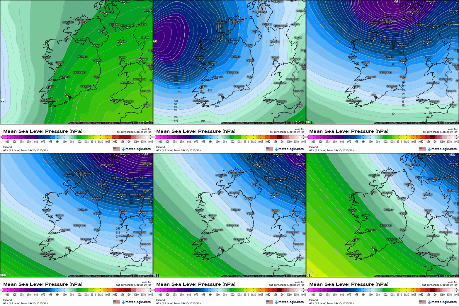
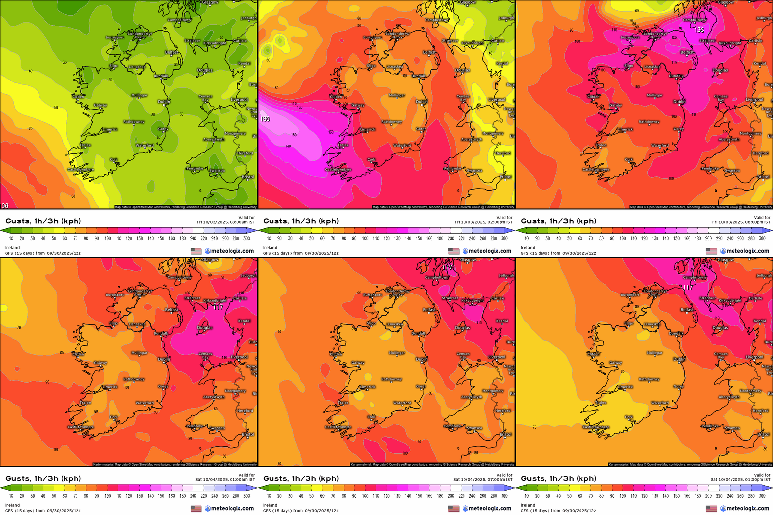
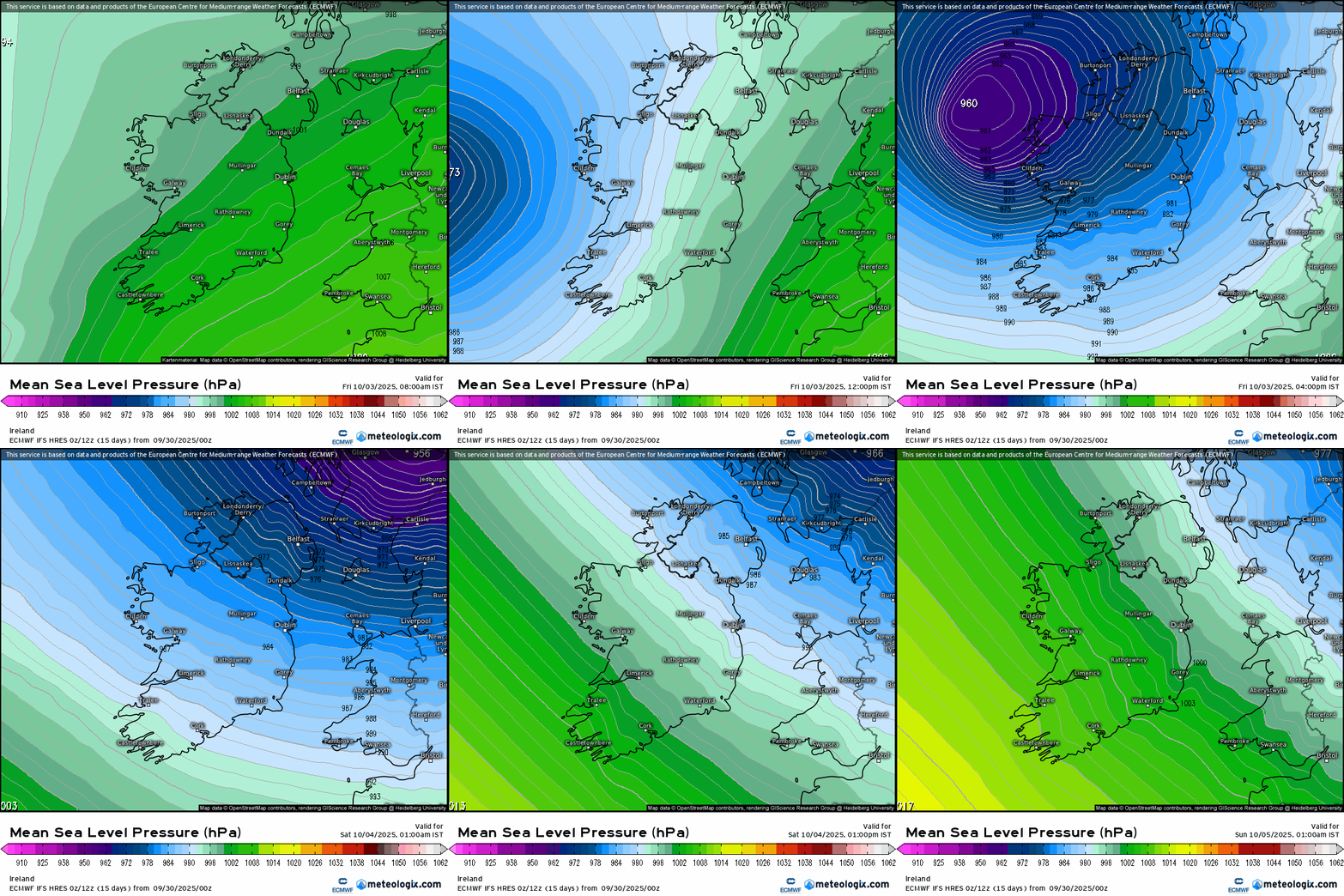
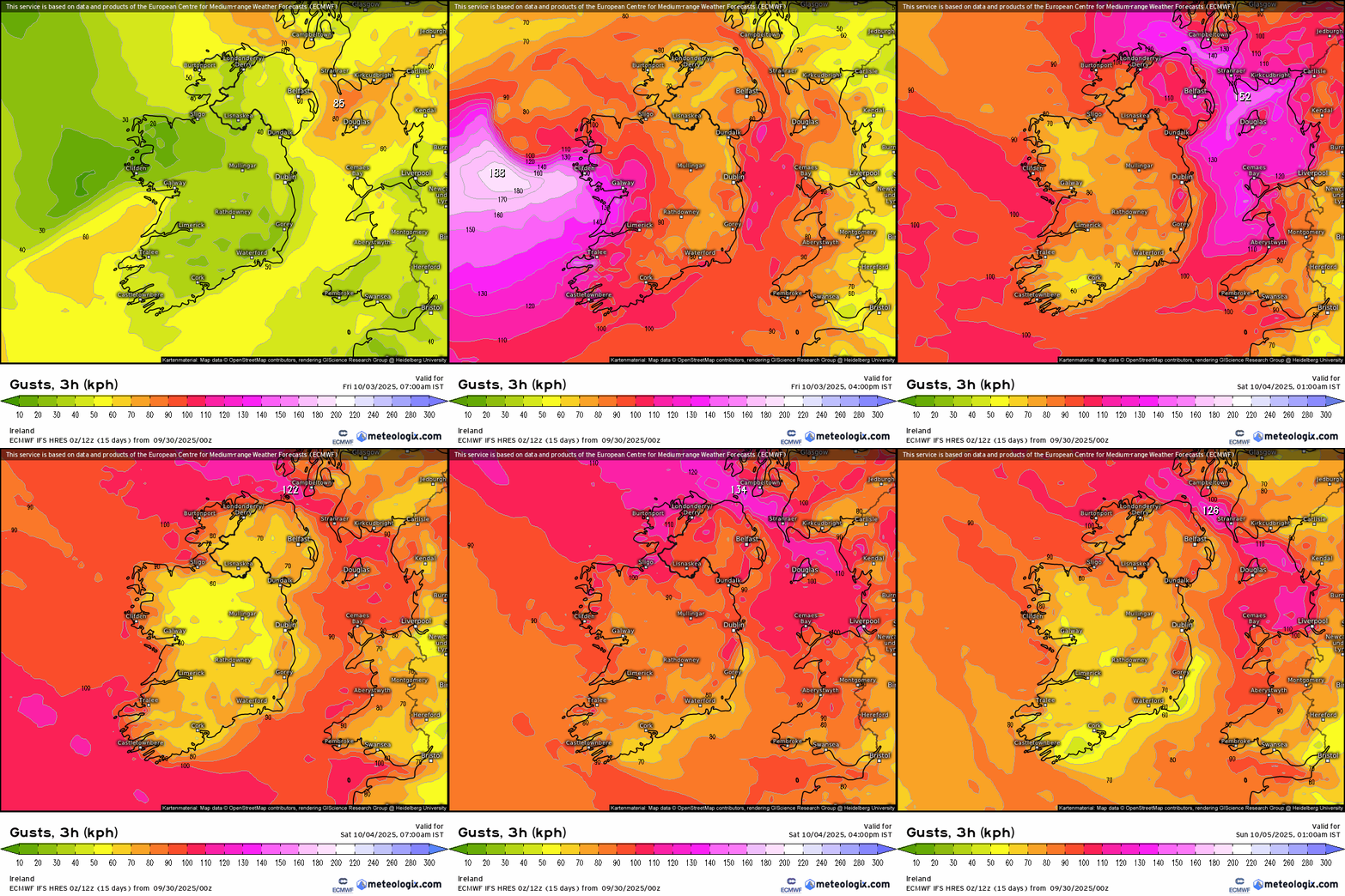
    Even though there is still uncertainty in the model output I think there is enough evidence to show that there is a lot of energy coming at us over Fri / Sat . Different tracks and timing still but some very strong stormy charts in the mix, the latest being the GFS 12Z bringing a swathe of very strong winds over the country, ECM strongest stormy winds in the West/ NW but still strong over the country. ARPEGE very stormy winds crossing the country, GEM stormy more the W, NW like ECM but very strong across the country also, ACCESS-G very strong in parts, UKMO strong overland but not as strong as the others, next run coming out later will see if it comes more in line with the others. ICON very strong also accross the country if somewhat less strong than GFS at this stage.

    So currently looking like storm force winds could occur in some part of Ireland, track will take some time to pin down with some certainty.

    Deepening rapidly on arrival as it makes a close pass. Looks like heavy frontal rain out ahead of the strong winds.

    If for some reason the storm veers off no harm done but the evidence coming out from the models is that it is not to be ignored.

    modusa_20251004_1000_animation (1).gif

    modusa_20251004_1000_animation.gif
    Post edited by Meteorite58 on


«13456725

Comments

  • Moderators, Science, Health & Environment Moderators Posts: 13,132 Mod ✭✭✭✭Meteorite58


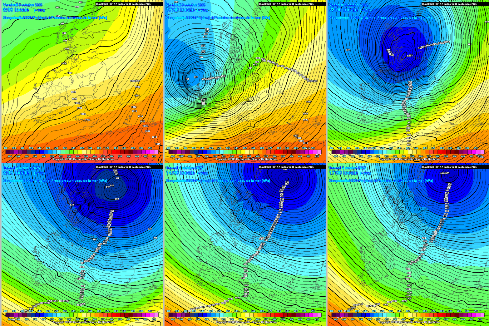
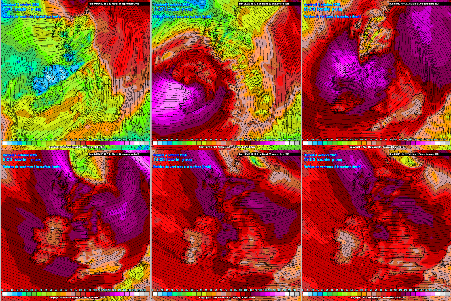
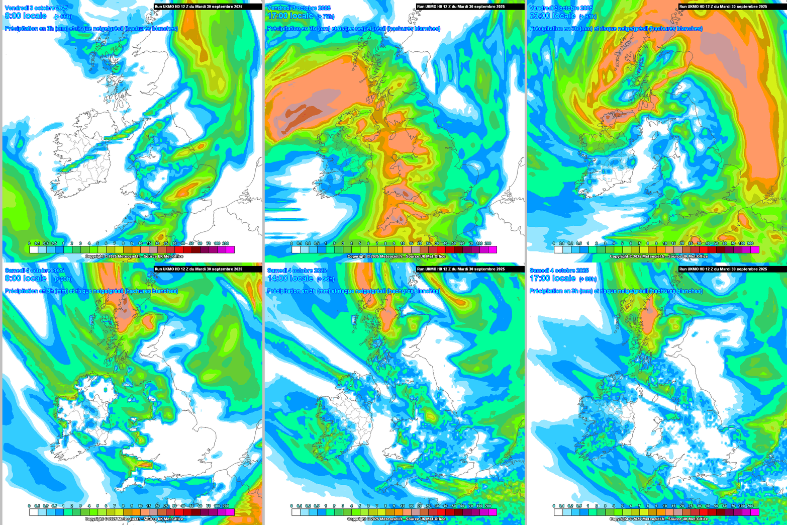
    Yeah UKMO is full on in the latest run, very stormy across the country on this one but still relatively early to know for sure but every output like this leaning more towards a strong wind event.

    Very heavy rain from the frontal passage ahead of the winds

    Untitled Image

    Untitled Image

    Untitled Image


  • Registered Users, Registered Users 2 Posts: 707 ✭✭✭eastmayo


    Surely Met Eireann will mention a potential storm on Friday on there forecasts this eve.


  • Registered Users, Registered Users 2 Posts: 4,002 ✭✭✭Dazler97


    I was watching the today show and during their weather segment Audrey did mention possible stormy Friday but that was it and their pressure map was 975mb which is under estimating it a little


  • Registered Users, Registered Users 2 Posts: 18,564 ✭✭✭✭RobbingBandit


    Country wide Orange with Red on usual South and West counties would be likely with those charts.


  • Moderators, Science, Health & Environment Moderators Posts: 13,132 Mod ✭✭✭✭Meteorite58


    Made a mistake, hadn't realised how strong the ECM 0Z . They are some charts, ECM 06Z bit more off the coast will see the 12Z soon.

    modez_20251005_0000_animation (1).gif

    modez_20251005_0000_animation.gif


  • Advertisement
  • Registered Users, Registered Users 2 Posts: 3,569 ✭✭✭JanuarySnowstor


    An orange in the Northwest and yellow elsewhere looks about right to me! Certainly Donegal/Sligo looks to be the sweet spot. Time for further upgrades yet of course down South!!

    I'll continue to yawn for now


  • Registered Users, Registered Users 2, Paid Member Posts: 5,183 ✭✭✭John mac


    heres what the Met office have so far ..


  • Registered Users, Registered Users 2 Posts: 2,463 ✭✭✭Cork2021


  • Registered Users, Registered Users 2 Posts: 7,195 ✭✭✭CrowdedHouse


    ….

    Seven Worlds will Collide


  • Registered Users, Registered Users 2 Posts: 939 ✭✭✭Robwindstorm


    Great work Meteorite as always. Absolutely no harm advising these scenarios, this possible storm is appearing regularly now. No point in now casting storms IMO. IT can be downgraded if needed. Keep us posted!


  • Advertisement
  • Registered Users, Registered Users 2 Posts: 6,634 ✭✭✭munsterlegend


  • Registered Users, Registered Users 2 Posts: 311 ✭✭Condor24


    After the amount of power outages we had last season, I'll pass on this. Looks worst up north as usual. South not so bad but trees in leaf might be a problem.


  • Registered Users, Registered Users 2 Posts: 2,276 ✭✭✭adocholiday


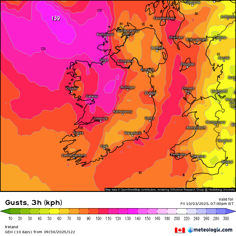
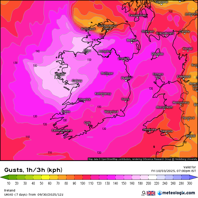
    ECM and GEM 12z now taking a more northerly track again with the West/Northwest coasts taking the brunt but not too bad elsewhere. The UKMO is basically a country-wide red but the UKMO has lost the plot with gust speeds in the last year or 2 and I've started ignoring it more or less other than just for consensus on tracks etc.

    xx_model-en-324-0_modez_2025093012_78_949_93.png xx_model-en-324-0_modcan_2025093012_78_949_93.png xx_model-en-324-0_modgbr_2025093012_78_949_254.png


  • Registered Users, Registered Users 2 Posts: 5,907 ✭✭✭endainoz


  • Registered Users, Registered Users 2 Posts: 26,907 ✭✭✭✭pjohnson


    Well fcuk.


  • Registered Users, Registered Users 2, Paid Member Posts: 9,291 ✭✭✭sdanseo


    My possibly flawed summary as of the main 12Z runs with the caveat that FI here is basically 48hrs - Humberto is still NW of Bermuda and interacting with another hurricane in close proximity which is causing the disparity in forecasts at relatively close range.

    GEM back to the north and west but by no means a fish storm - widespread >110km/h orange winds in Connacht.

    ECM similar, marginally weaker than GEM.

    UKMO unrealistically collects parts of Connemara and deposits them in Roscommon.

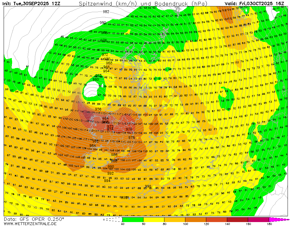
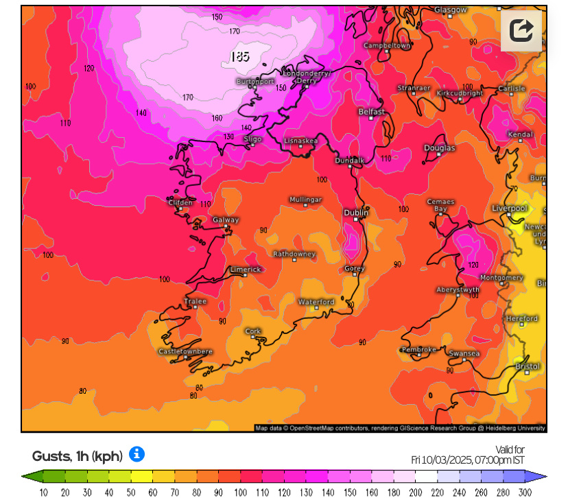
    GFS has been pretty consistent over all 3 of today's runs so far and would give fairly widespread >120kmh gusts in the west and potentially 100-120km/h gusts over the Dublin area during evening rush hour on Friday. That with the combination of trees in leaf and @~40mm of rain between this and then could be problematic.

    image.png


  • Registered Users, Registered Users 2 Posts: 15,397 ✭✭✭✭M.T. Cranium


    I find the NHC forecast discussion for Humberto to be somewhat confusing in that they seem to have no interest in the eventual extratropical low that we see on all guidance and instead seem to be saying that Humberto will totally lose identity and dissipate in that very small low you can see between our storm of interest and Imelda still churning along towards its extratropical transition (which will likely head close to Iceland).

    So for that reason I am not sure if met services will take the next name from the country lists or give this the name Humberto in discussions that may be coming along within hours and certainly by tomorrow unless the models change considerably.

    From my perspective the low we are talking about is extratropical Humberto but the NHC either disagree or have just dropped the ball on maintaining any continuity of discussion about its impacts on Ireland and Scotland.

    At the same time when I look at how close Humberto is to Imelda now, and seeing that Imelda is now stronger, I have some doubts in the entire scenario of what happens in the west-central Atlantic now to 48h and would not be shocked if we get some radical changes in map output as a result, as in, what happens if Imelda just takes over the whole combined circulation? Then extratropical Humberto could turn into a leading wave of a chain of lows with this cool shot advertised for Saturday taken out of the equation. Not saying this will happen but it could happen.


  • Registered Users, Registered Users 2 Posts: 15,397 ✭✭✭✭M.T. Cranium


    Will see if I can imbed this satellite image of the two hurricanes as they appear now …

    https://cdn.star.nesdis.noaa.gov/GOES19/ABI/SECTOR/eus/02/1000x1000.jpg

    cdn.star.nesdis.noaa.gov/GOES19/ABI/SECTOR/eus/02/1000x1000.jpg

    Well for some reason it opens if you block copy the above but not if you insert the above into the boards software, worth the effort of having a look anyway.


  • Site Banned Posts: 4,164 ✭✭✭Oíche Na Gaoithe Móire


    Strongest October storm since Ophelia, 2017, in the northern third of the country a fair possibility?


  • Registered Users, Registered Users 2 Posts: 2,276 ✭✭✭adocholiday


    Some of the GFS perturbations are showing this outcome alright, at least 3 of them.


  • Advertisement
  • Registered Users, Registered Users 2, Paid Member Posts: 9,780 ✭✭✭10-10-20


  • Moderators, Recreation & Hobbies Moderators, Paid Member Posts: 13,020 Mod ✭✭✭✭igCorcaigh


    Interesting choreography. The Fujiwhara effect?

    .


  • Moderators, Science, Health & Environment Moderators Posts: 1,684 Mod ✭✭✭✭WolfeEire
    Clare (430ft asl)


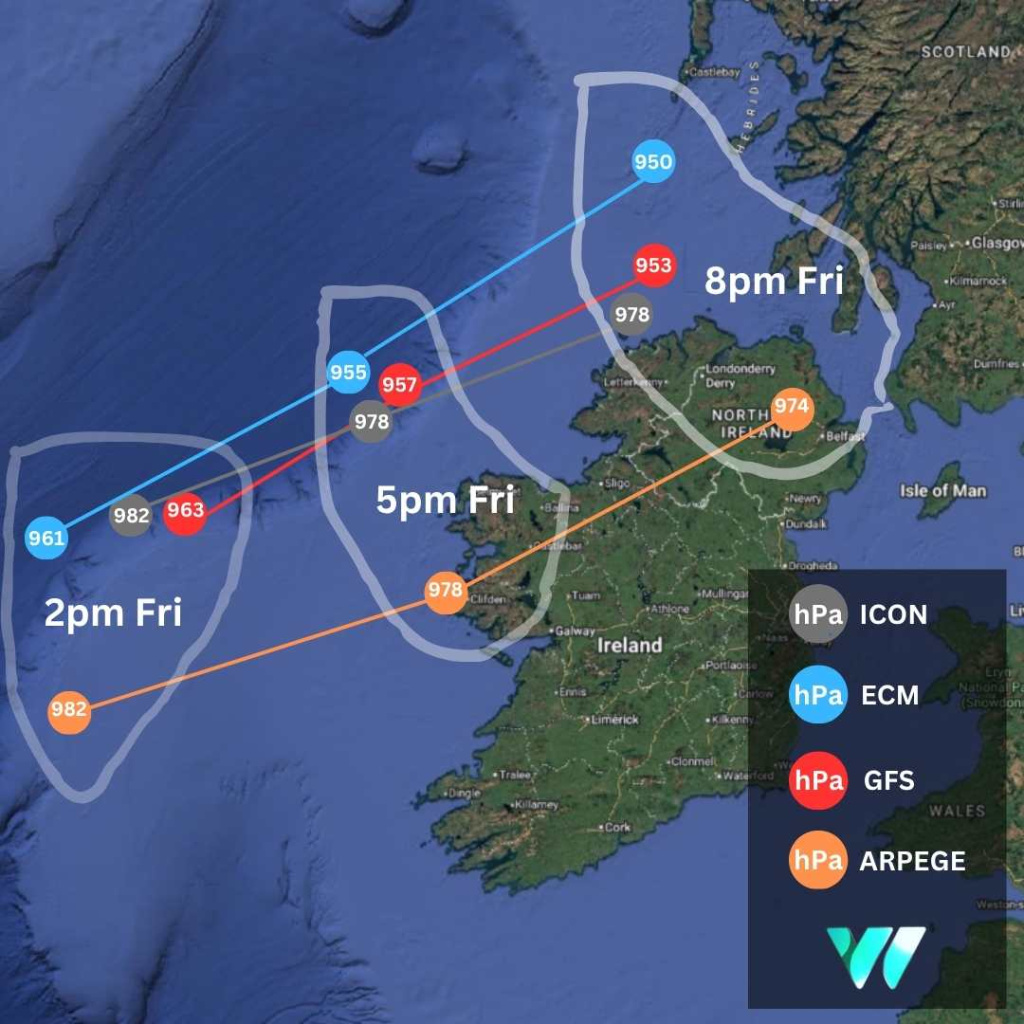
    Main model forecast for Friday system.jpg

    My take on the system as of tonight:

    Ireland is expected to face a spell of wet and windy weather from Friday into Saturday morning as a rapidly deepening Atlantic low-pressure system tracks northwest of Ireland towards Scotland.

    There is still significant uncertainty about the storm’s precise track and intensity. Current projections indicate it will deepen to the northwest of Ireland on Friday afternoon and evening before moving towards north-western Scotland overnight.

    On its present path, the system is expected to generate high seas along the Atlantic seaboard and bring strong, potentially damaging winds, particularly on its southern flank. The strongest gusts are likely to develop first in western counties before extending into the north.

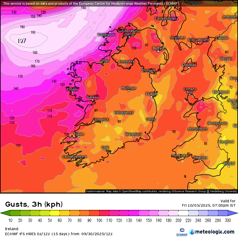
    Weather models suggest gusts of 110–120 km/h in western and north-western counties, with 90–100 km/h possible further inland. At the more severe end of forecasts, exposed coastal sites such as Mace Head in Co Galway and Belmullet in Co Mayo could see gusts exceeding 140 km/h. Extensive power cuts would be likely, particularly as many trees remain in leaf.

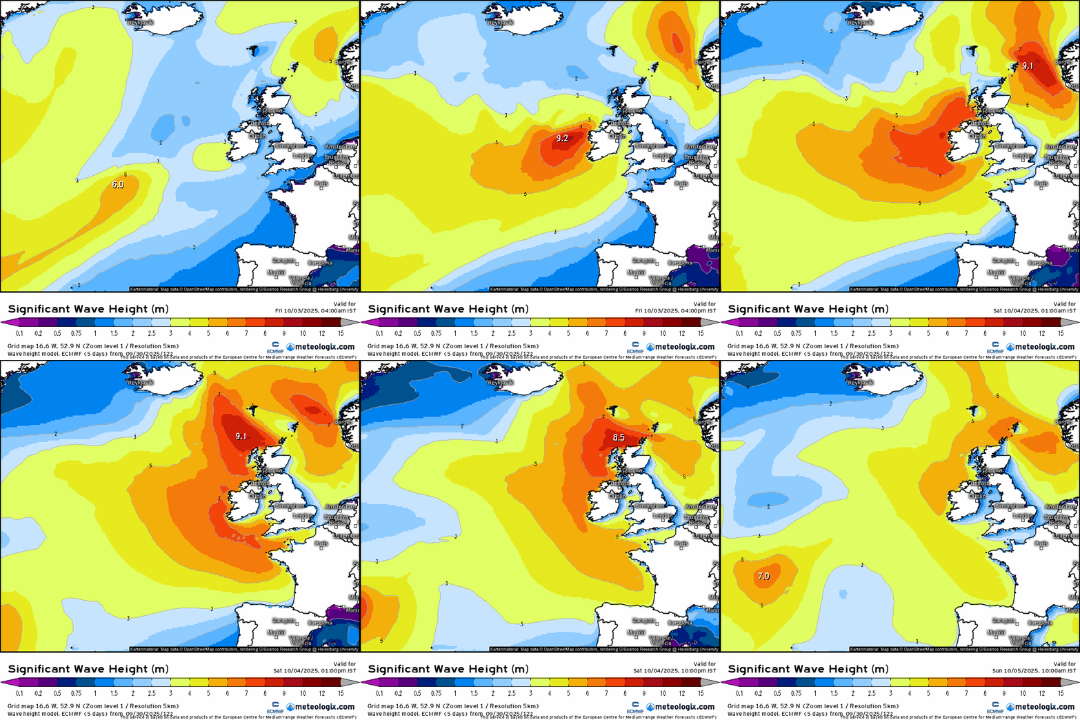
    Wave heights of up to seven metres are also anticipated along the west coast, raising the risk of coastal flooding in low-lying areas.

    Rainfall is not expected to be excessive, with totals of 10–15mm in the west and lesser amounts further east. However, with soils already saturated and further rain forecast for Wednesday and Thursday, the risk of localised flooding remains high.

    The system is linked to the remnants of Hurricane Humberto, which has weakened from a Category 5 hurricane to a Category 1 and is expected to be downgraded further to a tropical storm. Its remains are forecast to track northeast towards Ireland before being absorbed into the Atlantic westerly flow and undergoing rapid cyclogenesis on Thursday night and Friday morning.

    Met Éireann has not yet issued weather warnings but said “Friday will be a wet and windy day with widespread rain, heavy at times, accompanied by strong and gusty southerly winds.”

    Should the system be deemed strong enough to warrant official warnings, it may be designated Storm Amy by Met Éireann, the UK Met Office or the Dutch weather service, KNMI, under the joint European storm-naming system.

    It is worth noting that the storm, which is currently on track to impact Ireland, has not yet fully developed, adding to the uncertainty around both its track and severity. While some comparisons have been drawn on social media with Éowyn, at more than 72 hours out shifts in the storm’s trajectory and impact remain highly likely.

    www.weatheire.com


  • Registered Users, Registered Users 2 Posts: 3,569 ✭✭✭JanuarySnowstor


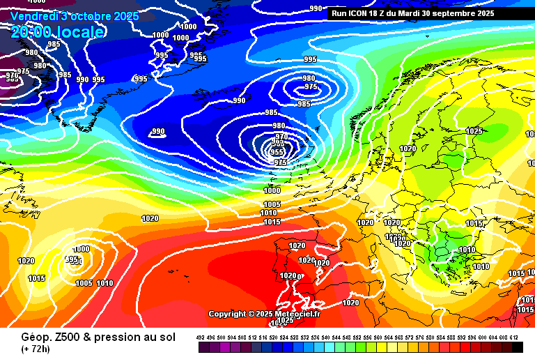
    Latest Icon, much deeper but also further West. Primarily a coastal NW event here

    17592661966875688870760136058846.png


  • Registered Users, Registered Users 2 Posts: 473 ✭✭Ros4Sam24


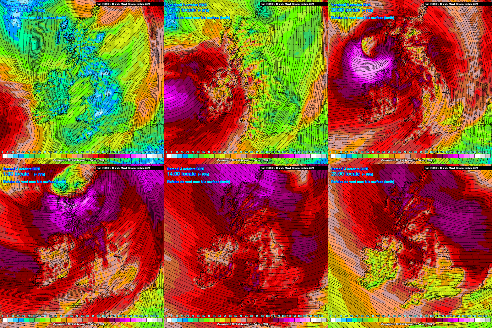
    Icon 18z wind speeds show more agreement with other models. Donegal getting hammered here but a small shift south could make this a big event for many.

    IMG_0949.jpeg


  • Moderators, Science, Health & Environment Moderators Posts: 13,132 Mod ✭✭✭✭Meteorite58


    As Wolfe said above huge seas predicted with this very low pressure system, in fact predicting higher seas than earlier runs. Mentioned in the Chart thread coming out of neaps and moving into higher tides this weekend so some coastal flooding a risk and would expect rivers especially along the West to be that bit higher adding to the risk.

    modwaveecmwf_20251005_0600_animation.gif


  • Registered Users, Registered Users 2 Posts: 3,273 ✭✭✭.Donegal.


    Thanks for starting the thread Meteorite. Could be the last storm before this site goes. GFS coming out now.


  • Registered Users, Registered Users 2, Paid Member Posts: 285 ✭✭littlema


    Elizabeth on BBC weather just showed the "twins" merging and said there would be very stormy weather for the UK and NI. So now ye know......…


  • Moderators, Science, Health & Environment Moderators Posts: 13,132 Mod ✭✭✭✭Meteorite58


    Thanks .Donegal. Of all areas looks like ye could be in the firing line .

    Some of the Hi Res Swiss models based on the ECMWF look very strong in the W, NW, N . High level warnings at this stage.

    Important chart from the GFS coming out to see if it continues its more or less consistent track over the last few runs.

    Untitled Image

    Untitled Image


  • Advertisement
  • Registered Users, Registered Users 2 Posts: 26,907 ✭✭✭✭pjohnson


    Dunno how I'll judge storms accurately without MT and Meteorite :(


Advertisement