Advertisement
If you have a new account but are having problems posting or verifying your account, please email us on hello@boards.ie for help. Thanks :)
Hello all! Please ensure that you are posting a new thread or question in the appropriate forum. The Feedback forum is overwhelmed with questions that are having to be moved elsewhere. If you need help to verify your account contact hello@boards.ie

Can you walk the wicklow way in 6 days?

Options
2»

Comments

  • Moderators, Recreation & Hobbies Moderators, Sports Moderators Posts: 15,696 Mod ✭✭✭✭Tabnabs


    Gillo wrote: »
    If I'm reading that right, you've worded it the way I wanted to but could't figure out. The bottom line is you aren't allowed to camp in any national park's.

    Not true (with an exception)

    Wild Camping

    Visitors seeking a wilderness experience while undertaking multi-day mountaineering journeys are permitted to camp in the more remote areas of the Park, subject to the following code of practise. The circumstances in which a permits will be required are outlined below.

    Please Note: Camping is not permitted, at all, in the valley of Glendalough. This rule is vigorously enforced, and campers will be moved on. Visitors arriving in Glendalough with a tent should be aware that they will need to walk for at least 3 hours before they can find a site that complies with the Wild Camping code.

    http://www.wicklowmountainsnationalpark.ie/WildCamping.html

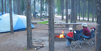
    Wouldn't it be great if they put in a family friendly camping ground in the Glendalough valley? Not a big open field like the usual Irish camp site, but something along the lines of the American national parks.

    camping1_1.jpg


  • Registered Users Posts: 236 ✭✭Niall_daaS


    Tabnabs wrote: »
    Wouldn't it be great if they put in a family friendly camping ground in the Glendalough valley? Not a big open field like the usual Irish camp site, but something along the lines of the American national parks.

    There are at least three camping spots in Glenmalure beside the road and deeper in the valley. It appears that most campers don't give a feck about leaving no trace. In summer those are messy places and a burden to the eye. As long as this is not sorted I wouldn't like to see more places declared for camping around Wicklow.


  • Registered Users Posts: 5,566 ✭✭✭Gillo


    Apologies, I always thought you weren't allow camp in any of the parks. My bad! Thanks for the correction.


  • Registered Users Posts: 312 ✭✭Gasherbraun


    Niall_daaS wrote: »
    There are at least three camping spots in Glenmalure beside the road and deeper in the valley. It appears that most campers don't give a feck about leaving no trace. In summer those are messy places and a burden to the eye. As long as this is not sorted I wouldn't like to see more places declared for camping around Wicklow.

    I agree with you in that the road in Glenmalure, leading up to the old youth hostel, gets into an awful state and based on its condition making it easier for people to camp seems a bad idea.

    I think what does protect most of upland Wicklow is that the sort of people who leave a campsite looking like a dump are essentially lazy so will not venture far from the beaten track; The Fraughn Rock Glen, further up from Glenmalure, was developing problems till Coillte put gate of the forest road.

    That said it does seem to be increasingly widespread and I have seen rubbish strewn campsites on the Western shore of Lough Dan and at the top of the Table track near Camenabologue to name two in the last few months. Another campsite on the banks of the Liffey near the Coronation Plantation was a mess of fishing line and hooks plus busted tents....strong ale that night obviously.

    I do accept that there are a lot of very responsible campers out there who observe leave no trace and the country code but if new 'official' campsites were instigated they need to be managed properly and maybe that is just not what Wicklow is about.


  • Closed Accounts Posts: 2,917 ✭✭✭BarryD


    The Pure Project may be able to help clean up some of these sites if they're reported at or near the time. Geared more towards fly tipping but not a huge difference at the end of the day between illegal dumping of rubbish and the sort of mess left behind by above.

    http://www.pureproject.ie/


  • Advertisement
  • Registered Users Posts: 236 ✭✭Niall_daaS


    I agree with you in that the road in Glenmalure, leading up to the old youth hostel, gets into an awful state and based on its condition making it easier for people to camp seems a bad idea.

    I think what does protect most of upland Wicklow is that the sort of people who leave a campsite looking like a dump are essentially lazy so will not venture far from the beaten track; The Fraughn Rock Glen, further up from Glenmalure, was developing problems till Coillte put gate of the forest road.

    That said it does seem to be increasingly widespread and I have seen rubbish strewn campsites on the Western shore of Lough Dan and at the top of the Table track near Camenabologue to name two in the last few months. Another campsite on the banks of the Liffey near the Coronation Plantation was a mess of fishing line and hooks plus busted tents....strong ale that night obviously.

    I do accept that there are a lot of very responsible campers out there who observe leave no trace and the country code but if new 'official' campsites were instigated they need to be managed properly and maybe that is just not what Wicklow is about.

    I agree with every single word.


  • Registered Users Posts: 312 ✭✭Gasherbraun


    BarryD wrote: »
    The Pure Project may be able to help clean up some of these sites if they're reported at or near the time. Geared more towards fly tipping but not a huge difference at the end of the day between illegal dumping of rubbish and the sort of mess left behind by above.

    http://www.pureproject.ie/


    They are very good. I had some involvement with them in 2010 over a car that had been dumped in the Fraughn Rock Glen. It had been pushed about 100M down a steep slope into marshy ground and looked near impossible to remove in that location. The Pure Project (guy called Ian Davis) persisted with this and worked with Coillte and landowners to get it removed.


  • Registered Users Posts: 17,886 ✭✭✭✭Thargor


    Hi this is the most recent thread so Ill ask here, whats the best way to enter the Wicklow Way into a GPS app on an Android phone please? I think Amazon gave away a good app for walking routes a while ago but my mind is gone blank.


  • Registered Users Posts: 1,303 ✭✭✭CardinalJ


    I used map my walk, but any GPS app will eat battery so bear that in mind.


  • Registered Users Posts: 17,886 ✭✭✭✭Thargor


    I dont see how that would let you follow the Wicklow Way? It seems to only record what you do...


  • Advertisement
  • Registered Users Posts: 3,621 ✭✭✭Enduro


    The WW is pretty easy to follow on the ground. It's a well signposted route, and it is always either on trail, road or fireroad, so really all you have to do is locate the correct path at junctions (in the vast majority of cases by following an arrow on a signpost).


  • Closed Accounts Posts: 2,917 ✭✭✭BarryD


    Thargor wrote: »
    Hi this is the most recent thread so Ill ask here, whats the best way to enter the Wicklow Way into a GPS app on an Android phone please? I think Amazon gave away a good app for walking routes a while ago but my mind is gone blank.

    ViewRanger should do the job but you don't really need it to follow the WW. Decent map and check at junctions.


  • Registered Users Posts: 17,886 ✭✭✭✭Thargor


    Thanks, Ive never actually done it and that's always annoyed me when Ive done long hikes abroad so was thinking of taking a few days off and getting it out of the way this Summer with a bivvy bag and long day hikes. Information is a bit sketchy though. For example, why end it in the random village of Clonegal which has no public transport whatsoever? You see confused tourists mention this on tripadvisor and other places all the time.

    Can anyone answer these questions please:

    1. Is it easier to do it from Clonegal to Marlay Park or the other way around? I ask because Id rather start in Clonegal and not having the uncertainty of hitching/taxis hanging over me for the whole trip but I don't want to do it if Clonegal direction heading North means twice as much uphill slogs or similar.

    2. Are there any shops along the route for resupply? Where are they?

    3. Are there any water taps along the route or do you have to boil everything?

    4. Has anyone seen a good online guide for 2014/2015 or 2013 at a stretch?

    5. Has anyone seen an app that has the wicklow way in it whether as a .gpx file or something similar, or a Google maps link?


  • Closed Accounts Posts: 2,917 ✭✭✭BarryD


    Thargor wrote: »
    Thanks, Ive never actually done it and that's always annoyed me when Ive done long hikes abroad so was thinking of taking a few days off and getting it out of the way this Summer with a bivvy bag and long day hikes. Information is a bit sketchy though. For example, why end it in the random village of Clonegal which has no public transport whatsoever? You see confused tourists mention this on tripadvisor and other places all the time.

    Can anyone answer these questions please:

    1. Is it easier to do it from Clonegal to Marlay Park or the other way around? I ask because Id rather start in Clonegal and not having the uncertainty of hitching/taxis hanging over me for the whole trip but I don't want to do it if Clonegal direction heading North means twice as much uphill slogs or similar.

    2. Are there any shops along the route for resupply? Where are they?

    3. Are there any water taps along the route or do you have to boil everything?

    4. Has anyone seen a good online guide for 2014/2015 or 2013 at a stretch?

    5. Has anyone seen an app that has the wicklow way in it whether as a .gpx file or something similar, or a Google maps link?

    It's about 2 miles from Clonegal to Bunclody or Kildavin where currently Bus Eireann Route 5 serves Dublin infrequently. I say currently as very recently they have announced plans to cut this service - the only public transport up the entire mid Wicklow, north west Carlow region until you get to Blessington. Disgraceful but there you go, get there quick in case it does go :) You'd swear it was the wilds of Cork or Kerry, not 50 miles from Dublin.

    Our Wicklow Way Map Guide has info on shop locations etc. and good route detail - it's all you need. You should be able to get it in Easons or Great Outdoors, 53 Degrees North etc. There's a downloadable list of accommodation on our web page.

    ViewRanger for smartphone app.


  • Registered Users Posts: 17,886 ✭✭✭✭Thargor


    Thanks for that, unbelievable from BE, I have to have my parents pick me up when I go home nowadays aswell because they cancelled a route that used to be full of students on a Friday and packed with tourists in the Summer, so what are people who finish the WW supposed to do now? turn around and hike back to Dublin?

    I suppose I could get the train to Gorey and hitch out that way, can you think of a better way to start with no bus? Also do you have any thoughts on if its better to start in Clonegal or Marlay? Ill be picking up your guide next time I pass Easons thanks.


  • Closed Accounts Posts: 2,917 ✭✭✭BarryD


    I think people do it either way - start Dublin and you get all the bigger ascents/ descents earlier on. Once past Aughavannagh, the route is over lower hills, more road in places.

    Plenty of trains/ buses to Gorey/ Enniscorthy. A little tricky to hitch direct to Clonegal though, expect to walk at least part of the way. The Gorey-Carnew road is also a bit narrow, might make it easier to get a lift, also easier to get run over!!


  • Registered Users Posts: 1,303 ✭✭✭CardinalJ


    Thargor wrote: »
    I dont see how that would let you follow the Wicklow Way? It seems to only record what you do...

    Sorry misunderstood you. It's well signposted and marked so you'd be fine.
    Thargor wrote: »

    1. Depending on how many days you want to do it in, Over all id say easier Marlay to Clonegal. As almost all the descents/ascents are in the first half

    2. The route bypasses a lot of villages. It gets near-ish to roundwood, Laragh, Tinahealy

    3. There's one tap between roundwood and laragh on the back of a farmers shed...

    4. http://www.wicklowway.com/trail-maps/index.php I used a this as a basic guide.

    5. Cant help


  • Registered Users Posts: 23 Paddyman38


    I did the wicklow way a few years ago on my own , i did it in 6 days and hiked camped it.I took my time and enjoyed the peace and beauty . bag was quiet heavy with tent sleeping bag food clothes and other bits but you get used to it, and your fitness improves day by day, i used the shop in Laragh as my only buying food stop. deffinately recommend doing it if you have the time and like hiking.


  • Registered Users Posts: 17,886 ✭✭✭✭Thargor


    Thanks, Ill be aiming for 3-4 days.


  • Registered Users Posts: 312 ✭✭Gasherbraun


    Thargor wrote: »

    2. Are there any shops along the route for resupply? Where are they?

    3. Are there any water taps along the route or do you have to boil everything?

    Re these two points I have only walked the Marlay to Glendalough section and the only shops en route are at Enniskerry and Roundwood but the first is too early in the route and while the second is at a good point it is a long detour off the WW.

    Re taps I did the section in one push in summer and approaching Glendalough was really in need of water. The only tap I found was on the side of a barn on Paddock Hill - ancient looking thing with a very old sign stating 'drinking water'. I drank from it without any ill effects


  • Advertisement
Advertisement