Advertisement
If you have a new account but are having problems posting or verifying your account, please email us on hello@boards.ie for help. Thanks :)
Hello all! Please ensure that you are posting a new thread or question in the appropriate forum. The Feedback forum is overwhelmed with questions that are having to be moved elsewhere. If you need help to verify your account contact hello@boards.ie
Hi there,
There is an issue with role permissions that is being worked on at the moment.
If you are having trouble with access or permissions on regional forums please post here to get access: https://www.boards.ie/discussion/2058365403/you-do-not-have-permission-for-that#latest

Info (including) photos) on ancestors - Inishkeel area

  • 04-06-2010 5:14am
    #1
    Registered Users, Registered Users 2 Posts: 22


    I posted last night but didn't use this thread, so thought I'd redo it here. If anyone goes back to St. Crone's and sees a headstone for my g-g-g-g grandfather, Rev. Thomas Stewart, I would love a copy even if it is not fully legible. Would he be at this church or the one in Dungloe, if he was with the church from 1779 to 1803? Anyone know? He lived on Rutland Island and I don't have a picture of that yet except for 2 of the old fishery of the net. If anyone travels that direction, I would really appreciate a nice photo. I should explain that I am from Vancouver Island, off the west coast of Canada and looking at the photos that you people post really gives me an idea of how beautiful Donegal is. Thanks, and sorry for posting in the wrong place yesterday.


«1

Comments

  • Registered Users, Registered Users 2 Posts: 82 ✭✭Termonator


    Victorian wrote: »
    I posted last night but didn't use this thread, so thought I'd redo it here. If anyone goes back to St. Crone's and sees a headstone for my g-g-g-g grandfather, Rev. Thomas Stewart, I would love a copy even if it is not fully legible. Would he be at this church or the one in Dungloe, if he was with the church from 1779 to 1803? Anyone know? He lived on Rutland Island and I don't have a picture of that yet except for 2 of the old fishery of the net. If anyone travels that direction, I would really appreciate a nice photo. I should explain that I am from Vancouver Island, off the west coast of Canada and looking at the photos that you people post really gives me an idea of how beautiful Donegal is. Thanks, and sorry for posting in the wrong place yesterday.

    I will be back there in the next few weeks so will have a look and take pictures if I see the headstone. I will be out around Rutland also so can forward you on a few pictures of there also.


  • Registered Users, Registered Users 2 Posts: 22 Victorian


    Thanks ever so much for your help. I look forward to seeing your photos. Would you happen to know anything about the location of the old C of I parish church of Inniskeel? It would have been prior to the one at Narin/Portnoo that was built in 1825. I'm curious about 1740 -1760. I was wondering if it was the ruins on Inniskeel Island or if there was a different site of ruins somewhere nearby.


  • Registered Users, Registered Users 2 Posts: 692 ✭✭✭Durnish


    Gosh, I know that area, Portnoo/Inishkeel quite well. I shall consult my books. Off the top of my head, the present church may be on the site of the old C o I church. Back shortly.


  • Registered Users, Registered Users 2 Posts: 692 ✭✭✭Durnish


    right, it seems that from 1662 the (Anglican) parish church moved from Inishkeel island (unfit due to " great arm of the sea" making it inaccessible much of the month) to a now ruined chapel of ease at Kiltoorish. That ruin is still there, surrounded now by fields of bluebells.

    Service continued there till 1723 when the select vestry built something, now completely gone, near the north end of the car park at Narin Strand, Portnoo. This place is remembered by the name Churchtown. I think this still appears on the 1840's ordnance survey maps. This Churchtown building must then have been replaced by the existing beautifully sited St Conall and St Mark's church.
    I hope I have paraphrased Lochlann McGill's words in
    "In Conall's Footsteps" , 1992, accurately.

    This church is now linked to the Lettermacaward, Glenties and Ardara rectory. The rector for all those churches is John Deane who has just completed a sponsored cycle tour of his scattered parish.


  • Registered Users, Registered Users 2 Posts: 22 Victorian


    That's of great interest and help to me. The only info I previously had on my g-g-g-g-g grandfather, Rev. Walter Stewart was that he was Rector of Inniskeel around that time period. A snippet from "Tour in Ireland 1752" mentions ..."passed under an old church called Kilkenny, a chapel of Ease to Enniskeel, a mile farther I came to a village called Balyaristan: and having a letter to Mr. Stewart the Minister of Inniskeel I came in two miles to his house, the first half on the Strand and the remainder within the Sand banks; opposite to it is a small island called Keel or Inniskell (Island Red) in which there are two churches, about one the Protestants bury and at the other the Papists".
    I had read about the present Reverend and this cycle tour. I hope he is fully recovered from this venture and pleased with his results.
    Thanks so much for answering my questions and, I hate to ask, but if you have some photos of this area, I would love to see them sometime.


  • Advertisement
  • Registered Users, Registered Users 2 Posts: 692 ✭✭✭Durnish


    SheskinNaransand.jpg

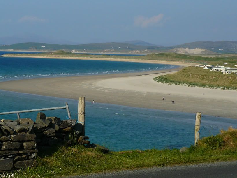
    This is the view from the front of the present church, Naran Strand is below. I must have better ones.


  • Registered Users, Registered Users 2 Posts: 22 Victorian


    Thank you Durnish for the photo from the church. It certainly is a beautiful coastline. Can you explain to me the difference between the spelling of Inniskeel and Inishkeel? Is one the island and the other the old parish? Or is Inniskeel just an obsolete use now?


  • Registered Users, Registered Users 2 Posts: 692 ✭✭✭Durnish


    Can't explain that. I just think that the spelling varies. I was just reading O'Donovan's writings of his attempts to set the names down in English. Sometimes he puts the "h" in and sometimes he doesn't. I am not even sure if the C of I Parish still exists or if it is now part of Ardara Parish. I forgot to mention that the rector's duties now extend to G'columkille. I think he has to shift from Lettermac to Glenck pretty quick on Sundays in August.

    Not sure about this as we are not church goers. However, some visiting grannies wanted to go to the service in Portnoo(Iniskeel/Narin) a couple of weeks back and ended up in the wrong church at the wrong time.


  • Registered Users, Registered Users 2 Posts: 22 Victorian


    Thanks for getting back to me on that Durnish. I just wanted to make sure our family tree info wasn't incorrect. It would appear that they are interchangeable. I see that Naran is sometimes Narin or even Nairn. Then there is the Irish translation as well. It is a bit confusing to a Canadian. Thanks again for all your help in this matter.


  • Closed Accounts Posts: 4 discovery 2


    Hi, Just wondering did you manage to obtain any photos of Rutland Island? I be there often on Duck st. and may be able to forward photos if you wish.


  • Advertisement
  • Registered Users, Registered Users 2 Posts: 22 Victorian


    I have not recieved any photos of Rutland yet. I would appreciate any you could send. Thanks.


  • Closed Accounts Posts: 4 discovery 2


    Hi there,
    I took these photos myself about two years ago.
    1st a photo of Duck st as it is today. Most are used as holiday homes.
    2nd photo shows a fireplace all that is left of an old ruins.
    3rd photo is of some cattle grazing on Rutland Island with the village of Burtonport in the background.
    4th photo is of part of the beach on Rutland Island known as the back strand.
    Rutland Island is a very beautiful place!!

    Hope you enjoy the photos!


  • Registered Users, Registered Users 2 Posts: 22 Victorian


    Many thanks for sending the great pictures of Rutland Island. I hadn't realized it was still utilized at all. And you're right - it looks beautiful. Thanks again for your help.


  • Closed Accounts Posts: 4 discovery 2


    You are very welcome. Glad you enjoyed them.If you ever need more info on Rutland please feel free to contact me anytime. Slan.


  • Closed Accounts Posts: 1 early


    Victorian wrote: »
    I posted last night but didn't use this thread, so thought I'd redo it here. If anyone goes back to St. Crone's and sees a headstone for my g-g-g-g grandfather, Rev. Thomas Stewart, I would love a copy even if it is not fully legible. Would he be at this church or the one in Dungloe, if he was with the church from 1779 to 1803? Anyone know? He lived on Rutland Island and I don't have a picture of that yet except for 2 of the old fishery of the net. If anyone travels that direction, I would really appreciate a nice photo. I should explain that I am from Vancouver Island, off the west coast of Canada and looking at the photos that you people post really gives me an idea of how beautiful Donegal is. Thanks, and sorry for posting in the wrong place yesterday.

    Here's another descendant of Thomas Orpen Stewart! This one is in England & through his son Walter George. Many thanks for some new information about him - I've researched other family lines but have just started on the Stewarts from an inherited family tree. Loved the view. It seems that he went to Jamaica under a bit of a cloud.


  • Registered Users, Registered Users 2 Posts: 22 Victorian


    Thomas Orpen Stewart was actually my ancestor's nephew and you are right about his reputation. Unusual for a man of the cloth. His grandfather was my ggggg grandfather, Walter. I have searched your branch in Jamaica.

    Someone else has also mentioned 'In Connall's Footsteps' and provided me with some valuable info from it. I hadn't previously considered buying but I will now take a look for it, as I am also looking for 'Clergy from Derry and Raphoe'. Thanks for the suggestion.


  • Registered Users, Registered Users 2 Posts: 692 ✭✭✭Durnish


    That was me.

    I would also recommend the Glenties book, Inishkeel and Glenties, which I mentioned somewhere. The beautiful little church at Lettermac is included in the parish and I think it had a Stewart rector/curate listed, either there or in Glenties.

    I am looking through my photo collection for Kilkenny, Lettermac and Churchtown (Narin) photos if you are still around.


  • Registered Users, Registered Users 2 Posts: 692 ✭✭✭Durnish


    Also, I seem to remember an article in the local Ardara annual, Dearcha, about the Churchtown/Naran site. Must look out for it next week.


  • Closed Accounts Posts: 495 ✭✭ardara1


    Victorian wrote: »
    Thomas Orpen Stewart was actually my ancestor's nephew and you are right about his reputation. Unusual for a man of the cloth. His grandfather was my ggggg grandfather, Walter. I have searched your branch in Jamaica.

    Someone else has also mentioned 'In Connall's Footsteps' and provided me with some valuable info from it. I hadn't previously considered buying but I will now take a look for it, as I am also looking for 'Clergy from Derry and Raphoe'. Thanks for the suggestion.

    I looked on Amazon and it was available at over 100Euro! - they're on sale in Nancy's bar in Ardara for about 15.


  • Registered Users, Registered Users 2 Posts: 22 Victorian


    Durnish wrote: »
    That was me.

    I would also recommend the Glenties book, Inishkeel and Glenties, which I mentioned somewhere. The beautiful little church at Lettermac is included in the parish and I think it had a Stewart rector/curate listed, either there or in Glenties.

    I am looking through my photo collection for Kilkenny, Lettermac and Churchtown (Narin) photos if you are still around.

    I would appreciate any photos you have of Churchtown area and the Lettermac Church and area. You can contact me by private message if you have any additional info, as I don't want to upset the applecart by talking about irrelavent topics on this thread. I'm new at this forum business and have an inquiring mind. My apologies.


  • Advertisement
  • Registered Users, Registered Users 2 Posts: 692 ✭✭✭Durnish


    I have found the Kilkenny old church and graveyard photos and am enjoying the slideshow over breakfast. Also pics of Lettermac, the cashel and the Glebe House behind. The Lettermac Glebe house is in such a spectacular setting. We were following the Conall's Footsteps book when we eventually found the old Kilkenny site.

    The Lettermac church/graveyard pics are in a different album.

    This is the photo requests thread, so that's what I am doing. I am an old hand at board stuff. It's very interesting to "meet" anyone connected to the old rectors as we have often wondered what their lives were like with so few parishioners and in such isolated spots.

    Right, off to Photobucket.


  • Registered Users, Registered Users 2 Posts: 692 ✭✭✭Durnish


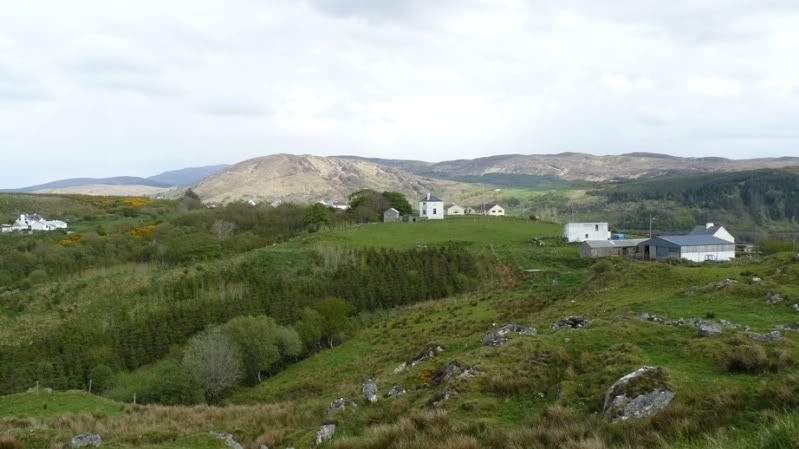
    This is the C of I Glebe house at Lettermacaward, now in private hands. Centre of pic. Photo taken from inside the cashel (stone ring fort) You can see the walled garden and the outbuildings as well as the chimneys. Side view.
    LetMglebe.jpg


    This is the site of the old ford, below the Glebe and cashel, mentioned in many travel books before the Gweebarra bridges were built.
    blubag1-1.jpg


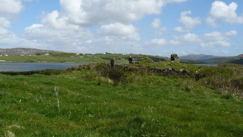
    This is on the south bank of the Gweebarra, at the ruins of the old Kilkenny church. Above and to the left of the cloth capped man's head is the Glebe house.

    P1060246.jpg


  • Registered Users, Registered Users 2 Posts: 22 Victorian


    Durnish wrote: »
    That was me.

    I would also recommend the Glenties book, Inishkeel and Glenties, which I mentioned somewhere. The beautiful little church at Lettermac is included in the parish and I think it had a Stewart rector/curate listed, either there or in Glenties.

    I am looking through my photo collection for Kilkenny, Lettermac and Churchtown (Narin) photos if you are still around.

    Those are great photos. I feel like I'm starting to get my bearings. Would you happen to have a photo of the cashel? I'm curious about it. Also, you mentioned the ruined chapel of ease at Kiltoorish with bluebells. Do you have one of that? I read about the castle on the island there which the Spanish visited. Great history.
    Do you have the author's name of the Glenties book, I can't find anything on line about it. I should be able to get the Loghlann McGill book on Amazon. Thanks again for the photos.


  • Registered Users, Registered Users 2 Posts: 22 Victorian


    Ford4000 wrote: »
    Thought it showed some good scenes of the very small (uninhabited) islands surrounding aranmore as well as the island itself, which if someone wanted could be extracted to generate a photo. sorry for the inconvenience.

    Thank you for the video. I watched it twice, but now it seems to have disappeared. Was it on a you tube site? I wouldn't mind catching it again.


  • Registered Users, Registered Users 2 Posts: 692 ✭✭✭Durnish


    The sites are all marked on the Ordnance Survey historical view maps, if you have investigated that resource yet. The best way to think of the old parish is to connect it by sea and river crossings as that was the way to get about.
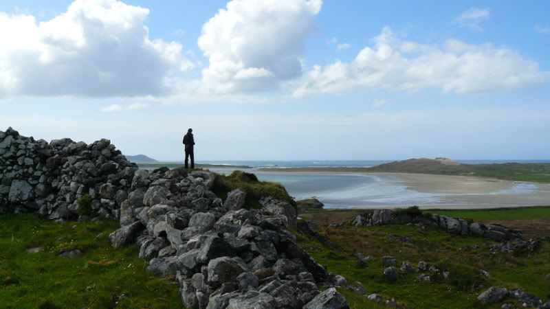
    The Lettermac cashel is spectacular. Here is the view from the cashel towards the sea at Dooey strand. Portnoo is visible, Dunmore Head, towards the left of the horizon.
    cashel1-2.jpg


  • Registered Users, Registered Users 2 Posts: 692 ✭✭✭Durnish


    Also, I am going up to Portnoo this evening so will try and get some pics of the Churchtown and Kiltoorish sites.


    Glenties and Inishkeel, Liam Briody, 1986, seems to have been a private publication of the Donegal Democrat. It does get a mention in Wikipedantia.


  • Registered Users, Registered Users 2 Posts: 692 ✭✭✭Durnish


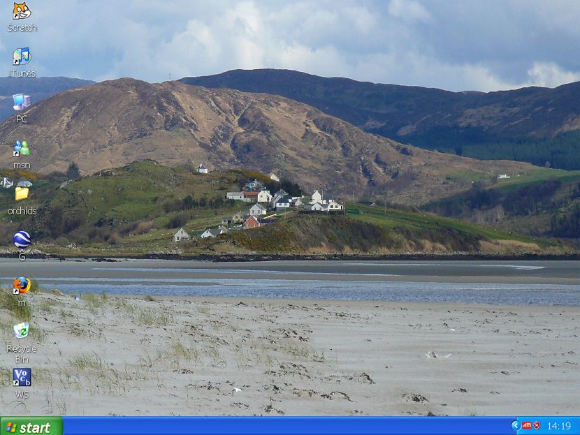
    Here is the view back up the ridge towards the cashel and the Glebe house, clearly visible in a dip in the centre, from the end of Dooey strand.

    desk.jpg


  • Registered Users, Registered Users 2 Posts: 46,555 ✭✭✭✭muffler


    I have moved a lot of the posts from the "photo request" thread to here.


  • Registered Users, Registered Users 2 Posts: 22 Victorian


    Hi Durnish. We meet again on this new thread. I think the photo from the cashel in incredible. Also, your screen saver showing the glebe house above the picturesque village. Is the village called Cullion?
    I was reading about the Gweebarra ford and how the people crossed it at low tide carrying items on their heads. Must have been scary.
    I have now figured out the ordnance maps and they are a great help.
    Thanks for the photos and info. Victorian


  • Advertisement
  • Registered Users, Registered Users 2 Posts: 22 Victorian


    Durnish wrote: »
    That was me.

    I would also recommend the Glenties book, Inishkeel and Glenties, which I mentioned somewhere. The beautiful little church at Lettermac is included in the parish and I think it had a Stewart rector/curate listed, either there or in Glenties.

    I am looking through my photo collection for Kilkenny, Lettermac and Churchtown (Narin) photos if you are still around.


    Durnish - I'm curious how you knew that Thomas Stewart was curate of Lettermac (in 1760). He was Rev. Walter's (of Inishkeel) son and ended up as Rector of Templecrone in Dungloe. Did you find that out from "Clergy of Derry & Raphoe"? or do you have another source? Thomas was also curate of Clondevaddock in Rosnakill.


  • Registered Users, Registered Users 2 Posts: 692 ✭✭✭Durnish


    posting live from Portnoo area, stormy day.

    That info was in the Glenties and Inishkeel /Liam Briody book. It has a chapter about the COI clergy for the district.

    My friend and I had a great day yesterday, investigating the Churchtown site and going on to the Kilkenny site. Without our families with us we can go off exploring. Great bacon sarnies in the cafe at Naran strand. I shall upload the pics and the info when I am back home, on cheap braodband.


  • Registered Users, Registered Users 2 Posts: 22 Victorian


    I had to look up what a bacon sarnie was. Sounds hearty, don't think I've heard of anyone eating a bacon sandwich before, but I'm sure it was great after exploring all day and I envy the view you had.
    I am going to order Lochlann McGill's book from Amazon. There is a used 1st edition 1992 for ~ $55 or a used revised edition 2001 for ~ $35. Which one would you recommend? Is the revised one lacking info or something, because it's $20 cheaper.
    Thank you in advance.


  • Registered Users, Registered Users 2 Posts: 692 ✭✭✭Durnish


    I have the 2001 edition. The paper is different and there is a forward by the local author, Brian Friel (Dancing at Lughnasa, Translations). Apart from that I don't know of any other difference.


  • Registered Users, Registered Users 2 Posts: 22 Victorian


    Durnish wrote: »
    I have the 2001 edition. The paper is different and there is a forward by the local author, Brian Friel (Dancing at Lughnasa, Translations). Apart from that I don't know of any other difference.

    Great. Thanks.


  • Registered Users, Registered Users 2 Posts: 692 ✭✭✭Durnish


    Right, I know this looks like a sporting even but it also is the best view from Naran beach of the Churchtown site. The white old style cottage, behind canoeist in red lifejacket, is on the site of the church and the graveyard (or laying out field) is between it and the row of cottages on the cliff. I reckon that the wall is prob part of old site.
    More to come.

    gapnaran2.jpg


  • Advertisement
  • Registered Users, Registered Users 2 Posts: 692 ✭✭✭Durnish


    This the view from the car park on Naran. The plain white cottage is now seen from the side, the area in front of it was where the church was, according to the kind local man who showed us. He was totally sure that no bodies had been buried in the "graveyard", seen as the green lawn with the beach wall to the right, they merely lay there waiting for the island graveyard to be accessible at low tide. The present church is seen, safely out of the way of the tide.

    A later, rather dramatic, picture may explain why the site was abandoned.
    Churchtown.jpg


  • Registered Users, Registered Users 2 Posts: 692 ✭✭✭Durnish


    Here we go, Churchtown site in the winter of 87, I think. Totally washed through by the Atlantic. This pic was in the bacon sarnie cafe.

    Churchtownwaves1987.jpg


  • Registered Users, Registered Users 2 Posts: 22 Victorian


    WOW. Those are fantastic photos. I can just imagine Rev. Walter in his glebe house along the shoreline. It must be horrifying when a brutal storm comes along like in 1987 but hopefully they're rare. You have also satisfied my curiosity about if he was buried there. The ordnance map said 'disused graveyard' and I had wondered if there were any graves still there.


  • Registered Users, Registered Users 2 Posts: 692 ✭✭✭Durnish


    Back to Lettermacaward. I must say that the drive from Portnoo to Dooey strand is exceptionally beautiful.
    If you take the left turn after Elliot's Tavern then you pass the tiny C of I Church, (1778) built beside an old pre-plantation church and graveyard annexed by the planters. LettermacCofI.jpg

    Inside the church outer wall the old church and graveyard are on the left. Some very old graves here, amazing to think that some of them would have been engraved by masons born around the time of the plantation and Cromwellian wars.

    Inside the enclosure,

    oldchurchandgraveyard.jpg


    This is a very interesting stone, with three leaping fish and a hammer clearly visible. Couldn't read the inscription.
    fishandhammer.jpg


  • Registered Users, Registered Users 2 Posts: 692 ✭✭✭Durnish


    Drive along about half a mile, on beautiful route, and there up on the right is the Glebe House, in a townland of its own, built plain and rectangular with a hidden basement, dummy windows, and a "return". Lovely little stable yard at the rear. Built with a grant from, wait for it, Board of First Fruits, in 1828.
    LettermacGlebe1.jpg


    I see from the old OS 25 inch that there must have been a garden at the back with fruit trees. A man along the road told us earlier that the present owner was trying to get a grant from the Heritage/Taisc people to restore the building sympathetically.


  • Advertisement
  • Registered Users, Registered Users 2 Posts: 692 ✭✭✭Durnish


    As I was up noseying about the old Glebe House, a tradional Donegal wedding procession went past. I caught the bride's car going past the gate. Charming.

    Lettermacwedding.jpg

    Actually, this pic shows the old ferry crossing and the road leading down to it as well.

    It is a very interesting area, with a very shaky Plantation history. Some of the Planters (mainly in Loughros Point) couldn't afford to pay to upkeep an Established Anglican rector and so turned to Methodism, according to McGill's History of the Parish.


  • Registered Users, Registered Users 2 Posts: 692 ✭✭✭Durnish


    Here is the sunken stable yard, with view of Dooey sandhills and the Na Rossa Gaelic pitch down in the callows (dark green),
    Glebeyard.jpg

    This is the doorway, in the return, showing original fanlight and new double doors.
    Glebefanlight.jpg


  • Registered Users, Registered Users 2 Posts: 22 Victorian


    I loved all the photos. The little church looks so quaint and must hold a very small congregation. I would not have recognized the fish on the gravestone with the hammer. I wonder what it represents. I can't believe how close you got to the glebe house. The owner must be very proud of this house to be taking such care restoring it. Good for him to keep the history alive. The views must be fabulous from up there.
    I received my copy of 'In Conall's Footsteps' a week ago and am thoroughly enjoying it. The history of the area that you have supplied me with makes it all come together. I did get confused with the chapter on St. Conall tho. The lineage of the saints is overwhelming to me. Do you learn about them all in school?
    Thank you so much for the trouble you have gone to to procure such interesting photos for me.


  • Registered Users, Registered Users 2 Posts: 692 ✭✭✭Durnish


    Gosh, I don't understand all that St Conall stuff, it's the little snippets of local history and geography that astonish me. The author's style is very wordy. His father's version, the History of the Parish of Ardara, (Probably long out of print) is more direct about the Plantation and the land/tithe wars. You do understand about the tithes the whole population, regardless of religion, had to pay to the Established Church, C of I?

    There was no one home in the Glebe house, otherwise I would have asked, eventually and politely, for a wee look inside. It must be one room thick, front to back, apart from the return.
    I am glad you like the pics, my friends and I, mostly long lapsed Anglicans, are fascinated by this stuff. I did learn about landwars and tithes and so on, at school but my school was an exception in NI, a state school providing Irish History to A level in the 70's.


  • Registered Users, Registered Users 2 Posts: 22 Victorian


    I wasn't actually aware that tithes were paid to the C of I by all denominations. I read an account whereby one fellow could not pay his tithe because he was destitute. As he didn't even own furniture that could be taken in lieu of his tithe, he was jailed. Harsh.
    I am gaining knowledge of Irish history as I go along. A few years back, all I knew about was the planters, the famine, U2 and St. Patrick.
    Speaking of tithes, when Rev. Thomas (Lettermac) was in Templecrone, his eldest son collected his father's tithes and was never seen in Ireland again. He bought himself a commission in the India Army. I always wondered how his parents and siblings managed that year.


  • Registered Users, Registered Users 2 Posts: 692 ✭✭✭Durnish


    oh aye, that's why the Anglican church was dis-established. I do rem that from "O" level history. It must have been a strange and isolated life for any Anglican rector and family who took up those western seaboard parishes two or three centuries ago.


  • Registered Users, Registered Users 2 Posts: 22 Victorian


    It was probably the lesser of 2 evils in our case. Family lore says Walter had to leave Scotland because he was implicated in the uprising of the Royal Stewarts. Exile or death.


  • Registered Users, Registered Users 2 Posts: 692 ✭✭✭Durnish


    Oh, I thought maybe it was all something to do with the Stewarts of Horn Head House. Is that the Jacobite rebellion you are writing about, like BPC and all?


  • Registered Users, Registered Users 2 Posts: 22 Victorian


    Yes, the Jacobite uprisings. Our family bible says that he left the Isle of Bute ~ 1745 and was given the living of Inniskeel by his cousin, John, the 3rd Earl of Bute. I already have contradictory evidence to much of this statement i.e. he was in Donegal in the 1730s; Inniskeel was not his first living; I can't find that the Earl of Bute was patron of any living in Donegal altho maybe he just pulled a few strings; the word 'cousin' is being stretched here and means distant relative. Walter was born ~1704 so would be too young for the 1st uprising. C'est la vie.


  • Registered Users, Registered Users 2 Posts: 812 ✭✭✭rightyabe


    Durnish wrote: »
    This the view from the car park on Naran. The plain white cottage is now seen from the side, the area in front of it was where the church was, according to the kind local man who showed us. He was totally sure that no bodies had been buried in the "graveyard", seen as the green lawn with the beach wall to the right, they merely lay there waiting for the island graveyard to be accessible at low tide. The present church is seen, safely out of the way of the tide.

    A later, rather dramatic, picture may explain why the site was abandoned.
    Churchtown.jpg


    Sorry just new to board.ie today.

    I'm only 22, and live in portnoo/narin area. I remember at a wake years ago people talking about the old graveyard on the strand road.

    The story goes that in the winter time when the seas were rough the dead were buried there, because the island was inaccessable. But i all stopped years ago(dont know a approx year) due to the old wall being washed away which let the sea erode the graves. they built a concrete wall there soon after.


  • Advertisement
Advertisement