Advertisement
If you have a new account but are having problems posting or verifying your account, please email us on hello@boards.ie for help. Thanks :)
Hello all! Please ensure that you are posting a new thread or question in the appropriate forum. The Feedback forum is overwhelmed with questions that are having to be moved elsewhere. If you need help to verify your account contact hello@boards.ie
Hi there,
There is an issue with role permissions that is being worked on at the moment.
If you are having trouble with access or permissions on regional forums please post here to get access: https://www.boards.ie/discussion/2058365403/you-do-not-have-permission-for-that#latest

Sat navs for bikes?

  • 27-11-2012 11:52am
    #1
    Registered Users, Registered Users 2 Posts: 1,277 ✭✭✭


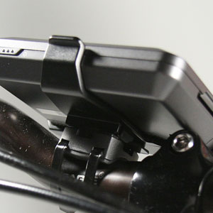
    Anyone ever attached anything like this to their bike? Garmin sat nav

    I cycle to go places rather than to train, have got lost a few times, don't fancy taking a paper map with me, and I'm not good at pre planning routes the night before, also don't have a smart phone for google maps on the go.

    Have toyed with the idea of getting a garmin edge, but I think it only tells you where you've been, and not where you are.

    I like that the above is only €100, will tell me where I am (when lost) and the direction home.


Comments

  • Registered Users, Registered Users 2 Posts: 31,218 ✭✭✭✭Lumen


    MB Lacey wrote: »
    Have toyed with the idea of getting a garmin edge, but I think it only tells you where you've been, and not where you are

    Garmin Edge 705 and 800 have map-based navigation.


  • Moderators, Science, Health & Environment Moderators Posts: 23,243 Mod ✭✭✭✭godtabh


    My uncle uses one that he originally got for walking. I think its a garmin. Havent a clue of the model number. Has maps. He usually uses it now for mountain biking


  • Registered Users, Registered Users 2 Posts: 1,311 ✭✭✭youtheman


    Haven't used anything like that for my bike. Should work subject to the following:

    1. It will only last a few hours as it is designed to be plugged into a car cigarette lighter for charging.
    2. It will not take too kindly to the rain (as it's designed for inside a vehicle).
    3. you'll have to manufacture some fancy bracket to hold it (as the bracket supplied is designed for a windscreen).

    A cycle GPS with mapping (eg Garmin 800) will cost you a good few hundred euros more, so what you are planning make (some sort) or sense - to me anyway !!!


  • Registered Users, Registered Users 2 Posts: 2,807 ✭✭✭g0g


    Here from Garmin for $ 18.
    cf-lg.jpglf-lg.jpg
    Also on amazon.co.uk search "nuvi handlebar"


  • Registered Users, Registered Users 2 Posts: 1,277 ✭✭✭MB Lacey


    youtheman wrote: »
    1. It will only last a few hours as it is designed to be plugged into a car cigarette lighter for charging.
    2. It will not take too kindly to the rain (as it's designed for inside a vehicle).
    3. you'll have to manufacture some fancy bracket to hold it (as the bracket supplied is designed for a windscreen).

    A cycle GPS with mapping (eg Garmin 800) will cost you a good few hundred euros more,

    I hadn't thought of any of the above, main one being battery life (I can be out all day).

    Have just looked up garmin edge 800 and that's very good and exactly what I'd like, but €417 is pricey enough, so will sit on it for a bit.
    Also if I'm considering splashing out that amount of cash, I'll have to get comparing the edge 800 and the satmap active 10 which I could use for my hillwalking too.

    Thanks for thoughts, at least I know the car satnav is a no go.


  • Advertisement
  • Registered Users, Registered Users 2 Posts: 31,218 ✭✭✭✭Lumen


    MB Lacey wrote: »
    I hadn't thought of any of the above, main one being battery life (I can be out all day).

    Have just looked up garmin edge 800 and that's very good and exactly what I'd like, but €417 is pricey enough, so will sit on it for a bit.
    Also if I'm considering splashing out that amount of cash, I'll have to get comparing the edge 800 and the satmap active 10 which I could use for my hillwalking too.

    Thanks for thoughts, at least I know the car satnav is a no go.

    The 800 you linked to doesn't include maps. You may be able to use OpenStreetMap data, but the easy/expensive route is to get the Garmin maps:

    http://www.wiggle.co.uk/garmin-edge-800-gps-performance-navigation-bundle/

    ..which is brings the price to €470.

    ..or €417 here:

    http://www.handtec.co.uk/garmin-edge-800-performance-and-navigation-bundle-010-00899-31.html

    The 705 is much cheaper:

    http://www.handtec.co.uk/garmin-edge-705-heart-rate-monitor-noh-010-00555-21.html

    ...but has only base maps.

    This might help regarding OSM.

    http://ridewithgps.com/edge_705


  • Registered Users, Registered Users 2 Posts: 11,505 ✭✭✭✭DirkVoodoo


    Second hand phone and some spare batteries?


  • Closed Accounts Posts: 3,013 ✭✭✭Ole Rodrigo


    If you can get a second hand Edge 705 they are good value. Heres one from adverts http://bit.ly/TiNDck

    Although, you might have to get an extra map card depending on where its being used.


  • Registered Users, Registered Users 2 Posts: 1,306 ✭✭✭CardinalJ


    Sportpursuit have an offer on GPS's at the moment. You've to join the site but its all legit. Can be mounted on handlebars.


  • Closed Accounts Posts: 573 ✭✭✭el Bastardo


    MB Lacey wrote: »
    Anyone ever attached anything like this to their bike? Garmin sat nav

    I cycle to go places rather than to train, have got lost a few times, don't fancy taking a paper map with me, and I'm not good at pre planning routes the night before, also don't have a smart phone for google maps on the go.

    Have toyed with the idea of getting a garmin edge, but I think it only tells you where you've been, and not where you are.

    I like that the above is only €100, will tell me where I am (when lost) and the direction home.

    The Garmin Edge 705/800 aren't just for for locating and planning routes: They're also used for logging data and as training aids. There're other Garmins available for the great outdoors and afaik bike mounts are available for them; Drawback is that they're neither cheap, small n'or lightweight and don't work well as training aids. Maybe try looking for a working used one like the a Garmin 60Csx.


  • Advertisement
  • Moderators, Recreation & Hobbies Moderators Posts: 4,034 Mod ✭✭✭✭Planet X


    Check out Garmin eTrex range.
    AA batteries X 2.
    24hrs. usage reported.


  • Registered Users, Registered Users 2 Posts: 717 ✭✭✭Mucco


    I use my Samsung S3. I bought it specifically for this purpose. You can download maps, and then use a free app, so not using any data downloads. I'm going to hook it up to the hub dynamo and have the prefect touring sat-nav.


  • Registered Users, Registered Users 2 Posts: 3,123 ✭✭✭mr spuckler


    i have an edge 705 which i use both on the bike and when hiking. i currently have topo maps on it as have been hiking a good bit recently and i think it's the dog's bollocks! battery life is at least 10 hours (from wicklow 200 experience) but it wasn't close to dead after that.

    if you don't want the HR strap & cadence sensor then i'd be willing to sell the unit on it's own as i've been planning to upgrade to the 800 anyway.


  • Registered Users, Registered Users 2 Posts: 287 ✭✭serendip


    Planet X wrote: »
    Check out Garmin eTrex range.
    AA batteries X 2.
    24hrs. usage reported.

    This is good advice. I have one and wouldn't swap it for one of the other lines mentioned above. However, YMMV.


  • Registered Users, Registered Users 2 Posts: 24,537 ✭✭✭✭Cookie_Monster


    buy a smartphone instead of the likes of that garmin. might cost a bit more but so much more useful for so many other things.


  • Registered Users, Registered Users 2 Posts: 31,218 ✭✭✭✭Lumen


    buy a smartphone instead of the likes of that garmin. might cost a bit more but so much more useful for so many other things.

    Most smartphones are not water resistant. The ones that are (e.g. Motorola Defy+, which I have) tend to have lower-specced processors.

    I also haven't seen a smartphone bike mount that looked anything but incredibly gawky, though I haven't done much research recently.

    Navigating in heavy traffic with a hand-held smartphone is not fun.

    The TCO of a smartphone is also quite high, although Android phones are getting cheaper.


  • Registered Users, Registered Users 2 Posts: 2,216 ✭✭✭Paul Kiernan


    The Sony Xperia Active smartphone is interesting. It's ANT+ compatible so will work with heart rate, speed, cadence and power. It also has barometric sensor for elevation. And it's fully waterproof.

    DC rainmaker has review of it and also a special bike mount for it (check out his underwater video of the babe in the sexy swimsuit:)).

    You can get it from amazon.co.uk for about €200 but it's only €160 or so on amazon.de.


  • Registered Users, Registered Users 2 Posts: 5,969 ✭✭✭hardCopy


    Lumen wrote: »

    Most smartphones are not water resistant. The ones that are (e.g. Motorola Defy+, which I have) tend to have lower-specced processors.

    I also haven't seen a smartphone bike mount that looked anything but incredibly gawky, though I haven't done much research recently.

    Navigating in heavy traffic with a hand-held smartphone is not fun.

    The TCO of a smartphone is also quite high, although Android phones are getting cheaper.

    An Android smartphone with gps turned on won't last more than a couple of hours in my experience. Even plugged in to the cigarette charger they burn electrons faster than they can charge.


  • Registered Users, Registered Users 2 Posts: 24,537 ✭✭✭✭Cookie_Monster


    Lumen wrote: »
    Most smartphones are not water resistant. The ones that are (e.g. Motorola Defy+, which I have) tend to have lower-specced processors.
    stick it in a ziplock bag, can still use the touch screen through the plastic too.
    I also haven't seen a smartphone bike mount that looked anything but incredibly gawky, though I haven't done much research recently.
    stick it in your pocket

    You won't need to have the phone out and gps on all the time, just refer to it every so often, i do it all the time when out on the bike checking junctions etc if I'm not sure.


  • Closed Accounts Posts: 3,013 ✭✭✭Ole Rodrigo


    The most I've got from an app on the iphone is 4 hours ( fully charged battery and not using it for anything else ) The elevation data wasn't as accurate as the garmin on the same route, and the average speed was suspect ( could have been me though :) ) There is still, apparently, a lot of difficulty developing gps apps with low battery usage. By contrast I've had 14 hours from the 705 with some juice left after, and heard of up to 18 hours.


  • Advertisement
  • Closed Accounts Posts: 2,889 ✭✭✭feck sake lads


    i have the garmin legend hcx pretty good
    (DEC still can programme it )
    but the nuvi will work not sure how long it will last battery wise but juse turn it on when you do get lost.


  • Registered Users, Registered Users 2 Posts: 1,100 ✭✭✭clog


    I now have a garmin but I used to use an old nokia 5230 smartphone. The battery life on these is excellent I have run one before with endomondo on for 12 hours straight and it hasn't drained half the battery (you can get a new battery for about e10). It also has a built in satnav. You could prob pick one of these up for about 20-30 euro. It won't work directly with Strava but you can export the endomondo file.


  • Registered Users, Registered Users 2 Posts: 266 ✭✭dancrowley


    I've a Lifeproof case for my iPhone 4S which also has a handlebar attachment. http://www.lifeproof.com/iphone/?path=TopNav
    Great piece of kit. IP-68 protection. Not the cheapest case in the world, but I'd be wary if it was cheaper.


  • Moderators, Recreation & Hobbies Moderators Posts: 4,034 Mod ✭✭✭✭Planet X


    Mucco wrote: »
    I use my Samsung S3. I bought it specifically for this purpose. You can download maps, and then use a free app, so not using any data downloads. I'm going to hook it up to the hub dynamo and have the prefect touring sat-nav.

    Do you have to use a "cache battery" as in an eWerk type of unit. You cannot charge directly off a dynamo as far as I know? I've read also off the CTC guys that you won't get a full charge iPhone or Android...........


  • Registered Users, Registered Users 2 Posts: 717 ✭✭✭Mucco


    Planet X wrote: »
    Do you have to use a "cache battery" as in an eWerk type of unit. You cannot charge directly off a dynamo as far as I know? I've read also off the CTC guys that you won't get a full charge iPhone or Android...........

    I'm going to get the new B&M light with USB socket. I haven't read up on how good the charging is though.


  • Moderators, Recreation & Hobbies Moderators Posts: 4,034 Mod ✭✭✭✭Planet X


    Mucco wrote: »

    I'm going to get the new B&M light with USB socket. I haven't read up on how good the charging is though.

    Very nice.
    I'm still led to believe that charging iPhones etc. needs a "consistent" electrical charge/flow as op.posed to dynamo irregular(pedalling cadence) charging. That's why I keep reading about cache batteries.......dynamo charges a cache battery. Cache battery charges a phone. Independantly


  • Registered Users, Registered Users 2 Posts: 31,218 ✭✭✭✭Lumen


    Planet X wrote: »
    Very nice.
    I'm still led to believe that charging iPhones etc. needs a "consistent" electrical charge/flow as op.posed to dynamo irregular(pedalling cadence) charging. That's why I keep reading about cache batteries.......dynamo charges a cache battery. Cache battery charges a phone. Independantly

    Yes, B&M IQ2 has a li ion battery to smooth the charging current.

    I assume that since even the latest iPhones will charge (slowly) via standard 500mA USB 2.0, there shouldn't be any issues.

    Handlebar-mounted iPad would be more of a challenge. :pac:


  • Registered Users, Registered Users 2 Posts: 1,277 ✭✭✭MB Lacey


    thanks all for opinions, will go through them, not going to get a smartphone - reading reviews I'm edging towards the edge 705/800, will lok at the etrex range, or just get a cheap sat nav and put it in a ziploc bag in my jersey pocket, only turning it on when I need it.


  • Registered Users, Registered Users 2 Posts: 121 ✭✭dardhal


    Planet X wrote: »
    Check out Garmin eTrex range.
    AA batteries X 2.
    24hrs. usage reported.

    I can only second that. There are few things as robust, reliable and with longer battery life than an older eTrex with some good maps loaded and a couple of spare cheap AA batteries (better if using rechargeables on the long run).

    It all depends on intended use, but I would be very wary of fitting anything but a dedicated outdoor and waterproof GPS to the handlebar of a bike, as most general purpose GPS navigators and phones can't stand vibrations, water and dirt very well. And their batteries run out of juice in a couple of hours.

    There must be truckloads of second hand Garmin eTrex Legend C / Cx / HCx around at bargain prices which would be my first choice any day of the week.


  • Advertisement
  • Registered Users, Registered Users 2 Posts: 42 WLPD


    Another +1 for Garmin Etrex range . I had a handheld for walking long before I took to the bike. The bike mounts work well and the device itself takes all that comes at it while on the bike, Road or MTB.


  • Registered Users, Registered Users 2 Posts: 198 ✭✭bedirect


    saw a device on amazon, where you put your sat nav into a waterproof holder & attach to handlebars, you would be dependant on battery life


  • Registered Users, Registered Users 2 Posts: 14,318 ✭✭✭✭Raam


    This thread was solved in post number two. I will link to it so as to help the confused. Here is the link: http://www.boards.ie/vbulletin/showpost.php?p=81956686&postcount=2


  • Registered Users, Registered Users 2 Posts: 1,277 ✭✭✭MB Lacey


    Quick question re Garmin edge 800/ etrex 30 maps.
    Do they tell you which roads are one way only?

    I preplanned my 60k spin yesterday via google maps on my comp at home and a pen and paper which I took with me on the cycle.

    Cycling from Lucan I planned to continue along the R835, take a left onto the R403 and continue onto Celbridge.
    Looked simple enough on Google maps, but when I arrived on my bike, the R835 was actually a one way road which we weren't allowed to go down.

    This is what the route looked like at home, where the R835 hits a v shape it becomes one way - not obvious on the map.

    https://maps.google.com/maps?q=lucan&hl=en&ll=53.353433,-6.471591&spn=0.006942,0.015922&sll=53.324909,-6.34899&sspn=0.013893,0.031843&t=h&hnear=Lucan,+County+Dublin,+Ireland&z=16

    Bit frustrated, we had set off late on the cycle, it was cold and starting to get dark, we asked several people which way was the best alternative route, ended up cycling back on ourslves and taking a slip road onto the motorway and joining the R403 that way.

    Would the edge 800/ etrex 30 have let us know this was a one way street?

    We ended up getting to Celbridge at 5pm, all food in Celbridge seemed to stop at 4pm, so we cycled onto Barberstown where a coffeshop in an antiques shop had also stopped doing food but gave us cake and coffee, our only sustenance for our 60k spin :o


  • Moderators, Society & Culture Moderators Posts: 15,812 Mod ✭✭✭✭smacl


    MB Lacey wrote: »
    Would the edge 800/ etrex 30 have let us know this was a one way street?

    I'd guess it depends on the mapping loaded, open street maps has many one way streets marked, but no idea if this works with the route planning software.

    FWIW, I use an older GPSMap 76cs with a bike handle attachment and find it fine for following routes I've set-up in advance but the mapping is pretty awful. On the plus side, the batteries will last for a couple of days continuous usage, and the screen is readable in most conditions. No route planning on the unit itself.


  • Closed Accounts Posts: 3,013 ✭✭✭Ole Rodrigo


    It probably wont if the road is temporarily marked as one way, is a recent change or is temporarily closed.

    What you can do with the Edge is plot your route on bikeroutetoaster or ridewithgps etc, upload the route to your device and load it as a course at the start of your ride. If you deviate from the route at any point you can easily navigate back and rejoin, it will give you directions and you can clearly see where you are in relation to the loaded route on the display screen.


  • Advertisement
  • Registered Users, Registered Users 2 Posts: 1,277 ✭✭✭MB Lacey


    Thanks, I actually rang the people at mysatnav.ie and they said the maps they provide plan routes avoiding one way streets.

    hoping the 800 might go down in price soon, people wont buy them now that there's talk of a edge 900/800s early 2013.

    http://www.bikeradar.com/road/news/article/garmin-edge-900-gps-bike-computer-coming-in-2013-35888/

    though I still might go for the etrex 30 from replies on this thread.


  • Registered Users, Registered Users 2 Posts: 121 ✭✭dardhal


    smacl wrote: »
    I'd guess it depends on the mapping loaded, open street maps has many one way streets marked, but no idea if this works with the route planning software.

    I am not 100%, but depending on the map and the loaded TYP (which is a sort of template that tells the GPS and mapping software how to drat the different items in the map AND how to consider each of them towards route calculation), even the oldest Garmin eTrex GPS won't route you along one way roads if those roads are adequately tagged as such, and your trip would force you to go against traffic.

    In fact, you may want to check some of the documentation at www.openmtbmaps.org. These are superb OSM-based Garmin maps which include information such as inclines, one-ways and surface type into the route calculations. The equivalent for road bike users is www.velomap.org, which is more focused on road bike users rather than MTB ones.

    I can't recommend enough to contribute to OpenStreetMaps: once the path / trail / road / street / tag is there, is there forever and for everyone, from Garmin maps (as those mentioned), to handheld / smartphone maps (Navfree, Navit, OSMand, Oruxmaps) to desktop application users (CompeGPS, Mapsource, QLandkarteGT, etc.). OSM is the "Wikipedia for geographical information", and it doesn't depend in the Google / Apple / Nokia / Whatever company to keep maps up to date, it is its users who update and improve the maps. It is, put simply, the correct way to go.

    FWIW, I use an older GPSMap 76cs with a bike handle attachment and find it fine for following routes I've set-up in advance but the mapping is pretty awful. On the plus side, the batteries will last for a couple of days continuous usage, and the screen is readable in most conditions. No route planning on the unit itself.

    A simple Garmin eTrex Legend Cx will DO routing IF the loaded maps have routing information included. There are Garmin maps which paint roads, but have no roads marked as such (routing wise), so the unit (or the desktop application) can't route at all.


Advertisement