Advertisement
If you have a new account but are having problems posting or verifying your account, please email us on hello@boards.ie for help. Thanks :)
Hello all! Please ensure that you are posting a new thread or question in the appropriate forum. The Feedback forum is overwhelmed with questions that are having to be moved elsewhere. If you need help to verify your account contact hello@boards.ie

Ordnance Survey benchmarks

Options
  • 17-04-2012 6:06pm
    #1
    Registered Users Posts: 692 ✭✭✭


    Does anyone know of any visible ones in Co Donegal, not trig points, just the old crows' feet cut benchmarks? So far I have only managed to find one on my own and the images or mention of two on line.
    Thanks in anticipation.


Comments

  • Registered Users Posts: 1,370 ✭✭✭Technique


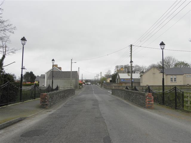
    There's one on the bridge at the entrance to Newtowncunningham village, which I believe was replaced upside-down when the bridge was rebuilt during recent roadworks!

    2876343_afe599ea.jpg


  • Registered Users Posts: 45,835 ✭✭✭✭muffler


    There are thousands of them around but its just a matter of knowing where to look.

    Im off to check something and I'll post back if Im successful.


  • Registered Users Posts: 45,835 ✭✭✭✭muffler


    Bench marks were originally carved into stone which was considered to be permanent at the time. In urban areas they were found quite often on the front wall or the corner of a building or on a bridge as stated above by Technique. Redevelopment over the years resulted in a substantial loss of these bench marks but there are still a good few of these around and local knowledge or a map will get you in the right direction.

    In rural areas they were usually found on roadside houses and farm buildings, stone pillars, stone ditches etc. Again a lot of these disappeared with rural house building, road widening etc etc. You really have to get an old road that has not been widened and where there has been no disturbance of the original buildings or walls/ditches.

    To find or attempt to find them use this link.That link should show a section of the Donegal Road just as you leave Ballybofey - around Mulrines bottling plant. Down at the bottom of the panel on the right hand side you can click the "Historic 25" button. That will show you an old map of the area and in the example I linked to you will see where there were 2 old bench marks but those are now gone unfortunately. Clicking on the pan button will allow you to move the map around including the old 25" so as to look for more benchmarks.

    But here's the best part. Below the Historic 25" button there's a little slider and if you click and hold on it you can move it to the side and as you do so the old and new maps are overlaid at various increments so you can see what was there 100 years ago and whats there today (within the last couple of years anyhow)

    You can use the mouse wheel to zoom in or out and also the top numeric digits on the keyboard from 1 - 7 can be used to view different maps and aerial photos.

    To view other areas just click on the pan button and then the "Street map" button and zoom out with mouse wheel and pan to whatever part of the county or country you want.


  • Registered Users Posts: 2,081 ✭✭✭GetWithIt


    ^^
    OT: Right click and you toggle between the Pan/Zoom options.

    Think of all the button clicks I've saved you.


  • Registered Users Posts: 9 Mike in CT


    That is an amazing site. The 6" maps look like they are the 1835 OS map. Would anyone know the year for the 25" maps? I made some copies of the 1901 map in library in Letterkenny some years ago and it looks like it might be the same.


  • Advertisement
  • Registered Users Posts: 45,835 ✭✭✭✭muffler


    Mike in CT wrote: »
    That is an amazing site. The 6" maps look like they are the 1835 OS map. Would anyone know the year for the 25" maps? I made some copies of the 1901 map in library in Letterkenny some years ago and it looks like it might be the same.
    Yes the 6" scale are the original 1835 series. Im not sure of the 25" scale.

    O.S. had 2 updates after 1876, one in 1903 and one in 1949 -1953 depending on area. In fairly sure its the 1903 series though.


  • Registered Users Posts: 692 ✭✭✭Durnish


    The lake levels say Sept 1902 so 1903 sounds good. Thanks, Muffler, I had been using the 25 inch historic set but not as efficiently as you suggest.

    OS NI has an historic map section and, as this was pre -partition stuff, I was wondering if more info about the re-mappings and scales could be found there.


  • Registered Users Posts: 47 milewidehead


    Durnish wrote: »
    Does anyone know of any visible ones in Co Donegal, not trig points, just the old crows' feet cut benchmarks? So far I have only managed to find one on my own and the images or mention of two on line.
    Thanks in anticipation.

    You could ring the OSi Office (Map Sales) and ask are any of the old levelling "Descriptions" still lying around.(When a line of levels was plotted, a fairly detailed drawing of each permanent installation 'BM' was made. These were then attached to the levelling sheets for that particular project, and were known simply as 'descriptions'.) The British sappers did this for the Crows Feet, and the later OS Levelling staff did the same, when installing new Rawl-Plug type BM's and concrete Junction-Blocks. These were carefully archived in the Levelling Office in Ordnance Survey HQ. for decades and it would be a travesty if they are lost now. There are still some people left in OSi who worked on levelling in Donegal(big hint:try the SLIGO Regional OS office!) and may be of assistance.


  • Registered Users Posts: 692 ✭✭✭Durnish


    Well thank you very much. Spent a few minutes trying to find a BM on an old lime kiln in Portnoo last weekend but... no success. Will try the Sligo Office by email.


  • Registered Users Posts: 47 milewidehead


    Durnish wrote: »
    Well thank you very much. Spent a few minutes trying to find a BM on an old lime kiln in Portnoo last weekend but... no success. Will try the Sligo Office by email.

    Church Steps are a good bet, Court Houses and Railway bridges too. Remember that the staff-man had to have at least seven feet vertical clearance over the BM to mount his levelling staff. I've seen (and used) BM's cut on large cropping rocks in fields in particularly rural areas. If you can access older 25" (1:2,500) or 1:1,000 plans they'll give you a good idea where the BM's are. (Newer plans only show new BM positions.)
    Levelling or Vertical Height control is no longer carried out in the traditional way by the O.S.i. and, as far as I know, no new BM's are being installed. Modern surveying equipment,(G.P.S. and Total or Smart Stations) automatically collect heighting data when in use. Accurate heighting data can also be generated from stereoscopic aerial photography or state of the art LIDAR (laser) equipment.
    So...no more Sappers with hammers and chisels!


  • Advertisement
  • Registered Users Posts: 692 ✭✭✭Durnish


    Thanks again. It's the erratic boulder ones I am interested in, the sappers' marks. I found one on the chuirch at Portnoo and am determined to find some more. I have tried to read the Paper Landscape book but it's very difficult. Was pleased to find Richard Kirwan's "If Maps Could Speak" in our library yesterday so am looking formore info in that.

    Will crows' feet on erratic rocks on the Dawros tundra have weathered into oblivion? They are marked on the 1903 25 inch.


  • Registered Users Posts: 610 ✭✭✭muckish


    Very interesting thread. There's a BM at the front door of the Courthouse in LIfford. I'll get a picture of it.


  • Registered Users Posts: 47 milewidehead


    Durnish wrote: »
    Thanks again. It's the erratic boulder ones I am interested in, the sappers' marks. I found one on the chuirch at Portnoo and am determined to find some more. I have tried to read the Paper Landscape book but it's very difficult. Was pleased to find Richard Kirwan's "If Maps Could Speak" in our library yesterday so am looking formore info in that.

    Will crows' feet on erratic rocks on the Dawros tundra have weathered into oblivion? They are marked on the 1903 25 inch.

    Generally not, though some weathering is to be expected. Crows Feet on cropping rocks can be found cut in the horizontal plane-(i.e. flat), with a small cup dished out where the cross-bar usually is. A marble or ball-bearing is placed in this and the staff raised on it. You really would be lucky to locate these without a proper "description".
    There is a fairly decent museum in Ordnance Survey H.Q. in the Phoenix Park, with the old and modern surveying equipment and techniques displayed and described. You might even find a real cartographer with genuine field experience knocking around though they're thin on the ground now, especially after the recent cull of the public service. Wish you luck, enjoying the thread.


Advertisement