Advertisement
If you have a new account but are having problems posting or verifying your account, please email us on hello@boards.ie for help. Thanks :)
Hello all! Please ensure that you are posting a new thread or question in the appropriate forum. The Feedback forum is overwhelmed with questions that are having to be moved elsewhere. If you need help to verify your account contact hello@boards.ie
Hi there,
There is an issue with role permissions that is being worked on at the moment.
If you are having trouble with access or permissions on regional forums please post here to get access: https://www.boards.ie/discussion/2058365403/you-do-not-have-permission-for-that#latest

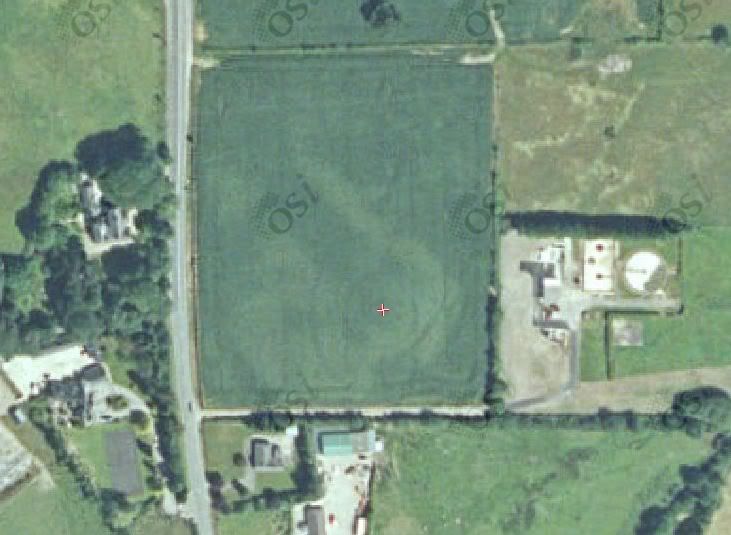
Ringfort?

  • 09-04-2012 7:03pm
    #1
    Registered Users, Registered Users 2 Posts: 102 ✭✭


    I found this on the osi map and checked monument database it's not registerd.
    Who, should i report that place?

    Ringfort.jpg


Comments

  • Closed Accounts Posts: 1,541 ✭✭✭Gee Bag


    That looks like it has potential. Looks way too big to be a ringfort though! Try google earth to see if you can get more detail.

    Suspected sites should be reported to the Archaeological Survey of Ireland. The ASI don't have a central office, they are spread out across Ireland. If you tell me what county the site is in I can forward on the contact details.


  • Moderators, Science, Health & Environment Moderators Posts: 5,223 Mod ✭✭✭✭slowburner


    Looks like the tracks left where a vehicle turned around. There are similar, regularly spaced tracks through the field.


  • Registered Users, Registered Users 2 Posts: 10,246 ✭✭✭✭Riamfada


    Im assuming there is nothing on the 6"?


  • Registered Users, Registered Users 2 Posts: 102 ✭✭Jakub25


    There is nothing on the 6" and google earth.
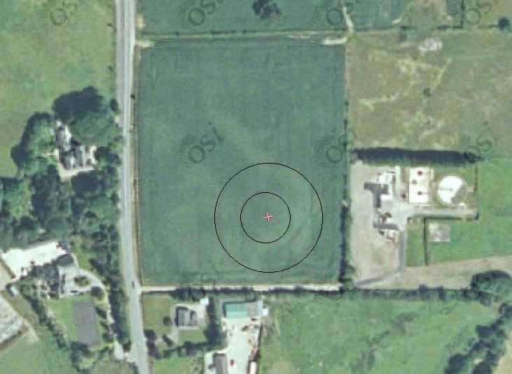
    In my opinion it looks like two rings.
    Tracks of vehicle are straight but as well i see there circular shapes.

    Ringfortt.jpg


  • Moderators, Science, Health & Environment Moderators Posts: 5,223 Mod ✭✭✭✭slowburner


    Try here for an alternative view http://www.bing.com/maps/
    The aerial photography is very good from this site, at least it is for my neck of the woods.
    I saw the rings alright, but I still think they are tracks.
    I hope I'm wrong.
    The 2000 aerial photos on the OSI site sometimes give more information than the 2005 images because they were taken during a very dry period when there was very limited grass growth - this frequently reveals features not evident in the 2005 images.
    The lighter markings could indicate a ploughed out earthwork.


  • Advertisement
  • Registered Users, Registered Users 2 Posts: 102 ✭✭Jakub25


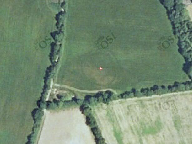
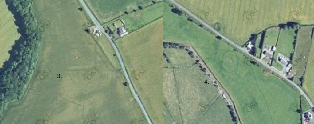
    I found another strange circle, what is visable only on the osi 2005.
    Nothing on th google earth and bing.
    What can it be, enclosure?

    Capture22.jpg


    laczoneeeee.jpg


  • Moderators, Science, Health & Environment Moderators Posts: 5,223 Mod ✭✭✭✭slowburner


    Jakub25 wrote: »
    I found another strange circle, what is visable only on the osi 2005.
    Nothing on th google earth and bing.
    What can it be, enclosure?
    If the circles are only visible at one date, then they are almost definitely vehicle tracks or possibly a fungus pattern in the crop.
    What part of the country are you looking at?


  • Registered Users, Registered Users 2 Posts: 3,594 ✭✭✭cfuserkildare


    Hi Jakub25,

    The marks are still visible in the other maps just very faint,

    I contacted the National / Natural History Museum (can't remember which) but after a while they replied.

    As a side note, It looks more like an enclosure, possibly bronze age or more recent.


  • Registered Users, Registered Users 2 Posts: 102 ✭✭Jakub25


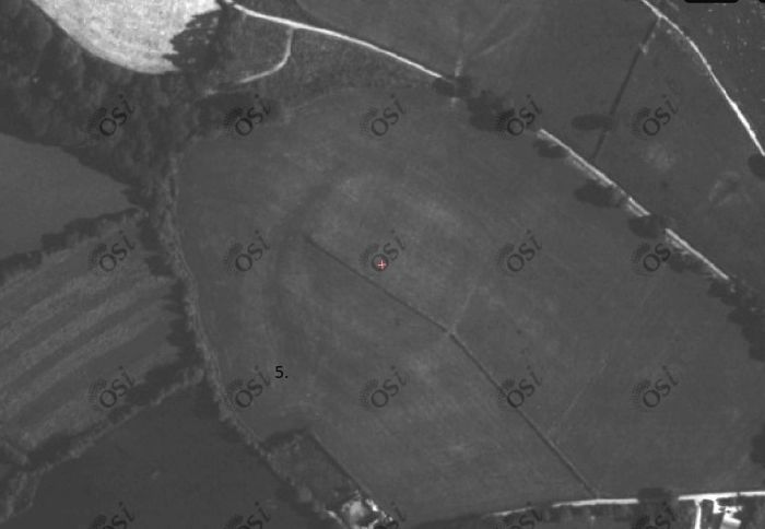
    Those two from county Laois, number 4 is near holy well.


    Clipboardddddd.jpg


  • Registered Users, Registered Users 2 Posts: 3,594 ✭✭✭cfuserkildare


    Hi Jakub25,

    The marks are still visible in the other maps just very faint, (Different light Conditions)
    I contacted the National / Natural History Museum (can't remember which) but after a while they replied. (In relation to an enclosure I found in Wicklow)
    As a side note, It looks more like an enclosure, possibly bronze age or more recent.

    Just to make things a little clearer.


  • Advertisement
  • Registered Users, Registered Users 2 Posts: 1,454 ✭✭✭bogwalrus


    Ok this sparked an interested. So i started just looking on google maps in my area for any "circles". By chance i found one in Dunmany out the road that is'nt on that historical register thing. What ya think=)

    ringfortdunmany3.jpg


    ringfortdunmany2.jpg

    ringfortdunmany1.jpg

    ringdunortho1.jpg

    ringdun2000.jpg


  • Moderators, Science, Health & Environment Moderators Posts: 5,223 Mod ✭✭✭✭slowburner


    bogwalrus wrote: »
    The ovals look a bit like marks you'd see in a training paddock for horses.
    The black and white image (1995 OSI) seems to show a ditch with a possible gateway to the north. The ditch seems fairly recent in the 2005 image - you can see bare soil.
    Any sign of it in the 6" map?

    There was an interesting ring in the V of the second field to the west - now built on.


  • Registered Users, Registered Users 2 Posts: 1,454 ✭✭✭bogwalrus


    On Google streetmaps you see the ditch and it does look recent. They do look like training paddocks but not the two on the field to the right imo. On the 6" there is nothing other then some ring monuments more west. On the field that is built on there looks to be another circle now built on top of.


  • Moderators, Science, Health & Environment Moderators Posts: 5,223 Mod ✭✭✭✭slowburner


    Time for some investigatory legwork, methinks ;)


  • Registered Users, Registered Users 2 Posts: 1,192 ✭✭✭yellowlabrador


    The rings are definitely made by horses. It's called 'the fairy gardens' locally and is next to the river Bandon. The local manege use it for riding lessons and as the land can get boggy, they move the spot they exercise at.
    All the land in that picture is prone to flooding including the new housing estate.
    Of more interest to me is the foundations of a tower near my house. It's in the fields above Castle street and is on the old 6'' maps. I've done a bit of field walking and found quite a bit of pottery. The walls are stone and there are the ruins of a jacobean house nearby with a georgian house built next to the ruins. I've asked around and apart from some war of independence history with talk of tunnels etc no one knows. I personally think it's a watch tower related to the McCarthy castle by the river.


  • Registered Users, Registered Users 2 Posts: 102 ✭✭Jakub25


    Possible rath or enclosure.

    Rath-1.jpg


  • Moderators, Science, Health & Environment Moderators Posts: 5,223 Mod ✭✭✭✭slowburner


    Where is it? It looks interesting.
    It's always worth checking to see if the site is known and listed, using the Monuments Viewer.


  • Moderators, Science, Health & Environment Moderators Posts: 5,223 Mod ✭✭✭✭slowburner


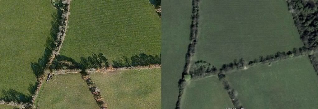
    Pretty sure it's a natural feature.
    My guess is that it is a remnant of the old course of a stream.
    This higher res. image shows the site from a different angle, and with low angle light.
    It should help to see the natural feature more clearly.
    If you check the field boundaries on the 1st edition map you can see how the boundaries followed the contours.


    207693.jpg


    Interestingly enough, the SMR lists a possible enclosure in the adjacent field, that's the striped field immediately to the left of the one where you noted the circular feature, or the small green field at the top of the picture above.
    It was based on observed crop marks. It was also noted as 'not visible at ground level' - like so many others.


  • Registered Users, Registered Users 2 Posts: 20 goldiepark


    The ASI website has a monument report form - might be worth your while submitting if you're still sure after checking their online database?

    http://www.archaeology.ie/ArchaeologicalSurveyofIreland/#d.en.12841

    http://www.archaeology.ie/media/archeologyie/PDFS/ASI%20Monument%20report%20form%20%28Jan%202012%29.pdf


  • Advertisement
  • Registered Users, Registered Users 2 Posts: 102 ✭✭Jakub25


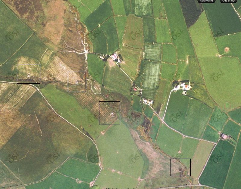
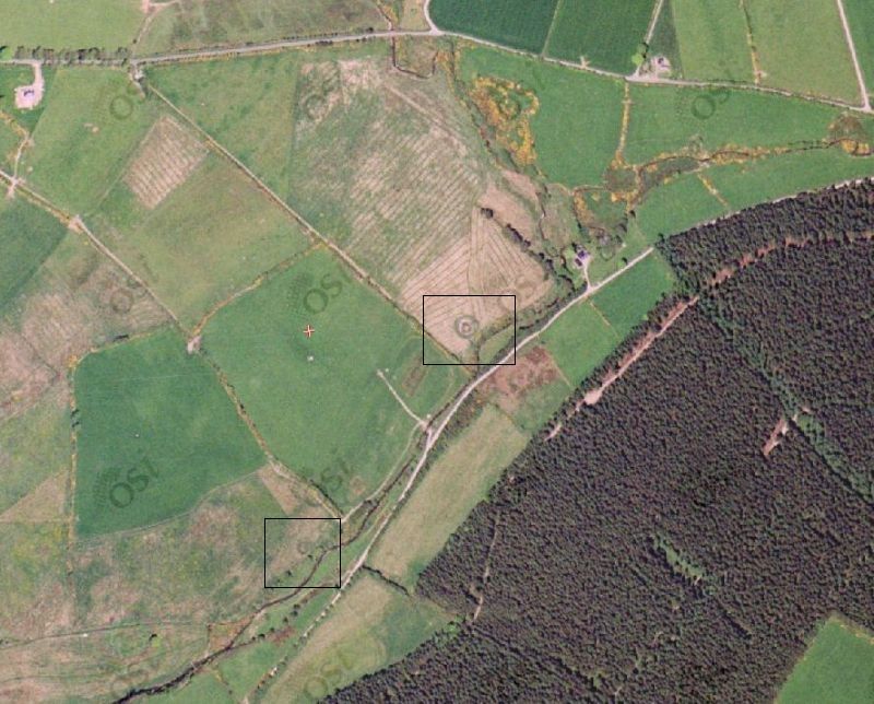
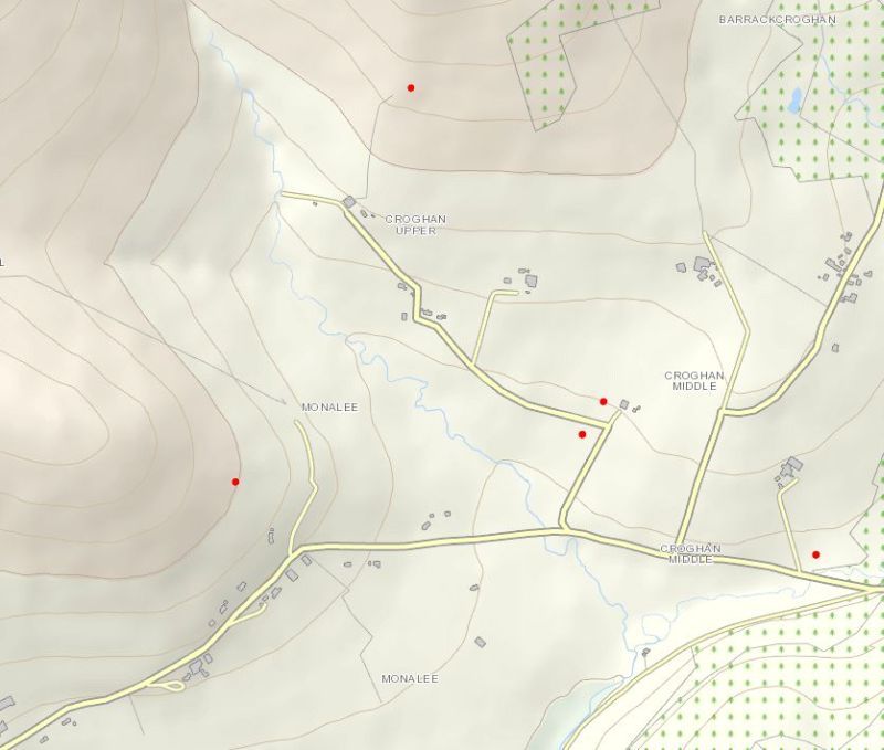
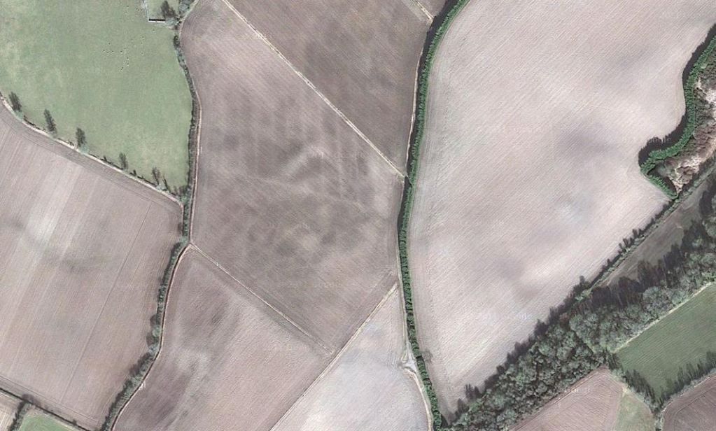
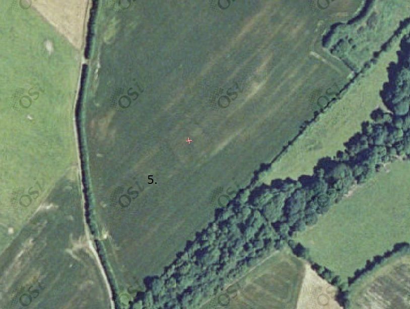
    Thank you for your replies, what can you tell me about those marked places. They're just at the south side of croghan mountain (co Wexford) close to big ringfort.


    Croghan1-1.jpg

    Croghan2-1.jpg

    Croghan3-1.jpg


  • Moderators, Science, Health & Environment Moderators Posts: 5,223 Mod ✭✭✭✭slowburner


    Re. picture 1.
    I think they are duck ponds - probably for rearing ducks for a shoot.
    They were constructed some time after 1995.
    Here is a higher resolution image of the same area

    214048.jpg


    Picture 2 is odd.
    If my interpretation of the location is correct from more recent imagery, it looks like more duck ponds.

    (It might take a bit of time to see them in the image below)

    214049.jpg

    What's odd, is that in the earlier image, the rings seem very much like the crop marks you'd expect with a ploughed out ring barrow, but in the later image it looks decidedly like a newish duck pond, just like the three in the first picture.
    There are signs of some interesting earthworks around there.


  • Registered Users, Registered Users 2 Posts: 102 ✭✭Jakub25


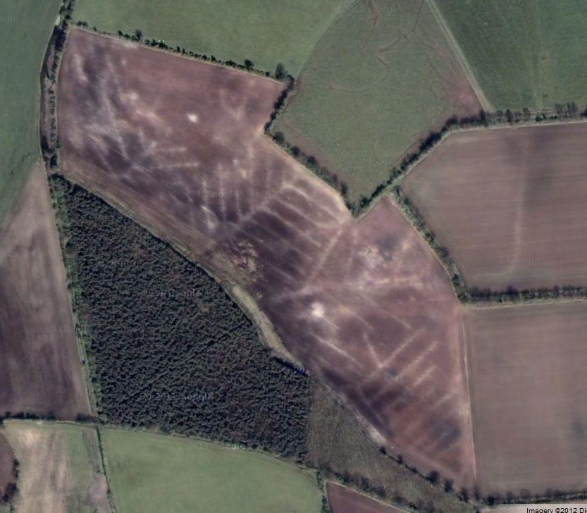
    Are those straight marks a old fields patterns below?
    Close to that place is unrecorded earth work
    probably bronze age.

    http://maps.osi.ie/publicviewer/#V1,650001,662121,7,0


    Pola.jpg

    Kilkennynorth-2.jpg


  • Registered Users, Registered Users 2 Posts: 102 ✭✭Jakub25


    I found some more strange marks are they old fields.

    http://goo.gl/maps/BHG6A

    http://goo.gl/maps/0Updi


    Capture-3.jpg


  • Moderators, Science, Health & Environment Moderators Posts: 5,223 Mod ✭✭✭✭slowburner


    They are field drains.


Advertisement