Advertisement
If you have a new account but are having problems posting or verifying your account, please email us on hello@boards.ie for help. Thanks :)
Hello all! Please ensure that you are posting a new thread or question in the appropriate forum. The Feedback forum is overwhelmed with questions that are having to be moved elsewhere. If you need help to verify your account contact hello@boards.ie
Hi there,
There is an issue with role permissions that is being worked on at the moment.
If you are having trouble with access or permissions on regional forums please post here to get access: https://www.boards.ie/discussion/2058365403/you-do-not-have-permission-for-that#latest

National Secondary Road Needs Study (2011)

Comments

  • Closed Accounts Posts: 6,093 ✭✭✭Amtmann


    This is a very detailed report. I am looking through the SE region at the moment. Substantial rebuilds seem to be proposed for most routes, with each route being broken down into shorter stretches. Type 1 S2, Type 2 S2 and Type 3 S2 are all proposed in various sections. There is a proposal for a short section of Type 2 DC for a section of N71 between Bandon and Cork.

    I haven't yet come across any proposals to retire or detrunk certain routes.


  • Registered Users, Registered Users 2 Posts: 71,186 ✭✭✭✭L1011


    Tremelo wrote: »
    There is a proposal for a short section of Type 2 DC for a section of N71 between Bandon and Cork.

    I haven't yet come across any proposals to retire or detrunk certain routes.

    And Type 1 dual if you look carefully enough but that scheme has been proposed for years - link the existing Chetwynd DC to the SRR.


  • Registered Users, Registered Users 2 Posts: 7,921 ✭✭✭munchkin_utd


    one of the priority schemes n the east is the N80 from Woodfield to Clara.
    Isnt the stretch of N80 at Clara redesignated to regional road?


  • Registered Users, Registered Users 2 Posts: 71,186 ✭✭✭✭L1011


    The only possible detrunk on the entire thing is the N63 from the to be built M17 junction to the to-be-downgraded N17

    Thats more of a dead cert downgrade, tbh.

    Just noticed they have two stretches of 2+1 suggested, both are over LONG distances compared to all prior schemes so might actually work. N81 from Blessington south and N59 Galway to Oughterard or so it looks like from the map.


  • Registered Users, Registered Users 2 Posts: 7,921 ✭✭✭munchkin_utd


    MYOB wrote: »
    The only possible detrunk on the entire thing is the N63 from the to be built M17 junction to the to-be-downgraded N17

    Thats more of a dead cert downgrade, tbh.
    the entire N63 could be regraded regional to be honest.

    Its importance is that it links the north midlands to Galway.
    YET- From Cavan/ Monaghan and beyond (i.e. Belfast) going via Athlone is the most sensible option
    Even from Longford, the N55 & M6 is the best option.

    Only from Roscommon and the bogs of Lanesboro does the N63 fulfil a function, and a local one at that.
    But that means its of no National significance so it shouldnt be a regional in the first place.
    Probably an arguement to be made in a different thread though to be honest.


  • Advertisement
  • Registered Users, Registered Users 2 Posts: 71,186 ✭✭✭✭L1011


    Reading the North section now, if they get all the proposed town bypasses built I'd be in heaven for work. Devlin, Clonmellin, Ballinagh, Granard, N55 at Edgesworthstown, etc etc etc.


  • Banned (with Prison Access) Posts: 25,234 ✭✭✭✭Sponge Bob


    At the rate of progress since 1990 they will finish that lot in 2093 or 2094. Bless them :)

    Astoundingly they do not propose to detrunk the rather vile and substandard N66 - Gort Loughrea road which should be item 1 on the agenda if they ever do the N18 bit of the Gort - Tuam scheme.

    Projected AADT in 2025 is a whopping 3381 on the busy bit. :(


  • Banned (with Prison Access) Posts: 25,234 ✭✭✭✭Sponge Bob


    http://www.nra.ie/RepositoryforPublicationsInfo/file,17885,en.pdf

    P 350 or so.


    Budget in €ms 2009 Projected Costs.
    AADT As NRA Proj In 2025 No Traffic Growth from now in some cases it seems.
    I have BOLDED some AADT assumptions coz I FELT like it one is = 128
    Red flag yes or no means really crap or not I think or bicycle friendly.
    N52 Birr to Tullamore is not there so don't hassle me about it :)


    RefNmber Description Standard as Txx Budget€m AADT Flag

    N51a.1.T2 Drogheda (M1) to Slane (N2) T2 27.240 13601 Yes
    N51b.1.T3 Slane (N2) to Navan (N3) T3 8.487 10256 Yes
    N51c.1.T3 Navan (N3) to Athboy T3 15.265 15151 Yes
    N51d.1.T3 Athboy to Delvin (N52) T3 21.358 8390 Yes
    N52b.1.T2 M1 to Ardee (N2) T2 28.450 4304 Yes
    N52c.1.T2 Ardee (N2) to Kells T2 50.519 13290 Yes
    N52d.1.T2 Kells (N3) to Delvin (N51) T2 40.000 5605 Yes
    N52e.1.T1 Delvin (N51) to Mullingar (N4) T1 60.253 14891 Yes
    N52f.1.T1 Mullingar(N4) Tyrrellspass (N6) T1 26.013 13127 Yes
    N52g.1.T1 Kilbeggan (N6) to Tullamore Bypass T1 17.586 17796 No
    N52i.1.T3 Birr (N62) to Borrisokane (N65) T3 19.070 6597 No
    N52j.1.T2 Borrisokane (N65) to Nenagh Bypass T2 20.457 13457 Yes
    N53a.1.T2 Dundalk to Northern Ireland Border T2 11.567 8544 Yes
    N54a.1.T2 Monaghan Town to Smithborough T2 14.170 11339 No
    N54a.2.T2 Smithborough to Clones T2 7.051 6091 No
    N54b.1.T3 Northern Ireland to Butlers Bridge T3 10.454 7296 Yes
    N55a.1.T2 Bellanagh to Granard T2 34.776 5346 No
    N55c.1.T3 Edgeworthstown (N4) to Ballymahon T3 21.102 6665 No
    N55c.2.T3 Ballymahon to Glassan T3 16.157 13387 Yes
    N55c.3.T2 Glassan to Ballykeeran T2 5.230 13924 Yes
    N56a.1.T2 Coolboy to Kilmacrenan T2 8.853 14980 Yes
    N56a.2.T3 Kilmacrenan to Creeslough T3 16.229 5838 Yes
    N56a.3.T2 Creeslough to Portnablathy T2 9.701 2732 Yes
    N56b.1.T3 Dunfanaghy to Gortahork (brk Falcarragh) T3 22.383 4085 Yes
    N56b.2.T3 Gortahork to Crolly (Gweedore) T3 13.994 4243 Yes
    N56c.1.T3 Crolly to Dunglow (brk at Loughanure) T3 16.471 4255 Yes
    N56d.1.T3 Dunglow to Lettermacaward T3 21.323 4711 Yes
    N56d.2.T3 Lettermacaward to Glenties T3 24.119 2885 Yes
    N56e.1.T3 Glenties to Ardara T3 9.349 3623 Yes
    N56e.2.T3 Ardara to Killybegs (R263 junction) T3 22.514 2698 Yes
    N56f.1.2.T1 Killybegs (Junction with R263) to Inver T1 40.755 5006 No
    N56f.2.T1 Inver to Mountcharles T1 12.192 10097 No
    N58a.1.T2 Bellavary to Foxford T2 21.075 6799 Yes
    N59a.1.T2 Ballysadare to Dromore West T2 36.619 5750 Yes
    N59a.2.T2 Dromore West to Ballina T2 36.742 4878 Yes
    N59b.1.T2 Ballina to Crossmolina T2 11.688 5434 Yes
    N59b.2.T3 Crossmolina to Bellacorrick T3 25.884 2051 Yes
    N59b.3.T3 Bellacorrick to Bangor T3 20.676 2050 Yes
    N59c.1.T3 Bangor to Ballycroy T3 26.607 1756 Yes
    N59c.2.T3 Ballycroy to Mallaranny T3 24.501 1756 Yes
    N59c.3.T3 Mallaranny to Newport T3 17.093 3401 Yes
    N59c.4.T3 Newport to Westport T3 18.662 2746 Yes
    N59d.1.T3 Westport to Leenaun T3 53.611 3854 Yes
    N59d.2.T3 Leenaun to Letterfrack T3 37.945 663 Yes
    N59d.3.T3 Letterfrack to Cliften T3 24.771 3088 Yes
    N59e.1.T3 Cliften to Maam Cross T3 45.368 3326 Yes
    N59e.2.T2 Maam Cross to Oughterard T2 40.383 7200 Yes
    N59e.3.T1 Oughterard to Moycullen T1 56.655 14814 Yes
    N59e.4.T1 Moycullen to Galway T1 11.115 18677 Yes
    N60a.1.T2 Balla to Claremorris T2 8.356 10464 Yes
    N60b.1.T2 Claremorris to Ballyhaunis T2 29.324 3528 No
    N60c.1.T2 Ballyhaunis to Ballinlough T2 12.768 4034 No
    N60c.2.T2 Ballinlough to Castlerea T2 9.993 3915 Yes
    N60d.1.T3 Castlerea to Ballymoe T3 7.691 4613 Yes
    N60d.2.T3 Ballymoe to Roscommon T3 13.589 6690 No
    N61a.1.T3 Boyle to Tulsk T3 28.387 3383 No
    N61b.1.T2 Tulsk to Roscommon T2 31.030 6470 Yes
    N61c.1.1.T1 Roscommon to south of Knockcroghery T1 39.880 12962 Yes
    N62a.1.T3 Athlone (N6) to Ferbane T3 13.947 7353 Yes
    N62a.2.T3 Ferbane to Birr T3 21.737 3860 Yes
    N62b.1.T2 Birr to Roscrea (N7) T2 18.946 7178 No
    N62c.1.T2 Roscrea (N7) to Templemore T2 19.846 6206 Yes
    N62d.1.T3 Templemore to Thurles T3 12.436 6321 No
    N62e.1.T2 Thurles to Horse & Jockey (N8) T2 8.015 12737 Yes
    N63a.1.T2 Longford to Lanesborough T2 19.234 4846 No
    N63b.1.T2 Lanesborough to the crossroads at Moneen T2 5.301 5975 Yes
    N63c.1.T3 Roscommon to Ballygar T3 14.391 4263 Yes
    N63c.2.1.T3 Ballygr to Moylough(inc Newbridge Rel Rd) T3 23.966 6114 Yes
    N63c.3.T3 Moylough to Abbey T3 19.188 8030 Yes
    N63c.4.T2 Abbey to Ardnasodan to M18 T2 10.772 8102 Yes
    N63c.5.T3 Ardnasodan M18 to Turloughmore T3 3.112 5238 No
    N63c.6.T3 Turloughmore to Carnoneen (Lackagh) T3 2.301 5238 Yes
    N65a.1.T3 Borrisokane to Portumna T3 16.077 7038 Yes
    N65b.1.T3 Portumna to Killimor T3 8.869 3877 No
    N65b.2.T3 Killimor to Loughrea (N6) T3 4.450 4793 Yes
    N66a.1.T3 Gort to Kilchreest T3 21.027 3381 Yes
    N66a.2.T3 Kilchreest to Loughrea T3 6.894 2042 Yes
    N67a.1.T3 Kilcolgan to Kinvara T3 4.767 7307 Yes
    N67a.2.T3 Kinvara to Ballyvaghan T3 31.317 2155 Yes
    N67a.3.1.T3 Ballyvgn to Lisdnvarna(brk at Corkscrewl) T3 29.317 1618 Yes
    N67b.1.T3 Lisdoonvarna to Ennistimon T3 17.448 3130 Yes
    N67c.1.T3 Ennistimon to Milltown Malbay T3 17.762 2787 Yes
    N67d.1.T3 Milltown Malbay to Doonbeg T3 25.691 2891 Yes
    N67d.2.T3 Doonbeg to Kilkee T3 13.429 1254 Yes
    N67e.1.T2 Kilkee to Kilrush T2 13.285 3472 Yes
    N67f.1.T3 Kilrush to Tarbert T3 9.865 35 Yes
    N68a.1.T3 Kilrush to Lissycasey T3 4.137 4783 No
    N68a.2.T2 Lissycasey to Ennis T2 8.730 8526 No
    N69a.1.T1 Mungret to west of Kilcornan T1 64.115 13000 Yes
    N69a.2.T2 Kilcornan to Askeaton Bypass T2 7.810 9300 Yes
    N69b.1.T2 Askeaton Bypass to Foynes T2 12.380 6050 Yes
    N69c.1.T3 Foynes to Loghill T3 10.438 3200 Yes
    N69c.2.T3 Loghill to Glin T3 8.237 3150 Yes
    N69c.3.T3 Glin to Tarbert T3 8.079 2750 Yes
    N69d.1.T3 Tarbert to Listowel T3 17.855 6150 Yes
    N69e.1.T2 Listowel to Tralee T2 38.826 9700 Yes
    N70a.1.T1 Tralee to Castlemaine T1 59.232 6800 Yes
    N70a.2.T2 Castlemaine To Milltown T2 4.178 9000 Yes
    N70a.3.T2 Milltown to Killorglin T2 14.012 8400 Yes
    N70b.1.T2 Killorglin to Glenbeigh T2 26.316 11000 Yes
    N70b.2.T3 Glenbeigh to Cahersiveen T3 47.406 7300 Yes
    N70c.1.T3 Cahersiveen to Waterville T3 19.736 1400 Yes
    N70d.1.T3 Waterville to Caherdaniel T3 31.682 2200 Yes
    N70d.2.T3 Caherdaniel to Castlecove T3 11.846 2200 Yes
    N70d.3.T3 Castlecove to Sneem T3 26.510 2200 Yes
    N70e.1.1.T3 Sneem to Kenmare (no Blackwater Bridge) T3 47.180 2900 Yes
    N71b.1.T1 D N28 to existing N71 Dualling T1 D 12.885 24804 No
    N71b.2.T2 D West of Ballynoe Halfway T2 D 29.792 20455 No
    N71c.1.T1 Innishannon to Bandon T1 7.531 13558 No
    N71d.1.T2 Bandon to Ballinascarty T2 23.596 9658 No
    N71e.1.T2 Clonakilty to Lissavard T2 8.896 10416 Yes
    N71e.2.T2 Lissavard to Ross Carbery T2 10.798 8930 No
    N71e.3.T2 Ross Carbery to Connonagh T2 6.005 4632 No
    N71e.4.T2 Connonagh to Leap T2 2.640 4630 No
    N71e.5.T2 Leap to Skibbereen T2 16.050 8982 Yes
    N71f.1.T2 Skibbereen to Aghadown T2 26.476 5133 No
    N71f.2.T2 Ballydehob to Junction with R586 T2 35.154 6007 No
    N71g.1.T3 Bantry to Ballylicky T3 5.146 3326 No
    N71g.2.T3 Ballylicky to Glengarriff T3 15.375 2522 Yes
    N71g.3.T3 Glengarriff to Kenmare T3 49.440 1040 Yes
    N71h.1.T3 Kenmare to Killarney T3 60.346 3890 Yes
    N72a.1.T2 Junction N25 (Dungarvan) to Cappoquin T2 28.924 8710 Yes
    N72b.1.T2 Lismore Fermoy (byp hairpin Tallowbridge) T2 57.172 6843 Yes
    N72c.1.T3 Fermoy to Ballyhooly T3 10.898 2612 Yes
    N72c.2.T3 Ballyhooly to Castletownroche T3 7.822 2591 Yes
    N72c.3.T3 Castletownroche to Junction with N73 T3 16.236 2630 Yes
    N72c.4.T2 Junction with N73 to Mallow T2 7.902 12160 Yes
    N72d.1.T2 Mallow to Dromagh T2 44.842 8589 Yes
    N72d.2.T2 Lislehane to Rathmore T2 16.389 4526 Yes
    N72d.3.T2 Church View to Barraduff T2 21.467 5400 Yes
    N72d.4.T2 Barraduff to Junction with N22 T2 12.612 4035 Yes
    N72e.1.T2 Beaufort to Killorglin T2 22.374 12579 Yes
    N73a.1.T2 Jn N72 to Kildorrery (inc Farahy R.Road) T2 45.400 8605 Yes
    N73b.1.T2 Kildorrery to Glennahulla T2 3.833 6916 Yes
    N73b.2.T2 Glennahulla to Michelstown Relief Road T2 10.282 6923 Yes
    N74a.1.T3 Tipperary to Golden T3 16.319 6710 Yes
    N74b.1.T2 Golden to Cashel (N74 Link Tipp Rd Rndabt) T2 11.362 5270 Yes
    N75a.1.T2 Thurles to M8/N8 Interchange T2 7.799 8939 Yes
    N76a.1.T2 Kilkenny Ring Road to Callan Bypass T2 13.728 9193 Yes
    N76a.2.T2 Callan Bypass (R692) to Ninemilehouse T2 12.153 5626 No
    N76a.3.T2 Ninemilehouse to Clonmel (jn N24) T2 23.365 5910 Yes
    N77a.1.T1 Kilkenny Ring Road Extension to jn N78 T1 15.027 21587 Yes
    N77a.2.T2 Junction with the N78 to Durrow T2 22.923 17022 Yes
    N78a.1.T2 Kilcullen to Rock T2 13.110 10703 No
    N78b.1.T2 Athy to N80 T2 10.839 5994 Yes
    N78c.1.T3 N80 to Newtown T3 8.494 1620 No
    N78c.2.T3 Coolbaun to Castlecomer T3 2.492 3463 Yes
    N78d.1.T3 Castlecomer to N77 near Kilkenny T3 14.428 5516 Yes
    N80a.1.T1 Woodfield to Clara T1 6.951 18608 No
    N80b.1.T1 Killeigh to Mountmellick T1 58.416 16722 Yes
    N80b.2.T1 Mountmellick to Portlaoise (M7) T1 19.223 19058 No
    N80c.1.T2 Portlaoise (M7) to Stradbally T2 7.194 10657 No
    N80c.2.T2 Stradbally to N78 T2 17.315 5155 Yes
    N80d.1.T2 N78 to Carlow T2 22.436 7127 Yes
    N80e.1.T2 Carlow to Ballon T2 6.241 9448 No
    N80f.1.T2 Ballon to Bunclody (Kildavin) T2 12.684 11793 Yes
    N81d.1.T1 Blessington to Hollywood Cross T1 43.912 8028 Yes
    N81d.2.T3 Hollywood Cross to Baltinglass T3 17.034 5442 Yes
    N81e.1.T3 Baltinglass to Tullow T3 21.020 2279 Yes
    N81f.1.T3 Tullow to N80 junction near Ballon T3 7.337 2747 Yes
    N83a.1.T3 Knock (N17) to Tooreen T3 9.761 585 Yes
    N83a.2.T3 Tooreen to Ballyhaunis (Ballyhaunis Bypass) T3 5.504 550 Yes
    N83b.1.T3 Ballyhaunis (Ballyhaunis Bypass) to Cloonfad T3 9.781 997 Yes
    N83b.2.T3 Cloonfad to Dunmore T3 9.506 1641 Yes
    N83b.3.T3 Dunmore to Tuam T3 14.320 3300 Yes
    N84a.1.T2 N6 Galway City Outer Bypass to Cloonboo T2 10.539 15396 Yes
    N84a.2.T2 Cloonboo to Headford T2 19.968 7925 Yes
    N84a.3.T3 Headford to Shrule T3 8.173 3356 Yes
    N84a.4.T3 Shrule to Kilmaine T3 8.564 3275 Yes
    N84a.5.T3 Kilmaine to Ballinrobe T3 8.322 4259 Yes
    N84b.1.T3 Ballinrobe to Partry T3 5.226 5715 Yes
    N84b.2.T2 South of Ballyhean (Creevagh) to CastlebarT2 10.900 3513 No
    N85a.1.T2 Ennis to Inagh T2 22.745 7033 Yes
    N85a.2.T2 Inagh to Ennistimon T2 24.069 8018 Yes
    N86a.1.T3 Blennerville to Camp T3 17.077 5750 Yes
    N86a.2.T3 Camp to Anascaul T3 24.447 1450 Yes
    N86a.3.T3 Anascaul to Lispole T3 14.789 2300 No
    N86a.4.T3 Lispole to Dingle T3 10.682 2600 No
    N87a.1.T3 Belturbet to Ballyconnell T3 10.132 3024 Yes
    N87b.1.T3 Ballyconnell to Bawnboy T3 7.793 2094 No
    N87b.2.T3 Bawnboy to Swanlibar T3 14.657 1380 No
    N87b.3.T3 Swanlibar to N.I. Border T3 1.910 128 No


  • Registered Users, Registered Users 2 Posts: 71,186 ✭✭✭✭L1011


    Red Flag seems to mean that there's something that Isaac could complain about actually.


  • Banned (with Prison Access) Posts: 25,234 ✭✭✭✭Sponge Bob


    MYOB wrote: »
    Red Flag seems to mean that there's something that Isaac could complain about actually.

    Red Flag means hold 10 x hearings the same week ....spaced as far as possible apart. Sorted.

    Priority 1 Schemes Grouped by Region. , subtotalled and totalled.

    ** 70% EU Funding Available to 2013 ( The Type 3 'Pilot Schemes). Not every Type 3 Pilot Scheme is a Priority 1 scheme.

    Lots of these roads give me the horrors thinking about them. A Grand Total of One is being done this year ( Mullingar - Tyrellspass) so scratch that one. Fragments of others are undergoing minor works.

    North.

    Number Scheme Name Road Standard Budget Cost (May 09) €m Red Flag

    N52e.1.T1 Delvin (N51) to Mullingar (N4) T1 60.253 Yes
    N52f.1.T1 Mullingar(N4) Tyrrellspass (N6) T1 26.013 Yes
    N55a.1.T2 Bellanagh to Granard T2 34.776 No
    N55c.2.T3 Ballymahon to Glassan T3 16.157 Yes
    N55c.3.T2 Glassan to Ballykeeran T2 5.230 Yes
    N56a.1.T2 Coolboy to Kilmacrenan T2 8.853 Yes
    N56a.2.T3 Kilmacrenan to Creeslough T3 16.229 Yes
    N56c.1.T3 Crolly to Dunglow (break at Loughanure) T3 16.471 Yes
    N56d.1.T3 Dunglow to Lettermacaward T3 21.323 Yes**
    N56d.2.T3 Lettermacaward to Glenties T3 24.119 Yes**

    N56f.1.2.T1 Killybegs (Junction with R263) to Inver T1 40.755 No
    N56f.2.T1 Inver to Mountcharles T1 12.192 No
    N59a.1.T2 Ballysadare to Dromore West T2 36.619 Yes

    Reg Tot €320m ( minus 25% cost drop 2009-2011) = €240m

    West

    Number Scheme Name Road Standard Budget Cost (May 09) €m Red Flag

    N59b.1.T2 Ballina to Crossmolina T2 11.688 Yes
    N59d.3.T3 Letterfrack to Cliften T3 24.771 Yes
    N59e.2.T2 Maam Cross to Oughterard T2 40.383 Yes**
    N59e.3.T1 Oughterard to Moycullen T1 56.655 Yes
    N59e.4.T1 Moycullen to Galway T1 11.115 Yes
    N60a.1.T2 Balla to Claremorris T2 8.356 Yes
    N61a.1.T3 Boyle to Tulsk T3 28.387 No
    N61b.1.T2 Tulsk to Roscommon T2 31.030 Yes
    N61c.1.1.T1 Roscommon to south of Knockcroghery T1 40.392 Yes
    N67a.1.T3 Kilcolgan to Kinvara T3 4.767 Yes
    N67e.1.T2 Kilkee to Kilrush T2 13.285 Yes
    N68a.2.T2 Lissycasey to Ennis T2 8.730 No
    N85a.1.T2 Ennis to Inagh T2 22.745 Yes
    N85a.2.T2 Inagh to Ennistimon T2 24.069 Yes

    Reg Tot €330m ( minus 25% cost drop 2009-2011) = €243m

    East

    Number Scheme Name Road Standard Budget Cost (May 09) €m Red Flag

    N51a.1.T2 Drogheda (M1) to Slane (N2) T2 27.240 Yes
    N52c.1.T2 Ardee (N2) to Kells T2 50.519 Yes
    N52d.1.T2 Kells (N3) to Delvin (N51) T2 40.000 Yes
    N52g.1.T1 Kilbeggan (N6) to Tullamore Bypass T1 17.586 No
    N80a.1.T1 Woodfield to Clara T1 6.951 No
    N80b.1.T1 Killeigh to Mountmellick T1 58.416 Yes
    N80b.2.T1 Mountmellick to Portlaoise (M7) T1 19.223 No
    N80c.1.T2 Portlaoise (M7) to Stradbally T2 7.194 No
    N80d.1.T2 N78 to Carlow T2 22.436 Yes

    Reg Tot €260m ( minus 25% cost drop 2009-2011) = €195m

    South West

    Number Scheme Name Road Standard Budget Cost (May 09) €m Red Flag

    N69a.1.T1 Mungret to west of Kilcornan (with bypasses)T1 64.115 Yes
    N69e.1.T2 Listowel to Tralee T2 38.826 Yes
    N70a.1.T1 Tralee to Castlemaine T1 59.232 Yes
    N70a.2.T2 Castlemaine To Milltown T2 4.178 Yes
    N70a.3.T2 Milltown to Killorglin T2 14.012 Yes
    N70b.1.T2 Killorglin to Glenbeigh T2 26.316 Yes
    N70b.2.T3 Glenbeigh to Cahersiveen T3 47.406 Yes
    N70d.1.T3 Waterville to Caherdaniel T3 31.682 Yes
    N71b.1.T1 D N28 to existing N71 Dualling T1 D 12.885 No
    N71b.2.T2 D Overbridge west of Ballynoe to Halfway T2 D 29.792 No
    N71c.1.T1 Innishannon to Bandon T1 7.531 No
    N71d.1.T2 Bandon to Ballinascarty T2 23.596 No
    N71e.1.T2 Clonakilty to Lissavard T2 8.896 Yes
    N71e.2.T2 Lissavard to Ross Carbery T2 10.798 No
    N71e.3.T2 Ross Carbery to Connonagh T2 6.005 No
    N71e.4.T2 Connonagh to Leap T2 2.640 No
    N71e.5.T2 Leap to Skibbereen T2 16.050 Yes
    N71f.1.T2 Skibbereen to Aghadown T2 26.476 No
    N71f.2.T2 Ballydehob to Junction with R586 T2 35.154 No
    N72c.4.T2 Junction with N73 to Mallow T2 7.902 Yes
    N72d.3.T2 Church View to Barraduff T2 21.467 Yes
    N72e.1.T2 Beaufort to Killorglin T2 22.374 Yes
    N73a.1.T2 Jn with N72 to Kildorrery (w Farahy R.Road) T2 45.400 Yes

    Reg Tot €570m ( minus 25% cost drop 2009-2011) = €425m

    South East

    Number Scheme Name Road Standard Budget Cost (May 09) €m Red Flag

    N52j.1.T2 Borrisokane (N65) to Nenagh Bypass T2 20.457 Yes
    N76a.3.T2 Ninemilehouse to Clonmel (jn with N24) T2 23.365 Yes
    N77a.1.T1 Kilkenny Ring Road to the jn with N78 T1 15.027 Yes
    N77a.2.T2 Junction with the N78 to Durrow T2 22.923 Yes
    N80d.1.T2 N78 to Carlow T2 22.436 Yes
    N80e.1.T2 Carlow to Ballon T2 6.241 No
    N80f.1.T2 Ballon to Bunclody (Kildavin) T2 12.684 Yes

    Reg Tot €123m ( minus 25% cost drop 2009-2011) = €93m

    Grand Total At 2011 Prices

    North 240m
    West 243m
    East 195m
    South West 425m
    South East 93m

    = €1.2bn
    The Lot ....I reckon.

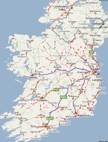
    €200m a year earmarked for these Priority One Roads would make a big difference. Many are accident magnets and between them they clock up a good few €m a year in incurred deaths and serious injuries. Unsurprisingly they also feature on the Speed Camera map.

    gcams.jpg


  • Advertisement
  • Banned (with Prison Access) Posts: 25,234 ✭✭✭✭Sponge Bob


    As many of our national secondaries are twisty horrors with a scrim of badly maintained tarmac I thought I would correleate a tad with collision costs from the RSA .

    In 2007 when the motorways were half built we had 338 deaths.

    In 2009 with the motorways nearly complete it was 238 deaths.

    In 2010 after completion of most of the motorway projects it was 212.

    Economic factors accounted for some of this drop, eg young builder type no long built or ran a skanger banger Honda Civic.

    2007 Collision Costs
    The cost of collisions was based on those as outlined in the 2004 Goodbody Economic Consultants report entitled ‘Cost Benefit Parameters and Application Rules for Transport Project Appraisal’ which was commissioned by the Department of Transport. Using the updating mechanism as set out in the
    Goodbody Economic Consultant’s report which is to inflate the year 2002 cost
    values to 2007 values, using the growth in Gross National Product (GNP) per
    person employed, the estimated cost of all fatal and injury road collisions
    reported to and recorded by An Garda Síochána in 2007 is €1.38billion. There is
    an increase in cost of collisions despite downward trend in fatal and injury
    collisions.

    Table A2: Total Cost of Road Collisions in 2007

    Type Number of collisions Cost per collision Total cost (€)
    Fatal 309 €2,891,435 €893,453,472
    Serious 618 €386,286 €238,724,498
    Minor 4,540 €38,045 €172,725,207
    Material Damage 23,770 €3,044 €72,346,752
    Total 29,237 N/A €1,377,249,928

    Collision costs have DEFLATED
    with GNP. So each collision now costs less.

    2009 Collision Costs
    Collision Costs The cost of collisions was based on those as outlined in the 2004 Goodbody Economic Consultants report entitled ‘Cost Benefit Parameters and Application Rules for Transport Project Appraisal’ which was commissioned by the Department of Transport. Using the updating mechanism as set out in the Goodbody Economic Consultant’s report which is to inflate the year 2002 cost values to 2009 values, using
    the growth in Gross National Product (GNP) per person employed, the estimated cost of all fatal and injury road collisions reported to and recorded by An Garda Síochána in 2009 was €974 million. This is a decrease in cost of collisions of €229 million when compared to 2008 figure.

    ROAD COLLISION FACTS IRELAND 2009

    Type Number of collisions Cost per collision Total cost ( €)
    Fatal 220 2,556,231 562,370,820
    Serious 463 341,503 158,115,899
    Minor 5,932 33,635 199,522,820
    Material Damage 19,880 2,691 53,497,080
    Total 26,495 N/A 973,506,609

    However!!!

    2007

    Table 46 Fatal and Injury Collisions Classified by Road Type
    Road Type Fatal Injury Total %
    Two-Way Single Carriageway 248 3,982 4,230 77.4
    One-Way Single Carriageway 7 272 279 5.1
    Dual Carriageway 14 154 168 3.1
    Motorway 8 75 83 1.5

    Other/Unknown 32 675 707 12.9
    TOTAL 309 5,158 5,467 100.0

    2009


    Table 46 Fatal and Injury Collisions Classified by Road Type
    Road Type Fatal Injury Total %
    Two-Way Single Carriageway 198 5,227 5,425 82.0
    One-Way Single Carriageway 5 270 275 4.2
    Dual Carriageway 4 255 259 3.9
    Motorway 4 131 135 2.0

    Other/Unknown 9 512 521 7.9
    TOTAL 220 6,395 6,615 100.0

    http://www.rsa.ie/Documents/Road%20Safety/Crash%20Stats/2009_Road_Collision_Fact_Book.pdf

    http://www.rsa.ie/Documents/Road%20Safety/Crash%20Stats/Collision_Fact_Book_07.pdf

    It is probably safe to say that a concerted investment in secondary roads would knock €100m a year off the road death and injury cost stack. It is probably that the worst and busiest (together) 20% of these would account for €50m a year of that saving.

    So 2007 I highlighted the accident rate per vehicle kilometre where it is equal to or over 0.15

    2007 Pri Acc rate .08 per veh km and Sec 0.12. Sec 50% more dangerous BUT abolishing the N87 in Cavan would be a great help :D

    2009 Pri Acc rate .08 per veh km and Sec 0.13. Sec 62.5% more dangerous

    Table 51 Fatal and Injury Collisions on National Routes Classified by Route and by Location Type

    N1 0 2 13 15 1 4 22 27 42 0.08
    N2 1 1 12 14 3 6 34 43 57 0.11
    N3 2 0 21 23 6 7 44 57 80 0.12
    N4 1 2 8 11 5 6 41 52 63 0.05
    N5 0 1 4 5 2 7 16 25 30 0.10
    N6 1 2 9 12 1 2 29 32 44 0.06
    N7 3 2 18 23 9 7 44 60 83 0.06
    N8 0 1 16 17 6 4 29 39 56 0.08
    N9 0 1 5 6 1 3 28 32 38 0.09
    N10 0 0 0 0 1 0 10 11 11 0.10
    N11 0 0 18 18 6 7 23 36 54 0.06
    N12 0 0 0 0 0 0 5 5 5 0.24
    N13 0 0 0 0 4 4 4 12 12 0.08
    N14 0 0 1 1 0 1 6 7 8 0.14
    N15 0 2 6 8 4 6 14 24 32 0.12
    N16 0 1 0 1 3 1 2 6 7 0.14
    N17 0 0 3 3 4 6 17 27 30 0.08
    N18 1 0 10 11 4 1 15 20 31 0.07
    N19 0 0 0 0 0 0 0 0 0 0.00
    N20 0 1 8 9 3 4 14 21 30 0.06
    N21 0 3 6 9 2 7 20 29 38 0.13
    N22 3 1 6 10 3 5 26 34 44 0.12
    N23 0 0 1 1 0 0 2 2 3 0.14
    N24 0 0 11 11 1 4 36 41 52 0.13
    N25 2 0 8 10 7 7 44 58 68 0.07
    N26 0 0 1 1 0 0 0 0 1 0.02
    N27 0 0 0 0 0 0 1 1 1 0.02
    N28 1 0 3 4 0 0 8 8 12 0.19
    N29 0 0 0 0 1 0 0 1 1 0.40
    N30 0 0 2 2 2 0 5 7 9 0.15

    N31 0 0 0 0 0 0 0 0 0 0.00
    N32 0 0 1 1 0 0 0 0 1 0.02
    N33 0 0 0 0 0 0 1 1 1 0.09
    M50 0 0 7 7 3 2 11 16 23 0.03

    TOTAL 15 20 198 233 82 101 551 734 967 0.08


    N51 1 0 1 2 0 1 7 8 10 0.12
    N52 1 2 11 14 5 3 23 31 45 0.13
    N53 0 0 1 1 3 0 8 11 12 0.27
    N54 0 0 3 3 0 0 5 5 8 0.13
    N55 0 1 3 4 1 1 10 12 16 0.13
    N56 0 2 6 8 3 4 23 30 38 0.14
    N58 0 0 0 0 0 0 1 1 1 0.07
    N59 0 0 4 4 2 6 13 21 25 0.06
    N60 0 0 2 2 1 5 6 12 14 0.09
    N61 0 1 1 2 2 5 10 17 19 0.16
    N62 0 0 1 1 0 1 18 19 20 0.13
    N63 0 0 1 1 0 4 7 11 12 0.09
    N65 0 0 0 0 0 2 5 7 7 0.16
    N66 0 0 0 0 0 0 2 2 2 0.07
    N67 1 0 2 3 2 3 10 15 18 0.14
    N68 0 0 0 0 2 2 5 9 9 0.12
    N69 0 0 1 1 2 0 21 23 24 0.11
    N70 0 0 3 3 0 1 9 10 13 0.07
    N71 0 1 9 10 2 4 22 28 38 0.09
    N72 0 1 0 1 4 2 25 31 32 0.13
    N73 0 0 0 0 0 0 0 0 0 0.00
    N74 0 0 0 0 0 0 2 2 2 0.08
    N75 0 0 0 0 0 0 0 0 0 0.00
    N76 0 0 3 3 0 3 8 11 14 0.15
    N77 0 0 1 1 0 0 5 5 6 0.09
    N78 0 0 1 1 0 1 15 16 17 0.16
    N80 0 4 12 16 2 5 20 27 43 0.16

    N81 0 5 20 25 1 0 25 26 51 0.18
    N82 0 0 1 1 0 0 0 0 1 0.12
    N83 0 0 1 1 0 0 1 1 2 0.05
    N84 0 0 0 0 1 1 4 6 6 0.04
    N85 0 0 1 1 0 2 1 3 4 0.08
    N86 0 0 0 0 1 1 5 7 7 0.06
    N87 0 0 1 1 1 0 9 10 11 0.38


    TOTAL 3 17 90 110 35 57 325 417 527 0.12

    OVERALL TOTAL 18 37 288 343 117 158 876 1,151 1,494 0.09


    2009

    N1 0 2 29 31 0 1 33 34 65 0.12
    N2 0 0 30 30 1 1 36 38 68 0.14
    N3 1 2 30 33 6 1 25 32 65 0.09
    N4 2 0 20 22 2 4 40 46 68 0.06
    N5 0 1 10 11 1 5 26 32 43 0.15
    N6 1 1 10 12 0 1 16 17 29 0.04
    N7 0 3 13 16 4 1 39 44 60 0.05
    N8 0 1 9 10 1 3 21 25 35 0.05
    N9 0 0 4 4 1 2 21 24 28 0.06
    N10 0 1 1 2 0 0 10 10 12 0.11
    N11 0 2 35 37 3 4 53 60 97 0.10
    N12 0 0 0 0 0 0 0 0 0 0.00
    N13 0 0 2 2 3 0 13 16 18 0.13
    N14 0 0 2 2 0 1 6 7 9 0.16
    N15 0 0 8 8 2 3 17 22 30 0.11
    N16 0 1 0 1 1 1 6 8 9 0.18
    N17 0 0 6 6 1 3 32 36 42 0.12
    N18 1 0 10 11 3 2 20 25 36 0.08
    N19 0 0 2 2 0 0 0 0 2 0.05
    N20 1 1 13 15 3 1 30 34 49 0.10
    N21 0 1 1 2 1 4 21 26 28 0.09
    N22 1 0 13 14 3 2 27 32 46 0.13
    N23 0 0 1 1 0 0 1 1 2 0.09
    N24 0 1 17 18 4 5 21 30 48 0.12
    N25 0 0 11 11 3 5 45 53 64 0.07
    N26 0 0 0 0 1 1 2 4 4 0.07
    N27 1 0 4 5 0 0 3 3 8 0.13
    N28 0 0 0 0 0 1 1 2 2 0.03
    N29 0 0 0 0 0 0 0 0 0 0.00
    N30 0 0 5 5 0 1 3 4 9 0.15
    N31 0 0 0 0 0 0 0 0 0 0.00
    N32 0 1 1 2 0 0 0 0 2 0.04
    N33 0 0 0 0 0 0 0 0 0 0.00
    M50 0 0 27 27 1 0 25 26 53 0.07

    TOTAL 8 18 314 340 45 53 593 691 1,031 0.08

    N51 1 0 0 1 0 0 11 11 12 0.15
    N52 0 1 18 19 2 7 35 44 63 0.18

    N53 0 0 1 1 0 2 8 10 11 0.25
    N54 1 0 2 3 1 0 8 9 12 0.20

    N55 0 0 2 2 0 4 16 20 22 0.18
    N56 0 3 5 8 0 2 22 24 32 0.12
    N58 0 0 0 0 0 0 3 3 3 0.21
    N59 2 2 12 16 1 2 26 29 45 0.12
    N60 0 0 4 4 1 1 12 14 18 0.12
    N61 0 0 2 2 0 2 11 13 15 0.12
    N62 0 0 5 5 1 0 14 15 20 0.13
    N63 0 0 2 2 0 3 9 12 14 0.10
    N65 0 0 0 0 0 0 3 3 3 0.07
    N66 0 0 1 1 0 0 4 4 5 0.18
    N67 0 0 3 3 0 1 14 15 18 0.14
    N68 0 0 1 1 1 1 6 8 9 0.12
    N69 0 0 10 10 1 0 10 11 21 0.10
    N70 0 0 0 0 1 0 15 16 16 0.08
    N71 0 1 9 10 1 2 20 23 33 0.08
    N72 1 0 6 7 1 5 27 33 40 0.16
    N73 0 0 1 1 1 0 2 3 4 0.10
    N74 0 0 0 0 0 0 3 3 3 0.12
    N75 0 1 0 1 0 0 0 0 1 0.07
    N76 0 0 0 0 1 1 7 9 9 0.10
    N77 0 0 0 0 0 0 4 4 4 0.06
    N78 0 0 4 4 0 4 10 14 18 0.17
    N80 1 2 14 17 3 2 10 15 32 0.12
    N81 1 2 26 29 1 0 27 28 57 0.20
    N82 0 0 1 1 0 0 0 0 1 0.12
    N83 0 0 0 0 0 1 4 5 5 0.13
    N84 0 1 1 2 0 1 11 12 14 0.10
    N85 0 0 0 0 0 0 6 6 6 0.13
    N86 0 0 1 1 0 1 6 7 8 0.07
    N87 0 0 0 0 1 0 6 7 7 0.24

    TOTAL 7 13 131 151 18 42 370 430 581 0.13

    OVERALL TOTAL 15 31 445 491 63 95 963 1,121 1,612 0.10

    I will update with 2010 data anon but I suspect Primary rates per Veh KM fell more than secondary and that the 'danger gap' grew.


  • Registered Users, Registered Users 2 Posts: 1,041 ✭✭✭Brian CivilEng


    @Sponge Bob can I steal your research? It fits in very neatly with my masters dissertation ;)


  • Banned (with Prison Access) Posts: 25,234 ✭✭✭✭Sponge Bob


    @Sponge Bob can I steal your research? It fits in very neatly with my masters dissertation

    Seeing as you asked nicely :D Make sure you cite "Sponge Bob from Boards.ie" in the DOI Citation :D

    2008 stats actually show Sec to be only around 45% more dangerous than Pri per veh km but the single most effective way to improve the collision stats ( based on 2007 - 2009) is to detrunk the N87 with extreme prejudice...thereby making our National Road network a safer place :D

    The N87 is a complete **** of aroad that goes nowhere. The nationally useless N83 is a lot safer.

    http://www.rsa.ie/Documents/Road%20Safety/Crash%20Stats/RCF20083-2-2010.pdf

    2008 collision stats, 0.15 plus collision rate roads in Bold.

    Table 51 Fatal and Injury Collisions on National Routes Classified by Route and by Location Type

    National Route F SI MI Total F SI MI Total Overall Rate per Veh. Km

    N1 1 0 17 18 2 3 26 31 49 0.09
    N2 0 3 19 22 2 9 31 42 64 0.13
    N3 1 2 28 31 3 5 33 41 72 0.10
    N4 1 2 26 29 2 5 41 48 77 0.06
    N5 0 0 10 10 2 5 33 40 50 0.17
    N6 2 2 13 17 2 3 34 39 56 0.08
    N7 1 0 20 21 6 7 39 52 73 0.06
    N8 1 1 15 17 2 5 20 27 44 0.06
    N9 1 0 5 6 1 4 23 28 34 0.08
    N10 0 0 1 1 0 2 12 14 15 0.14
    N11 1 2 36 39 1 7 41 49 88 0.09
    N12 0 0 0 0 0 0 0 0 0 0.00
    N13 0 0 1 1 3 1 13 17 18 0.13
    N14 0 0 2 2 0 1 9 10 12 0.21
    N15 0 1 12 13 5 3 12 20 33 0.12
    N16 0 0 3 3 0 0 3 3 6 0.12
    N17 0 0 5 5 0 5 35 40 45 0.13
    N18 0 1 13 14 4 6 17 27 41 0.09
    N19 0 0 4 4 0 0 1 1 5 0.11
    N20 2 2 26 30 2 7 29 38 68 0.14
    N21 0 0 9 9 3 2 15 20 29 0.10
    N22 0 1 8 9 2 2 27 31 40 0.11
    N23 0 0 0 0 0 0 2 2 2 0.09
    N24 0 1 18 19 1 4 28 33 52 0.13
    N25 0 1 19 20 4 9 42 55 75 0.08
    N26 0 1 3 4 0 1 3 4 8 0.13
    N27 0 0 6 6 0 1 1 2 8 0.13
    N28 0 0 1 1 0 2 3 5 6 0.09
    N29 0 0 0 0 0 0 1 1 1 0.40
    N30 0 1 2 3 1 1 8 10 13 0.22
    N31 0 0 5 5 0 0 0 0 5 0.10
    N32 0 1 3 4 0 0 0 0 4 0.09
    N33 0 0 1 1 0 0 1 1 2 0.17
    M50 0 1 23 24 0 0 16 16 40 0.05

    TOTAL 11 23 354 388 48 100 599 747 1135 0.09


    National Route F SI MI Total F SI MI Total Overall Rate per Veh. Km

    N51 0 0 5 5 0 2 11 13 18 0.22
    N52 0 2 21 23 1 5 29 35 58 0.17
    N53 0 0 6 6 1 2 1 4 10 0.23
    N54 0 0 4 4 1 0 9 10 14 0.23

    N55 0 0 2 2 1 1 13 15 17 0.14
    N56 0 0 4 4 1 7 20 28 32 0.12
    N58 0 0 1 1 1 1 0 2 3 0.21
    N59 0 1 10 11 3 4 34 41 52 0.13
    N60 0 0 6 6 1 0 10 11 17 0.11
    N61 0 0 3 3 0 1 9 10 13 0.11
    N62 1 0 5 6 1 1 6 8 14 0.09
    N63 0 1 2 3 0 4 15 19 22 0.16
    N65 0 0 0 0 0 1 5 6 6 0.14
    N66 0 0 0 0 1 0 1 2 2 0.07
    N67 0 1 5 6 1 1 3 5 11 0.08
    N68 0 1 2 3 1 1 7 9 12 0.16
    N69 0 1 4 5 2 1 20 23 28 0.13
    N70 2 1 4 7 1 1 13 15 22 0.11
    N71 0 4 16 20 0 4 19 23 43 0.10
    N72 0 1 4 5 2 2 21 25 30 0.12
    N73 0 0 0 0 0 0 2 2 2 0.05
    N74 0 0 1 1 0 0 6 6 7 0.28
    N75 0 0 0 0 0 0 1 1 1 0.07
    N76 0 0 1 1 1 0 8 9 10 0.11
    N77 0 0 0 0 0 0 2 2 2 0.03
    N78 0 0 6 6 0 1 8 9 15 0.14
    N80 0 1 11 12 3 2 21 26 38 0.14
    N81 2 2 28 32 3 1 24 28 60 0.21
    N82 0 0 0 0 0 0 0 0 0 0.00
    N83 0 1 2 3 0 0 1 1 4 0.10
    N84 0 0 6 6 1 1 6 8 14 0.10
    N85 0 0 0 0 1 0 4 5 5 0.10
    N86 0 0 3 3 1 1 4 6 9 0.08
    N87 0 0 1 1 0 0 4 4 5 0.17

    TOTAL 5 17 163 185 29 45 337 411 596 0.13

    OVERALL TOTAL 16 40 517 573 77 145 936 1,158 1,731 0.10


  • Registered Users, Registered Users 2 Posts: 1,041 ✭✭✭Brian CivilEng


    Bob, S, 2011, National Secondary Road Needs Study, Boards.ie, Location Location

    Got the citation right anyway.


  • Banned (with Prison Access) Posts: 25,234 ✭✭✭✭Sponge Bob


    If you are gonna do something _interesting_ then calculate what a €100m a year investment for the next five years would achieve considering a Fatal costs €2.4m and a serious injury €350k .

    So a death and 2 serious injuries would cost €3m and if a given stretch of road cost €20m then €3m equates to 15% interest on €20m.

    Consequently it can be cheaper to borrow the money and do the road up even at current borrowing costs.

    There are roads out there that are too costly as they are, in a tight fiscal environment modelling the greater cost benefit stack is vital.

    Also find out how many hospital patients somewhere like Galway NUIG Hospital are 'overly' sick because of excessive travel times....eg stroke or trauma...and how much each 10 mins of travel delay costs the Health Service .

    Having a patient in there for a day extra costs €1,000 , 100 patients times 2 days extra recovery is €200k.

    Bad roads kill people in a lot of ways, Stack it up dude :)


  • Closed Accounts Posts: 3,010 ✭✭✭Tech3


    What is the difference in T1, T2 and T3 again?

    Also does anyone know if Glenties will be bypassed as part of this scheme? I would love to see the route for this one! I dont know which is worse - the bumpy section or the Gweebarra bends.
    N56d.2.T3 Lettermacaward to Glenties T3 24.119 2885 Yes


  • Registered Users, Registered Users 2 Posts: 71,186 ✭✭✭✭L1011


    The maps/schemes do suspiciously start and end each side of Glenties but there's no scheme for a bypass of Glenties. Seeing as it can be a half an hour delay at certain times of the year (festival, any bike races, etc - more often than you'd imagine) and there's a loss of priority for the N56 at the old hospital this definitely needs doing.

    The bends are far worse, if only because you can't listen to the radio while stuck behind someone!


  • Banned (with Prison Access) Posts: 25,234 ✭✭✭✭Sponge Bob


    MYOB wrote: »
    The maps/schemes do suspiciously start and end each side of Glenties but there's no scheme for a bypass of Glenties.
    It would be easy if the locals had not built all those horrible ghost estates west of the town. Once NAMA owns the west side of Glenties all will be clear :)

    T3 is often called T3SC around here (to get into the boards search index) , search for T3SC in this forum!!!

    http://www.boards.ie/vbulletin/showpost.php?p=68991474&postcount=5
    Wide Single is now gone and replaced by

    Standard = 3m Verge + 2.5m HS + 3.65+3.65 Carriageway + 2.5m HS + 3m Verge = 12m Pavement and 6m Verge ( probably Type 1 SC or T1SC )

    Reduced Standard = 3m Verge + 0.5m HS + 3.5+3.5 Carriageway + 0.5m HS + 3m Verge = 8m Pavement and 6m Verge ( probably Type 2 SC or T2SC )

    TYPE 3 Single Carriageway ( T3SC ) = 1.5m Verge + 0m HS + 3.5+3.5 Carriageway + 0.0m HS + 1.5m Verge = 7m Pavement and 3m Verge


  • Closed Accounts Posts: 1,735 ✭✭✭Irish and Proud


    Wide Single (WS2) has been replaced by 2+2:

    2 x 2.5m Verges;
    2 x 0.5m Hard Strips;
    4 x 3.5m Traffic Lanes;
    1 x 1.5m Median with Wire Barrier;
    Total Pavement for 2+2 = 16.5m;
    Total Pavement for WS2 - 15.0m.


  • Banned (with Prison Access) Posts: 25,234 ✭✭✭✭Sponge Bob


    A Note on Land Acquisition costs . These are from the reports above and even though they are nominally at 2009 prices they are off with the fcuking fairies if you ask me. :( Agricultural land is around €12k ha on the open market nowadays.
    Thus, the following typical land costs are assessed;
    • Fully off-line land acquisition - €100k/acre

    • Acquisition of slivers of lane adjacent to existing roads - €50k/acre
    • Fully on-line land acquisition - negligible
    Taking these basic land acquisition costs and assumed typical profiles for the S2 Single
    Carriageway upgrade standards, the following are the approximated land costs per km of
    upgrade;
    • S2 Type 3 fully offline - €500k/km.
    • S2 Type 3 off-line adjacent to the existing road – €125k/km.
    • S2 Type 2 fully offline - €700k/km.
    • S2 Type 2 off-line adjacent to the existing road – €175k/km
    • S2 Type 1 fully offline €900k/km.

    Madness.


    SUMMARY OF COST ESTIMATION METHODOLOGY ADOPTED
    Using the available sources of costing information, the following summarises the proposed cost model adopted for the National Secondary Road Needs Study with a base date of May 2009;

    S2 Type 1 Standard ( T1SC Offline) – Off-line construction
    Construction cost - €3.1m/km
    Land and property - €0.90m/km
    Planning, Design, supervision - €0.3m/km
    Archaeology - €0.13m/km
    Total €4.43m/km plus exceptional costs, if any

    S2 Type 2 Standard (T2SC Offline) – Off-line construction
    Construction cost - €2.3m/km
    Land and property - €0.70m/km
    Planning, Design, supervision - €0.3m/km
    Archaeology - €0.13m/km
    Total €3.43m/km plus exceptional costs, if any
    Introduction

    S2 Type 2 Standard (T2SC Online) – On-line construction
    Construction cost - €0.96m/km
    Land and property - €0.00m/km
    Planning, Design, supervision - €0.30m/km
    Archaeology - €0.00m/km
    Total €1.26m/km plus exceptional costs, if any

    S2 Type 2 Standard (T2SC Semi Offline) – Partially off-line construction
    Construction cost (50% off-line + 50% on-line) - €1.63m/km
    Land and property - €0.175m/km
    Planning, Design, supervision - €0.30m/km
    Archaeology (50% of fully off-line) - €0.065m/km
    Total €2.17m/km plus exceptional costs,
    if any

    S2 Type 3 Standard T3SC Offline) – Off-line construction
    Construction cost - €1.75m/km
    Land and property - €0.50m/km
    Planning, Design, supervision - €0.30m/km
    Archaeology - €0.13m/km
    Total €2.68m/km plus exceptional costs, if any
    S2 Type 3 Standard ( T3SC Online) – On-line construction
    Construction cost - €0.82m/km
    Land and property - €0.00m/km
    Planning, Design, supervision - €0.30m/km
    Archaeology - €0.00m/km
    Total €1.12m/km plus exceptional costs, if any

    S2 Type 3 Standard ( T3SC Semi Offline ) – Partially off-line construction
    Construction cost (50% off-line + 50% on-line) - €1.285m/km
    Land and property - €0.125m/km
    Planning, Design, supervision - €0.30m/km
    Archaeology (50% of fully off-line) - €0.065m/km
    Total €1.775m/km plus exceptional costs,
    if any


  • Advertisement
  • Closed Accounts Posts: 6,093 ✭✭✭Amtmann


    So: what will the NRA do with this report?


  • Registered Users, Registered Users 2 Posts: 9,167 ✭✭✭SeanW


    Ballykeeran on the N55 is a particular shambles - on the entire route, a bypass of this village would be the place to start.

    BTW what exactly is going on Mullingar-Tyrellspass?


  • Registered Users, Registered Users 2 Posts: 4 Cnat


    As regards the Ballykeeran scheme surely this is the only project worth going ahead with on the N55 (in the current fiscal climate)?


  • Moderators, Science, Health & Environment Moderators Posts: 5,226 Mod ✭✭✭✭spacetweek


    Tremelo wrote: »
    So: what will the NRA do with this report?
    Tremelo, because most primary schemes are too expensive/moribund for the next few years, the schemes in that report are likely to be the only ones we'll see in the next while.


  • Banned (with Prison Access) Posts: 25,234 ✭✭✭✭Sponge Bob


    Source. Took their time releasing it this year. :(

    http://www.rsa.ie/Documents/Road%20Safety/Crash%20Stats/Road_Collision_fact_book_2010.pdf

    2010 collision stats, 0.15 plus collision rate roads in Bold. This is the number on the right expressed as collisions rate Rate per 1m Veh. Km

    Table 51 Fatal and Injury Collisions on National Routes Classified by Route and by Location Type

    National Primaries.

    National Route F SI MI Total F SI MI Total Overall Rate per Veh. Km

    N1 0 2 32 34 1 1 26 28 62 0.12
    N2 0 3 17 20 2 3 23 28 48 0.10
    N3 0 3 25 28 6 3 28 37 65 0.09
    N4 0 0 25 25 2 5 36 43 68 0.06
    N5 2 0 8 10 0 4 24 28 38 0.13
    N6 0 1 7 8 1 3 29 33 41 0.06
    N7 0 2 11 13 4 2 42 48 61 0.05
    N8 0 0 2 2 1 1 24 26 28 0.04
    N9 0 0 1 1 4 2 19 25 26 0.06
    N10 0 0 1 1 1 0 4 5 6 0.05
    N11 2 2 32 36 3 3 42 48 84 0.09
    N12 0 0 1 1 0 0 1 1 2 0.09
    N13 0 0 0 0 1 0 13 14 14 0.10
    N14 0 0 2 2 0 1 9 10 12 0.21
    N15 0 0 4 4 1 4 17 22 26 0.10
    N16 0 0 0 0 1 0 9 10 10 0.20
    N17 1 0 1 2 2 0 28 30 32 0.09
    N18 0 0 9 9 0 4 22 26 35 0.08
    N19 0 0 1 1 0 0 2 2 3 0.07
    N20 0 2 10 12 1 2 22 25 37 0.08
    N21 0 0 7 7 5 4 12 21 28 0.09
    N22 1 1 12 14 0 4 16 20 34 0.09
    N23 0 0 2 2 0 0 2 2 4 0.19
    N24 0 2 8 10 1 3 17 21 31 0.08
    N25 0 0 19 19 5 3 51 59 78 0.09
    N26 0 1 1 2 0 2 1 3 5 0.08
    N27 0 0 1 1 0 0 4 4 5 0.08
    N28 0 0 1 1 2 0 1 3 4 0.06
    N29 0 0 0 0 0 0 0 0 0 0.00
    N30 0 0 4 4 0 1 4 5 9 0.15
    N31 0 0 2 2 0 0 0 0 2 0.04
    N32 0 0 1 1 0 0 1 1 2 0.04
    N33 0 0 0 0 0 0 0 0 0 0.00
    M50 2 0 2 4 0 0 27 27 31 0.04

    TOTAL 8 19 249 276 44 55 556 655 931 0.08

    Same as 2009 at 0.08 even with two bad winters and salt shortages. I suppose the new sections of motorway opened in 2010 compensated for weather/salt.

    The short N14 ( 20km) and the short N30 (33km) continue to be noteworthily dangerous for National Primary Roads.

    National Route F SI MI Total F SI MI Total Overall Rate per Veh. Km

    N51 0 0 0 0 2 1 8 11 11 0.13
    N52 0 1 13 14 3 1 34 38 52 0.15
    N53 0 0 3 3 0 0 5 5 8 0.18
    N54 0 0 4 4 0 1 1 2 6 0.10
    N55 0 1 3 4 3 1 13 17 21 0.17
    N56 1 0 7 8 0 4 15 19 27 0.10
    N58 0 0 0 0 0 1 1 2 2 0.14
    N59 0 0 16 16 1 2 29 32 48 0.12
    N60 0 0 4 4 2 4 15 21 25 0.16
    N61 0 0 1 1 3 1 8 12 13 0.11
    N62 0 1 8 9 1 1 12 14 23 0.15
    N63 0 0 8 8 0 1 9 10 18 0.13
    N65 0 0 0 0 0 0 3 3 3 0.07
    N66 0 0 0 0 0 0 3 3 3 0.11
    N67 0 0 3 3 1 0 10 11 14 0.11
    N68 0 0 0 0 0 2 8 10 10 0.13
    N69 0 1 7 8 1 0 10 11 19 0.09
    N70 0 0 6 6 1 2 13 16 22 0.11
    N71 0 0 8 8 1 3 22 26 34 0.08
    N72 0 0 3 3 1 1 15 17 20 0.08
    N73 0 0 0 0 1 1 6 8 8 0.20
    N74 0 0 1 1 0 0 1 1 2 0.08
    N75 0 0 0 0 0 0 0 0 0 0.00
    N76 0 0 1 1 0 0 4 4 5 0.05
    N77 0 0 1 1 0 0 5 5 6 0.09
    N78 0 0 2 2 2 0 11 13 15 0.14
    N80 0 2 11 13 1 1 19 21 34 0.12
    N81 0 3 29 32 2 5 16 23 55 0.19
    N82 0 0 0 0 0 0 0 0 0 0.00
    N83 0 0 3 3 0 0 4 4 7 0.18
    N84 0 2 3 5 0 0 19 19 24 0.17
    N85 0 1 1 2 0 0 6 6 8 0.17

    N86 0 1 1 2 0 1 4 5 7 0.06
    N87 0 0 0 0 0 1 7 8 8 0.28

    TOTAL 1 13 147 161 26 35 336 397 558 0.12


    OVERALL TOTAL 9 32 396 437 70 90 892 1,052 1,489 0.09

    Accident rates for National Secondaries and Primaries, together with the overall rate rate, held fast in 2010 despite very few improvements to secondaries and the exceptionally shíte weather.

    I see my old friend the N87 again topped the poll but my views on that legacy piece of crap national road are well known as is my view on the perennially problematic N83. Detrunk them and spend money on the N16 N17 and N84 instead. How many years do I gotta say this. The N85 showed up this year too. Detrunk that as well. :)

    Roads that stand out every year include the N53 ( difficult to police that) and it used to be utterly scarily dire but is much piecemeal improved in recent years albeit not the NI sections of the road some of which are utter crap.

    Donegal is notorious but the N56 never makes it into the very top drawer for accident stats all the same. The N61 in Roscommon does but I am dubious as to whether the Roscommon - Boyle section should be an N Road at all. The N55 is crap but some work is being done on the dangerous bits and that may get it below 0.15 after this year.

    But the danger gap I referred to earlier in this thread held absolutely firm. That is good news, I thought it would grow a netch.


  • Registered Users, Registered Users 2 Posts: 71,186 ✭✭✭✭L1011


    The remaining bad bends on the N53 were removed this year, a bad crossroads staggeered; and there's another offline wider section due to open shortly. Suspect it'll fall down the listing now.


  • Registered Users, Registered Users 2 Posts: 7,476 ✭✭✭ardmacha


    The remaining bad bends on the N53 were removed this year, a bad crossroads staggeered; and there's another offline wider section due to open shortly. Suspect it'll fall down the listing now.

    Further improvement is warranted in Louth, especially where the there are dips in the road, like here . Also the long mooted cross border bridge needs to go ahead.

    But someone was killed on the well aligned Monaghan section a couple of weeks ago, so sadly this won't eliminate accidents, drivers need to get their act together too.


  • Moderators, Social & Fun Moderators Posts: 13,105 Mod ✭✭✭✭JupiterKid


    I can think of a whole rake of National secondaries that could (and should IMO) be detrunked to Regional road or even Local road status. Roads like the N83, N63, N66, N52 between Borrisokane and Birr (a really atrocious stretch of boreen, the bit between Nenagh and Borris could be redesignated N65).

    The N55, N72, N52 between Delvin and Ardee, N81, N80 and N61/N62 need massive improvements such as widening and realignment to WS2 with 2+2 in places. These roads are important cross-country connectors.

    The West coast tourist route "looping" National Secondarties also need much improvement.


  • Banned (with Prison Access) Posts: 25,234 ✭✭✭✭Sponge Bob


    JupiterKid wrote: »
    The West coast tourist route "looping" National Secondarties also need much improvement.

    I think the 'non radial' sections along the west coast should be detrunked, eg Clifden to Bangor Erris and Killybegs to Gweedore along with Kilkee to Kinvara or the east edge of the Burren National park.

    They are of no importance nationally, never were. Either that or bring in National Tertiary routes. This does not mean they should not be upgraded...merely that National Importance should mean just that.

    But my pet hate is the N87, simply a relic of a bombing campaign by the British in the early 1970s. :(


  • Advertisement
  • Registered Users, Registered Users 2 Posts: 7,476 ✭✭✭ardmacha


    But my pet hate is the N87, simply a relic of a bombing campaign by the British in the early 1970s.

    There is a strong case for detrunking the N87. This won't reduce the accident rate though.


  • Banned (with Prison Access) Posts: 25,234 ✭✭✭✭Sponge Bob


    ardmacha wrote: »
    There is a strong case for detrunking the N87. This won't reduce the accident rate though.

    Before the RSA took over publication this was an annual NRA report ( the format is exactly the same)

    Here is 2004 for de bit of depth.

    http://www.nra.ie/Publications/DownloadableDocumentation/RoadSafety/file,3629,en.pdf

    Table 51 Fatal and Injury Collisions on National Routes Classified by Route and by Location Type
    Inside Built-up Areas Outside Built-up Areas
    National Route F SI MI Total F SI MI Total Overall Rate per
    Total 106
    Veh. Km*

    National Primaries.

    N1 1 0 17 18 4 5 33 42 60 0.11
    N2 2 3 29 34 5 8 38 51 85 0.17
    N3 1 2 9 12 3 11 33 47 59 0.09
    N4 0 1 27 28 8 4 50 62 90 0.08
    N5 0 2 9 11 1 3 24 28 39 0.13
    N6 2 0 13 15 3 8 31 42 57 0.08
    N7 2 4 23 29 6 8 32 46 75 0.06
    N8 0 3 15 18 6 8 39 53 71 0.10
    N9 0 0 6 6 5 6 23 34 40 0.09
    N10 0 0 2 2 1 1 7 9 11 0.10
    N11 0 2 31 33 4 5 30 39 72 0.07
    N12 0 0 0 0 1 0 1 2 2 0.09
    N13 0 1 0 1 1 2 6 9 10 0.07
    N14 1 0 2 3 0 2 7 9 12 0.21
    N15 1 2 12 15 3 4 16 23 38 0.14
    N16 0 0 2 2 0 0 5 5 7 0.14
    N17 1 1 4 6 4 2 18 24 30 0.08
    N18 1 0 7 8 3 3 14 20 28 0.06
    N19 0 0 1 1 0 0 0 0 1 0.02
    N20 1 0 6 7 3 3 15 21 28 0.06
    N21 1 2 9 12 3 4 9 16 28 0.09
    N22 0 3 8 11 2 3 21 26 37 0.10
    N23 0 0 0 0 0 0 1 1 1 0.05
    N24 1 2 16 19 6 1 20 27 46 0.12
    N25 0 3 22 25 7 14 42 63 88 0.10
    N26 0 0 4 4 0 1 1 2 6 0.10
    N27 0 0 3 3 0 0 2 2 5 0.08
    N28 2 1 2 5 0 0 1 1 6 0.09
    N29 0 0 0 0 0 0 0 0 0 0.00
    N30 0 1 3 4 2 0 3 5 9 0.15
    N31 0 0 0 0 0 0 0 0 0 0.00
    N32 0 0 0 0 0 0 0 0 0 0.00
    N33 0 0 0 0 0 0 1 1 1 0.09
    M50 0 0 0 0 1 1 22 24 24 0.03
    TOTAL 17 33 282 332 82 107 545 734 1,066 0.09

    Same pair stand as in 2010, the N14 and the N30. Note that no motorways were complete at this stage. The first of them, the M1 was completed in 2005.

    N51 0 1 1 2 1 0 7 8 10 0.12
    N52 1 1 15 17 4 4 22 30 47 0.14
    N53 0 0 8 8 0 1 4 5 13 0.29
    N54 0 0 0 0 1 1 6 8 8 0.13
    N55 0 2 6 8 0 4 10 14 22 0.18
    N56 0 1 3 4 0 8 22 30 34 0.12
    N58 0 0 1 1 0 0 1 1 2 0.14
    N59 0 0 7 7 3 2 20 25 32 0.08
    N60 0 0 2 2 0 1 4 5 7 0.05
    N61 0 0 4 4 3 0 12 15 19 0.16
    N62 1 0 1 2 2 3 12 17 19 0.13
    N63 0 0 1 1 2 0 16 18 19 0.14
    N65 0 0 1 1 0 1 0 1 2 0.05
    N66 0 0 0 0 0 0 2 2 2 0.07
    N67 0 1 2 3 2 1 9 12 15 0.11
    N68 1 1 0 2 0 0 5 5 7 0.09
    N69 0 1 3 4 5 1 14 20 24 0.11
    N70 0 1 3 4 1 1 16 18 22 0.11
    N71 0 1 22 23 2 5 12 19 42 0.10
    N72 0 1 4 5 0 7 21 28 33 0.13
    N73 0 0 0 0 0 0 3 3 3 0.08
    N74 0 0 3 3 0 0 3 3 6 0.24
    N75 0 0 1 1 0 0 2 2 3 0.21

    N76 1 0 2 3 0 0 11 11 14 0.15
    N77 0 0 3 3 0 0 8 8 11 0.16
    N78 1 2 5 8 0 3 10 13 21 0.20
    N80 0 1 14 15 3 1 12 16 31 0.11
    N81 0 5 16 21 0 5 15 20 41 0.14
    N82 0 0 0 0 0 0 0 0 0 0.00
    N83 0 0 1 1 0 1 3 4 5 0.13
    N84 1 1 2 4 1 0 8 9 13 0.09
    N85 0 0 4 4 0 1 2 3 7 0.15
    N86 0 0 1 1 0 0 6 6 7 0.06
    N87 0 1 2 3 0 0 5 5 8 0.28

    TOTAL 6 21 138 165 30 51 303 384 549 0.12

    OVERALL TOTAL 23 54 420 497 112 158 848 1,118 1,615 0.10


  • Registered Users, Registered Users 2 Posts: 9,167 ✭✭✭SeanW


    Sponge Bob wrote: »
    The N55 is crap but some work is being done on the dangerous bits and that may get it below 0.15 after this year.
    What's being done with the N55? (I used to use this road a lot years ago).

    Anything outside Cavan?

    Also this might be slightly off topic, but what is the AADT that causes a route to justify Dual Carriageway (for example, 2+2)?


  • Registered Users, Registered Users 2 Posts: 6,106 ✭✭✭antoobrien


    Reformatted for table layout
    Sponge Bob wrote: »
    Before the RSA took over publication this was an annual NRA report ( the format is exactly the same)

    Here is 2004 for de bit of depth.

    http://www.nra.ie/Publications/DownloadableDocumentation/RoadSafety/file,3629,en.pdf

    Table 51 Fatal and Injury Collisions on National Routes Classified by Route and by Location Type
    Inside Built-up Areas Outside Built-up Areas
    National Route F SI MI Total F SI MI Total Overall Rate per
    Total 106
    Veh. Km*

    National Primaries.

    N1 | 1 | 0 | 17 | 18 | 4 | 5 | 33 | 42 | 60 | 0.11
    N2 | 2 | 3 | 29 | 34 | 5 | 8 | 38 | 51 | 85 | 0.17
    N3 | 1 | 2 | 9 | 12 | 3 | 11 | 33 | 47 | 59 | 0.09
    N4 | 0 | 1 | 27 | 28 | 8 | 4 | 50 | 62 | 90 | 0.08
    N5 | 0 | 2 | 9 | 11 | 1 | 3 | 24 | 28 | 39 | 0.13
    N6 | 2 | 0 | 13 | 15 | 3 | 8 | 31 | 42 | 57 | 0.08
    N7 | 2 | 4 | 23 | 29 | 6 | 8 | 32 | 46 | 75 | 0.06
    N8 | 0 | 3 | 15 | 18 | 6 | 8 | 39 | 53 | 71 | 0.10
    N9 | 0 | 0 | 6 | 6 | 5 | 6 | 23 | 34 | 40 | 0.09
    N10 | 0 | 0 | 2 | 2 | 1 | 1 | 7 | 9 | 11 | 0.10
    N11 | 0 | 2 | 31 | 33 | 4 | 5 | 30 | 39 | 72 | 0.07
    N12 | 0 | 0 | 0 | 0 | 1 | 0 | 1 | 2 | 2 | 0.09
    N13 | 0 | 1 | 0 | 1 | 1 | 2 | 6 | 9 | 10 | 0.07
    N14 | 1 | 0 | 2 | 3 | 0 | 2 | 7 | 9 | 12 | 0.21
    N15 | 1 | 2 | 12 | 15 | 3 | 4 | 16 | 23 | 38 | 0.14
    N16 | 0 | 0 | 2 | 2 | 0 | 0 | 5 | 5 | 7 | 0.14
    N17 | 1 | 1 | 4 | 6 | 4 | 2 | 18 | 24 | 30 | 0.08
    N18 | 1 | 0 | 7 | 8 | 3 | 3 | 14 | 20 | 28 | 0.06
    N19 | 0 | 0 | 1 | 1 | 0 | 0 | 0 | 0 | 1 | 0.02
    N20 | 1 | 0 | 6 | 7 | 3 | 3 | 15 | 21 | 28 | 0.06
    N21 | 1 | 2 | 9 | 12 | 3 | 4 | 9 | 16 | 28 | 0.09
    N22 | 0 | 3 | 8 | 11 | 2 | 3 | 21 | 26 | 37 | 0.10
    N23 | 0 | 0 | 0 | 0 | 0 | 0 | 1 | 1 | 1 | 0.05
    N24 | 1 | 2 | 16 | 19 | 6 | 1 | 20 | 27 | 46 | 0.12
    N25 | 0 | 3 | 22 | 25 | 7 | 14 | 42 | 63 | 88 | 0.10
    N26 | 0 | 0 | 4 | 4 | 0 | 1 | 1 | 2 | 6 | 0.10
    N27 | 0 | 0 | 3 | 3 | 0 | 0 | 2 | 2 | 5 | 0.08
    N28 | 2 | 1 | 2 | 5 | 0 | 0 | 1 | 1 | 6 | 0.09
    N29 | 0 | 0 | 0 | 0 | 0 | 0 | 0 | 0 | 0 | 0.00
    N30 | 0 | 1 | 3 | 4 | 2 | 0 | 3 | 5 | 9 | 0.15
    N31 | 0 | 0 | 0 | 0 | 0 | 0 | 0 | 0 | 0 | 0.00
    N32 | 0 | 0 | 0 | 0 | 0 | 0 | 0 | 0 | 0 | 0.00
    N33 | 0 | 0 | 0 | 0 | 0 | 0 | 1 | 1 | 1 | 0.09
    M50 | 0 | 0 | 0 | 0 | 1 | 1 | 22 | 24 | 24 | 0.03
    TOTAL | 17 | 33 | 282 | 332 | 82 | 107 | 545 | 734 | 1,066 | 0.09

    Same pair stand as in 2010, the N14 and the N30. Note that no motorways were complete at this stage. The first of them, the M1 was completed in 2005.

    N51 | 0 | 1 | 1 | 2 | 1 | 0 | 7 | 8 | 10 | 0.12
    N52 | 1 | 1 | 15 | 17 | 4 | 4 | 22 | 30 | 47 | 0.14
    N53 | 0 | 0 | 8 | 8 | 0 | 1 | 4 | 5 | 13 | 0.29
    N54 | 0 | 0 | 0 | 0 | 1 | 1 | 6 | 8 | 8 | 0.13
    N55 | 0 | 2 | 6 | 8 | 0 | 4 | 10 | 14 | 22 | 0.18
    N56 | 0 | 1 | 3 | 4 | 0 | 8 | 22 | 30 | 34 | 0.12
    N58 | 0 | 0 | 1 | 1 | 0 | 0 | 1 | 1 | 2 | 0.14
    N59 | 0 | 0 | 7 | 7 | 3 | 2 | 20 | 25 | 32 | 0.08
    N60 | 0 | 0 | 2 | 2 | 0 | 1 | 4 | 5 | 7 | 0.05
    N61 | 0 | 0 | 4 | 4 | 3 | 0 | 12 | 15 | 19 | 0.16
    N62 | 1 | 0 | 1 | 2 | 2 | 3 | 12 | 17 | 19 | 0.13
    N63 | 0 | 0 | 1 | 1 | 2 | 0 | 16 | 18 | 19 | 0.14
    N65 | 0 | 0 | 1 | 1 | 0 | 1 | 0 | 1 | 2 | 0.05
    N66 | 0 | 0 | 0 | 0 | 0 | 0 | 2 | 2 | 2 | 0.07
    N67 | 0 | 1 | 2 | 3 | 2 | 1 | 9 | 12 | 15 | 0.11
    N68 | 1 | 1 | 0 | 2 | 0 | 0 | 5 | 5 | 7 | 0.09
    N69 | 0 | 1 | 3 | 4 | 5 | 1 | 14 | 20 | 24 | 0.11
    N70 | 0 | 1 | 3 | 4 | 1 | 1 | 16 | 18 | 22 | 0.11
    N71 | 0 | 1 | 22 | 23 | 2 | 5 | 12 | 19 | 42 | 0.10
    N72 | 0 | 1 | 4 | 5 | 0 | 7 | 21 | 28 | 33 | 0.13
    N73 | 0 | 0 | 0 | 0 | 0 | 0 | 3 | 3 | 3 | 0.08
    N74 | 0 | 0 | 3 | 3 | 0 | 0 | 3 | 3 | 6 | 0.24
    N75 | 0 | 0 | 1 | 1 | 0 | 0 | 2 | 2 | 3 | 0.21
    N76 | 1 | 0 | 2 | 3 | 0 | 0 | 11 | 11 | 14 | 0.15
    N77 | 0 | 0 | 3 | 3 | 0 | 0 | 8 | 8 | 11 | 0.16
    N78 | 1 | 2 | 5 | 8 | 0 | 3 | 10 | 13 | 21 | 0.20
    N80 | 0 | 1 | 14 | 15 | 3 | 1 | 12 | 16 | 31 | 0.11
    N81 | 0 | 5 | 16 | 21 | 0 | 5 | 15 | 20 | 41 | 0.14
    N82 | 0 | 0 | 0 | 0 | 0 | 0 | 0 | 0 | 0 | 0.00
    N83 | 0 | 0 | 1 | 1 | 0 | 1 | 3 | 4 | 5 | 0.13
    N84 | 1 | 1 | 2 | 4 | 1 | 0 | 8 | 9 | 13 | 0.09
    N85 | 0 | 0 | 4 | 4 | 0 | 1 | 2 | 3 | 7 | 0.15
    N86 | 0 | 0 | 1 | 1 | 0 | 0 | 6 | 6 | 7 | 0.06
    N87 | 0 | 1 | 2 | 3 | 0 | 0 | 5 | 5 | 8 | 0.28
    TOTAL | 6 | 21 | 138 | 165 | 30 | 51 | 303 | 384 | 549 | 0.12
    OVERALL| 23 | 54 | 420 | 497 | 112 | 158 | 848 | 1,118 | 1,615 | 0.10


Advertisement