Advertisement
If you have a new account but are having problems posting or verifying your account, please email us on hello@boards.ie for help. Thanks :)
Hello all! Please ensure that you are posting a new thread or question in the appropriate forum. The Feedback forum is overwhelmed with questions that are having to be moved elsewhere. If you need help to verify your account contact hello@boards.ie

Old quarry near the blue gardenia?

Options
  • 20-01-2011 1:47am
    #1
    Registered Users Posts: 2,482 ✭✭✭


    Any one know of one? Supposedly there is a radio or communications mast in it and if you were coming from dublin it's left after the blue gardenia, I am beggining to think I have been sent on a wild goose chase. I have no name. It is not the one on the Bohernabrina road.


Comments

  • Closed Accounts Posts: 2,822 ✭✭✭iPlop


    JG009 wrote: »
    Any one know of one? Supposedly there is a radio or communications mast in it and if you were coming from dublin it's left after the blue gardenia, I am beggining to think I have been sent on a wild goose chase. I have no name. It is not the one on the Bohernabrina road.


    If you're driving up the N81 (at night)just after the embankment ,when you get to level out after driving up the hill bit if you look over to your 2 o'clock there should be a red light from a mast just sticking out above the trees ,that could be it ,It sounds about right by the area you're describing


  • Registered Users Posts: 2,482 ✭✭✭JG009


    If you're driving up the N81 (at night)just after the embankment ,when you get to level out after driving up the hill bit if you look over to your 2 o'clock there should be a red light from a mast just sticking out above the trees ,that could be it ,It sounds about right by the area you're describing

    That could be the ones at saggart hill. If I had a name I would be laughing. Im guessing its in this general area on google maps. 53.204655,-6.460361


  • Closed Accounts Posts: 2,822 ✭✭✭iPlop


    JG009 wrote: »
    That could be the ones at saggart hill. If I had a name I would be laughing. Im guessing its in this general area on google maps. 53.204655,-6.460361

    picmtn_ct-00848-4.jpg

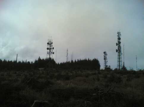
    Picture: Anyone want to play 'count the masts'? Expand pics. by wicklore 28 Mar 2009 Taking advantage of a half day on this miserable rain-lashed Friday I decided to take a look at Saggart Hill. I was curious why no one had posted a report before, and why only one member had even claimed climbing it. Feeling like a pioneer braving a new frontier I donned my waterproofs and set off.
    At Brittas on the N81 (about 10 minutes drive out of Tallaght) I took a right and found my way to the forestry road at O014 225 (Point G) (OS map 50). Walking up the forestry road I passed loggers and the inevitable "Do not Climb on Timber Stacks" signs. The rough road led to the top in about 10 minutes. There were three junctions along the track and I simply took the uphill option each time.
    My pioneering hopes were dashed as I reached the most industrialised hilltop I have ever seen. At every turn there were masts, transmitters, buildings, spiked fences and, believe it or not, security cameras. I counted about 10 masts of various sizes, enclosed in separate compounds. It was like Ballymount Industrial Estate up there, and I wondered if security staff would appear from the many structures to chase me off.
    The summit is relatively flat. It was obviously cleared of forestry in the past to make way for the masts and buildings. I think the bulldozers just pushed everything to the north and east, making the ground there difficult to walk on.
    I searched in vain around the hilltop for a redeeming feature, but even the ringfort to the east of the "summit" was a sad affair, barely discernible from the surrounding wasteland. A forlorn looking dead tree stands over it for those of you seeking it.
    The views out to the east and south would be great in clear weather. Even with the rain and cloud I could see across to Seahan and Corrig and further south to Sorrell and beyond.
    As I left this miserable hilltop I took a route through the trees desperate to find something of interest to report to MV. I found a carefully made scrambler course in the forest and I was glad someone is getting pleasure from Saggart Hill


    This should help I think it's called Slievethoul

    http://www.stepwhere.com/maps/route/Saggart-Hill-near-Dublin


  • Registered Users Posts: 2,482 ✭✭✭JG009


    Thanks, I know saggart hill, not that one. The one I am looking for is on its own and supposedly in a quarry that is no longer in use.


  • Registered Users Posts: 724 ✭✭✭cock robin


    Take the left or right depending on your direction of travel at the Blue and follow the road all the way up (there is a T junctionof sorts so keep left). There is an old quarry on your left as the road heads towards Callighstown. Remember at the Blue Gardenia not across the road from as that will only bring you towards Bohnabreena.


  • Advertisement
  • Registered Users Posts: 2,482 ✭✭✭JG009


    Thanks man would you have map coordinates?


  • Registered Users Posts: 724 ✭✭✭cock robin


    53 degrees 14'13.60" N
    06 degrees 28'57.65" W


  • Registered Users Posts: 2,482 ✭✭✭JG009


    Thanks dude can I pm you? you arent able to receive them.


  • Registered Users Posts: 724 ✭✭✭cock robin


    JG009 wrote: »
    Thanks dude can I pm you? you arent able to receive them.

    No problem PM away.


Advertisement