Advertisement
If you have a new account but are having problems posting or verifying your account, please email us on hello@boards.ie for help. Thanks :)
Hello all! Please ensure that you are posting a new thread or question in the appropriate forum. The Feedback forum is overwhelmed with questions that are having to be moved elsewhere. If you need help to verify your account contact hello@boards.ie
Hi there,
There is an issue with role permissions that is being worked on at the moment.
If you are having trouble with access or permissions on regional forums please post here to get access: https://www.boards.ie/discussion/2058365403/you-do-not-have-permission-for-that#latest

training spins in south dublin/wicklow

  • 29-07-2010 8:50am
    #1
    Closed Accounts Posts: 252 ✭✭


    Any good spins around dublin with a few shortish (mile or 2) hills, but steep??

    ive got one or two but its hard to get any decent spins around here that are on quiet roads, and i dont really want to spend an hour goin up the sally gap and then freewheel home for the last half hour.

    my couple that i do is

    1) from sandyford down to enniskerry and up the back road that goes paralled to the scalp (nice little hill there) out at kilternan. on upto stepaside and up to johnny foxes. 2 laps of that.

    2) from sandyford to stepaside upto johnyfoxes turn right over to stocking lane, upto glencree, down to enniskerry and home again over the wrong side of the scalp.

    any other good roads around this general area that i done know about?

    also, anyone know where the steepest hill around here is?? i was out the other night and i was half way from stocking lane to brittas turned up some back road and my clock on the bike was tellin me the gradient was 27% only for about 200 meters tho.

    should we put up a few mapmy rides here or is there another thread for that already?


Comments

  • Registered Users, Registered Users 2 Posts: 237 ✭✭Muller_1


    There are so many good roads around that area. Best way to get to know them is just to pick a road and ride it.

    I think the steepest in the area is probably the devil's elbow which is between the Glencree road and Johny Foxes but it's not long.

    There are some nice short hilly loops around Ballycourus Road, Puck's Castle, Quary Road, Murphy's Lane. which is really riding over the Leadmines, both Puck's Castle and Quary Road are steep.


  • Closed Accounts Posts: 252 ✭✭markcroninbsc


    Ah yea! i went up that hill there last wednesday i think (whichever day we got all the rain) there was a river flowin down it, its a good hill. had to go thru 2 floods upto me knees.

    heres 3 of my favorite routes around there


    19 miles
    http://www.mapmyride.com/route/ie/stillorgan/695128039377813399

    25 miles
    http://www.mapmyride.com/route/ie/stillorgan/683128039392212809

    50 miles
    http://www.mapmyride.com/ride/ireland/-dublin/351128039404792173

    anyone ever notice how mapmyride is ****e at workin out gradients and total meters climbed??

    if you map a hill that goes from 0 to 300 meters at a gradient of 10% then do a bigger map with that exact same hill in the middle of it and it'll only goto probably 300 meters at 5%


    Muller_1 wrote: »
    There are so many good roads around that area. Best way to get to know them is just to pick a road and ride it.

    I think the steepest in the area is probably the devil's elbow which is between the Glencree road and Johny Foxes but it's not long.

    There are some nice short hilly loops around Ballycourus Road, Puck's Castle, Quary Road, Murphy's Lane. which is really riding over the Leadmines, both Puck's Castle and Quary Road are steep.


  • Registered Users, Registered Users 2 Posts: 15,995 ✭✭✭✭blorg


    if you map a hill that goes from 0 to 300 meters at a gradient of 10% then do a bigger map with that exact same hill in the middle of it and it'll only goto probably 300 meters at 5%
    It averages the gradient over a distance, so the shorter the route you plot the closer it will be to the actual gradient. If something goes up for 10% but then down again you will get a lower average gradient.


  • Closed Accounts Posts: 252 ✭✭markcroninbsc


    blorg wrote: »
    It averages the gradient over a distance, so the shorter the route you plot the closer it will be to the actual gradient. If something goes up for 10% but then down again you will get a lower average gradient.
    I meant to say it goes from 300 meters at 10 percent to 200 meters at 5 percent


  • Registered Users, Registered Users 2 Posts: 1,032 ✭✭✭rigal


    Check out this one, did it after work the other night. It's a nice route and the first half is nearly all climbing....

    http://www.mapmyride.com/route/ie/dun20laoghaire/802128043436929325


  • Advertisement
  • Registered Users, Registered Users 2 Posts: 3,010 ✭✭✭velo.2010


    Tallagh Hill just off the N81! Pass Killenarden estate heading south and its the first left after the copse of trees. Golf club nearby. If you want a hard climb of 2km at about 10% with ramps of up to 23% then this will do.

    Possibly also has the scariest descent back down in the country but thankfully the surface is super smooth. You could you just go on down to Brittas and come round again via N81.


  • Closed Accounts Posts: 7,150 ✭✭✭kumate_champ07


    i dont really want to spend an hour goin up the sally gap and then freewheel home for the last half hour.
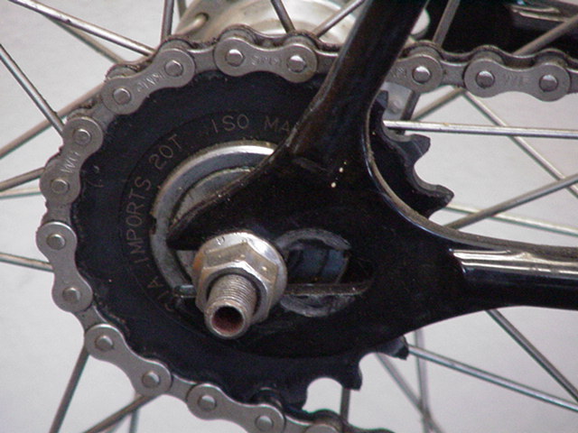
    cog.jpg
    well you could spend 1-2 hrs going up it and then half an hour of furious pedaling down it!


  • Closed Accounts Posts: 7,150 ✭✭✭kumate_champ07


    velo.2010 wrote: »
    Tallagh Hill just off the N81! Pass Killenarden estate heading south and its the first left after the copse of trees. Golf club nearby. If you want a hard climb of 2km at about 10% with ramps of up to 23% then this will do.

    Possibly also has the scariest descent back down in the country but thankfully the surface is super smooth. You could you just go on down to Brittas and come round again via N81.

    Ive done that a few times on my way to kildare, it's a killer!


  • Moderators, Society & Culture Moderators Posts: 15,812 Mod ✭✭✭✭smacl


    For a shorter, hillier version of your 50, instead of turning off at 11 miles to go down grassamucky, go on to sallygap, turn off for blessingto direction, and at your 27 mile marker, go left to go over seahan and seefin to take you back to boharnabreena road, for a couple of hundred meters only, to take you up where you are coming down at your 16 mile marker and back up grassamuck brakes, which is an effer of a climb near the end of your ride. Word of warning coming from seefin back to boharnabreena road; there are some huge potholes on the downhill section, if you dont know the road, take it slowly!


  • Closed Accounts Posts: 252 ✭✭markcroninbsc


    HAHA thats a good one. but i dont own a pair of hipsters so im not sure if i could get away with that one.
    cog.jpg
    well you could spend 1-2 hrs going up it and then half an hour of furious pedaling down it!


  • Advertisement
Advertisement