Advertisement
If you have a new account but are having problems posting or verifying your account, please email us on hello@boards.ie for help. Thanks :)
Hello all! Please ensure that you are posting a new thread or question in the appropriate forum. The Feedback forum is overwhelmed with questions that are having to be moved elsewhere. If you need help to verify your account contact hello@boards.ie
Hi there,
There is an issue with role permissions that is being worked on at the moment.
If you are having trouble with access or permissions on regional forums please post here to get access: https://www.boards.ie/discussion/2058365403/you-do-not-have-permission-for-that#latest

whats your favourite walk in Greystones

  • 18-02-2010 4:33pm
    #1
    Posts: 0


    My favourite walk in Greystone would be down by the Harbour and then along the beach, under the archers up the main st ( optional stop for hot chocolate in the happy pear )..or for a longer walk head towards killincarrig turn in to Burnaby heights walk through the golf course head down through the burnaby, then on to the beach and walk to the harbour

    so what anyone else's favourite walk in Greystones


Comments

  • Registered Users, Registered Users 2 Posts: 970 ✭✭✭dr ro


    when you say through the golf course, is there actually a path for walkers there, and where does it come out.


  • Registered Users, Registered Users 2 Posts: 6,250 ✭✭✭pixbyjohn


    I think what is meant is the public walkway between Burnaby Heights and the Whitshed road.


  • Closed Accounts Posts: 710 ✭✭✭Blandpebbles


    Down the South Beach, past Kilcoole to the Breeches. Can't discount the Cliff Walk either. Amazing to realise how popular it was in the late 19th Century, Cable Car and all


  • Registered Users, Registered Users 2 Posts: 970 ✭✭✭cuddlycavies


    All those walks are lovely. Coast walk to the harbour from the playground and council offices has become a game of dog**** hopscotsh.


  • Registered Users, Registered Users 2 Posts: 4,565 ✭✭✭jaffa20


    Mine would be Kindlestown wood. I know it's more Delgany but it's lovely all the same. Glen of the downs is nice too.


  • Advertisement
  • Registered Users, Registered Users 2 Posts: 970 ✭✭✭cuddlycavies


    For a bit of exercise, you could do well worse than a walk up the spine past Charlesland and eden gate all the way to the N11 and back. Farmland on both sides, good path and great sea views.


  • Registered Users, Registered Users 2 Posts: 258 ✭✭Mullie


    Is there any way through the fields from Charlesland to the seafront?


  • Registered Users, Registered Users 2 Posts: 2,183 ✭✭✭jobless


    my favourite walk is to the pub!


  • Registered Users, Registered Users 2 Posts: 480 ✭✭Huntthe


    The little sugar loaf.


  • Registered Users, Registered Users 2 Posts: 41,156 ✭✭✭✭Annasopra


    dr ro wrote: »
    when you say through the golf course, is there actually a path for walkers there, and where does it come out.
    yes there is - not sure what the name where it comes out though

    It was so much easier to blame it on Them. It was bleakly depressing to think that They were Us. If it was Them, then nothing was anyone's fault. If it was us, what did that make Me? After all, I'm one of Us. I must be. I've certainly never thought of myself as one of Them. No one ever thinks of themselves as one of Them. We're always one of Us. It's Them that do the bad things.

    Terry Pratchet


  • Advertisement
  • Closed Accounts Posts: 199 ✭✭Joliegood


    Mullie wrote: »
    Is there any way through the fields from Charlesland to the seafront?
    There is but it's not a well worn path and it's very marshy. Be prepard to get your feet soaked if you do it. Brings you out right by the sewage treatment place. Better off going the long way round methinks.


  • Registered Users, Registered Users 2 Posts: 313 ✭✭Wineman


    jaffa20 wrote: »
    Mine would be Kindlestown wood. I know it's more Delgany but it's lovely all the same. Glen of the downs is nice too.

    Never knew it existed - went up there this morning with the kids, it's a lovely walk.:)


  • Registered Users, Registered Users 2 Posts: 24 coolhandd


    How do you get to Kindlestown wood?


  • Registered Users, Registered Users 2 Posts: 6,250 ✭✭✭pixbyjohn


    As you pass the old Delgany Inn take the hill on the right instead of heading for N11. Travel for approx 5Km til you see entrance on righthand side. Lovely views of Sugarloaf from entrance to Kindlestown Wood. As you reach the eastern end of Kindlestown Wood there is a viewing point overlooking Greystones. We are spoiled for lovely places to go within a 10 Km radius really.


  • Registered Users, Registered Users 2 Posts: 313 ✭✭Wineman


  • Closed Accounts Posts: 710 ✭✭✭Blandpebbles


    Have these woods been cleaned up now? Used to be a major drugs and drinks den.


  • Registered Users, Registered Users 2 Posts: 726 ✭✭✭dubsgirl


    Have been up there plenty of times with the kids and no sign of it being drink and drugs den :rolleyes:


  • Closed Accounts Posts: 710 ✭✭✭Blandpebbles


    Thats good to hear


  • Closed Accounts Posts: 193 ✭✭Maisy


    I like all the walks mentioned too - another nice one is from Kilcoole beach down by the bird sanctuary towards Wicklow Head, very nice scenery and you never know what you might spot in the sanctuary :)


  • Closed Accounts Posts: 149 ✭✭dreamingoak


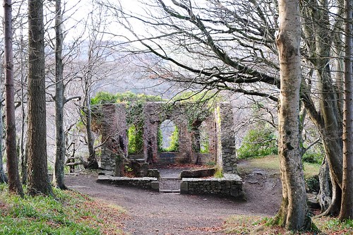
    The Octagon! Its a lovely woodland walk near delgany. The walk through burnaby heights to the burnaby is called the Pigs' Hollow, it's an ancient right of way, i walked there as a child. Although it's pretty short, the walk there is really about walking through the burnaby.


  • Advertisement
  • Registered Users, Registered Users 2 Posts: 6,250 ✭✭✭pixbyjohn


    The Octagon! Its a lovely woodland walk near delgany. The walk through burnaby heights to the burnaby is called the Pigs' Hollow, it's an ancient right of way, i walked there as a child. Although it's pretty short, the walk there is really about walking through the burnaby.

    4327386683_da3cb634e5.jpg


  • Registered Users, Registered Users 2 Posts: 7,025 ✭✭✭d'Oracle


    Have these woods been cleaned up now? Used to be a major drugs and drinks den.

    Thats a bit harsh, a few cans lying around, but its close to a couple of big towns, its hardly den of inequity.

    On Topic, there is a walk above the other side of the glen o the downs.
    (across the glen from the la touche house and the octagon)

    You have to go through willow grove and take a left at the the house with the big wall.
    Then head up that road right at the farm and you should see the entrance on the left. Nice walk that.


  • Registered Users, Registered Users 2 Posts: 7,025 ✭✭✭d'Oracle


    Can't discount the Cliff Walk either. Amazing to realise how popular it was in the late 19th Century, Cable Car and all

    Say what?


  • Registered Users, Registered Users 2 Posts: 594 ✭✭✭Fiachra2


    d'Oracle wrote: »
    Say what?

    At the Bray end there was a cable car that brought you part way up Bray head to a tea shop. Closed in the 60's

    Another good variant is to walk half way to Bray on the cliff walk and then climb the face of Bray Head. The views of Greystones from there are stunning.


  • Registered Users, Registered Users 2 Posts: 93 ✭✭Clodagh84


    Fiachra2 wrote: »
    At the Bray end there was a cable car that brought you part way up Bray head to a tea shop. Closed in the 60's

    Another good variant is to walk half way to Bray on the cliff walk and then climb the face of Bray Head. The views of Greystones from there are stunning.

    Yes, the chair-lift brought you up to "The Eagle`s Nest" coffee shop!

    My favourite walk in Greystones is along the sea-front.


  • Registered Users, Registered Users 2 Posts: 7,025 ✭✭✭d'Oracle


    Fiachra2 wrote: »
    At the Bray end there was a cable car that brought you part way up Bray head to a tea shop. Closed in the 60's

    Another good variant is to walk half way to Bray on the cliff walk and then climb the face of Bray Head. The views of Greystones from there are stunning.

    Is that what the structures there are?

    Never knew that.


  • Closed Accounts Posts: 367 ✭✭I Drink It Up!


    Cliff Walk.

    Burnaby up through the golf club and into Kilincarrig


  • Closed Accounts Posts: 2 Jim Ryan


    Joliegood wrote: »
    There is but it's not a well worn path and it's very marshy. Be prepard to get your feet soaked if you do it. Brings you out right by the sewage treatment place. Better off going the long way round methinks.


    There was a driveway to charlesland, the original farmhouse still there, from the Kilcoole road, the R762. This ran parallel to the new dual carriageway access road. But it also ran past the house at least as far as the new hotel / colf club... then there was a stream that when onto the shore...

    It is many years since I was there... hard to think where lane is between the hotel and charlesland now... I think superquinn is in the way!!

    As for the walk through the golf course.... it runs from the bottom of the hill on the way into Burnaby Hights between what was once separate golf 'links', behing Killincarrig Manor (greystones golf club) to the Burnaby, emerging at the top of Whitshed road, which will take you straight into the village.

    there is now a heritage sign in delgany opposite the off licence which details walks around that village...


  • Closed Accounts Posts: 2 Jim Ryan


    Just remembered the short cut from Burnaby Heights to the Burnaby was called the Pigs Hollow...before burnaby heights of course... no slur on colonel hyde or major denbolton etc

    QUOTE=Jim Ryan;64728741]There was a driveway to charlesland, the original farmhouse still there, from the Kilcoole road, the R762. This ran parallel to the new dual carriageway access road. But it also ran past the house at least as far as the new hotel / colf club... then there was a stream that when onto the shore...

    It is many years since I was there... hard to think where lane is between the hotel and charlesland now... I think superquinn is in the way!!

    As for the walk through the golf course.... it runs from the bottom of the hill on the way into Burnaby Hights between what was once separate golf 'links', behing Killincarrig Manor (greystones golf club) to the Burnaby, emerging at the top of Whitshed road, which will take you straight into the village.

    there is now a heritage sign in delgany opposite the off licence which details walks around that village...[/QUOTE]


  • Advertisement
  • Registered Users, Registered Users 2 Posts: 1,979 ✭✭✭Jammyc


    Maisy wrote: »
    I like all the walks mentioned too - another nice one is from Kilcoole beach down by the bird sanctuary towards Wicklow Head, very nice scenery and you never know what you might spot in the sanctuary :)
    To walk this do you just follow the train tracks?


  • Closed Accounts Posts: 193 ✭✭Maisy


    I cheat a bit and drive - take the left off Kilcoole main street at the mini roundabout onto Sea Road and follow it until you see the train tracks in front of you - there is a little car park off to your left, its as far as you can go in the car. Then cross over the tracks at Kilcoole station and take a right, tracks are then to your right together with the bird sanctuary and some very nice scenery - and you can see clear down to Wicklow head. The beach is to your left and is a nice one too, though stonier than Greystones.


  • Registered Users, Registered Users 2 Posts: 1,979 ✭✭✭Jammyc


    Why thankya!:D


  • Registered Users, Registered Users 2 Posts: 1,322 ✭✭✭ian_m


    d'Oracle wrote: »
    Is that what the structures there are?

    Never knew that.

    Have a look here d'Oracle
    http://www.boards.ie/vbulletin/showthread.php?t=2055298422


  • Closed Accounts Posts: 13,992 ✭✭✭✭recedite


    Many people walk up along the Farrankelly Road in the evenings. Why not try a variant with some “off–road” sections?
    Start either of these walks from the point where an old Mass Path right of way linking Delgany/Kilquade/Kilcoole crosses the new Farrankelly Road (point marked by wooden fencing and large brown signs warning “Do not cross here”.

    1. The Rock of Kilcoole.
    Go up Farrankelly Rd. on the left hand side and turn in left towards the sea. After a few hundred metres following a stream through woodland, arrive at a ruin. From here the path became overgrown when Wicklow County Council closed public access during the road construction. Since then they have refused to help reinstate it, so bring a secateurs and do your bit of chopping. It is currently necessary to divert along the edge of the wasteland field to the left of the overgrown section for about 100 metres. Back on the path, continue to a steel gate marked “no shooting” where you emerge onto the road near a cemetery. Turn right (downhill) on the road for about 50 metres to a bridge over the stream, and then turn left onto a farm track, keeping the stream on your right. At the end of the track, the right of way continues along the edge of a field to an old walled garden behind the convent in Kilcoole. Follow the path across a footbridge and around the outside of the wall. At the “Foresters Hall” building there is a junction. Go right onto the tarmacadam lane called “Upper Green” which emerges onto Kilcoole main street near Lee’s pub. Crossing the street, go straight down the lane opposite you, past the corner of “the Motor Body Workshop”. The Rock is a viewing point, from where you can survey the sea and the surrounding area. The enticing Copper Kettle coffee shop in the car park of the nearby Tesco is also clearly visible from The Rock. Return back the same way, or make your way down to Kilcoole Beach via the main street and then walk along the seashore/ railway tracks to Greystones. At a steel railway bridge on the seashore, there is a shortcut to Charlesland. Turn onto a small path along the stream between the Golf Course and the Driving Range. At the road, cross the bridge and turn left along a very narrow path. The boundary of the water treatment plant will be on your right and the stream on your left. The path follows the treatment plant boundary to the blind roundabout nearest Charlesland.

    2.Drummin & Blackberry Lanes.
    Go up Farrankelly Rd. on the right hand side and turn in right over the stile at a farm track. Don’t make the mistake of going up the track; it’s a dead end. Instead turn in immediately to the left up a barely visible path. It’s a bit overgrown, but its only 20 metres in length. Go through a rusty “kissing gate” into a field. If you are nervous of farm animals, you might want to check what livestock is in the field before proceeding, but usually its only sheep or cattle and rabbits. Walk along the edge of the field to the two gates of the farmyard on the far side. Go through these onto the tarmacadam, and you will find yourself at the end of Drummin Lane. It’s a pleasant quiet lane. After a woodworking workshop, keep left at a fork. The next junction is beside the N11; turn right along the footpath of the Old Wicklow Road. The footpath ends at the next lane; turn right up a steep hill called Blackberry Lane. Keep on straight ahead at a T-Junction (left would go into Delgany village). Soon the tarmacadam ends, but keep going straight down the walled track which was an original part of Blackberry Lane. Emerge at Priory Road, turn right, and walk along the road. Take care with traffic here although there usually are not too many cars, and return to the roundabout at Eden Gate.


  • Registered Users, Registered Users 2 Posts: 44 joinerydivision


    pixbyjohn wrote: »
    As you pass the old Delgany Inn take the hill on the right instead of heading for N11. Travel for approx 5Km til you see entrance on righthand side. Lovely views of Sugarloaf from entrance to Kindlestown Wood. As you reach the eastern end of Kindlestown Wood there is a viewing point overlooking Greystones. We are spoiled for lovely places to go within a 10 Km radius really.

    This sounds lovely - would it be suitable to do this with a buggy? my son is 18 months old and can walk, but i'm guessing we would still need the buggy as its a long walk. are all the paths/roads ok to push along the buggy as and when required?

    Thanks!


  • Advertisement
  • Closed Accounts Posts: 13,992 ✭✭✭✭recedite


    - would it be suitable to do this with a buggy?
    Kindlestown Wood is wheelchair accessible, so buggies no problem.


  • Registered Users, Registered Users 2 Posts: 15,329 ✭✭✭✭loyatemu


    has anyone been walking in the "MountKennedy 400" woods? I passed the entrance on the bike the other day, there are signs up but its not listed on Coillte's website (despite being right behind their headquarters). Entrance is here


  • Closed Accounts Posts: 13,992 ✭✭✭✭recedite


    Its quite small, follows the course of a stream. They use it to test small plantations of various tree species.


  • Registered Users, Registered Users 2 Posts: 562 ✭✭✭artvandelay48


    jaffa20 wrote: »
    Mine would be Kindlestown wood. I know it's more Delgany but it's lovely all the same. Glen of the downs is nice too.

    Where's the Glen of the Downs walk? Would love to explore that area more...


  • Registered Users, Registered Users 2 Posts: 15,329 ✭✭✭✭loyatemu


    Where's the Glen of the Downs walk? Would love to explore that area more...

    carpark entrance is here and there are various paths lead up the hill to the Octagon building


  • Advertisement
  • Registered Users, Registered Users 2 Posts: 21,499 ✭✭✭✭Alun


    loyatemu wrote: »
    carpark entrance is here and there are various paths lead up the hill to the Octagon building
    Be very careful both entering and leaving the car park though, there is no slip road in either direction and you have to use the rather narrow hard shoulder to both decelerate on entry and accelerate on exit.


  • Registered Users, Registered Users 2 Posts: 4,565 ✭✭✭jaffa20


    You can also enter glen of the downs from the other entrance here


  • Closed Accounts Posts: 1,759 ✭✭✭Dr.Silly


    This sounds lovely - would it be suitable to do this with a buggy? my son is 18 months old and can walk, but i'm guessing we would still need the buggy as its a long walk. are all the paths/roads ok to push along the buggy as and when required?

    Thanks!

    Tried this on the weekend, absolutely brilliant, kids loved it.
    Some views as well.
    I've been in the area for 8 years and didn't even know about it, so thanks !!


  • Closed Accounts Posts: 1,759 ✭✭✭Dr.Silly


    actually, anyone ever been here, or know how to get there ?

    http://www.visitwicklow.ie/walk/knocksink_woodland_walk.htm


  • Registered Users, Registered Users 2 Posts: 258 ✭✭Mullie


    Dr.Silly wrote: »
    actually, anyone ever been here, or know how to get there ?

    http://www.visitwicklow.ie/walk/knocksink_woodland_walk.htm

    Thats a really nice natural woodland, not many of them left. If you are coming into Enniskerry from the Stepaside direction, its on the right as you enter the village, about 200m before the church.
    Its a narrow tract of forest that runs the lenght of the valley. Not really a walk if you have a buggy as the path deteriorates and it gets hilly.
    Worth a visit.


  • Closed Accounts Posts: 1,759 ✭✭✭Dr.Silly


    Mullie wrote: »
    Thats a really nice natural woodland, not many of them left. If you are coming into Enniskerry from the Stepaside direction, its on the right as you enter the village, about 200m before the church.
    Its a narrow tract of forest that runs the lenght of the valley. Not really a walk if you have a buggy as the path deteriorates and it gets hilly.
    Worth a visit.

    Super thanks


  • Closed Accounts Posts: 13,992 ✭✭✭✭recedite


    Mullie wrote: »
    Thats a really nice natural woodland, not many of them left. If you are coming into Enniskerry from the Stepaside direction, its on the right as you enter the village, about 200m before the church.
    Its a narrow tract of forest that runs the lenght of the valley. Not really a walk if you have a buggy as the path deteriorates and it gets hilly.
    Worth a visit.
    Some very nice walks around Enniskerry and Glencree valleys can be found on the Dublin Mountain map by Eastwest mapping, (can be got on the internet).


  • Closed Accounts Posts: 149 ✭✭dreamingoak


    bump


Advertisement