Advertisement
If you have a new account but are having problems posting or verifying your account, please email us on hello@boards.ie for help. Thanks :)
Hello all! Please ensure that you are posting a new thread or question in the appropriate forum. The Feedback forum is overwhelmed with questions that are having to be moved elsewhere. If you need help to verify your account contact hello@boards.ie
Hi there,
There is an issue with role permissions that is being worked on at the moment.
If you are having trouble with access or permissions on regional forums please post here to get access: https://www.boards.ie/discussion/2058365403/you-do-not-have-permission-for-that#latest

Virtual storm chase #2 -- 22 to 24 March

  • 22-03-2009 7:22pm
    #1
    Registered Users, Registered Users 2 Posts: 14,741 ✭✭✭✭


    Virtual storm chase #2 -- 22 to 24 March
    ________________________________________


    Can the excitement get any greater? Well yes, if we actually have a tornado this time.

    Virtual storm chase #2 has just landed at DFW (again) and we're on the way to our overnight stop at Garden City KS, awaiting developments along a moderately strong cold front that is expected to come together overnight and start advancing from eastern CO and NM into the TX panhandle, the smaller OK panhandle, and western KS, then becoming active by mid-day with the possibility of severe storms and what we currently assess to be a slight risk of a tornado.

    Will post more after the 00z map run, our evening planning session that will hit your screens in the morning in Ireland, so check in and post any thoughts, data, and links you've found.

    Expecting that we may intercept some storms late Monday in central KS then move back south to chase in eastern TX on Tuesday.


Comments

  • Registered Users, Registered Users 2 Posts: 11,134 ✭✭✭✭maquiladora


    Monday was downgraded from Severe to Slight risk and now up to Moderate again. Should be fun to follow this and see how things play out...


  • Registered Users, Registered Users 2 Posts: 14,741 ✭✭✭✭M.T. Cranium


    0720z (2:20 CDT Monday 23 March)
    __________________________

    Overnight stop at Garden City in southwest Kansas. The latest guidance seems a little more intense than the previous set, as Maq says above, and the new wrinkle seems to be an arc of low pressure that would favour central KS for bow echo development.

    Warm and sultry feel to the evening (too bad I'm not actually there) with south wind, temp holding at 60 F or 16 C and dew points coming up gradually. The cold front is quite strong already, running from northeast CO diagonally southwest across that state into western NM.

    This radar should pick up the first signs of development in the morning local time, which would be after 15z (10:00 am CDT). That's about when I should be back to report on how we are setting up the virtual chase.

    http://radar.weather.gov/radar.php?rid=pux&product=N0R&overlay=11101111&loop=no

    The chase begins when cells develop, possibly 15 to 17 z.


  • Registered Users, Registered Users 2 Posts: 11,134 ✭✭✭✭maquiladora


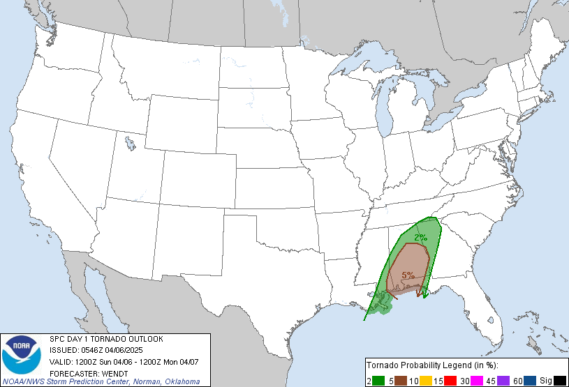
    day1probotlk_1200_torn.gif

    PUBLIC SEVERE WEATHER OUTLOOK
    NWS STORM PREDICTION CENTER NORMAN OK
    0336 AM CDT MON MAR 23 2009

    ...SEVERE THUNDERSTORMS EXPECTED OVER PARTS OF THE CENTRAL AND
    SOUTHERN PLAINS...

    THE NWS STORM PREDICTION CENTER IN NORMAN OK IS FORECASTING THE
    DEVELOPMENT OF TORNADOES...LARGE HAIL AND DAMAGING WINDS OVER PARTS
    OF THE CENTRAL AND SOUTHERN PLAINS THIS AFTERNOON THROUGH TONIGHT.

    THE AREAS MOST LIKELY TO EXPERIENCE THIS ACTIVITY INCLUDE

    CENTRAL AND EASTERN KANSAS
    NORTHERN OKLAHOMA

    ELSEWHERE...SEVERE STORMS ARE ALSO POSSIBLE FROM THE RED RIVER
    VALLEY REGION OF TEXAS AND OKLAHOMA NORTH/NORTHEAST INTO PARTS OF
    NEBRASKA...MISSOURI...IOWA...SOUTH DAKOTA...AND SOUTHWEST MINNESOTA.

    A POWERFUL JET STREAM DISTURBANCE...WITH WINDS IN EXCESS OF 120
    MPH...WILL SWEEP EAST-NORTHEAST FROM THE FOUR CORNERS REGION ACROSS
    THE SOUTHERN PLAINS AND LOWER MISSOURI VALLEY LATER TODAY THROUGH
    EARLY TUESDAY. AS THIS OCCURS...A STRONG SURFACE LOW NOW IN WESTERN
    NEBRASKA WILL TRACK NORTHEAST INTO EASTERN SOUTH DAKOTA.

    A COLD FRONT AND PRE-FRONTAL TROUGH ASSOCIATED WITH THE LOW WILL
    SERVE AS A FOCUS FOR THUNDERSTORM DEVELOPMENT THIS AFTERNOON AND
    TONIGHT AS THE FRONT AND TROUGH PROGRESS EAST-SOUTHEAST ACROSS THE
    CENTRAL AND SOUTHERN PLAINS.

    THE AMOUNT OF MOISTURE AVAILABLE TO STORMS WILL BE SOMEWHAT MARGINAL
    COMPARED TO SOME SEVERE WEATHER EVENTS. WINDS...HOWEVER...WILL BE
    FAVORABLE FOR LONG-LIVED...ROTATING STORMS CALLED SUPERCELLS.
    SHOULD SUSTAINED SUPERCELLS FORM...THEY WILL HAVE THE POTENTIAL TO
    PRODUCE A FEW STRONG TORNADOES...IN ADDITION TO SEVERE HAIL AND
    WIND.

    ALTHOUGH ISOLATED SEVERE STORMS MAY OCCUR ANYTIME BETWEEN NOW AND
    SUNRISE TUESDAY IN THE HIGHLIGHTED REGION...THE BULK OF THE SEVERE
    WEATHER IS EXPECTED LATE THIS AFTERNOON THROUGH LATE THIS EVENING.

    THOSE IN THE THREATENED AREA ARE URGED TO REVIEW SEVERE WEATHER
    SAFETY RULES AND TO LISTEN TO RADIO...TELEVISION...AND NOAA WEATHER
    RADIO FOR POSSIBLE WATCHES...WARNINGS...AND STATEMENTS LATER TODAY.
    ADDITIONALLY...STATE AND LOCAL EMERGENCY MANAGERS ARE MONITORING
    THIS DEVELOPING SITUATION.

    ..CORFIDI.. 03/23/2009


  • Registered Users, Registered Users 2 Posts: 14,741 ✭✭✭✭M.T. Cranium


    1610z _ 1110 CDT Monday 23rd
    _________________________

    The team checked the latest 12z guidance over breakfast in the motel at Garden City KS, determined that nothing much had changed overnight and that development should begin around noon to 1 pm somewhat to the northeast of their current location. A dry line feature had developed overnight and had already moved slightly to the east of Garden City, while the main cold front was expected to continue to develop in an arc hanging down across west-central KS by 2 pm from a deepening low in South Dakota.

    Upper level winds are looking fairly robust, 80 kts on the 500-mb charts and a LLJ (low-level jet) is evident as low as 850 mbs (winds 50-60 kts on the 850 and 700 mb panels indicate potential for rapid intensification). Dew points in the warm sector are coming up slowly into the prime range of 18-22 C for this sort of set-up, currently around 14 C. In general, the set-up presents somewhere in the slight to moderate risk range, it is a little less intense than some cases on all parameters. Another concern is that the region to the south and southwest of the projected storm zone is in long-term drought which can sometimes translate into spotty development potential. More practically, this could introduce blowing dust into the scenario near the dry line feature. Winds are already quite strong from the SW in the dry sector and from the S in the warm, moist sector ahead of us.

    Plan then is to head east taking a route through Dodge City at rather low speeds for continuous observation (radar and visual) hoping to make a quick visit to Greensburg KS in about an hour, the location of a powerful F4-5 tornado in May, 2007. The town is being rebuilt using green technology as a foundation.

    This radar now shows some developments near the KS-CO border well to the northwest of the team, who are currently 20 miles west of Garden City and heading east. Will post some hourly updates as the chase develops.

    http://radar.weather.gov/radar.php?rid=gld&product=N0R&overlay=11101111&loop=no

    Update 1620z ... first estimate of chase target is west of Great Bend KS northeast of Greensburg, 18-19z ... updates to follow


  • Registered Users, Registered Users 2 Posts: 14,741 ✭✭✭✭M.T. Cranium


    1720z _ 1220 CDT
    ____________________

    It is definitely "two hands on the wheel" driving east to Greensburg, a 40 mph south wind is blowing odd bits of dust, soil and loose vegetation (tumbleweed to the locals) across the highway. The sky is a light blue but you can see the dust suspended in the air, back in the dirty thirties a big old dust storm would be blowing for sure, but these days, it takes several days of this kind of weather to blow up that bad.

    We're taking a look around Greensburg, you can still see some signs of the massive damage that took place here two years ago.

    Today's storm is really cranking up now, looking across Nebraska and South Dakota to our north, the winds are generally south at 40-60 mph from here to North Dakota, but on the other side of the front, Rapid City SD is reporting north 45-65 mph and a blizzard is predicted for later today. So there's no shortage of frontal contrast setting up.

    We are still in the dry sector squeezed between the cold front to our northwest and the dry line or developing polar front to our east, although this is a rather broad mixing zone at present and we are now pretty close to the higher dew points. Often in these set ups the dry line migrates a bit back to the west at mid-day and then the system explodes into action.

    Figuring that activity will be starting up fairly soon to our northeast, and will grab a quick lunch here, and start heading towards Great Bend, although due north at first. This is probably the heart of tornado alley around here, the most successful storm chases in terms of visuals and tornado longevity are often found between our present location and the I-70 highway running east-west about 80 miles to our north.

    More in about 90 minutes or so.


  • Advertisement
  • Registered Users, Registered Users 2 Posts: 11,134 ✭✭✭✭maquiladora


    Thanks for the update MT.

    As we head on our virtual chase to Great Bend we can keep an eye on fellow chasers to see what luck they are having through live streaming : http://tornadovideos.net/full-screen-chaser-video.php

    Could be a case where storms will be at their most severe after dark this evening/tonight, a lot more dangerous with no visibility.


  • Registered Users, Registered Users 2 Posts: 14,741 ✭✭✭✭M.T. Cranium


    UPDATE _ 1830z _ 1:30 pm CDT
    ______________________

    While heading east on US 50, decided at St John KS to continue east towards Hutchinson, as cells are firing well to our south and moving NNE, more so than around Great Bend, although some convection near there as well.

    Let's see if this map boots up. We are heading east near Stafford KS.

    http://www.mapquest.com/maps/map.adp?city=Hutchinson&state=KS&zoom=4

    If this looks okay, I will return in 10-20 minutes with a radar summary.

    Have the strong feeling this will blow up big-time in about an hour or two, winds are exceptionally strong at the moment, gusts to about 62 mph from the south, like a light breezy day at Achill I suppose.


  • Closed Accounts Posts: 311 ✭✭forkassed


    WUNIDS_map?station=ICT&brand=wui&num=6&delay=15&type=N0R&frame=0&scale=1.000&noclutter=0&t=1237845660&lat=0&lon=0&label=you&showstorms=0&map.x=400&map.y=240&centerx=400&centery=240&transx=0&transy=0&showlabels=1&severe=0&rainsnow=0&lightning=0&smooth=0


  • Registered Users, Registered Users 2 Posts: 14,741 ✭✭✭✭M.T. Cranium


    UPDATE _ 1845z _ 1:45 pm CDT
    ______________________________

    Okay, the map in the previous post works, except that it needs to be scaled out on the zoom to catch our previous location. On the scale shown we are off the grid to the west but by now will be onto that grid.

    Meanwhile, development is very rapid. A large cluster of severe storms has developed to the north of Great Bend into central Nebraska. This was expected but I wanted to be closer to the south end of the complex now developing to our south, for safety and visibility reasons. We have some promising cells now between our location (10 miles east of Stafford KS) and Medicine Lodge to Pratt KS off to our south. The radar is here ...

    http://radar.weather.gov/radar.php?rid=ict&product=NCR&overlay=11101111&loop=no

    From what I remember, this is flat, wide-open wheat growing country, with almost unlimited visibility in all directions, except for the odd grove of trees beside the roads in a few spots. However, there is a haze of blowing dust reducing visibility to about 3-5 miles at best, sometimes more like half a mile. The wind is howling from about 170 degrees at 40 mph gusting to 65.

    Close that damn window, they just manured the fields around here. :eek:

    UPDATED PLAN -- May soon intercept cells going tornadic near Hutchinson, navigator is looking for safe routes around south end of city so we avoid traffic congestion and loss of visibility in urban areas (Kansas cities have a lot of mature shade trees planted and tend to be like urban forests, at least from here east to Missouri border ... these are just coming into full leaf now, and also there are quite a few tall evergreen trees here and there in the cities, you don't want to try chasing through large towns for any number of reasons).

    Update when we have contact with a storm.


  • Registered Users, Registered Users 2 Posts: 14,741 ✭✭✭✭M.T. Cranium


    UPDATE _ 1922z _ 2:22 pm CDT
    ____________________________

    Moving into position now to intercept the developing cell currently located 30 miles southwest of Hutchinson KS, while we are driving through south end of that city, planning to continue east on US 50 watching the cell on radar, estimate we will have contact about 5-10 miles east of here in about 30-40 minutes. Road options from contact include east and north to a parallel east-west road, appears to be a paved county road (often quite acceptable for storm chase) called Arapaho Road (see google earth ... this is about 10 miles north of US 50).

    Not sure if this cell will become a supercell but shows the usual stages of development so far, it's only 2:20 pm, rather early for tornadic development on the average, so I'm thinking the chances are 40 per cent for a tornado sighting, and 70 per cent for a severe storm out of this cell (not warned yet although the winds are howling in general so any cell could accelerate the gusts to 70-80 mph, already seeing reports of roof and tree damage from the non-thunderstorm winds).

    Updates as action develops. During the typing of this report, have cleared east end of Hutchinson and can see anvil cloud covering most of southwest sky, orange-grey look to that part of the sky, darker base, pale blue off to northwest with hints of towering cu, grey looking to our east. Sultry, 24 C with 14 C dew point, wind SSE 40 mph gusting to 60. If this drops off a bit, I think the severe storm is on.


  • Advertisement
  • Registered Users, Registered Users 2 Posts: 14,741 ✭✭✭✭M.T. Cranium


    UPDATE _ 1940z _ 2:40 pm CDT
    ________________________

    Now sitting at a gas station and store at the small town of Burrton on US 50. The target cell has now acquired a severe storm warning and the NWS mentions 2005z (3:05 pm) for arrival at our location. We have a north-south road available to go a few miles south if that seems advantageous to the view. You may see lighter echoes on radar ahead of the main cell which is now looking like a small supercell. These lighter echoes are mainly from the storm's overshooting anvil, they are not ground clutter or low-base scud.

    There's a yellow brick road off to our north. :D

    Storm reports are trickling in, mostly from the generally strong southerly winds blowing a few roofs and many signs down, power outages here and there, but nothing too dramatic yet. Next report as the storm crosses US 50 near our location (we hope not too near).


  • Registered Users, Registered Users 2 Posts: 11,134 ✭✭✭✭maquiladora


    Brief tornado touchdown in Brownlee, Cherry, NE.


  • Registered Users, Registered Users 2 Posts: 14,741 ✭✭✭✭M.T. Cranium


    UPDATE _ 2015z _ 3:15 pm CDT
    ________________________

    Watching our onboard radar we drove to a point three miles south of Burrton as we wanted to have a clearer view of the storm going through the town. The radar suggested some vortex development as the cell approached US 50 about 1955z but our visual contact suggested it was borderline severe as it crossed the highway. We are now driving at full speed east on US 50 to get onto a northbound highway to make a second intercept. Estimated gusts to 70 mph, in the position we took up, the storm went by to our north and we only had a brief rain shower. Small branches down on the road back into town before hitting the highway. Nothing too dramatic yet.

    Almost at the I-135 junction now to head north on KS 15, cell is moving northeast at about 45 knots. Looking for other candidate cells but nothing too compelling to take us off this chase. We may have a second contact closer to Moundridge KS in about 20 minutes at 2035z.

    Have now turned north on State Hwy 15. Storm is about seven miles north of us now, we are slowly closing on it at 60 mph.


  • Registered Users, Registered Users 2 Posts: 14,741 ✭✭✭✭M.T. Cranium


    2030z _ 3:30 pm CDT
    ______________________

    Near Goessel KS on Highway 15, storm is splitting on radar, a possible sign of intensification to follow. Our plan is to continue chasing north on this route as far as Canton KS, then re-assess situation, as cells further south may then have more potential for a later intercept.

    In real life, I have to go out for half an hour, so I will have to reconstruct the chase from the radar loop and other observations available on line.

    Next report around 2130z or 4:30 pm.


  • Registered Users, Registered Users 2 Posts: 14,741 ✭✭✭✭M.T. Cranium


    2150z _ 4:50 pm CDT
    _______________________

    Okay, here's what might have happened while I was out ...

    Just north of Goessel KS about an hour ago, decided to terminate this cell as it seemed to be accelerating out of our range, and head south to check out developments closer to Wichita.

    This proved to be a good decision (as most hindsight ones are) as cells south of Wichita are now at severe levels and some rotation has been spotted.

    We made good time southbound on the Interstate and are now taking the east-side ring road around Wichita in heavy but moving traffic. The plan seems to be to head a little further east then south, checking maps for a route. Intercept may be about 20-30 minutes from now.


  • Registered Users, Registered Users 2 Posts: 14,741 ✭✭✭✭M.T. Cranium


    UPDATE _ 2210z _ 5:10 pm CDT
    _______________________


    We are now southeast of Wichita KS heading south on US 77, about 20 miles north of Winfield KS. Area ahead of us is now under a tornado warning. Not sure if we have a safe route to the viewable side of the supercell which is basically covering most of the southwest quadrant of our radar screen. Occasional showers, the wind has backed to SE 20 mph and it is a lot less gusty here than most of the day has been. Probably this signals the peak of development in the supercells. Update as we approach.


  • Registered Users, Registered Users 2 Posts: 14,741 ✭✭✭✭M.T. Cranium


    UPDATE _ 2222z _ 5:22 pm CDT
    _____________________________

    Our location five miles north of Winfield, about to turn east on a side road to connect to the paved county road running generally east to New Salem KS. The supercell has apparently spawned a tornado which is now about 8 miles SSE of Winfield, and heading in the general direction of New Salem. We will see if we can get ahead of the heavy to severe portion of the storm, if not, we will trail it and see if there is a route safe for chasing from behind.

    Just turning east now, uh-oh it's two miles of dirt road. Thundering loudly and raining moderately, CG lightning to our south over the city of Winfield. We of course cannot see through the cell to the tornado.

    Okay, stop sign ahead, paved road from south curving to east ahead of us. We are going to assume that the local state troopers have better things to do than check radar on this rather quiet stretch of road. New Salem 6 miles.

    Storm is closing fast, but our radar says go, the vorticity is pretty obvious about 7 miles to our south, heading northeast.

    Update when we intercept (or die).


  • Registered Users, Registered Users 2 Posts: 11,134 ✭✭✭✭maquiladora


    Looks like as we head down 77 towards Arkansas City to intercept the storm we'll be passing through some hail and heavy rain.

    Most of our fellow chasers are lined up on 166 just east of Arkansas City now.


  • Registered Users, Registered Users 2 Posts: 14,741 ✭✭✭✭M.T. Cranium


    UPDATE _ 2235z _ 5:35 pm CDT
    _________________________

    Onboard radar combined with spotter reports suggest intermittent tornado touchdown track is heading northeast towards our current location, 4 miles east of New Salem KS, on paved county road 4. We are making good time because the wind has dropped off to ESE 15 mph as inflow continues into the large supercell now centered about 10 miles to our SSW. See the Wichita radar for the details. Our plan is to head further east, outrun the front edge of the storm if possible, then turn south to see if we can get a clear view of the southeast side of the supercell and its structure.

    At the moment all we can see is black sky to our south, with frequent CG lightning getting rather close at times. Rain is moderate to heavy at times.

    We are now about 8 miles east of New Salem, will return to report on visuals and our location in ten minutes. Not much traffic on this road.


  • Registered Users, Registered Users 2 Posts: 14,741 ✭✭✭✭M.T. Cranium


    UPDATE _ 2245z _ 5:45 pm CDT
    _______________________

    Storm cut off our southward exit on US 160 at Burden KS, and we had to keep moving east, almost in the heart of the supercell at that point (2240z) ... all of this assumes we could have driven at 55-60 mph and that might not be realistic, but in any case, here we are, out front of the storm again, with the sky beginning to brighten from the south, very black behind us, frequent lightning, rain now back to moderate for us. Reports from Winfield suggest a heavy rainfall in the core of the cell. Spotter reports suggest tornado may be obscured by the rain behind us, our radar shows a possible TVS. I'm going to have to rely on actual reports and storm chaser video to authenticate our story from here on, but would not be surprised if ... we are now 5 miles east of Burden with the southern edge of the supercell to our WNW, tornado funnel visible, does not appear to be reaching the ground. Looking for a safe stopping point for video.

    Out of the vehicle now, wind surprisingly light here (SSE 20 mph), reason probably the extensive development going on further southwest along the cold front (formerly dry line). Getting some good video of a partial tornado funnel. More reports as we get real eyewitness accounts.


  • Advertisement
  • Registered Users, Registered Users 2 Posts: 14,741 ✭✭✭✭M.T. Cranium


    UPDATE _ 2255z _ 5:55 pm CDT
    ______________________

    While out of the vehicle we noticed that the wall cloud was extending south and this caused us to jump back in the vehicle and drive east through Cambridge KS, still on US 160. Currently heading south on a dirt road and filming tornado to our west ( :D ). Looks to be an F2, could do some damage in the very small town of Cambridge. Appears to be crossing the highway about 2 miles to our northwest. Getting quite gusty now SW 40 to 65 mph.

    (note to readers, virtual report ... no confirmed tornado)

    Will update when the event is over. This will end the active storm chase as sunset is about an hour away. Plan is to assess storm damage and get video, then head to Tulsa for overnight stop, planning for Tuesday storm chase probably further southeast.


  • Registered Users, Registered Users 2 Posts: 14,741 ✭✭✭✭M.T. Cranium


    I would say in retrospect, rather difficult to estimate the real travel times since they involved driving around some larger towns and also through the backside of a supercell. In reality, we could have broken away from the first cell a bit earlier and easily made it to Winfield before the storm began.

    So I'm not sure if the virtual exercise is all that accurate for the potential of the day. Also not seeing any actual confirmation of a tornado near Cambridge KS but the radar went quite weak about 5 minutes after that might have happened.

    Likely to be some further damaging storms overnight in eastern NE, western IA, eastern KS, northeast OK. Will now be driving to Tulsa OK for overnight stay, next report around 0500 GMT.


  • Registered Users, Registered Users 2 Posts: 14,741 ✭✭✭✭M.T. Cranium


    UPDATE _ 0545z Tuesday
    _________________________

    The western half of South Dakota is getting a ferocious blizzard from this low, northerly winds gusting to 70 mph and 20-30 inches of snow in some places. Hard to imagine really ... so we won't.

    Meanwhile lines of heavy thunderstorms continue to roll east slowly, through western IA, nw MO, eastern KS and central OK. Given the severity of the dynamics it seems like a minor miracle that no severe damage or casualties have so far been reported (subject to later revision).

    Overnight at Tulsa OK, will pick up thread around 15z, will probably be looking to leave early and head south to be in position around Longview TX possibly. Could turn into a rather difficult chase with heavy rain obscuring the storms that do produce severe weather.

    Update at about 1530z.


  • Registered Users, Registered Users 2 Posts: 11,134 ✭✭✭✭maquiladora


    At least 11 tornados were reported yesterday in NE, KS & IA.

    Looks like we are entering a period of reduced severe weather risk but there is potential for more violent activity towards the end of the week.


  • Registered Users, Registered Users 2 Posts: 14,741 ✭✭✭✭M.T. Cranium


    UPDATE _ 1645z _ 1145 CDT
    _______________________

    Log of virtual storm chase activity from 1400 to 1645z ...

    made early decision to move east from Tulsa and set up by 3 pm CDT in south central MO, with options to continue to southeast MO or northeast AR. Currently on the road in southwest MO having just left I-44 at Springfield, estimating arrival in West Plains MO by 1:30 pm and Jonesboro AR (if necessary) by 4 pm. We may slow this pace if severe weather develops further west than expected. We are about 50 miles ahead of the front now.

    Northeast TX was ruled out at 0800 as front is running into low level cloud mass over southeast TX, severe weather may well develop there but chase conditions would be poor as far eastern TX and northern LA are forested and storm chase would be unlikely to provide video opportunity.

    We assess tornado risk as slight in our chase target area, but the dynamics have not changed greatly from yesterday. One update there, the observed funnel cloud near Cambridge KS apparently lifted as it crossed the highway and damage trail ended in rural areas to the southwest (prelim reports).

    Today's storm chase updates may be less active than yesterday's, but I will play out this hand and terminate the thread with events later today, win lose or draw.

    Currently 20 miles west of Mountain Grove, MO. Weather is cloudy and warm with southerly winds 15-25 mph, 23 C, dew point 15 C. Line of moderate to heavy rain with some embedded thunderstorms, following us from the west, can be seen on radar below:


    http://radar.weather.gov/radar.php?rid=sgf&product=N0R&overlay=11101111&loop=no


  • Registered Users, Registered Users 2 Posts: 14,741 ✭✭✭✭M.T. Cranium


    UPDATE _ 19z _ 2 pm CDT
    __________________________

    Now at West Plains MO near the AR border, have decided to head southeast with target of Walnut Ridge AR by 3:15 pm CDT. Severe storm potential seems greater from there to Jonesboro than anywhere in Missouri from examination of radar loops. Cloudy, 21 C and spots of rain, turning quite dark to our west. We will have to make good time to stay ahead of developments.

    More from the chase around 20z.


  • Registered Users, Registered Users 2 Posts: 14,741 ✭✭✭✭M.T. Cranium


    UPDATE _ 2015z _ 3:15 pm CDT
    _______________________

    A few miles to go now, to Walnut Ridge AR. A weak pre=frontal shower band is moving across our path giving a steady rain and dropping the temperature to about 17 C. Some clearing off to our southwest, and the main front off to our west behind haze and the Ozark Mountains which we can't see at all because of the humidity and haze.

    We will now be closely watching the main frontal zone which has continued to produce severe non-tornadic storms for several hours in hilly western Arkansas. If we get lucky, we may see a more severe outbreak when the front reaches heated ground in eastern AR (temps to our east have reached 25 C in partly sunny conditions before clouding over).

    We figure there is perhaps a 30% chance of a significant chase opportunity now to 7 pm and darkness. Checking road maps to plan possible routes south or east from Walnut Ridge, which now looms ahead.

    Is that Bill Clinton coming out of that trailer? :)


  • Registered Users, Registered Users 2 Posts: 14,741 ✭✭✭✭M.T. Cranium


    UPDATE 2105z _ 4:05 pm CDT
    ___________________________

    Have moved on to Jonesboro in northeast Arkansas (AR).

    Radar has quickly filled in the gaps and it is looking more like a squall line than any chance of discrete cells, but a storm's a storm on a storm chase.

    We are counting on further development as this front leaves hilly terrain for the flatter Mississippi valley and encounters more heated ground from earlier sunshine here. It still feels quite warm despite the cloud cover that arrived with us, 22 C and a SSW wind 20 mph with occasional gusts to 35 mph.

    Here's the radar, we probably won't be moving too far now, just picking a chase route probably to the south of here in half an hour or so.

    http://radar.weather.gov/radar.php?rid=nqa&product=N0R&overlay=11101111&loop=no


  • Registered Users, Registered Users 2 Posts: 14,741 ✭✭✭✭M.T. Cranium


    UPDATE _ 22z _ 5 pm CDT
    ____________________

    Have moved south to Waldenburg on US 49, severe storm on radar to our west but considerable convection inflow is blocking our view and starting to dump intermittent heavy rain on us. Hoping to get a last-minute indication of where to position if there is a break between cells.

    This may turn into a flood chase rather than a storm chase, with the flood chasing us if we get too close to these broad streams.

    Possibly one more report before packing this one in.


  • Advertisement
  • Registered Users, Registered Users 2 Posts: 14,741 ✭✭✭✭M.T. Cranium


    End of the trail ... Tuesday evening
    _______________________

    Well, we got right underneath a good old-fashioned bayou filling soaker that lasted about two hours and dropped two or three inches of rain. We have retired to Memphis, TN to visit Elvis and find a saloon that has cold beer and hot women, pretty much the opposite of what I'm used to.

    Perhaps we'll do another storm chase in a while. If somebody else spots one they want to do, I hope you'll give it a try, the links can be figured out from some of those posted on storm chases 1 and 2.


  • Registered Users, Registered Users 2 Posts: 11,134 ✭✭✭✭maquiladora


    Thanks again MT for those entertaining and educational posts. :) Great stuff.


Advertisement