Advertisement
If you have a new account but are having problems posting or verifying your account, please email us on hello@boards.ie for help. Thanks :)
Hello all! Please ensure that you are posting a new thread or question in the appropriate forum. The Feedback forum is overwhelmed with questions that are having to be moved elsewhere. If you need help to verify your account contact hello@boards.ie
Hi there,
There is an issue with role permissions that is being worked on at the moment.
If you are having trouble with access or permissions on regional forums please post here to get access: https://www.boards.ie/discussion/2058365403/you-do-not-have-permission-for-that#latest

Slieve Foye Loop Question for those who have completed it!

  • 16-02-2009 5:00pm
    #1
    Registered Users, Registered Users 2 Posts: 234 ✭✭


    Hello all,

    Just back from a nice day out on the hills in Carlingford. Set off around 10ish to complete the Slieve Foye Loop and generally had a good day out.

    The loop walk is well signposted intially and after a tough climb the summit of Slieve Foye, I headed NNW towards Eagles Rock and the eventual descent.

    Unfortunately the upper 100 meters or so of the entire mountain was shrouded in cloud and visibility went from unlimited to maybe 100-200m and back every few minutes. With some careful compass work, pacing and grabbing bearings from the surrounding countryside whenever I could see it, I made my way to the south face of the craggy peak a few hundred meters from Eagles Rock at just over 530m.

    Then I set off NE to start the descent. At this stage I had not seen a single waymarker since Slieve Foye's summit and soon realised that I was in fact following the course of the Two Mile river from it's source. Stopping well short of what sounded like a waterfall and at an elevation of around 400m I began tracking SE across the mountain side to find the correct route but ultimately never did. I eventually spotted the entrace to the Forest Car Park way down below me and carefully made my way down to it. The eventual route I took was pretty much bang on the course I had expected and planned for but the entire descent was very steep and absolutely treacherous. In fact, it is a descent that I would not make again - experience in the bag thank you very much! From the bottom, I could not for the life of me see any safe route whatsoever.

    So where did I go wrong? Or is the Loop really this dangerous in it's latter stages?

    Just before I started down, the map with help from bearings from Rostrevor, Kilowen and Greenore seemed to show me in exactly the right place, yet there were no markers or signs of a path anywhere in my vicinity. About halfway down I saw two walkers heading to the forest car park from the South East but I never managed to catch them to ask what route they were on.

    So, any ideas?

    Discover Ireland Route Description here

    Thanks everyone!


Comments

  • Closed Accounts Posts: 1,171 ✭✭✭paulocon


    Climbed Slieve Foye from the Forest Car Park last summer. Sounds like you took pretty much the correct route and yes, it is very badly marked. From recollection, there are a couple of poles on the way up but they are easily missed. I went up on a clear day and picked my own route up/down.

    Your description of the descent sounds about right - even back in the summer, patches of it were quite wet so I can only imagine what it was like at the weekend. It is also extremely steep and I couldn't see any better route that the one I took.

    All in all, it's not a route I'd take again. Climbed it just before Christmas but went up and descended from the other side, a much nicer walk.


  • Registered Users, Registered Users 2 Posts: 234 ✭✭Ta me anseo


    paulocon wrote: »
    Climbed Slieve Foye from the Forest Car Park last summer. Sounds like you took pretty much the correct route and yes, it is very badly marked. From recollection, there are a couple of poles on the way up but they are easily missed. I went up on a clear day and picked my own route up/down.

    Your description of the descent sounds about right - even back in the summer, patches of it were quite wet so I can only imagine what it was like at the weekend. It is also extremely steep and I couldn't see any better route that the one I took.

    All in all, it's not a route I'd take again. Climbed it just before Christmas but went up and descended from the other side, a much nicer walk.

    Well glad to know that it's not just me! It's a warning to everyone intending to try it I suppose that starting from Carlingford and ending with the decent onto the forest track is pretty dangerous. I slipped briefly just twice on the way down as the surface layer underfoot broke away and caught myself both times, but was only to aware that a complete loss of balance would leave me in a broken heap hundreds of meters below. I suppose because you are on a waymarked way you expect it must not be as bad as it looks and perhaps press on regardless. Also, since you are well past the halfway mark you could be pressured into continuing escpecially if you started the walk late in the day.

    The south side ascent and descent is very nice indeed though....


  • Registered Users, Registered Users 2 Posts: 21,506 ✭✭✭✭Alun


    I've never done Slieve Foy etc. from the Carlingford side, but have done the whole ridge a couple of times in an inland loop taking in a part of the Tain Way before which is quite a pleasant walk. I have a GPS track of the walk if anyones interested.


  • Registered Users, Registered Users 2 Posts: 117 ✭✭acorn


    Thanks for the tip off, hoping to visit Sleve Foye at Easter. Would it be an option to follow the waymarked trail to the summit and retrace my steps to descend if conditions are bad ?


  • Closed Accounts Posts: 1,171 ✭✭✭paulocon


    acorn wrote: »
    Thanks for the tip off, hoping to visit Sleve Foye at Easter. Would it be an option to follow the waymarked trail to the summit and retrace my steps to descend if conditions are bad ?

    That is probably the best bet. I've climbed the mountain a number of times now from different locations and I would definitely recommend you stay well away from ascending or descending from the forest due to the difficult terrain.

    Handiest way to climb the mountain is either from Carlingford or from the other side where the Tain Way meets the road (I don't have a map to hand). Both ways bring you up to the gap between Foye and Barnavave. At this point, you leave the Tain way for a relatively short walk to the summit - this part isn't very well marked from recollection and the summit is pretty much hidden until you are on top of it. Took a run up it a couple of weeks ago in thick fog and it can be a confusing place in these conditions.

    4372475445_5a10d45a11.jpg

    Having said that, it really is a superb walk on a clear day and the views from Foye really are spectactular.

    3095832017_0763d509c8.jpg

    Some more details of the walk up from Carlingford are on here..
    http://www.walkingandhikingireland.com/?p=92

    I have some more links which I can dig up for you. Enjoy!


  • Advertisement
  • Registered Users, Registered Users 2 Posts: 8 mcrtchly


    On the 13th Feb we tried to follow the Foye loop walk. Getting to the summit was fine then the route descends below the Eagles Rock down a steep valley towards Slieve Foye forest. Then the signs stop and here the problems arose. We tried to make our own way down towards the car park shown on the map and avoiding the steep cut of the river in the valley. But there was no track and even worse, no gate or stile into the forest (which is now no longer a forest due to on-going clear felling). Eventually we managed to cross the fence and struggled over the remains of fallen trees and through deep sticky mud to reach the Tain Way which we followed back SE to our start in Carlingford.

    I contacted Louth Co. Co. on my return and they are aware of the problem and have said that they will put up temporary signs on the Slieve Foye walk alerting walkers. They are also talking with Coillte about the best way to cross the forest once the clear felling is completed.


  • Registered Users, Registered Users 2 Posts: 627 ✭✭✭Mullaghteelin


    I have done this numerous times over the years, and I was unaware there were ever any signs or posts of any description on the steep rocky mountain section itself.
    I usually climb from the Slieve Foye woods however, and enjoy a quick descent into Carlingford, and as a rule have only ever done it in clear weather. The descent back to the woods near Omeath can be awkward unless you are very familiar with the route.
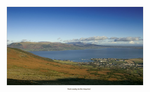
    To be honest, I fail to see the point in doing it in poor visibility, with such spectacular scenery hidden from view. The Isle of Man, Wicklow Mountains, Lough Neagh, and of course, the jagged peaks of the Mournes, are all visible on a clear day.
    Its interesting to hear about the felling in the forest, the carpark there was always a popular viewpoint for locals and tourists alike.


  • Registered Users, Registered Users 2 Posts: 117 ✭✭acorn


    Thanks for the info.
    After driving 150+ miles I'll be climbing Foye regardless of the weather and visibility :)
    Have experience and navigation skills, just wary of forestry trail which are notoriously inaccurate on os maps.
    Will adjust my route according to the conditions on the day.
    Thanks again


  • Registered Users, Registered Users 2 Posts: 117 ✭✭acorn


    Excellent link Paul, Thanks.

    Have already used some of your routes on mountain views website on my county tops quest - Thanks.

    Knowing where to start and finish a walk is half the battle.

    Days are getting longer, more hill time on the way:D


  • Registered Users, Registered Users 2 Posts: 624 ✭✭✭boatbuilder


    Planning to do the Slieve Foye Blue Loop on Friday - any tips? Anyone know if you can get a gps app for your phone with the route on it?


  • Advertisement
  • Registered Users, Registered Users 2 Posts: 312 ✭✭Gasherbraun


    Planning to do the Slieve Foye Blue Loop on Friday - any tips? Anyone know if you can get a gps app for your phone with the route on it?

    You can buy and download Viewranger that allows you to download map tiles for the whole of Ireland. You can certainly get OS maps and I think you can also use East West maps on the app but not sure if EW cover the Cooley Mountains.

    The map tiles will not have routes on them and you need to either import them from various sources or create them yourself (This ideally needs some first hand knowledge of the area)

    Viewranger works reasonably well but is limited by the battery life of the phone and also the fact that a phone is not designed to be out in the worst of Irish weather.

    There is a tourist information office in the town close to the car park and they will have some guides that that can be a useful addition to a map.


  • Closed Accounts Posts: 2,917 ✭✭✭BarryD


    Old thread but note that the Slieve Foye loop was changed a few years ago, presumably after complaints re above. It now sticks to the forest and avoids the summit, ridge and descent. See https://tcsinfoland.ireland.ie/content/Multimedia/Attachments/1913_1Bslievefoye.pdf


Advertisement