Advertisement
If you have a new account but are having problems posting or verifying your account, please email us on hello@boards.ie for help. Thanks :)
Hello all! Please ensure that you are posting a new thread or question in the appropriate forum. The Feedback forum is overwhelmed with questions that are having to be moved elsewhere. If you need help to verify your account contact hello@boards.ie
Hi all,
Vanilla are planning an update to the site on April 24th (next Wednesday). It is a major PHP8 update which is expected to boost performance across the site. The site will be down from 7pm and it is expected to take about an hour to complete. We appreciate your patience during the update.
Thanks all.

Seen & Found

Options
1151618202132

Comments

  • Registered Users Posts: 6,700 ✭✭✭Mountainsandh


    Thanks Slowburner, I just emailed the NMS with coordinates.
    It's obviously intensively farmed, but a record is always important right ?
    I often think even just knowing the distribution, and maybe what way the raths' openings were facing must be interesting and tell something of the population of the time.

    I wonder did they somehow communicate from one fort to the other, for example some of the forts near me must have been visible to each other as some were on hillsides, and others down in the valley, and within eyesight. That opens up a world of possibilities for early forms of communications.

    Red cloth : bring some sugar when you come up for tea later. :D

    Green cloth : All okey dokey how'r'yeez.

    2 torches : master is home from hunting
    3 torches : caught a deer today
    5 torches : we need meat today come down we have milk and fish


    :p


  • Moderators, Science, Health & Environment Moderators Posts: 5,218 Mod ✭✭✭✭slowburner


    It's obviously intensively farmed, but a record is always important right ?
    Absolutely.


  • Registered Users Posts: 880 ✭✭✭celica00


    Please excuse me if this is something "stupid" or a rookie mistake.
    I am starting to get familiar with Archaelogy out of interest and had a look in my area.
    I found this, probably nothing important but could marks like this say when the borders were changed for example etc?

    Click

    51.794983, -8.571058 and also 51.802627, -8.564797


  • Registered Users Posts: 6,700 ✭✭✭Mountainsandh


    Update :

    Got a reply from the South Tipp dedicated person for the archeological survey database, as follows :
    The Bing Image you noted was passed onto the Archaeological Survey, for which I manage South Tipperary. The cropmark would appear to be of an archaeological monument and it has been added to our monuments database as TS088-081---- an enclosure.

    :D

    The detail of record is as follows :
    Townland: KILNACARRIGA
    Description: In tillage, c. 100m W of the Glenboy River which flows roughly N-S. A roughly circular enclosure (diam. 68m N-S; 70m E-W)

    The lady said I can contact her via her email if I ever find anything else interesting, so that's really handy, you never know.


  • Moderators, Science, Health & Environment Moderators Posts: 5,218 Mod ✭✭✭✭slowburner


    celica00 wrote: »
    Please excuse me if this is something "stupid" or a rookie mistake.
    I am starting to get familiar with Archaelogy out of interest and had a look in my area.
    I found this, probably nothing important but could marks like this say when the borders were changed for example etc?

    Click

    51.794983, -8.571058 and also 51.802627, -8.564797
    The first site (Rigsdale) is almost certainly a combination of old field boundaries, drainage, and old stream channels.
    I can't see anything of archaeological significance at the second site (Ballyheedy).

    Changes in field use often leave distinctive, usually fairly straight parch marks. These can usually be confirmed by referring to the Ordnance Survey Historic maps. The circular feature identified by Mountainsandh cannot be related in any way to a field system or boundary. It is an enclosure - or at least all that remains of one.


  • Advertisement
  • Moderators, Science, Health & Environment Moderators Posts: 5,218 Mod ✭✭✭✭slowburner


    This might be of interest to readers in the Kildare area and could well do with some decent surface verification.
    Could some of the features interpreted as 'barrows' be pits from aggregate extraction, or military activities. Some look to be pretty good finds, others are less certain.
    If anyone is inclined to verify on the ground, please keep us informed :)

    http://nidarchaeosurvey.blogspot.ie/2015/02/the-curragh-co-kildare-over-30.html


  • Closed Accounts Posts: 608 ✭✭✭Bonedigger


    Thanks for posting this link SB!
    This is my backyard and am familiar with most if not all of those areas.
    Feature 'KD8' listed on that blog site is something I've been looking at myself and was most surprised it was not already on the 'Sites and Monuments Record'. It is in a rough alignment with two other ring-barrows which are in close proximity and all seem to be aligned to the summit of Dún Ailinne. The image below was taken a week after the Winter solstice sunrise of 2014 - feature 'K8' is that 'bumpy' mound in the foreground. You can just about make out the silhouette of Dún Ailline between the trees:

    702B3CE82A2942C78D9C97B987CE3E1E-0000372749-0003733321-00800L-AE74FF76DE294E7AB40B479BA16D4842.jpg


  • Moderators, Science, Health & Environment Moderators Posts: 5,218 Mod ✭✭✭✭slowburner


    Bonedigger wrote: »
    Thanks for posting this link SB!
    This is my backyard and am familiar with most if not all of those areas.
    Feature 'KD8' listed on that blog site is something I've been looking at myself and was most surprised it was not already on the 'Sites and Monuments Record'. It is in a rough alignment with two other ring-barrows which are in close proximity and all seem to be aligned to the summit of Dún Ailinne. The image below was taken a week after the Winter solstice sunrise of 2014 - feature 'K8' is that 'bumpy' mound in the foreground. You can just about make out the silhouette of Dún Ailline between the trees:
    It's very likely that many of these features weren't identified for the simple reason that the current level and range of high quality aerial imagery wasn't available to the survey in its heyday.
    More than three centuries of military presence on the Curragh, complicate this landscape pretty significantly, so a certain amount of caution needs to be exercised in interpreting features in the landscape as prehistoric archaeology.
    It's definitely a 'boots on the ground job' and the person filling those boots probably needs to learn something about early modern military encampment practices in order to be able to state what may or may not be modern military remains.


  • Registered Users Posts: 776 ✭✭✭Fries-With-That


    Something worth looking at or the product of an over active imagination :) .

    I was in this area recently and decided to cast my eyes over the area from above with the aid of the OSI maps and Bing maps.

    The area I'd like your opinions on is just above and to the immediate left of the derelict church. The church is marked on the OSI Maps but the distinct rectangular areas to the left and above are not mentioned.

    The two rectangular areas are joined to each other and joined to the western end of the church. The area to the north appears to have several footprints.

    This is the link from Bing http://binged.it/1bcB4PC I would love to hear what you think these were.


  • Registered Users Posts: 316 ✭✭Simon.d


    Something worth looking at or the product of an over active imagination :) .

    I was in this area recently and decided to cast my eyes over the area from above with the aid of the OSI maps and Bing maps.

    The area I'd like your opinions on is just above and to the immediate left of the derelict church. The church is marked on the OSI Maps but the distinct rectangular areas to the left and above are not mentioned.

    The two rectangular areas are joined to each other and joined to the western end of the church. The area to the north appears to have several footprints.

    This is the link from Bing http://binged.it/1bcB4PC I would love to hear what you think these were.

    Definately something worth passing on to the NMS.. No record for the earthworks and no modern explanation I can see.. Think the very regular bits may relate to the 17th century house.. Might be formal gardens.. Lots of other irregular bits and pieces too, especially to the immediate north of the graveyard, which may to access from the house to the main road and church..


  • Advertisement
  • Moderators, Science, Health & Environment Moderators Posts: 5,218 Mod ✭✭✭✭slowburner


    Something worth looking at or the product of an over active imagination :) .

    I was in this area recently and decided to cast my eyes over the area from above with the aid of the OSI maps and Bing maps.

    The area I'd like your opinions on is just above and to the immediate left of the derelict church. The church is marked on the OSI Maps but the distinct rectangular areas to the left and above are not mentioned.

    The two rectangular areas are joined to each other and joined to the western end of the church. The area to the north appears to have several footprints.

    This is the link from Bing http://binged.it/1bcB4PC I would love to hear what you think these were.
    Presumably walled gardens associated with the probable 17thC priest's house (OF044-011001).

    That mound due east, looks interesting. A fulacht fia is listed a little more towards the north of the field (OF044-016). I wonder if the SMR is slightly off and this is the fulacht fia, or if it is worth checking out as a potentially new feature. I seems to be situated within a bend in a palaeochannel which would fit with the situation of a fulacht.
    It's an interesting area.


  • Registered Users Posts: 776 ✭✭✭Fries-With-That


    Hi Simon & SB, I can't open either of your links on iPad, I wasn't aware of a 17th century house at this location and can't see reference to it on any OSI map.

    I think might be correct with the marking of the fulacht fia site but on bing this field seems to have several circular anomalies.

    What drew my attention to this area in general was the abundance of anomalies that can bee seen on bing, but the rectangular markings at this location stood out especially the fact that they seen to show on the northern one several footprints, this would not be consistent with a walled garden given that a wall would have been built once not several times.

    Further research required.


  • Moderators, Science, Health & Environment Moderators Posts: 5,218 Mod ✭✭✭✭slowburner


    Hi Simon & SB, I can't open either of your links on iPad, I wasn't aware of a 17th century house at this location and can't see reference to it on any OSI map.
    It's listed on the SMR in some detail as a 17th C house.
    I think might be correct with the marking of the fulacht fia site but on bing this field seems to have several circular anomalies.

    What drew my attention to this area in general was the abundance of anomalies that can bee seen on bing, but the rectangular markings at this location stood out especially the fact that they seen to show on the northern one several footprints, this would not be consistent with a walled garden given that a wall would have been built once not several times.

    Further research required.
    The only feature that I can see worth further investigation is that mound but there may be more, who knows? I think the others are palaeochannels or natural vegetation patterns.
    I'm not so sure that the rectilinear features are inconsistent with walled gardens, although small fields might be a more appropriate term. It's very probable that the house had gardens/fields to support the inhabitants. It would be interesting to see if the term glebe was ever used or connected with the area.


  • Registered Users Posts: 728 ✭✭✭pueblo


    Anyone think this looks worked? It strikes me as a possible core, with the third pic showing a large flake like depression and a possible bulb of percussion?

    Ref%20Flint%20%28Combined%29.jpg


  • Moderators, Science, Health & Environment Moderators Posts: 5,218 Mod ✭✭✭✭slowburner


    Presumably this is from a similar source to your previous finds and it's well water rolled?
    Looks like a good bulb of percussion and a clear striking platform to my eyes but we'll await the experts for a better opinion.


  • Registered Users Posts: 728 ✭✭✭pueblo


    slowburner wrote: »
    Presumably this is from a similar source to your previous finds and it's well water rolled?
    Looks like a good bulb of percussion and a clear striking platform to my eyes but we'll await the experts for a better opinion.

    yep, same source as previous and is heavily water rolled...


  • Registered Users Posts: 776 ✭✭✭Fries-With-That


    slowburner wrote: »
    It's listed on the SMR in some detail as a 17th C house.

    The only feature that I can see worth further investigation is that mound but there may be more, who knows? I think the others are palaeochannels or natural vegetation patterns.
    I'm not so sure that the rectilinear features are inconsistent with walled gardens, although small fields might be a more appropriate term. It's very probable that the house had gardens/fields to support the inhabitants. It would be interesting to see if the term glebe was ever used or connected with the area.

    I got my hands on a laptop today and had a look at your link, yourself and Simon are correct.

    I'll have to fire up my old PC as that database is not available to me on my ipad.


  • Closed Accounts Posts: 608 ✭✭✭Bonedigger


    I was browsing the Photographer's Ephemeris this afternoon and found what may be an unrecorded barrow/ring-ditch/rath situated in the townland of Barberstown Upper, Co.Kildare (north of the village of Straffan, and just off the R406 to Maynooth). I've checked the National Monuments Service database and the OSI's historic maps and it would appear it has not been previously recorded. There may in fact be another smaller circular feature less than 50 metres away to the SE of this larger circular feature. They are sitting in a tillage field and it's likely they've both been ploughed-out at this stage. There also appears to be a curious line of circular crops marks running roughly north-south through the large circular enclosure.

    http://app.photoephemeris.com/?ll=53.158188,-6.911728&center=53.3265,-6.6090&dt=20130806085100%2B0100&z=19&spn=0.00,0.00&sll=53.115298,-6.775705

    A Bing satellite image:
    http://binged.it/1NrR8ZS

    This Google image shows the smaller circular feature to the SE of the larger one and the curious line of crop marks running north-south through the large feature:
    04F6A7D2D718403E8A033CDE9A573837-0000372749-0003745699-01024L-17EDAF1CB3194DE9B77B984A32C8F925.jpg


  • Moderators, Science, Health & Environment Moderators Posts: 5,218 Mod ✭✭✭✭slowburner


    Very nice find. Based on the size range and the fact that there appears to be no entrance, it's almost certainly a barrow. It shows up very clearly on the OSI 1995 image.

    I'm a little confused: the Google image above is of the smaller feature to the SE? If so, I can't find the larger one you mentioned, or the row of cropmarks.


  • Moderators, Science, Health & Environment Moderators Posts: 5,218 Mod ✭✭✭✭slowburner


    http://www.geog.cam.ac.uk/cucap/
    Posted this in the links thread, but thought it might prove useful here too.
    The Cambridge collection (CUCAP) is now available online and contains a vast range of interesting aerials. Unfortunately, the mapping system doesn't work for Ireland.


  • Advertisement
  • Closed Accounts Posts: 608 ✭✭✭Bonedigger


    slowburner wrote: »
    Very nice find. Based on the size range and the fact that there appears to be no entrance, it's almost certainly a barrow. It shows up very clearly on the OSI 1995 image.

    I'm a little confused: the Google image above is of the smaller feature to the SE? If so, I can't find the larger one you mentioned, or the row of cropmarks.

    The circular feature you see in the Google image is the original large one, but if you cast your eye SE of that one you will see a rather faint smaller circular feature - maybe I'm just seeing things and there's nothing of note there at all!
    I've highlighted the area in question in the image below - can you see it?

    I'm just on my lunch break, so I'll come back to you later.

    46DAB578789B42038B8C11CA3FE6545D-0000372749-0003745999-01024L-B63A88C7C49B42629B1A40769A2F3470.jpg


  • Closed Accounts Posts: 608 ✭✭✭Bonedigger


    The OSI's 1995 Ortho. image looks quite impressive alright. It's a pity you can't zoom in any closer though. You can definitely see a smaller circular feature to the SE of the large one in this image too. That 'row' of smaller irregularly-shaped circular features running in a rough north-south alignment looks to me rather reminiscent of prehistoric pits you would see in a geomagnetic survey (granted quite large pits), but in saying that, they could just be evidence of more recent agricultural activity. Again you can see them very clearly in that 1995 OSI ortho. image. I've highlighted several of them in the image below:

    5AEBA11E302B415CB2EDA60246328F51-0000372749-0003746081-01024L-5B1C6F8BFACF4FC39618259549B3573E.jpg

    I sent an email to the NMS this evening, so will let you know what happens in due course.


  • Registered Users Posts: 5 ts30


    Nice find. Would be interesting to find out a little bit more information about these circles.


  • Closed Accounts Posts: 608 ✭✭✭Bonedigger


    I thought I'd post some photos of clay tobacco pipe bowls and fragments which I've found in a field close to my home. They've all been surface finds on ploughed soil. I've sent some to the NMI already and hope to send these in due course. By the way, I'm no clay tobacco pipe expert and all the information I impart below has come by way of several hours research on-line. If I've got anything wrong, don't be afraid to say so!

    17079472239_55b89aa90a_b.jpg

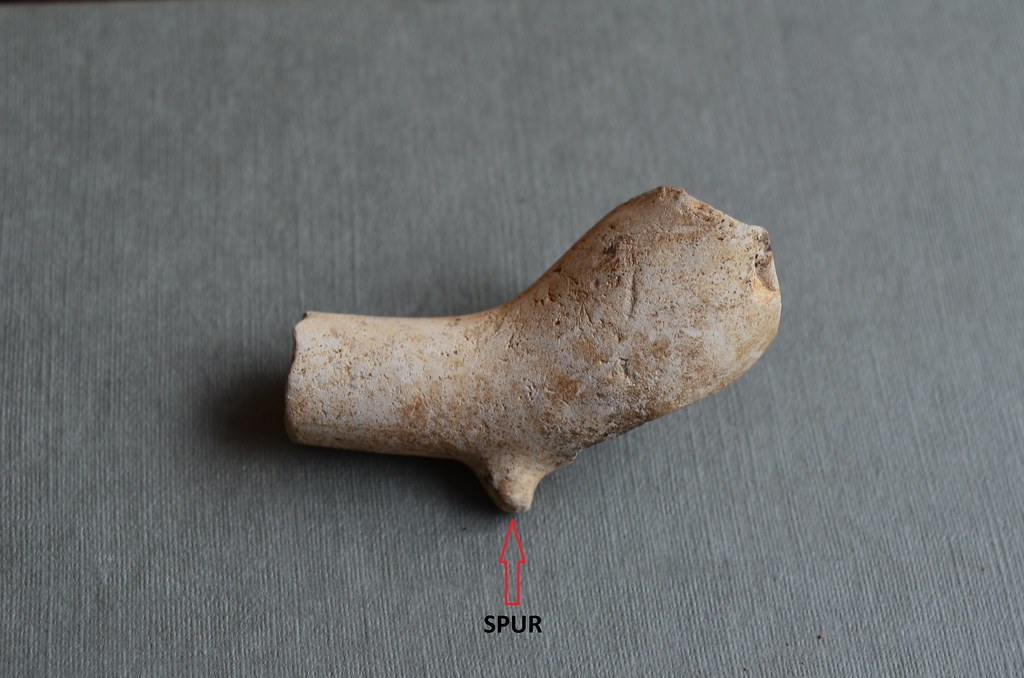
    The clay pipe bowl below is by far the oldest one, dating to the late 17th Century, c.1680. These clay pipes usually had small bowls, but as tobacco became more readily available and thus cheaper, the pipe bowls consequently got larger in later centuries. Note the 'spur' on this pipe bowl - this type of spur didn't appear on pipes until after the mid-17th century. Pipes prior to this had larger, flatter 'heels'.

    16643321154_fa5e23b473_b.jpg

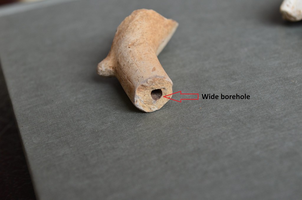
    Another diagnostic feature which helps distinguish early pipes from later ones (there's always the exception of course) is the diameter of the borehole in the stems. The diameter of the borehole on this early pipe bowl is quite wide compared to those on late 19th century pipes.

    16646181583_2270070d7b_b.jpg


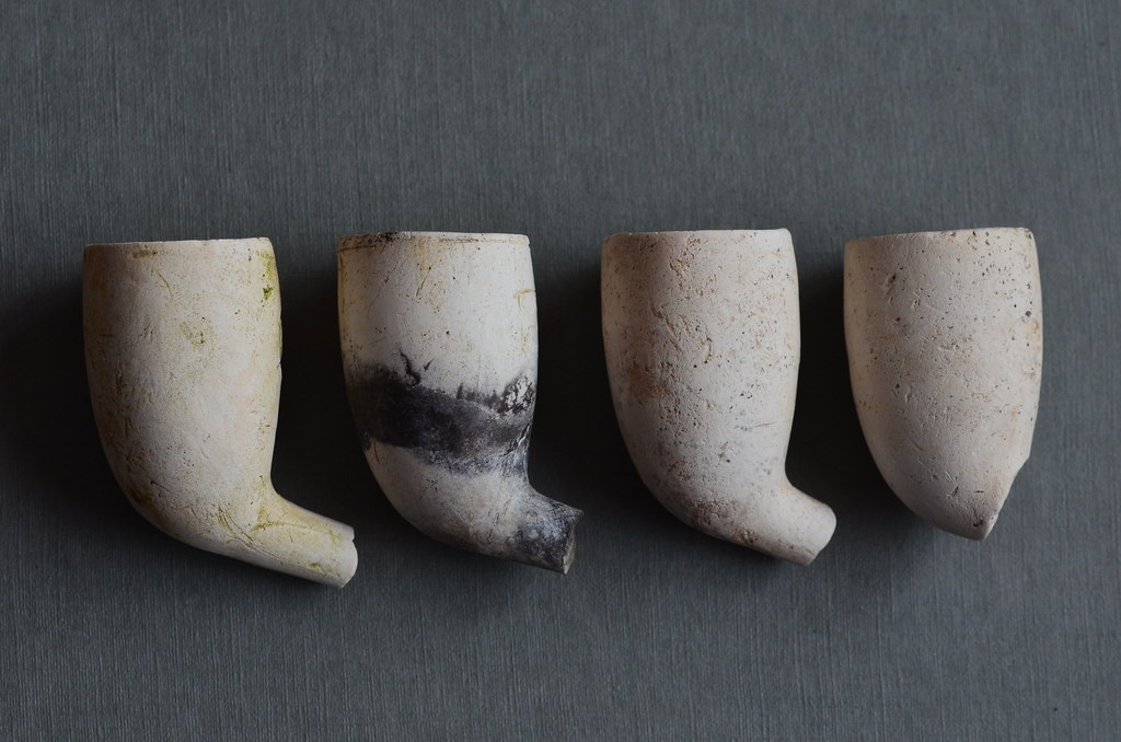
    The four pipe bowls below are distinctly Irish in shape, and date from circa 1860 to 1880. Irish clay tobacco pipes dating to this period tended to have quite large bowls which sat rather upright on the end of the stems. Note also how they lack 'heels' or 'spurs'.

    17078206360_3f8da9080b_b.jpg

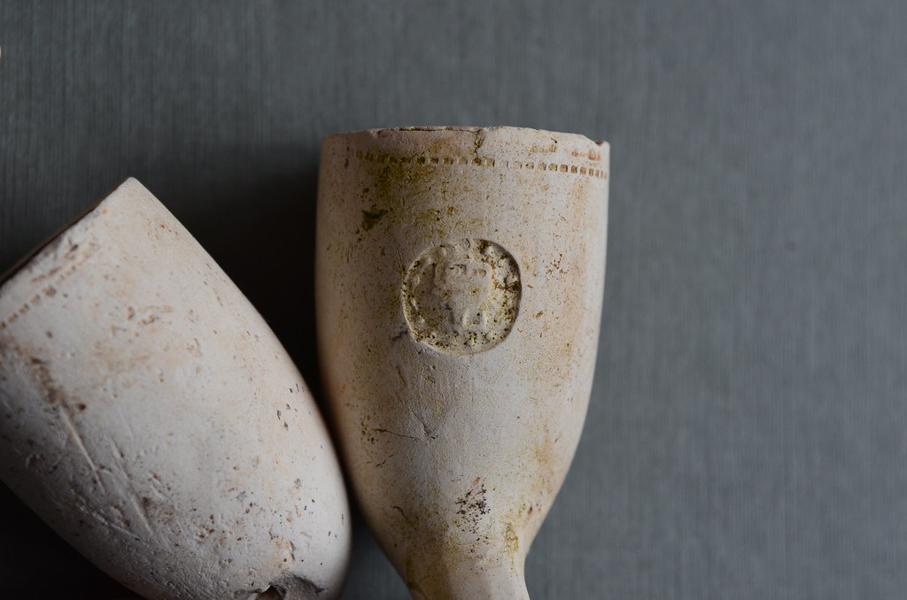
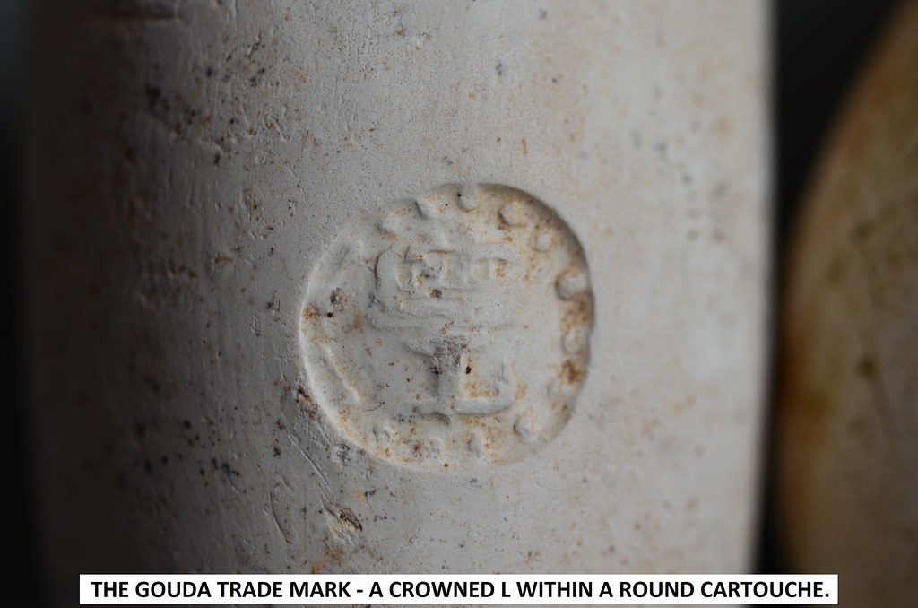
    All four of these bowls bear decoration or maker's marks. Three of them bear a round cartouche inset with a 'Crowned L', which was a famous trade mark from Gouda in the Netherlands. Gouda clay tobacco pipes were renowned for their superior quality and it was not uncommon for both Irish and English clay tobacco pipe makers to copy the motif in an attempt to boost their prestige and their sales!

    17239734306_8253fa95bb_b.jpg
    17266959625_832ec083b8_b.jpg

    Only one of the bowls in the group of four above bears a maker's mark. The name 'A. Mason / Waterford' sits within a rectangular cartouche on the side of the bowl. Despite exhaustive efforts, I've been unable to find a record for this maker. The Spring 2013 issue of Archaeology Ireland (Vol.27; No.1; Issue 103; 31-36), has an article which lists known clay tobacco pipe makers in Ireland; it is an article by Joe Norton and is entitled 'Pipe Dreams: A Directory of Clay Tobacco Pipe-Makers in Ireland'. I've checked with Wordwell (the publishers) and it seems they don't have a back issue of the Spring 2013 magazine. If by chance someone here should have that issue, would it be too forward of me to ask you to check this article to see if this clay tobacco pipe maker appears in that directory?!! I'd love the thought that this particular pipe bowl with maker's name is a hitherto unknown example, but know the chances are slim!

    17265654305_b1c1439bb9_b.jpg

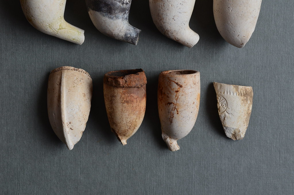
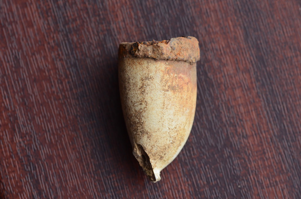
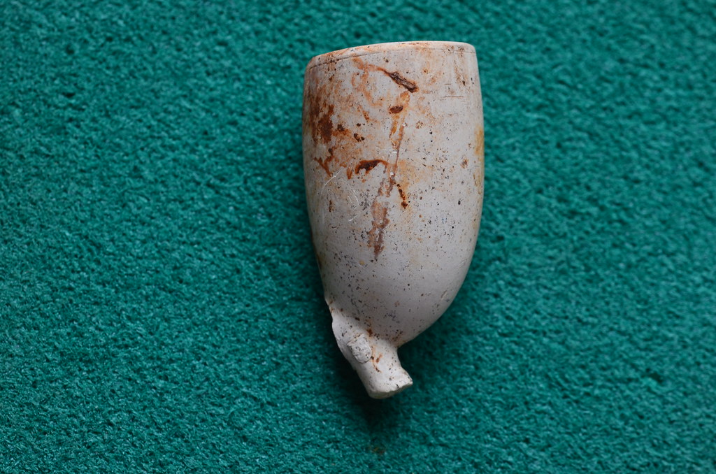
    The bowls and fragments below all date from the late 19th to early 20th century, circa 1890 - 1910. The two complete bowls in the centre are quite interesting. One has remnants of a metal lid still attached and the other has decoration in the form of a maker's mark/symbol on the heel and crests where the stem meets the bowl.

    17082134269_22ebe9d042_b.jpg

    This pipe bowl has the corroded remnants of a metal lid still attached to its rim:
    17267874191_4f5699e64b_b.jpg

    The bowl with decoration:

    17265213051_84acba2563_b.jpg
    17265739705_ec5662bdb6_b.jpg

    A close-up of the maker's symbol/mark on the heel, which looks like a stylised crown perhaps?:

    17265212671_aa6b3ae699_b.jpg
    16643348134_f6c1d04177_b.jpg

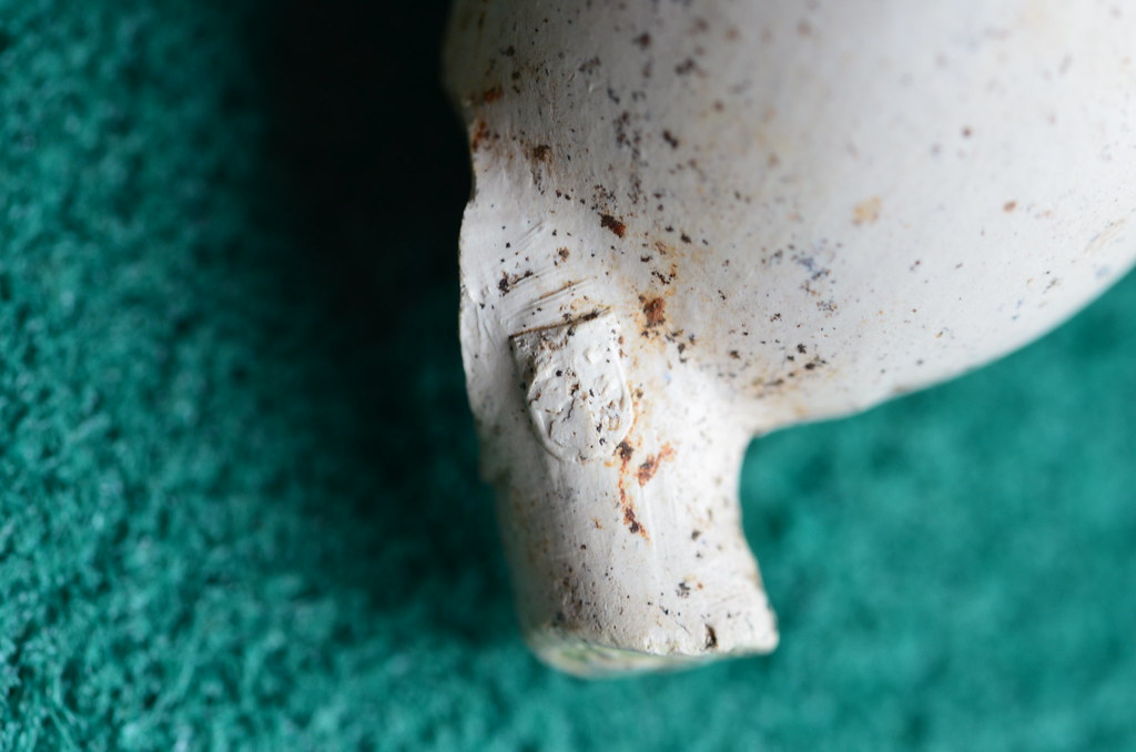
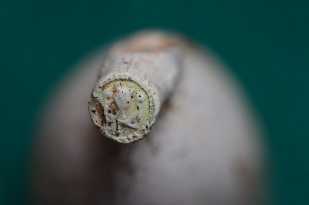
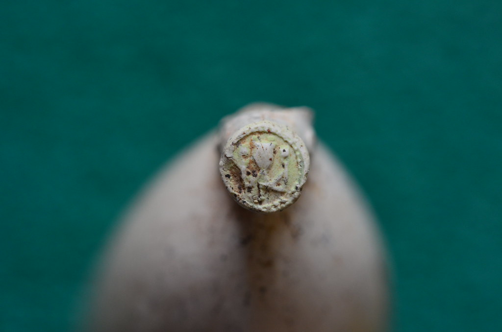
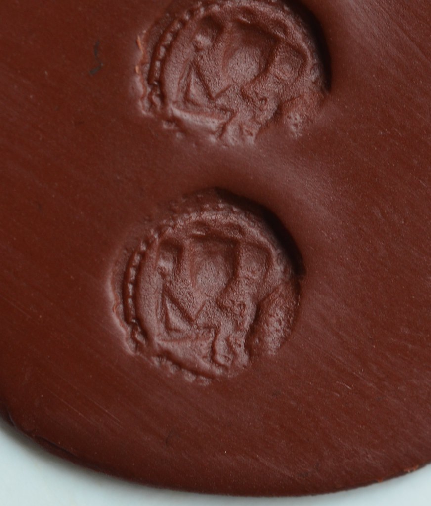
    An impression of the mark:

    16645569413_13b536be1c_b.jpg

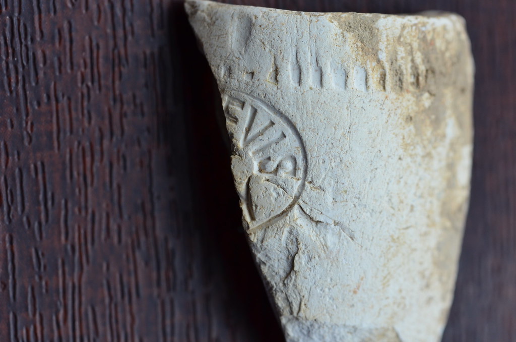
    The bowl fragment below bears a partial inscription/name with the letters ".....EVIS / .....Y" still visible:

    16645453403_0821a1abc0_b.jpg

    Following a rather lengthy search, I eventually found something that I thought would fit the bill; I found an image of a bowl with the inscription 'BEN NEVIS / CUTTY' upon it. Clay tobacco pipes with this inscription were very common in the latter part of the 19th Century, both here and in Scotland. There were two major manufacturers of this type of pipe - W.White of Glasgow and an Irish maker W.Curley based in Knockcroghery, Co.Roscommon.
    The maker's names were often imprinted on the stems. The lines of decoration around the rim of the fragment shown above was known as 'rouletting' and seems to have been a distinctly Irish invention, so it's very likely this pipe was made by W.Curley of Knockcroghery. Incidentally, the word 'cutty' comes from a practice whereby a labourer would deliberately shorten a clay pipe stem making it easier to hold in his mouth while working. Of course it didn't take long thereafter before a manufacturer would begin making pipes with shorter, thicker stems to suit their customers' needs.
    The short-stemmed 'BEN NEVIS' cutty would have been used by Irish émigré workers and navvies. Indeed, many have been found as far afield as Australia and the U.S. - a recent find is reported here:
    http://www.antarctica.gov.au/living-and-working/stations/macquarie-island/this-week-at-macquarie-island/2012/this-week-at-macquarie-island-3-august-2012/3

    How these clay pipes ended up in the plough soil can only be speculated upon and it may have been something as prosaic as farm labourers throwing away broken pipes when they were ploughing the soil or during harvest time. There was a tradition at wakes here in Ireland whereby a tray of tobacco filled pipes would have been passed around to the mourners; the 'dúidín' (the Irish word for a clay tobacco pipe) was kept until the mourners reached the graveside and when the ceremony had finished, the mourners would smoke the pipes and then discard them in or around the vicinity of the graveyard. Joe Norton coined the phrase 'pipe graveyards' to describe this tradition. Where am I going with this you may ask? Well, there sits at the centre of the finds' field a very old, walled-graveyard, and I've found gravestones with inscriptions dating back to as early as 1760. I love the notion that following a funeral a group of local men threw their pipes over the wall of the graveyard where they would get churned about in the plough soil for centuries until I happened upon them!


  • Registered Users Posts: 6,700 ✭✭✭Mountainsandh


    Interesting finds and story, thanks for sharing.
    I'm in co Waterford, will ask older friends if they know anything about Mason's pipe makers.

    edit : you might have seen it, there is a reference to an Alan Mason from Dromana co Waterford there.

    The Waterford County museum here in Dungarvan has a brilliant website, a quick search of the website yielded nothing, but maybe if you emailed them they might trace the Mason's family ? I wonder is this a profession that would be recorded in the census.
    Love that site, it's got a brilliant collection of photographs : http://www.waterfordmuseum.ie/exhibit/web


  • Closed Accounts Posts: 608 ✭✭✭Bonedigger


    Thanks Mountainsandh!
    It'll be great if someone has heard of Masons in Waterford.

    Edit: Fair play Mountainsandh! I did have a cursory look at the Waterford Museum website, but didn't see anything. I might just give them a ring though.
    Checking out the census is good thinking - I'll certainly give that a go too!
    I can't find Alan Mason on that other link you posted, but I'll keep looking.
    Thanks again.


  • Registered Users Posts: 772 ✭✭✭baaba maal


    Great post Bonedigger! Really great photos bring the whole thing to life. I found a Ben Nevis Cutty on a beach on the west coast a couple of years ago and so did a bit of research. Can't remember the source but it wasn't surprising to know that the pipes made their way particularly along the north and west coast as part of the local trade route between Scotland and Ireland.

    I also have a pipe with a crown above an 'L'- brilliant to know the meaning!

    The early pipe bowls have a lovely handworked quality and the thin walls are visually attractive but I imagine the later pipes were a marked improvement from a smoking perspective.

    You would be aware of it I'm sure but I love the idea (assuming it is true) that you can start dating burials in general from before and after the introduction of tobacco from the characteristic half-moon wearing on certain teeth from them being clamped permanently on the pipe stem!

    Ps- I checked, but I'm missing the spring 2013 AI, sorry.


  • Registered Users Posts: 6,700 ✭✭✭Mountainsandh


    Bonedigger it's in the section that says: "some deed memorials of interest".

    According to the book below, section on Villiers (Mason-Villiers Earl of Grandison)
    Alan Mason married the Countess of Grandison of Dromona, co Waterford, a Villiers family. The family presumably gave their name to the village of Villierstown, which sits right beside Dromanagh House (see also Dromanagh Bridge). Seemingly he was an M.P.
    Whether there's any sense in a well married, well off M.P. lending his name to clay pipes I will leave it up to you to decide :)

    You never know though, it could have been a fancy of aristocracy to have a pipe designed and named after you ?

    Or the A. Mason is a completely different person that there is no trace of.
    Also, dates don't really tally, as (if I understand the records right) Alan died 1800. He did have a daughter named Amelia, who kept Mason along with other names.
    Don't know if any of that is relevant at all, I find it interesting anyway, since I know the place mentioned.

    https://books.google.ie/books?id=X8UujEDqn9oC&pg=PA1058&lpg=PA1058&dq=Alan+Mason+Dromona+co+Waterford&source=bl&ots=5R_d6r9ijo&sig=bmpZPGJERumEjN5H7c0g_wIRc6Q&hl=en&sa=X&ei=kEA9VZ-GK4XdapGIgYgO&ved=0CDIQ6AEwAw#v=onepage&q=Alan%20Mason%20Dromona%20co%20Waterford&f=false


  • Closed Accounts Posts: 608 ✭✭✭Bonedigger


    baaba maal wrote: »
    Great post Bonedigger! Really great photos bring the whole thing to life. I found a Ben Nevis Cutty on a beach on the west coast a couple of years ago and so did a bit of research. Can't remember the source but it wasn't surprising to know that the pipes made their way particularly along the north and west coast as part of the local trade route between Scotland and Ireland.

    I also have a pipe with a crown above an 'L'- brilliant to know the meaning!

    The early pipe bowls have a lovely handworked quality and the thin walls are visually attractive but I imagine the later pipes were a marked improvement from a smoking perspective.

    You would be aware of it I'm sure but I love the idea (assuming it is true) that you can start dating burials in general from before and after the introduction of tobacco from the characteristic half-moon wearing on certain teeth from them being clamped permanently on the pipe stem!

    Ps- I checked, but I'm missing the spring 2013 AI, sorry.

    Thanks Baaba.
    Yeah, I've seen images of excavated skulls which have that distinctive wear on the front teeth - fascinating!
    The 'crowned L' pipes were obviously just as common as the 'Ben Nevis' cutties it seems.
    By the way, thanks for checking if you had the Spring 2013 Issue of 'Archaeology Ireland'. I used to buy the magazine religiously every quarter, but didn't buy this one - sure who'd want to read up about clay tobacco pipes anyway?!!!:rolleyes: Typical isn't it!

    Bonedigger it's in the section that says: "some deed memorials of interest".

    According to the book below, section on Villiers (Mason-Villiers Earl of Grandison)
    Alan Mason married the Countess of Grandison of Dromona, co Waterford, a Villiers family. The family presumably gave their name to the village of Villierstown, which sits right beside Dromanagh House (see also Dromanagh Bridge). Seemingly he was an M.P.
    Whether there's any sense in a well married, well off M.P. lending his name to clay pipes I will leave it up to you to decide :)

    You never know though, it could have been a fancy of aristocracy to have a pipe designed and named after you ?

    Or the A. Mason is a completely different person that there is no trace of.
    Also, dates don't really tally, as (if I understand the records right) Alan died 1800. He did have a daughter named Amelia, who kept Mason along with other names.
    Don't know if any of that is relevant at all, I find it interesting anyway, since I know the place mentioned.

    https://books.google.ie/books?id=X8UujEDqn9oC&pg=PA1058&lpg=PA1058&dq=Alan+Mason+Dromona+co+Waterford&source=bl&ots=5R_d6r9ijo&sig=bmpZPGJERumEjN5H7c0g_wIRc6Q&hl=en&sa=X&ei=kEA9VZ-GK4XdapGIgYgO&ved=0CDIQ6AEwAw#v=onepage&q=Alan%20Mason%20Dromona%20co%20Waterford&f=false

    I feel slightly guilty you're doing all this work for me M.!:o Thanks!
    I've in the meantime checked the census records for Waterford and can't seem to find anyone that fits the bill. I did find a Helena Mason in the 1911 census, apparently from Dromona, who is a housekeeper - so I'm sure she was related to the Masons you've mentioned above. I did check Griffith's Valuation and found an Arthur Mason who was residing/working at properties on the Quays in Waterford City in 1850 & 1851. This could be our man, but unfortunately there's no mention in the record of this man's occupation. I also found an obituary for a Mary Mason, dated 22nd June, 1865, who was the wife of the late Arthur Mason. So it seems Arthur passed away prior to 1865. The style of pipe with the maker's mark 'A. Mason' upon it would fall roughly into the 1860 to 1880 time frame, so it's not inconceivable Arthur was making this type of pipe in a small workshop along the Quays in the early 1860's prior to his death. Who knows?
    I'll send an email off to the Waterford Museum as you suggested and hopefully they'll come back with something.

    Thanks again guys!


  • Advertisement
  • Registered Users Posts: 6,700 ✭✭✭Mountainsandh


    No, thanks to you I am now reading loads and loads of interesting sources about my area, so don't feel guilty. I love researching such things.

    Except now I've been reading a good while, and I've got lots of other links to read, and it's going to kill me I can't read them all tonight !

    For example there's a thing about the linen industry in Villierstown, and I just read a really interesting Memoirs of Dromana(gh) document about the said Masons and Villiers, that was a great read.
    And I came across this http://snap.waterfordcoco.ie/collections/ejournals/100158/100158.pdf Waterford and South East Archeological Society ejournal, and there's something about the New Geneva that has me really intrigued, not to mention the "Material conditions of the Waterford churches" in 1615, and the burning of Wexford Chapels in 1798.

    Oh well, I'll just have to spread it out. :D

    edit : and that's the end of my OT posts.


Advertisement