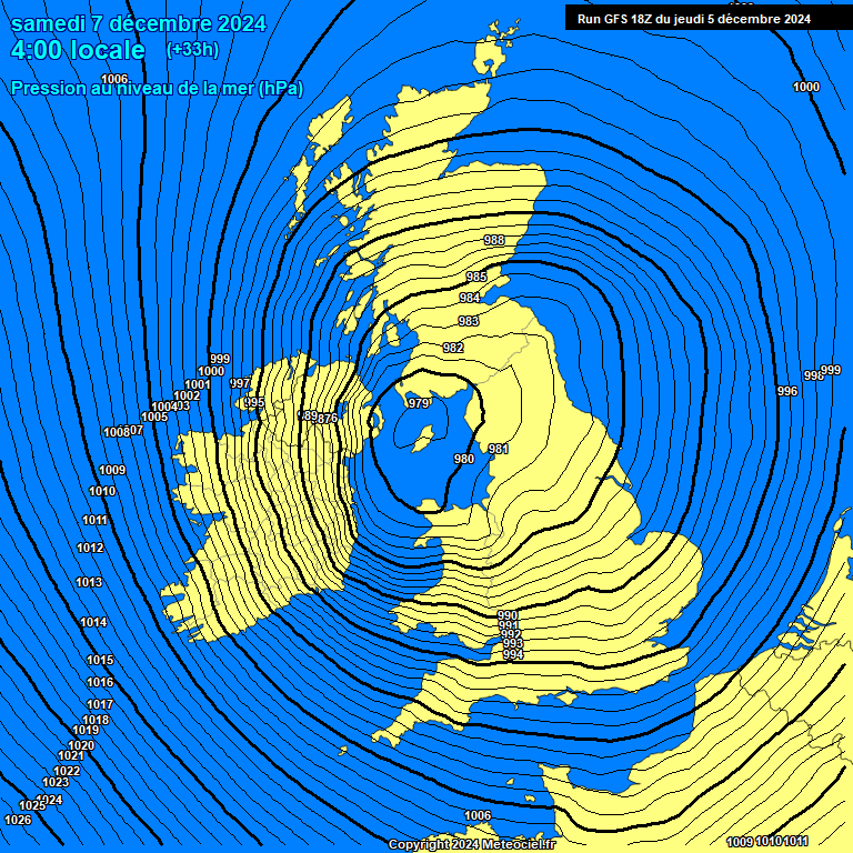
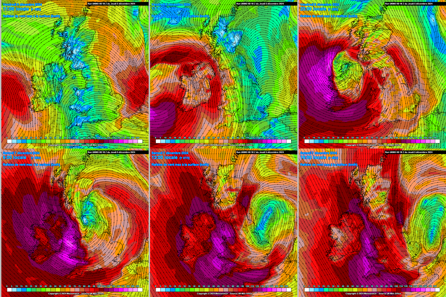
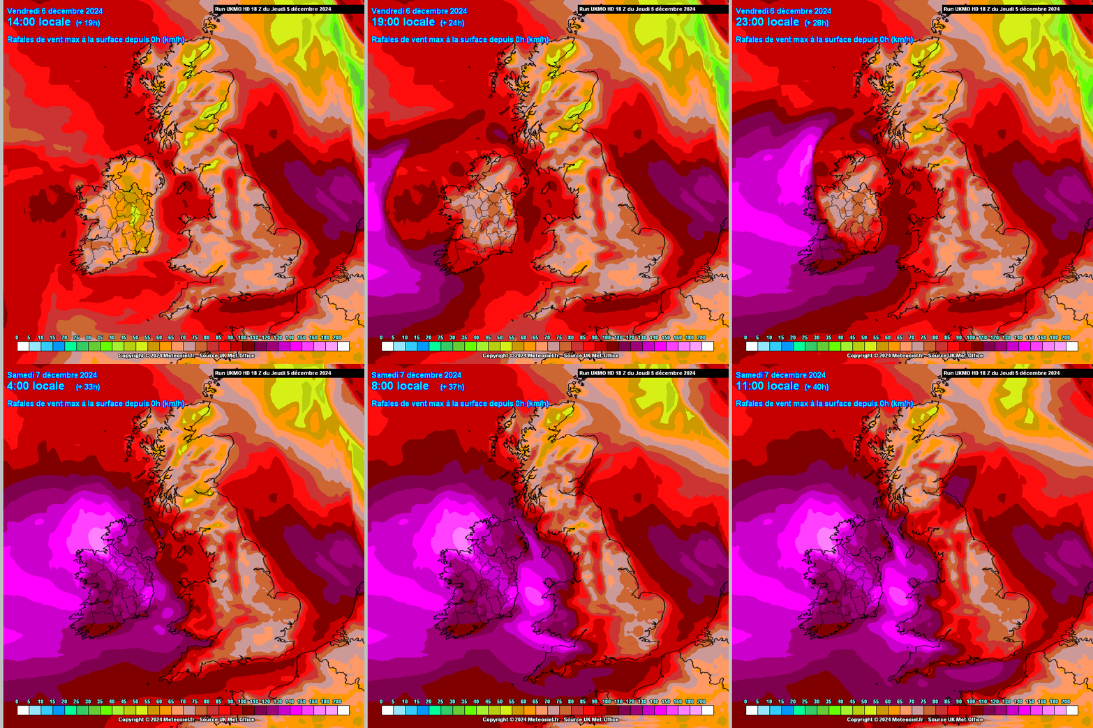
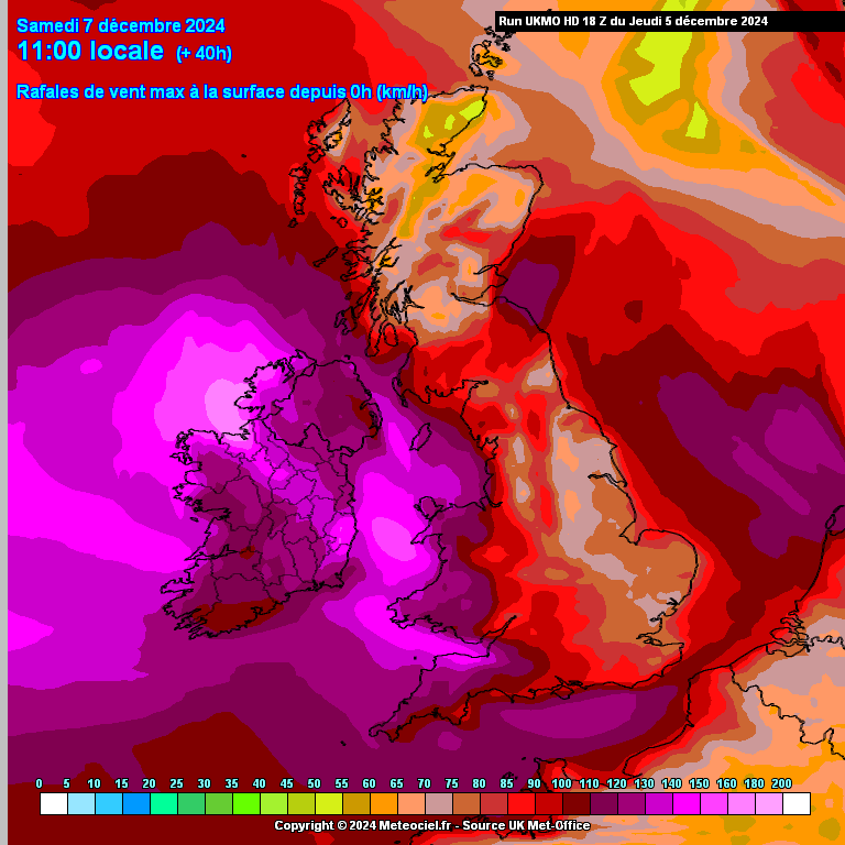
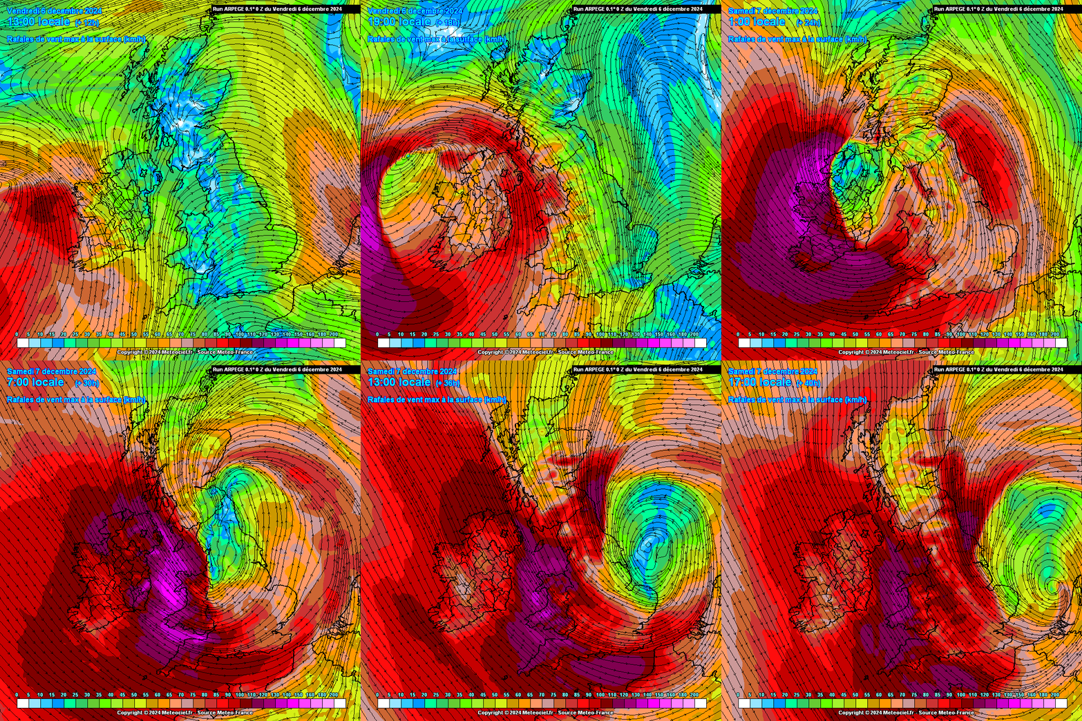
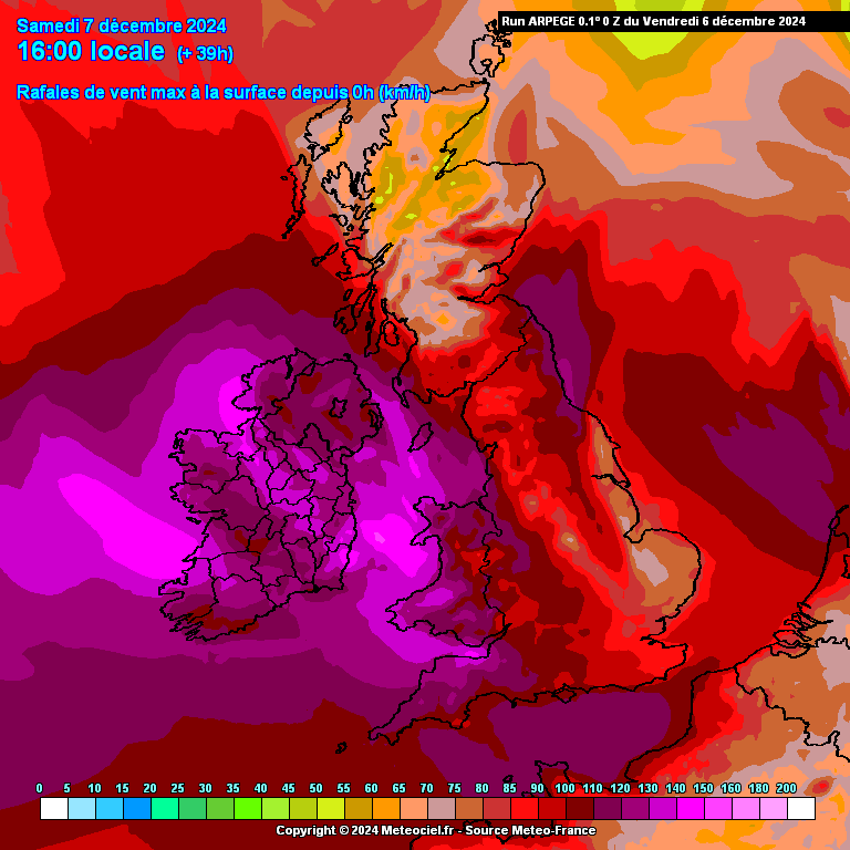
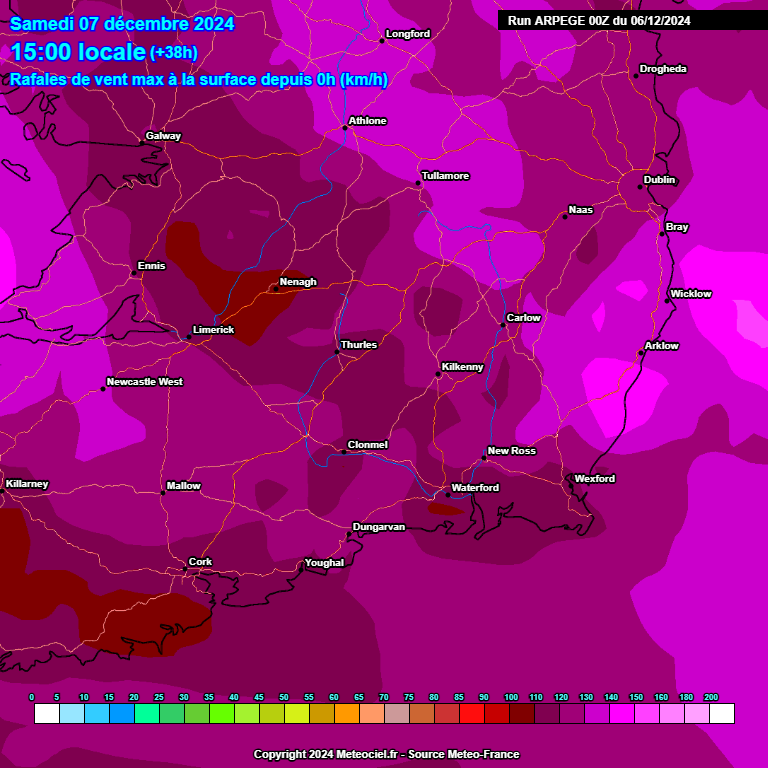
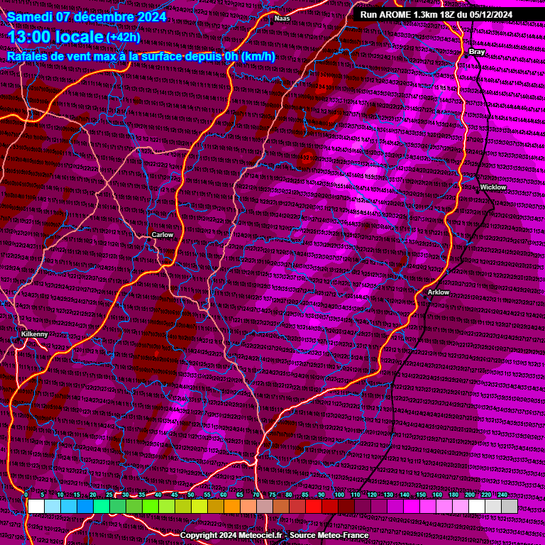
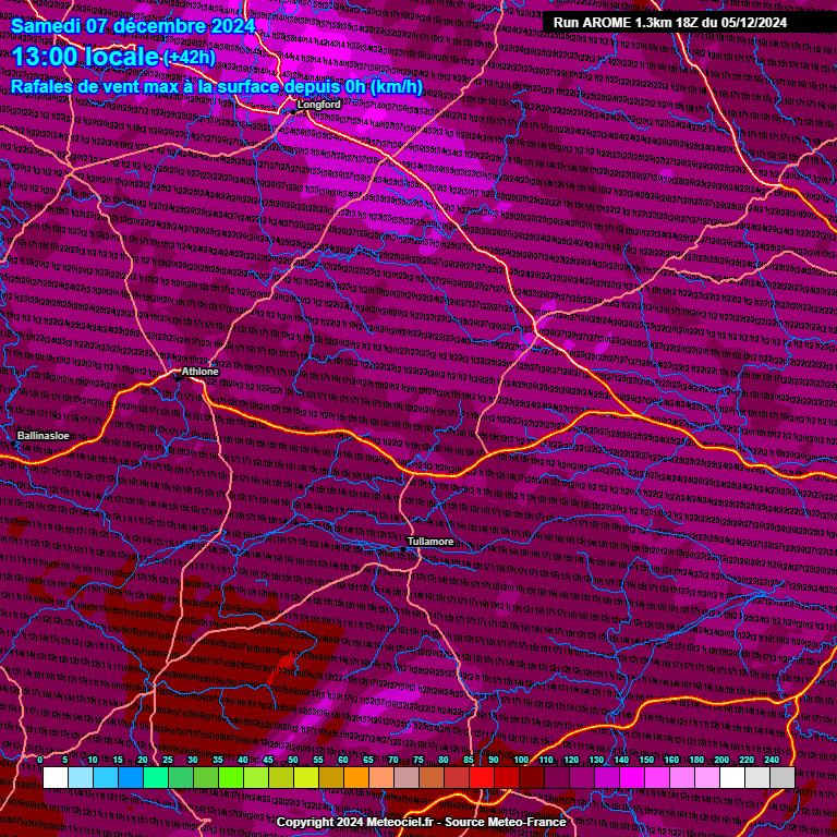
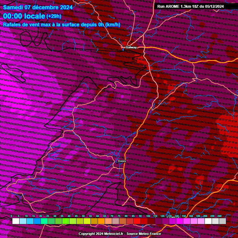
The main models have really ramped up the possibility of very windy or stormy weather with impactful conditions later Friday into Saturday. There is a big spread even at this stage in track , strength, duration and rainfall totals but I would be siding with the global models in the main at the moment , I don't think the Hi Res models are anywhere near this yet. The difficulty with this system is that it is arriving and deepening rapidly along a very fast Jet as it transits the country. Some models showing going through quickly but with a punch and others very strong and stalling the strong winds for a long duration from later Friday into Saturday.
Much to be resolved and needing a close watch and monitoring . Always a different type of storm when it is actually deepening and crossing the country, must have a look to see if there is a possibility of Low level Jet winds.
UKMO strongest as often is at the lead up and prone to moderating quite a bit over a few runs ( long duration ), GFS and GEM quite strong with yellows and orange warning levels currently quite widespread with long duration, ECM quick and very windy passage in a number of hours, yellow and orange perhaps, ACCESS G very strong widespread storm but a bit to go to steady down, ICON quite windy yellows and orange warnings, strongest winds not lasting as long as the GFS and GEM but longer lasting than the ECM.
Rainfall totals highest in Western and Northern counties, not overly high totals but quite wet being on top of the rain to fall over the coming days.
Colder weather set to follow later Fri into Sat, windy with blustery wintry showers of rain and sleet, hail could be fairly prominent due to the unstable airmass with thunderstorms possible especially along Atlantic coastal counties. Showers set to retreat to coastal counites during the day .Cold with a Windchill.




![Photo of [Deleted User]](https://w4.vanillicon.com/v2/44213d49e582143a64579da0f0d68488.svg)