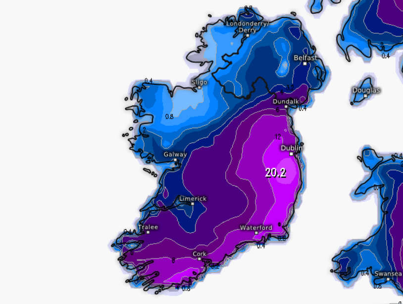
jdcv94 wrote: » ECMWF model accumulations for Saturday 6am. Inches.
Bio Mech wrote: » Looks like it’s been snowing most of the night in clonsilla. About ten inches lying on bins etc. Bit more on the ground as a lot is being blown off the bins etc. It’s drifted to about 30 inches at our back door as the wind blows into a corner there. I had to hop out a side window to pick up a large potted tree that blew over in th wind. My spring flowers have taken a pasting.
igCorcaigh wrote: » Just imagine. If the gulf stream stopped, this would be our normal weather.
pistolpetes11 wrote: » I’m dropping the neighbors around to the shops at the moment , ain’t the folks that didn’t spring the extra few quid for the 4wd versions of the fancy SUVs loving it now , In saying that , second time in 8years I’ve got really good use
RollieFingers wrote: » Hardly any snow in Greystones, delighted, hopefully miss it all again today, although it was just on the radio that there could be more rain than snow later so who know's!
FuzzyZoeller wrote: » Being snowing here on Naas all morning, so there is a big hole in that radar! If I was subscribing to the Netweather radar I would be well miffed!!
Artane2002 wrote: » Heavy snow and windy again in Dublin 5.
Reckless Abandonment wrote: » You should get first post on every page jealous southsider here
Originally Posted by M.T. CraniumAs the gradient tightens next six hours, this light to moderate sea effect snow will tend to get more concentrated into heavy bands and the pressure falls will turn the wind slightly northeast from Bray north, while it's likely that strong southeast winds will downslope off the Welsh highlands and rip across towards Wicklow. This will set up convergence of sea effect regimes and then the storm's snowfall arriving will converge with the streamers. This may lead to locally heavy banding by evening over the central east coast.




![Photo of [Deleted User]](https://w5.vanillicon.com/v2/5dc0c82bb5d5c9e7a358d7971a18240f.svg)