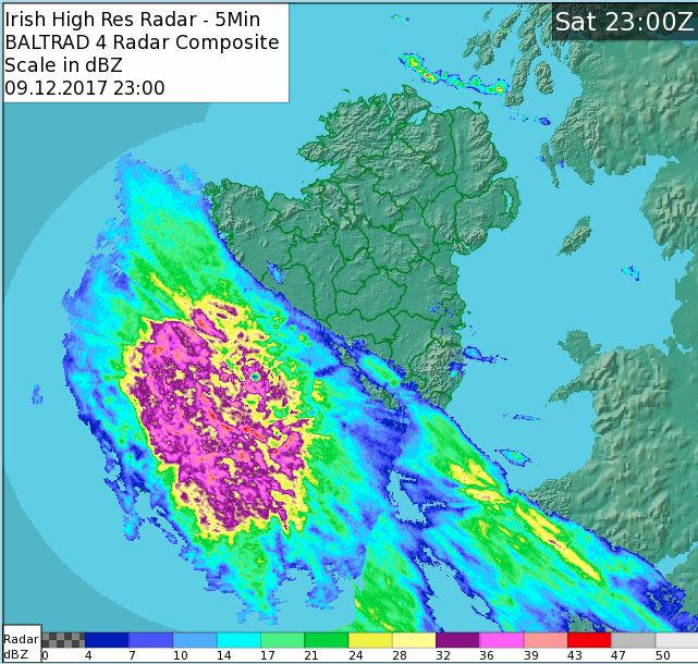
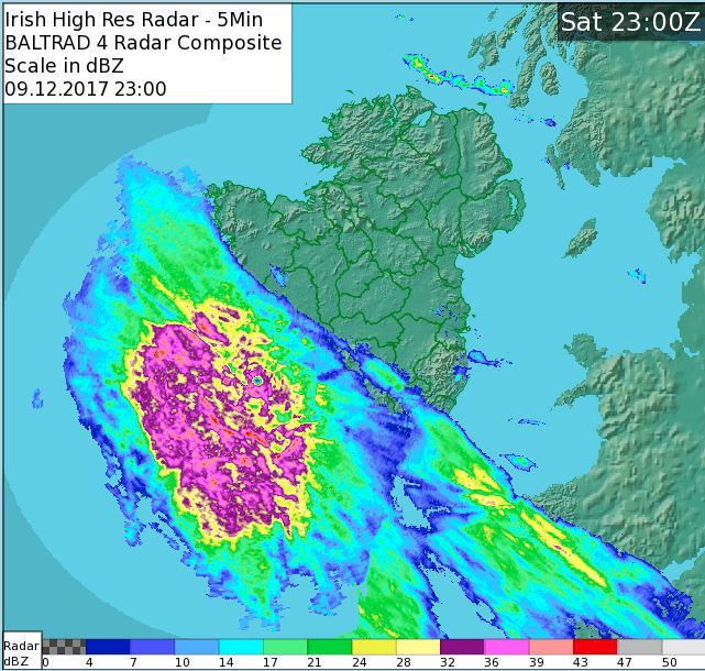
GhostyMcGhost wrote: » Sure sounds like it!
Oscar Bravo wrote: » that must of been some day in June 76! clear blue skies, fields cut, tar melting. nice records.
Oscar Bravo wrote: » 11pm reports Knock -1 Markree(sligo) -1 Ballyhaise -1 (Sherkin islands 9 degrees)
M.T. Cranium wrote: » Carlow, Laois, Kilkenny -- 10 to 20 cm, potential for 30 cm on higher ground Apologies if I overlooked your county
Speak Now wrote: » Does that weather station still exist. I know Met Eireann replaced with with Oak park. Got to Urban i think. Lashing in Waterford now 7c.
M.T. Cranium wrote: » Here are my best guesses county by county: Cork -- some northern parts 5 cm, south see Kerry Apologies if I overlooked your county
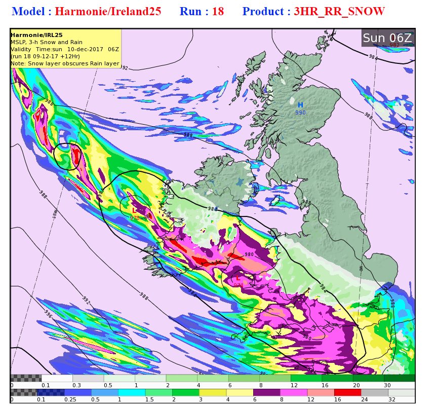
M.T. Cranium wrote: » The 18z Arpege shows a scenario in which rain that spreads over most of the eventual snowfall zone changes to snow hour by hour with the snow beginning to prevail over most central and inland southeast counties by 0600h, then the second low looks quite promisingly deep (976 mbs) and it may become the focus of some exceptionally heavy snowfalls further west than some might be expecting, like from Galway south and southeast to Limerick. That stage would come around mid-day Sunday with the rest of the snowfall zone in light to moderate snow, always edging further south. The main problem for Meath is being too far north rather than too mild, except along the coast it's both problems. If those can be overcome by some extension of the precip shield co-operating with a lack of inflow of Irish Sea surface layer warming, then Meath could see 5 cms. Here are my best guesses county by county: Galway and Roscommon -- 10-15 cm south, 5-10 cm north Mayo, Sligo and Leitrim -- 2-5 cm southern portions, trace to 2 cm north (most of Ulster will only get localized flurries outside the storm zone, southern boundaries could see 1-2 cm) Clare -- 5 to 10 cm except 2 to 5 cm southwest of Ennis Limerick -- 8 to 12 cm Kerry -- snow only on higher terrain Cork -- some northern parts 5 cm, south see Kerry Tipps -- 10 to 15 cm Waterford -- 5 to 10 cm on some northern hills, trace to 3 cm south Wexford -- 5 to 10 cm well inland, trace to 3 cm near coast Carlow, Laois, Kilkenny -- 10 to 20 cm, potential for 30 cm on higher ground Wicklow -- 10 to 20 cm west of higher ground, and on some east-facing slopes above 200m, trace to 3 cm coastal Kildare, Offaly, south Westmeath, southwest Meath, western co. Dublin -- 15 to 25 cm, risk of freezing rain mixing in Longford -- 5 to 10 cm (15 cm south possibly) Dublin -- wide variations from zero near shoreline to 10 cm on higher parts of city Meath -- gradual reduction from 20 cm southwest corner to 5 cm central to near zero coastal Louth -- likely to be outside snowfall zone but potentially could see 2-3 cm. Apologies if I overlooked your county






![Photo of [Deleted User]](https://wb.vanillicon.com/v2/bf554d628c1647d7f5d0146b8dea9789.svg)