whitebriar wrote: » Bring,your jim jams,2 charged phones,pleny diesel in the jeep,contact numbers for the nearest tractors etc Road onto croghan,is driveable to the field onto that mountain ,so you can get to about 550 metres or so there. The limited road up leinster,that's up to rte?
Problem123456 wrote: » Gfs looking good so far
patneve2 wrote: » test
Mr Cumulonimbus wrote: » 600+ viewers at the moment!
Deank wrote: » How do you see that info on a thread, I've been looking and can't seem to find that stats anywhere
Saganist wrote: » Just click into the main forum. ( i.e. Weather and the users are listed down the end of the page. )
channaigh wrote: » This bloody Rollercoaster is making me sick. Something is brewing though the birds are going mental the last two days so is the bloody cat lol
Musicman2000 wrote: » Sunday night into monday is looking very interesting, from the GS12z run, but take these charts with a pinch of salt:)
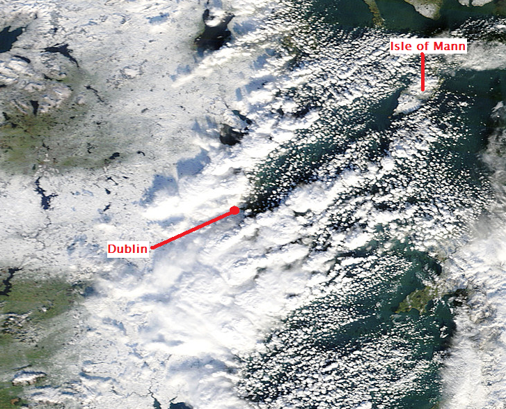
M.T. Cranium wrote: » Remember the Greenland Express? This will be more like the Scotland Slow Train stopping at all stations, but it has set out on its journey and the first stop is Ulster east, then Ulster west, then north Connacht then on to Dublin. Pack a lunch or two because it won't be going a lot faster than walking pace, but I do think it will call just about everywhere before it reaches Cork on Monday. Put into forecasting terms, this looks like being a gradual north to south replacement of mild Atlantic air now present by snow-chilled air masses seeping into the increasingly easterly circulation from a much colder Britain. The process starts late Friday night when tonight's frontal system stalls and gets pulled back into low pressure near Donegal. That should place most of Ulster in the colder variety of air masses near -1 C with sleet changing to snow, and there could be heavy falls on higher terrain. Expect 5-10 cm in places but 15-25 cm on some hills in the north by late Saturday. The seepage continues all day Saturday placing parts of inland Connacht and north Leinster on the cold side of a frontal boundary but also the air mass to the south of the boundary will lose its connection to the milder Atlantic source and will begin to modify itself, with temperatures sinking towards 2 C by late Saturday. That will turn showers in the milder air mass more wintry while snow is pushing south. By late Saturday night the frontal boundary will dissolve and all regions will be getting a roughly equal easterly feed of colder air that will now be modified only by crossing the Irish Sea. I would expect streamers to develop with mixed sleety showers near sea level and heavy snow potential in higher parts of Dublin and Wicklow. If any stronger low pressure does develop in the Atlantic and begins to interact with all of this, heavy snow could develop, but if not, the process will remain gradual with further outbreaks of light snow here and there across the central and eventually southern counties. The last district to fall to this process would probably be west Cork and coastal Kerry and that might take most of Monday to finish up, with the possibility that one or two really mild spots could stay above freezing throughout. I think that by mid-day Monday about 50-70 per cent of the country will have snow cover with an average depth of perhaps 2-4 cm and some fairly isolated falls of 10-30 cm are possible. The most likely places to see heavy snow would be hills in south Donegal and about halfway up the eastern slopes in Wicklow and south Dublin (around 350m might see the heaviest accumulations). I expect reports to be highly variable simply because there won't be strong organization taking place in this colder pattern. Overnight temperatures could eventually fall to about -7 C (would say -3 C for Dublin at some point mid-week) so today would be the day to get yourself some de-icing materials for both the vehicle (if you park outside, expect some hassles with frozen locks and iced over windscreens) and the pavement around your home.
heffoo wrote: » Score !!! Im 215mtr ish up the wicklow hills around 4to 5mins drive from lug
M.T. Cranium wrote: » I would expect streamers to develop with mixed sleety showers near sea level and heavy snow potential in higher parts of Dublin and Wicklow.
Mars rover wrote: » Hi, Like so many I have been reading this for ages but am only posting now It has been brilliant reading all the insights and learning so many bits about the weather and charts, ok I admit I only like the winter ones!!!! But a big thanks to everyone for looking at the charts and breaking it down into simple terms for the likes of me to understand. I talk about it so much now everyone in work thinks I am a full geek now. (Star Trek/Wars/Gate and the weather???:eek:) I am trying so hard not to get too excited about the chance of waking up to a dusting of white but my tummy hurts form the excitement of this rollercaoster. I will be up non stop tonight looking at lamp posts for even a hint of a flake!! Again big thanks for all the information it helps those who are weather dim like me learn a little bit more
M.T. Cranium wrote: » The most likely places to see heavy snow would be hills in south Donegal
leahyl wrote: » My mum thinks I'm half cracked at this stage :pac: It's all part of the fun!