Here we go again.
This is my third season and I think all of us have learned more each time.
Some links
http://www.inscc.utah.edu/~reichler/research/projects/TS/TS.shtmlhttp://www.cpc.ncep.noaa.gov/products/stratosphere/strat-trop/http://www.geo.fu-berlin.de/en/met/ag/strat/produkte/winterdiagnostics/index.htmlhttp://ds.data.jma.go.jp/tcc/tcc/products/clisys/STRAT/
Link to a previous thread that give loads of info
http://www.boards.ie/vbulletin/showthread.php?t=2055728070
I've a good feeling this time round that we will see a Strat Warming which will promote height rises to our North, giving a negative Arctic Oscillation and thus helping to create a major wintry outbreak.
Now whether that happens at all is another thing but we are seeing a negative QBO high up and in the New Year these should have transferred lower to help decrease the strength of the Polar Vortex.
Major winter stratospheric warmings preferentially occur during the easterly phase of the QBO, Holton and Tan (1980).
Easterly QBO high over equator (BLUE-Mean Easterly winds)
Jet Stream around 40n-50n

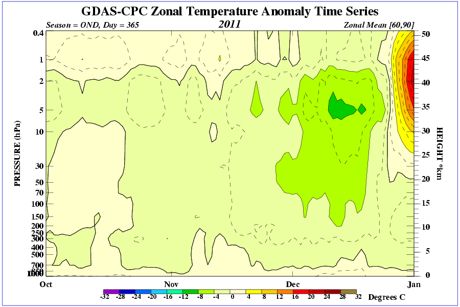
In the below image im looking to seeing any warming anomaly taking place.
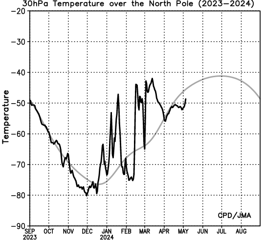
And Current condition at 30mb over the pole.
All input welcome.


