Well its now the time of year to be reintroducing this complicated subject.
Those of you that followed the previous record breaking warming will understand some of this.I too along with many others are only learning as we go.
On the last warming i learned alot from the people commenting on forum across the water and i have learned through them and my own research.
So i am in no means an expert on this matter.
I hope to gain much more knowledge through trial and error.
So with your help, hopefully we can come together and discuss any new findings that will someday create a better understanding of all that relates to this( ie teleconnections ).
Here's a good pdf file to kick start this and help others new to this subject
http://www.nwra.com/resumes/baldwin/pubs/Thompsonetal_2002.pdf
And heres a link to the previous stratospheric warming thread just to refresh the memories,
http://www.boards.ie/vbulletin/showthread.php?t=2055469856
Also this hugh link was my last post in above thread and i found it very informative.
http://climatechange1.wordpress.com/2009/03/08/the-atmosphere-dancing-in-the-solar-wind-el-nino-shows-his-face/
I,ve taken this from a post across the water because it also makes understanding a little easier.
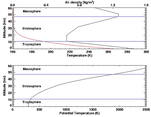
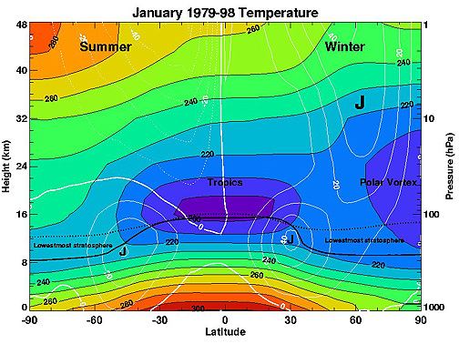
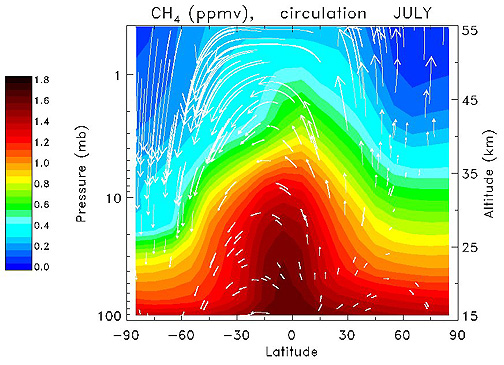
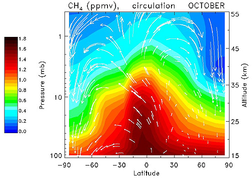
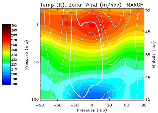
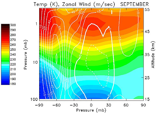
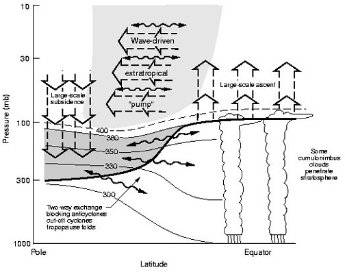
The stratosphere is the layer of the atmosphere situated between 10km and 50km above the earth. It is situated directly above the troposphere, the first layer of the atmosphere that is directly responsible for the weather that we receive. The boundary between the stratosphere and the troposphere is known as the tropopause. The air pressure ranges from around 100hPa at the lower levels to around 1hPa at the upper levels. The middle stratosphere is often considered to be around the 30hPa level.
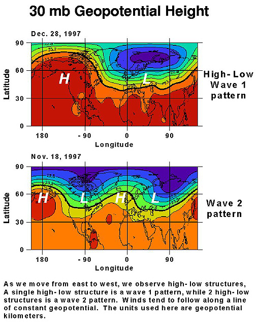
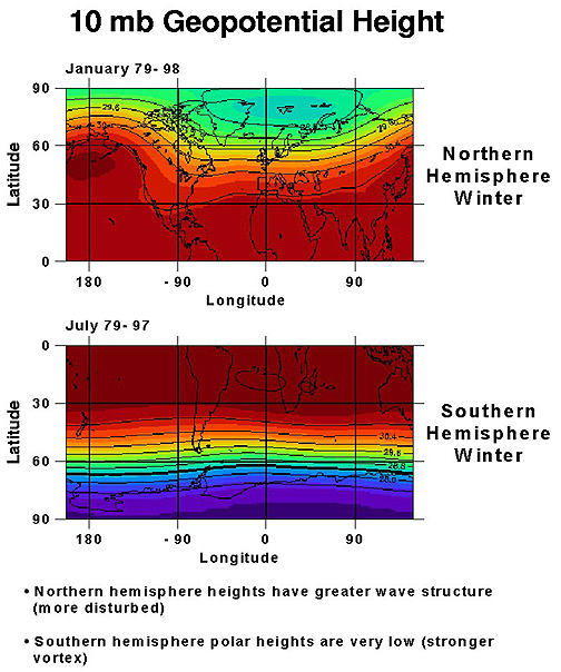
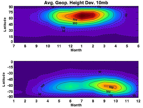
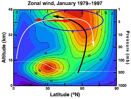
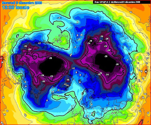
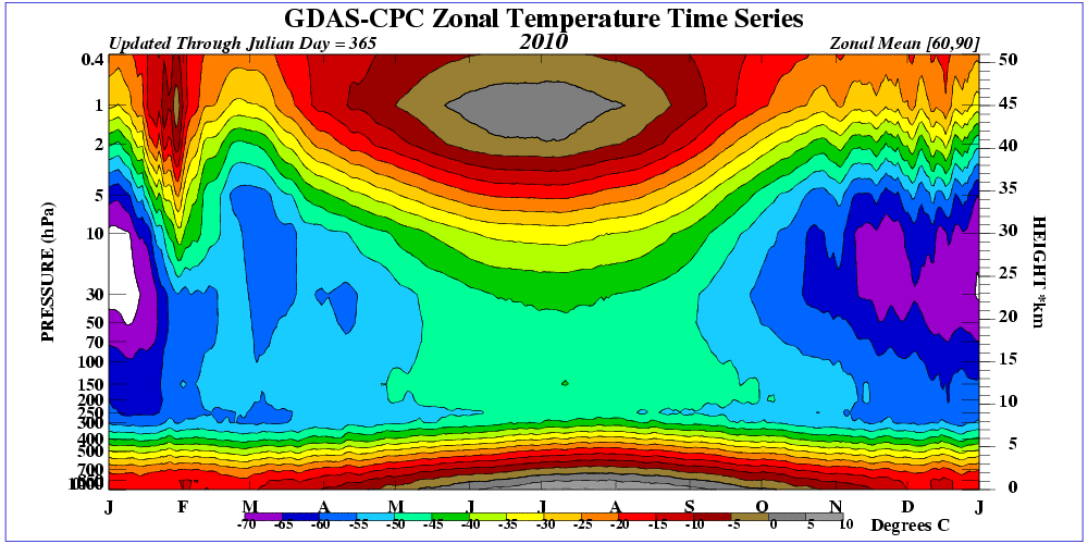
Every winter the stratosphere cools down dramatically as less solar UV radiation is absorbed by the ozone content in the stratosphere. The difference in the temperature between the North Pole and the latitudes further south creates a strong vortex – the wintertime stratospheric polar vortex. The colder the stratosphere, the stronger this vortex becomes. The stratospheric vortex has a strong relationship with the tropospheric vortex below. The stronger the stratospheric vortex, the stronger the tropospheric vortex becomes.
The strength and position of the tropospheric vortex influences the type of weather that we are likely to experience. A strong polar vortex is more likely to herald a positive AO with the resultant jet stream track bringing warmer wet southwesterly winds. A weaker polar vortex can contribute to a negative AO with the resultant mild wet weather tracking further south.

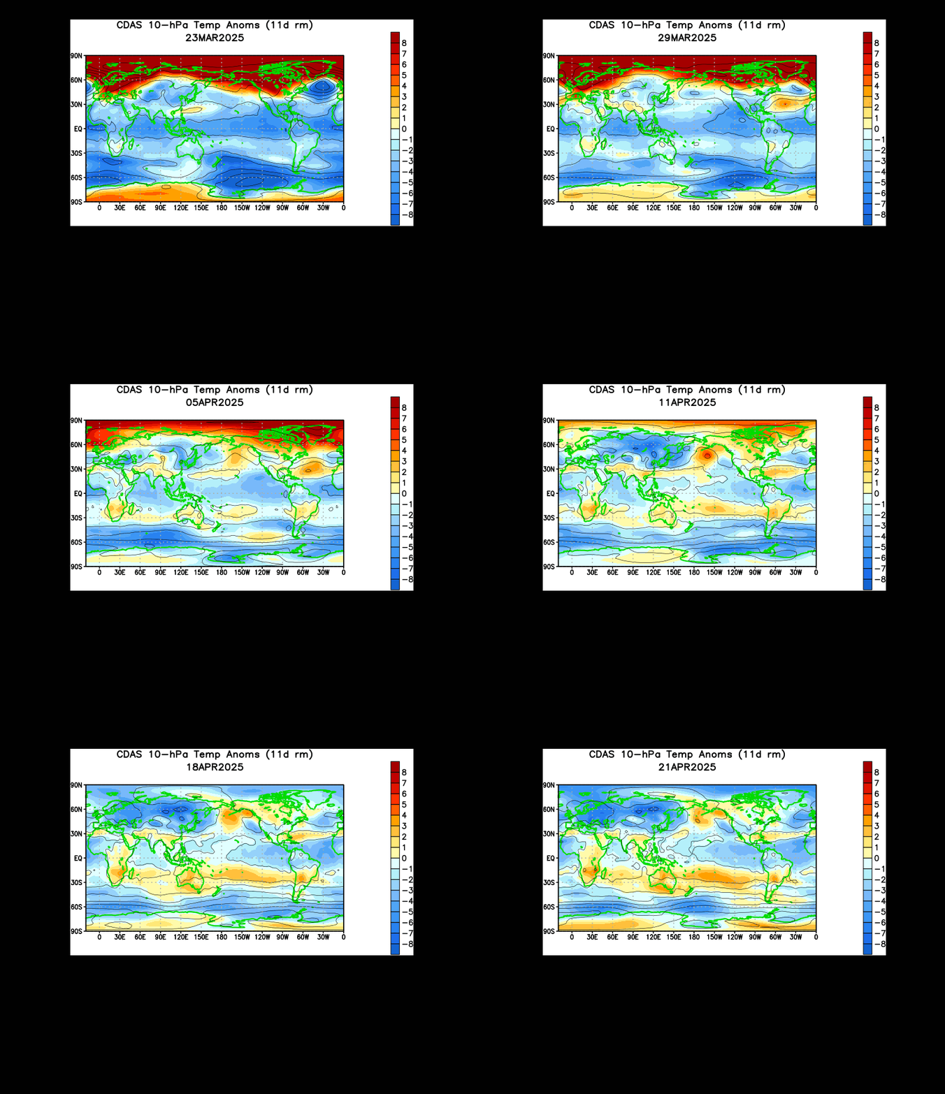
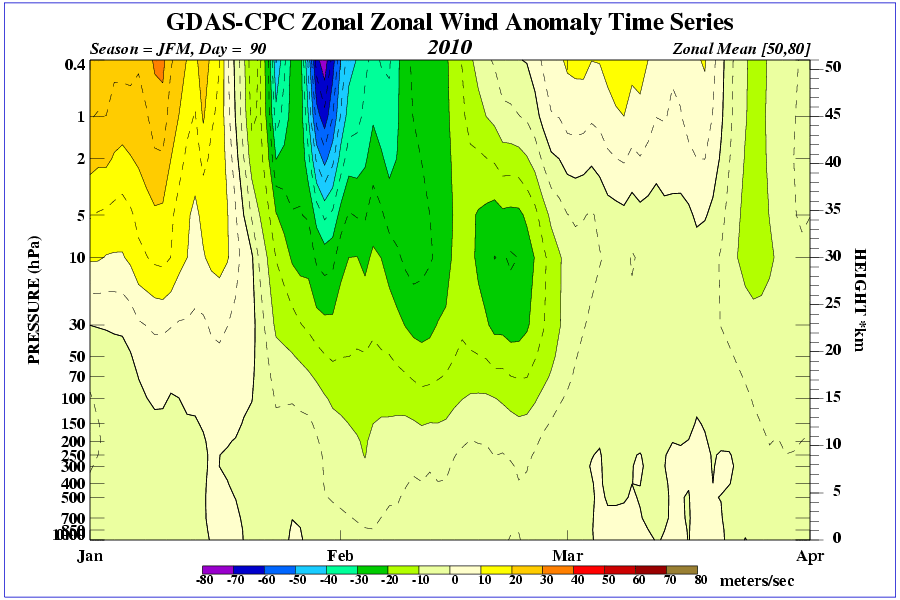
Occasionally the wintertime stratosphere can undergo dramatic warming events. These are called Sudden Stratospheric Warmings (SSWs) or Major Midwinter Warmings (MMWs). These are caused by large-scale planetary waves being deflected up into the stratosphere and towards the North Pole, often after a strong mountain torque event. These waves can seriously disrupt the stratospheric vortex, leading to a slowing or even reversal of the vortex. This can occur by the vortex being displaced off the pole – a displacement SSW, or by the vortex being split in two – a splitting SSW.
The effects of a SSW can be transmitted into the troposphere as the propagation of the SSW occurs and this can have a number of consequences. There is a higher incidence of northern blocking after SSW’s but (after last winter) we are all aware that not every SSW leads to northern blocking. Last January we experienced a record breaking splitting SSW that was responsible for the pulse of easterly snow some areas received in February (directly from the split) but it did not lead to any major northern blocking.
Here is a list of site that stratospheric information can be gained from:
CPC-
http://www.cpc.ncep....ere/strat-trop/
ECM (from 1/11 hopefully) -
http://strat-www.met...n/diagnostics?1
JMA -
http://ds.data.jma.g...x.html#monit_nh
NCEP data-
http://acdb-ext.gsfc...t/ann_data.html
The sudden stratospheric warming site -
http://www.appmath.c.../ssws/index.php
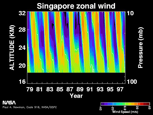
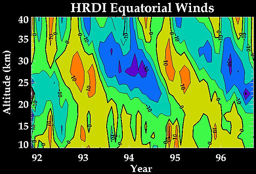
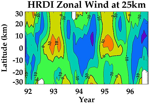
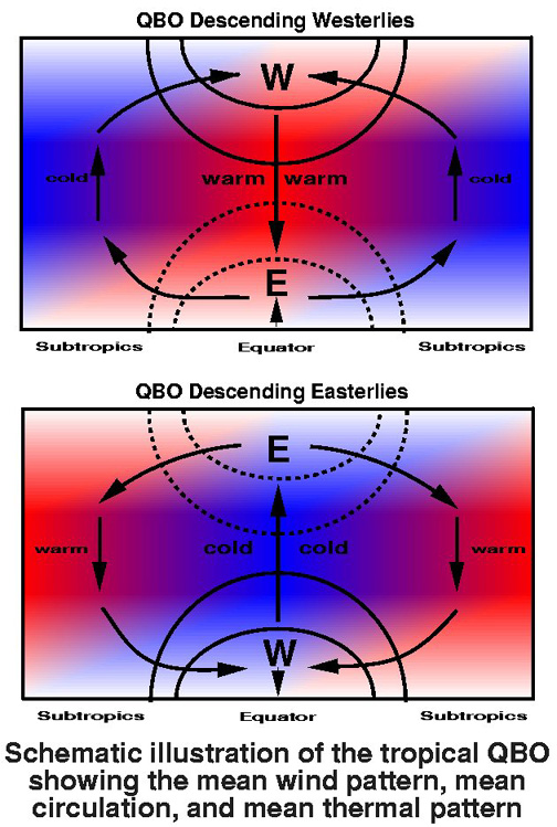
One major influence on the stratosphere is the Quasi-Biennial Oscillation (QBO). This is a tropical stratospheric wind or gravity pulse that has a rough two year cycle. This wind descends from the top of the stratosphere towards the troposphere in an either westerly or easterly direction. Presently we are in an easterly phase of this wind which is flowing in an opposite direction to the polar vortex flow. It has been shown that an easterly QBO will lead to warming of the stratosphere and therefore this is more favourable in reducing the polar vortex.
Please remember that the purpose of this thread is to monitor the state of the stratosphere and discuss the implications that this may have on the troposphere and how this may affect us. I politely request that any climate change discussion is kindly left outside of this thread. Many of the charts posted in this thread may be difficult to understand if you have not seen them before, so please do not hesitate to ask if you require an explanation and I will do my best to explain (if I can!).
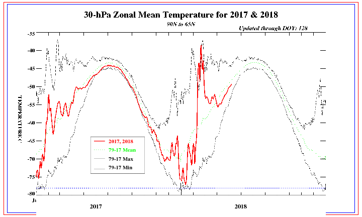
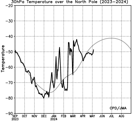
The cooling of the stratosphere this autumn so far has been far from uniform with some minor warmings along the way when comparing to last autumn. Presently we are slightly above average for this time of year and the stratospheric vortex is correspondingly below average with some slight negative zonal wind anomalies.
 http://www.cpc.ncep....re/30mb9065.gifhttp://www.cpc.ncep....OND_NH_2009.gif
So thats it for now,hoping to read all your thoughts on this so we can try get our heads around it once and for all.



![Photo of [Deleted User]](https://w0.vanillicon.com/v2/05bfdb0bc9f81b358ccf2f55186422bb.svg)







![Photo of [Deleted User]](https://wd.vanillicon.com/v2/d96cd5eb793ec44f833dd8d0bb2a52ac.svg)


