Snowbie wrote: There is nothing over Ireland at the mo some sporadic strikes down in the Celtic but Scotland havin a few.
darkman2 wrote: Yeah its hard to know whats gonna happen on the south coast especially when the upper level cloud (the stuff were interested in) starts coming in off the Irish sea. Have to wait and see. I think your guarenteed a storm or two today. Good sunny weather on sattelite coming into the south.
pp_me129 wrote: Good personally i love thunder agus lightning so i am keepin my fingers crossed will Keep ye up to date with weather in waterford without fancy gadgets and numbers all i do is look out the window
darkman2 wrote: Well I had two rumbles (the sharp loud type which is surely fork lightning) this morning. Some of it isnt showing up on seferics. The activity is definatley dying down for now but the Cape will kick in, in the afternoon and convection should really get going:D
darkman2 wrote: Its the best way:) Cheers
pp_me129 wrote: Cheers ? u from dublin by any chance
darkman2 wrote: Yup, the 'northside', well north of the northside....
pp_me129 wrote: See i can sniff ye out like a dog
darkman2 wrote: Its not hard I wouldnt think;) Anyway some strikes to the south of Ireland now and I can see the upper level clouds here now and they do look very threatening.
pp_me129 wrote: Yay Any graphs ? or watevea u want to call them
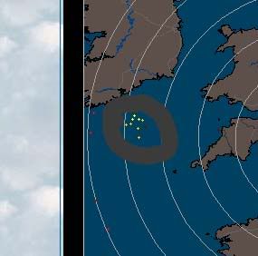
darkman2 wrote: Here is one:http://www.isleofwightweather.co.uk/live_storm_data.htm
pp_me129 wrote: Wooo its gettin *busie* out there now
pp_me129 wrote: too me looks like cork is going to get a battering ???
darkman2 wrote: I think you will find the strikes spread and intensify in very different ways. Looks can be decieving. The storm should be heading Northeast but could turn north at the last moment because the wind direction is about to change to a southeasterly.
pp_me129 wrote: well a sign of things to come no?
darkman2 wrote: Oh yeah:D
darkman2 wrote: It is really kicking off down there. That storm is now being tracked....
pp_me129 wrote: yea tracked?
Earthman wrote: That said I've seen livelier sferics down there than that come to nothing but distant rumbles when they head north... The lightning might be very high based.
darkman2 wrote: At the bottom of the link to the lightning detector;)
pp_me129 wrote: yea wateva
darkman2 wrote: It was being tracked, that was quick.......
Earthman wrote: theres nothing on the radar for the area where the IOW detector is showing all those strikes which leads me to think they are very high based and wont in themselves amount to much other than distant rubles. The stuff off NW France is a lot more active and interesting though and will come into play later on. Also the temps over SW England and wales are very high which is more than likely to trigger some late afternoon activity there which we could import. We *should* ( but arent guaranteed to ) also import some of the stuff off NW france at the moment. The stuff with the high based lightning could fire off properly later in this instability as it pushes further north over us.It needs local heat of the day to help this and thats not a certainty but its a highish probabliity. Overall assessment stays the same... "I would be surprised if we didnt see a fair scattering of thunderstorms in Ireland today and over the next few days"



![Photo of [Deleted User]](https://w1.vanillicon.com/v2/1f155c6d348e43968355b5338b185688.svg)
