It looks like a new scheme is on the way as Limerick County Council have started the procurement of consultants for the Foynes to Limerick Road Improvement Scheme.
I can't see anyone raising issue with award of the contract, it's too small a job and there was a very high probability outcome from even before the tender was issued. That high probability winner is unlikely to want to dirty their bib with the contracting authority by creating unnecessary problems in the unlikely event that they are not successful.
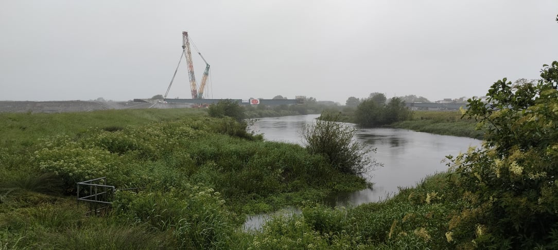
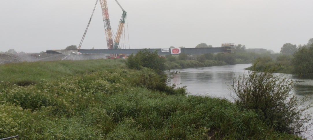
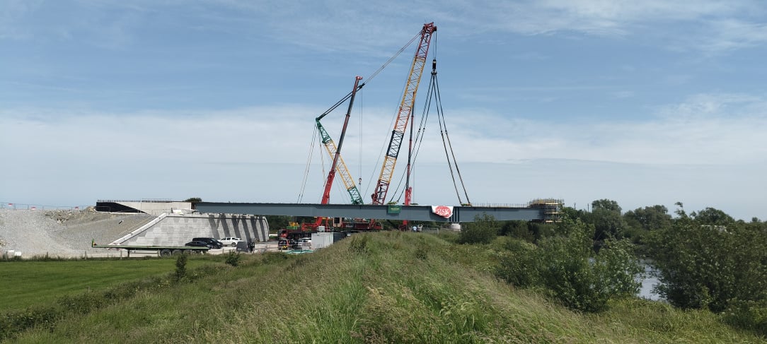
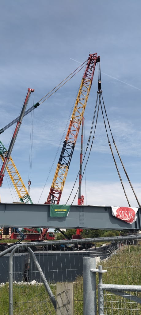
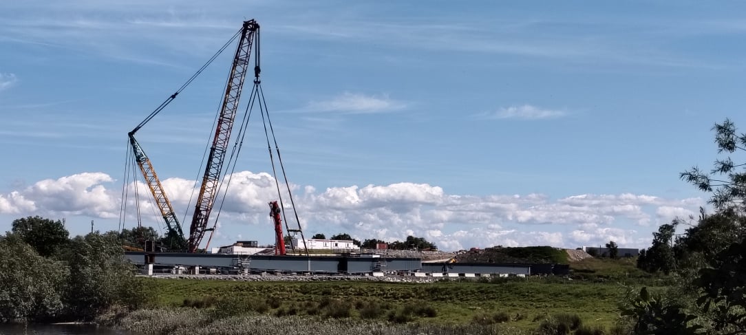
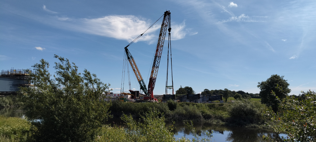
The first sections of the bypass bridge in Adare will hopefully be lifted in this week. The wind has been sent a strongly worded email to behave. Needs to be 7m/s. Fingers crossed.
https://www.linkedin.com/posts/andrew-oconnell-8763092a_gobriencranes-ocarrollcranes-sisk-ugcPost-7470195013117956098-UcTg/?utm_source=share&utm_medium=member_desktop&rcm=ACoAABavszUBJm7U3JyzZwXWr35n-d0c-B4YghE
A time lapse video of the lifting process would be great to see. Hopefully the next video put out might have that as it'd be very interesting to see how exactly it's done etc.
The first beam is in.
Word of the latest developments with the bridge has made it to the local press
https://www.irishexaminer.com/news/munster/arid-41860719.html
Ugh, can they get anything right? Even in a simple puff piece?
The beams will not be 'pile driven into place'. They'll simply be laid on the already in place foundations and welded together.
There aren't multiple cranes, there a single heavy lift crawler crane.
And there is not a 17.5km motorway form Rathkeale to Patrickswell along with a separate 7km Adare Bypass!
Oh and 94m above the river? WTF?
The article also says it will cut journey times by an hour to the South West. Thats a bit of an exaggeration! Maybe once in the blue moon during particularly chronic congestion would the delay ever be that long. 15 mins on average to maybe 30 mins on bank holiday weekends or evening rush hour is the more typical delay that will be eliminated.
https://vm.tiktok.com/ZNRc5u1fF/
andrewoconnell47 on tiktok with a drone shot of the first beam in place.
Anyone here with knowledge of construction know why the bridge span is so wide with it extending over land on both sides of the river banks rather than it just spanning the actual river? Thanks.
I would assume wider span is to allow for flooding. The river is tidal at this point so allows for flood conditions.
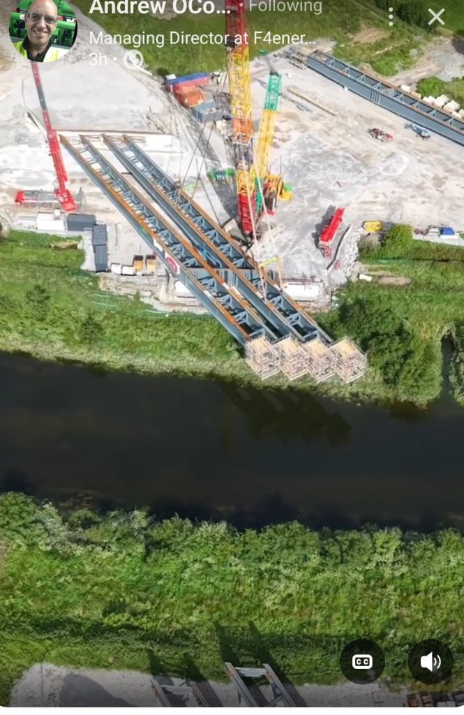
Good post showing two beams landed. Wind has not being kind to them this week.
https://www.linkedin.com/posts/andrew-oconnell-8763092a_sisk-were-very-unlucky-with-the-weather-this-ugcPost-7471221402260598785-KX53/?utm_source=share&utm_medium=member_desktop&rcm=ACoAAADJbmQBkTeWakrBW7bUAludKjlzED4s7mk
Screenshot from his latest LinkedIn the post. The second beam was placed this morning.
https://www.linkedin.com/posts/andrew-oconnell-8763092a_ugcPost-7471489552017334272-wC5Q/?utm_source=social_share_send&utm_medium=android_app&rcm=ACoAABavszUBJm7U3JyzZwXWr35n-d0c-B4YghE&utm_campaign=copy_link
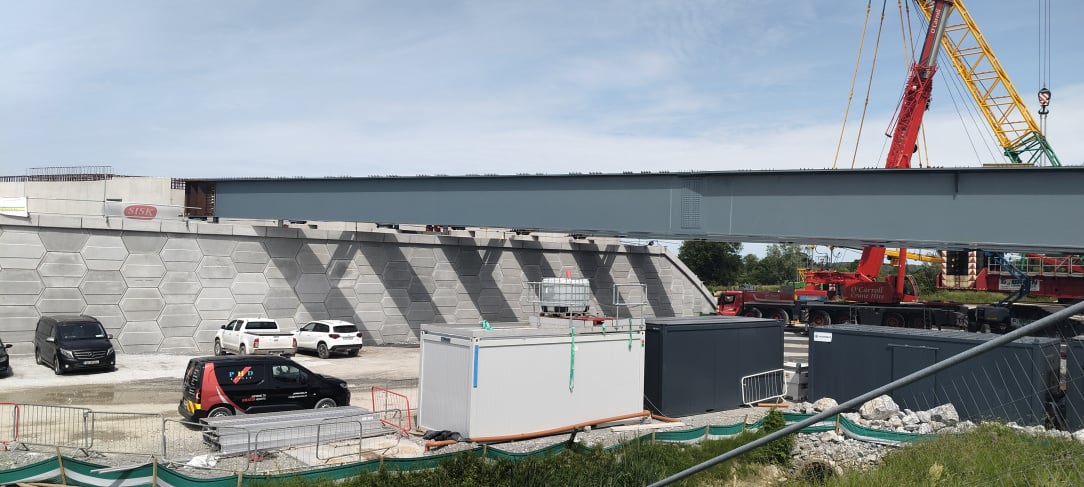
And the third one was lifted in this morning. As I don't have a drone you'll have to use the shadows as evidence 😉
The crane will now be dismantled and moved to the other side of the river to lift the rest into place.
Google maps have updated their satellite imagery very recently, You can see the beams for the bridge ready for lifting and some surfacing done.
..
A lot of tar on the road already. Very encouraging.
Out of interest, how will a learner driver drive from Adare Village to Limerick city once the M21 opens? The option to exit at the Croom junction no longer would be permissible for L drivers as that will form part of the new motorway, no?
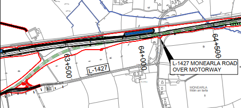
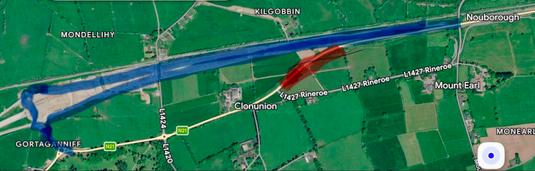
The old N21 (L1427) from Patrickswell to Adare will become the R526 and will link up to the existing N21 at the Lantern Lodge.
(The tender for the M21 missing link had signage referring to the existing N21 at the Adare junction becoming the R526)
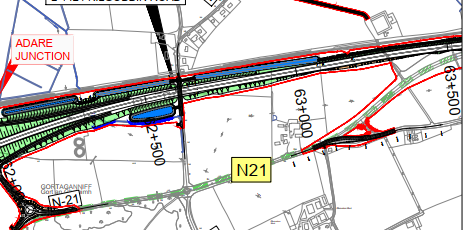
You can see here how the stub of the current N21 will be realigned to meet the L1427.
A picture speaks a thousand words.
I’m not sure if there’s any interventions required on the future R526 out of Patrickswell (outside the scope of the two M21 projects). It’s down to 60km/h and hasn’t been busy in 25 years now. The junction just below the Monearla overbridge might need to be reconfigured to give continuous priority along the R526 also in the event of a closure of the M21.
How will they handle updating the signposts for opening next year? For example I imagine any signpost in or just around Limerick City will need to be updated from Tralee N21 to Tralee M21 for opening next year or will that be taken care of after it opens? The signposts in Adare will need to change from green to white in Adare village once the M21 opens and the road through becomes the R526 instead of the N21.
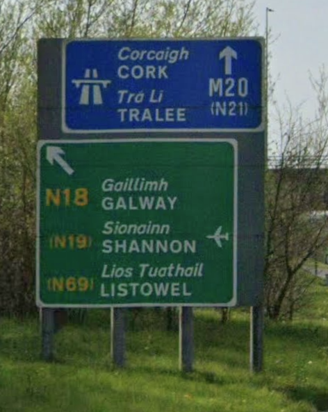
Existing signs for Tralee will most likely just be patched rather than replaced. Most references to N21 Tralee within Limerick itself are as bracketed route numbers “(N21) Tralee”, as you can’t get onto that route it without first travelling on N20. Even at the entry to M20, you’ve got signs like this (below) where a small patch to change "(N21)" to "(M21)" is all that’s needed:
Signs on the replaced N21 will be changed to white and R526 (if that's the new number), as normal.
Will Adare bypass be M21 from the start? Will they call it N21 for the first few months to allow drivers and vehicles, which are prohibited from motorways, to use the new road until after the RC? The qualified driver accompanying an L-driver could take over for the few minutes for the days when access to Adare will be restricted. Those L-drivers who are unaccompanied would probably not realise/care that they should not be on a motorway.
It's being built under motorway order so should be motorway from Day 1, especially since it'll now be linking directly into the M20 and the ridiculous clownshow that would've unfolded had the gap issue not been addressed will now not be forthcoming.
Unlikely seeing as the M20 (which L drivers already shouldn't be on) will seamlessly become the M21 and vice versa.
And the road will be opened by the end of June 27 at the latest (and probably much earlier) which is a number of months before the Ryder Cup begins.
L drivers will have to use alternative cross country routes for the week of the tournament.
The crane is setup on the Eastern side of the river ready for the next lift. They were painting the girder this morning, so it's unlikely to be today.
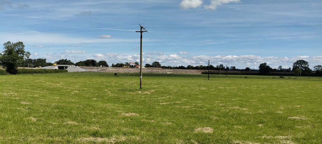
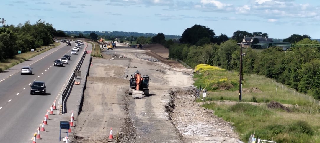
Great progress on the embankment between the Monearla bridge and the L1424 bridge.
I'm not sure if it comes across in the photos but they seem to be nearly done. It'll definitely be ready for the next contractor by August.
The westernmost part of the gap (west of L1424 overbridge to the Adare Bypass/Phase 1A contract start) has had a culvert to be installed (which is done) which explains why that section is last to be handed over to the contract.
Now that traffic will be down for the next 2 months with schools off hopefully they'll soon commence hacking away at the existing N21 and diverting the alignment onto the new M21 alignment in the above picture.
The sheer width of the N21 along here will make this easier given the amount of room they have to shift lanes to the south.
Looking at this I wonder might the intention be to use the eastern dumbbell junction as a temporary partially opened left out left in junction and reconnect traffic with the new roundabout to the south? This will allow the exiting N21 route to be partially integrated into the new road layout and then following this the second lanes, the rest of the junction and obviously the rest of the motorway heading west will be opened in phases after that.
As shown, albeit very crudely, in the image attached below.
Can anyone make an educated guess as to when the full dual carriageway to Foynes is completed, whether it will be quicker to use that route to Tralee ( continuing on via Tarbert and Listowel bypass) or will it still be quicker to continue to endure Newcastlewest and Abbeyfeale (until their respective bypasses are completed)?
As the N21 alignment is better than the N69, my guess is you continue to use the N21. Unless you’re going to be passing through those N21 towns at rush-hour.