As suggested in other thread, starting new thread, to continue discussion, and reduce the issue of 'Vanilla Tremble' (…another great new Boards feature!!!).
After event, will merge threads.
I reckon you could see a covering after this evening and tonight. A lot of showers heading your direction later. The conditions required for snowfall will be marginal but better than they are now
Excellent post. Thanks for the detailed explanation.
This has been a very notable snow event.
did you not Read my post in reply to you this morning and can I ask how is it you haven’t a clue about weather science having been on this forum so long?
Let’s educate you again slowly
Current air mass from north is a modified artic maratime it’s just not cold enough to mitigate marine layer air
2010 and 2018 was Artic continental air source from a much much colder place and unlike polar maratime travelled mostly over land on it’s journey here
It then traversed a warmer North Sea and Irish sea which was long enough for it to fetch moisture for big showers but short enough to have not enough effect on the temperature of the air from cloud to sea such that the precipitation stayed as snow
It’s also obviously why biggest snowfalls/chaos in that scenario was in the East
We had 10 foot drifts in Arklow in 2018 and 2010 as had many Eastern areas and snow on the ground for a whole month
This spell has seen a foot of snow in some places which is amazing and beautiful but won’t even last a week and absolutely no where near as extreme as the worst affected highly populated Eastern areas snowed in by the 2010 & 2018 episodes
During Storm Emma, I had to use a bulldozer to gain access to the milking parlour before I could milk my cows,the cows were peeping out over a 10 foot drifts,my cattle crush disappeared and shed roofs collapsed under the weight of the stuff
This is 2kms from Arklow and the Irish Sea
Snowing in west Waterford. A very slight thaw earlier. The roads are treacherous, can only imagine what they'll be like when the big freeze sets in.
Looking at daytime and nighttime temps for the coming week, the severity of the cold is certainly diluated from what it was showing even yesterday. My own location is expected to reach 3-4c tonight before falling by daybreak.
just as an aside, I know a farmer on the old head of Kinsale peninsula and they actually had 6 and 7 foot drifts from the streamers leading up to storm Emma, and that’s a place that never gets snow being a peninsula sticking out of our southern coastline. The angle of wind just perfectly mirrored the shape of our southern coast so every shower fell on them.
very cool
have you a link to where you got these?
No prob. Here you go
brilliant
a link to yesterdays satellite view 😂
Stunning! 😋
Some photos from this morning. One hour of blizzard from 10.50 till 11.50. East Mayo 143m asl. Sunny and beautiful now with slushy roads. Internet was coming in and out all morning hence the delay in posting.
Few more showers around now hopefully a few can make it to me inland, 2c temp -2c dp
flag at half mast 🫡
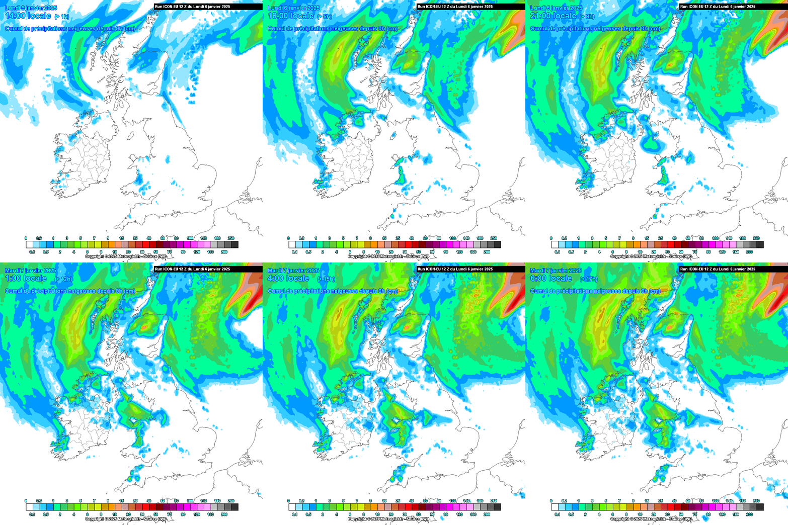
'Snow-starved' Kerry, even down to sea level, and SW Clare may see a dusting of snow by tonight based on the latest ICON model output. Elsewhere, small accumulations are likely in parts of the northwest and into Leinster if the showers progress further south as modelled.
As a result of turning into my driveway (slowly) on snow and the jeep taking off on me. Hit the pier not too hard I thought.!
No shower activity since the 2 hours of snow this morning. Less thawing going on now. Hopefully we get a bit of a freeze before the next shower train comes this evening
That's a sickener 😶
I see the FI thred has some mentions of a reload on the coming weeks, any update lads ? Especially for the snow starved East Cavan, Meath amd Louth folk
That was some tip!
For fear of derailing this thread, here is the most visual, briefest way of explaining the potential. It becomes colder by the end of the last GEFS. Note the 32 perturbations for upper air temperatures. Nothing severe or disruptive is signalled at this point. No sign of a 'multi-hazard weather event'…..
Just started snowing heavily here in Letterkenny 154m
Nasty but would have been worse if it was a brand new 251😉.
Can you please let me know where you get that table on Meteociel? Thanks
yes,I meant to mention that too
The exact same scenario as the east as that air blowing into Kinsale was the exact same continental air mass
It’s rare as hen’s teeth to have the coincidence of a flow from the continent indirectly returning to the south coast like that ,whereas it’s a given in the east in the direct path of such a flow
Here you go. Location chosen is Midlands
To pick your own area (pending it features in the cutaway remains of Ireland available, click on the map
Not seeing the commencement of a 1947 in there anyhow.
Clouds actually building up again now. More snow on the way, hopefully.
The UKMO long range isn't that inspiring- although if we get a cold high out of it that wouldn't be so bad. I just really hope we don't get a repeat of what we had in December
In fairness, the UKMO long range gave few hints of the current spell 2-3 weeks out. The NAO heading back to neutral territory after mid month is ominous, but let's just see what happens. That high is going to be around like a bad smell for the bones of 7-10 days. I am beginning to think Friday morning could be troublesome for parts of the country.