Hi folks,
This is probably deserving of it's own thread at this point.
1st Janurary hazards:
- Snow (generally 1 - 5cm, higher on hills/mountains)
- Ice
2nd January - 8th January:
- Cold weather
- Frost and Ice
- Snow showers later in the period
Possible land warnings in the period:
Cold Weather/Low Temperature - Yellow
Snow and/or Ice - Yellow/Orange
We have two interesting things to watch from Wednesday.
(I'm not flooding the OP with different model runs, I'm sticking with GFS)
January 1st
Starting with New Year's Day a weather system will be moving in off the Atlantic and the northern side of this will be hitting a much colder airmass moving down from the Arctic. There will be plenty of moisture with the developing system as it moves close to or over Ireland and as the frontal zones meet the cold air the precipitation turns to snow firstly on the northern side of the system but on the western side also later on.
Current risk areas for 1 - 5cm of snow at low levels:
- Ulster
- Connaught
- North Munster
- Leinster
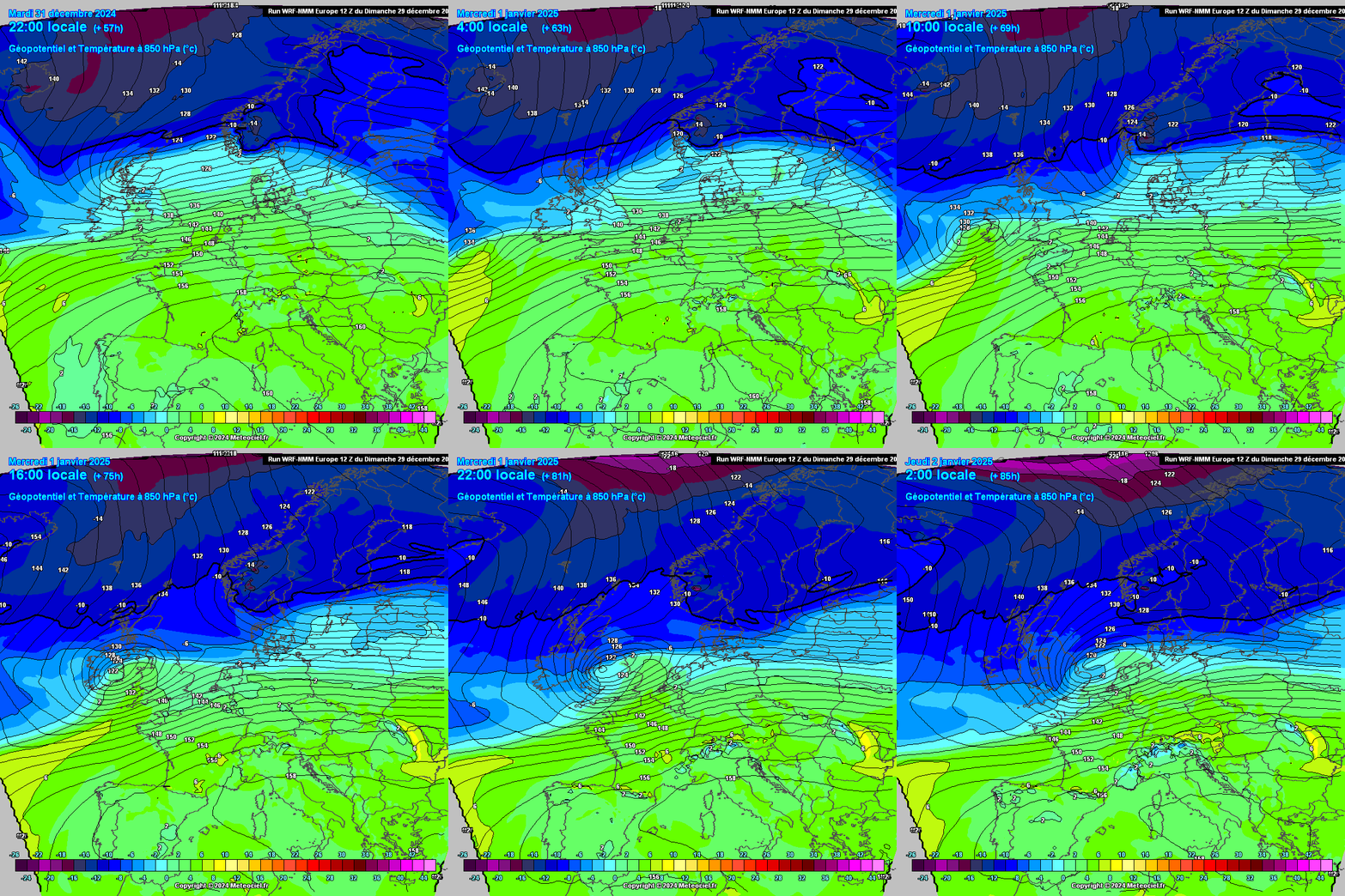
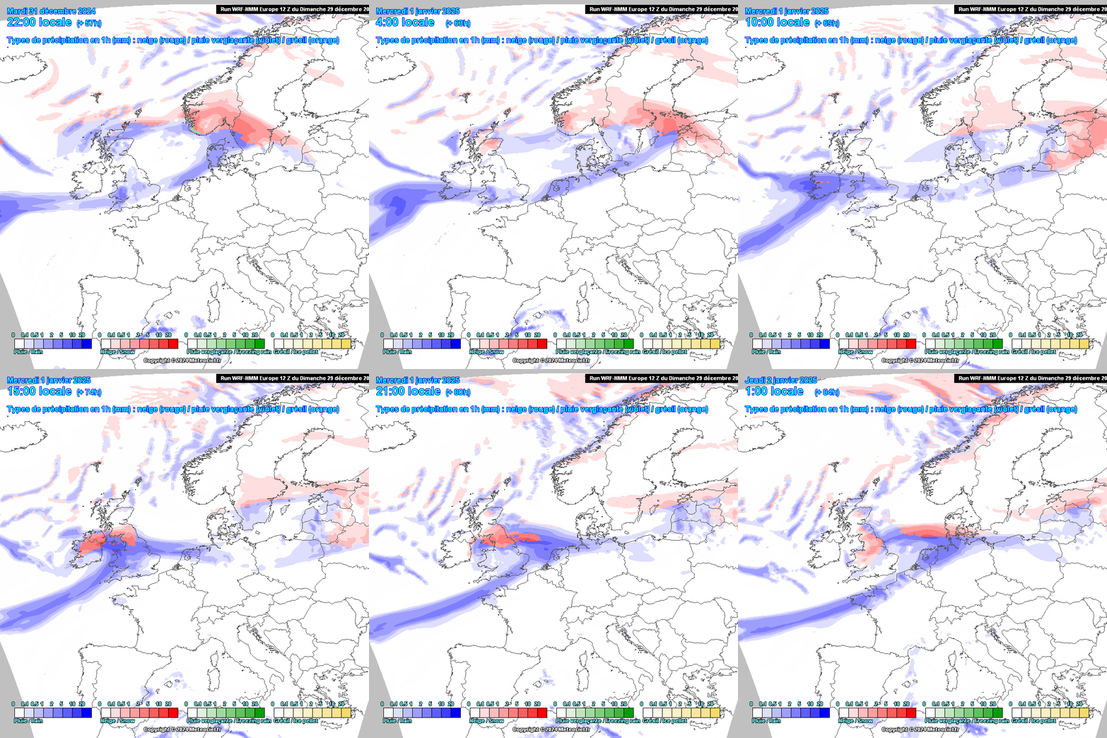
I don't expect the snow with this system to be particularly disruptive at this point. I suspect there is more likely to be a yellow warning issued rather than orange.
Lying snow is likely to be hanging around for quite a few days.
January 2nd onwards
After New Years Day, while there'll be some snow showers drifting in to northern counties most of the country will be mainly dry for a few days but it will be very cold especially at night under high pressure with clear skies and slack winds.
Very cold setup under high pressure…

Indicative night-time minimum temperatures will particularly low where snow has settled. Random selection for the 3rd of January but this will be the case probably all nights until at least Sunday:

Daytime temperatures are also going to really struggle to get above freezing everywhere from Thursday:

After the drier and very colkd few days things might get even more exciting for those who like this type of weather depending on how things evolve over the next couple of days.
And there are some interesting ways it could go starting to emerge for the latter part of the forecast period but that's more uncertain at this point. Here's a tease 😁

In summary a much, much colder period of icy winter weather starting New Year's Day and continuing for the forseeable future, there will be openings for snowfall throughout in various places. We just have to nail down the smaller scale specifics.
Exciting eh?😎





