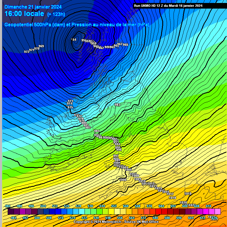
Thought it timely to start a thread to keep a focus on the possibility of a storm for next Sunday as we move under T120 . On the latest model runs shown as a fast approaching and rapidly deepening potential Storm system being powered up by a very strong and fast Jet ,currently tracking off the NW and getting down as low as 953hPa . Some models showing it to be quite windy the day before also. Good agreement from the main models of a potentially strong to severe wind event on sunday at this stage but as was seen over the previous few days it had initially been shown to be off the scale severe but has moderated some bit and could moderate more.
In general moving into a very mobile Atlantic regime from later Fri/ early Sat up until the following Weds or so at least with lots of warnings possible for both wind and possibly heavy rain in the Western side of the country at times, more so in Atlantic coastal counties where a high sea state could add to the risk of coastal flooding.
Some models showing Monday to be quite windy also and again for late Tues or Weds with another signal for very strong winds so can keep an eye here to see if there are other strong wind events being picked up by the models up to next Weds.
-------------------------------------------------------------------------------------------------------
Mod Note: This thread could get busy towards the weekend if a Storm materializes so your cooperation is greatly appreciated to please stay on topic, use appropriate threads and please adhere to the forum charter. Off topic posts cant be moved so will need to be deleted. Everybody is entitled and welcome to post on the topic. This is a thread for weather enthusiasts to discuss ,speculate and give opinion on the upcoming windy weather and post observations and relevant data in a civil and friendly manner.
--------------------------------------------------------------------------------------------------------







![Photo of [Deleted User]](https://w1.vanillicon.com/v2/196803dfa0698243a1e4321ab9efd141.svg)


![Photo of [Deleted User]](https://wd.vanillicon.com/v2/d38dadd4e9049f636f3a15f844846484.svg)