Does this look bad this far out?
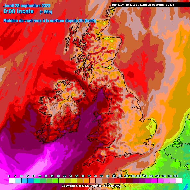
Here's the full list
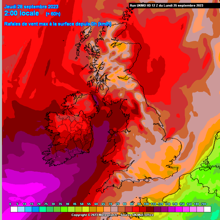
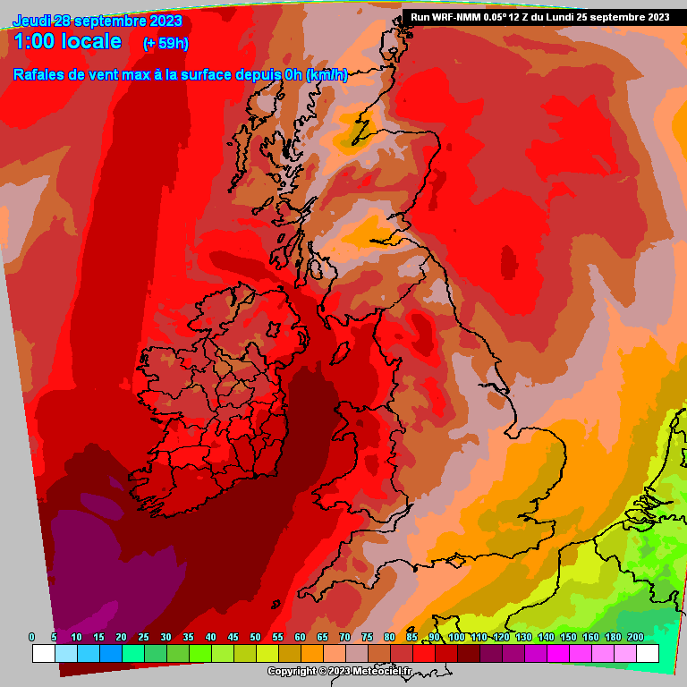
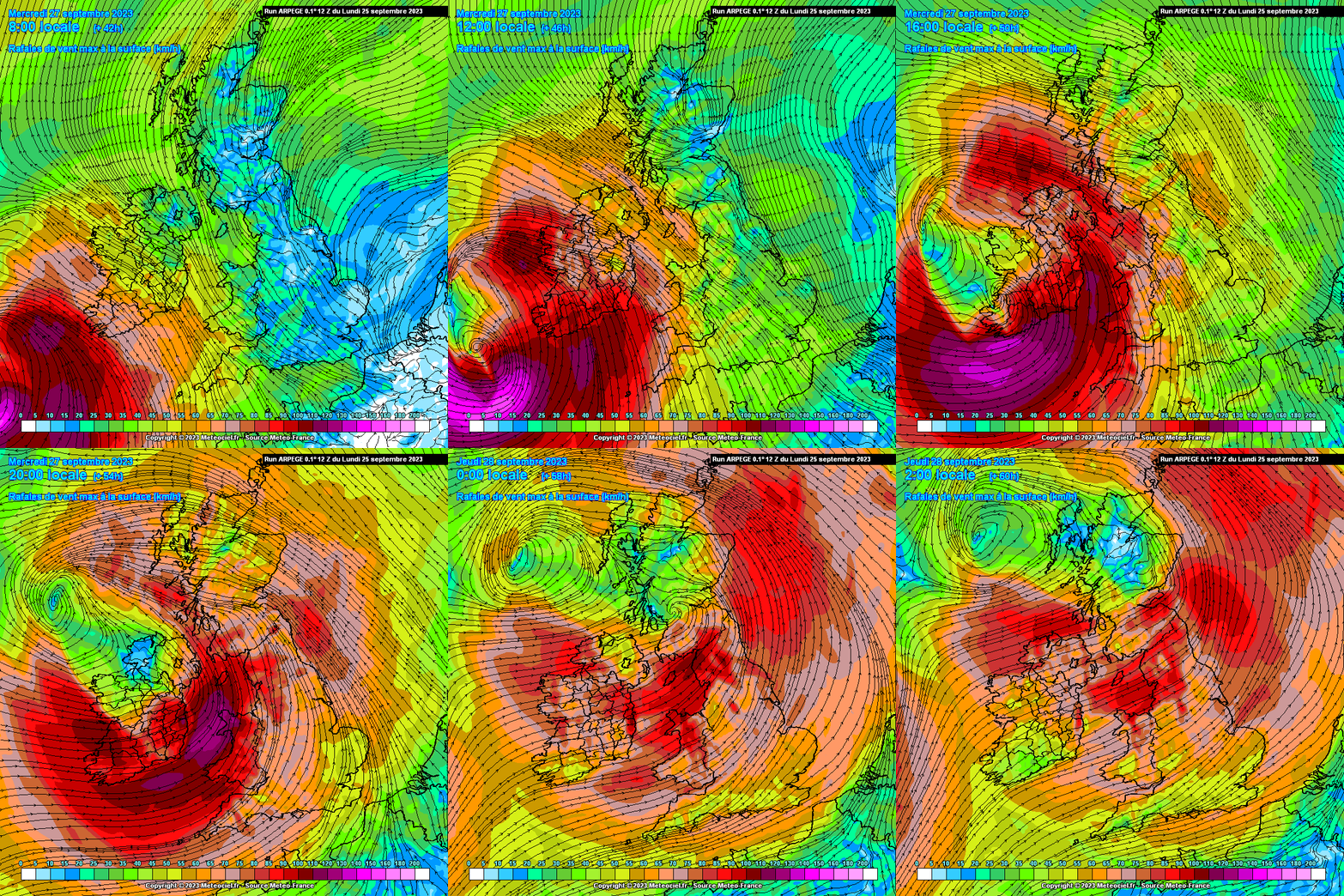
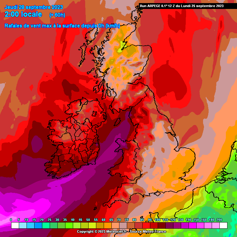
UKMO the strongest by far , way ahead of the GFS and ECM which are quite similar and ARPEGE probably similar to them if a bit stronger, WRF would be ag good representation of the GFS.
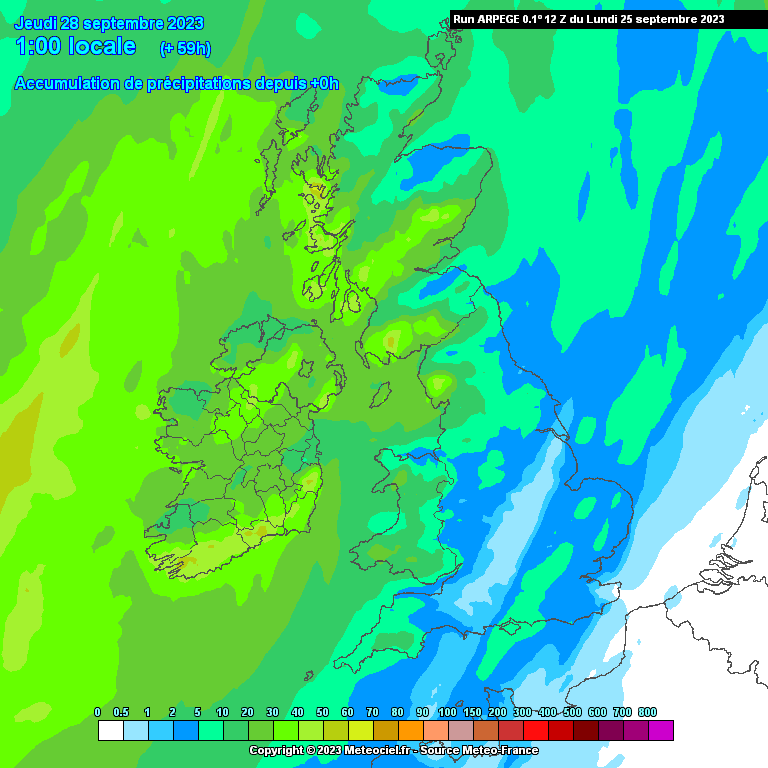
ARPEGE probably a good average leaning more towards the ECM and GFS
HARMONIE just getting there up to 12.00 and showing gusting 100km/h inland Cork, doesn't show the SW well, probably similar.
I think GEM is a bit off the mark
ACCESS- G starting to look more like the ECM but a bit higher inland still.
For now Id be inclined to go with the ARPEGE as a good average leaning towards the ECM for the moment anyway.
From Met Eireann:
Meteorologist's Commentary
Storm Agnes has been named by the UK Met Office on the morning of Monday September 25th. This significant weather event is due to make land fall over Ireland on Wednesday September 27th. Ahead of its arrival Met Éireann have issued yellow level wind warnings across counties in Leinster, and Munster. The UK Met Office have also issued a yellow level wind warning for Ulster.
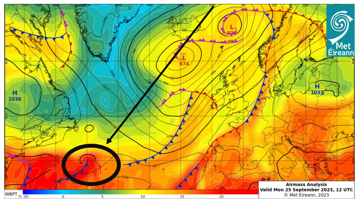
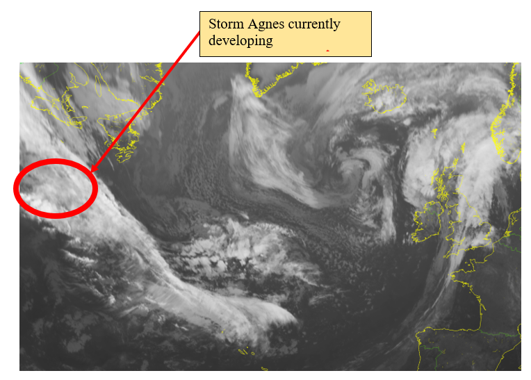
This developing storm is currently out in the mid-Atlantic. Our latest analysis chart shows the weather system in its infant stage.
The infra-red satellite image from 12Z on Monday the 25th of September shows the large mass of cloud which will eventually develop into Storm Agnes.
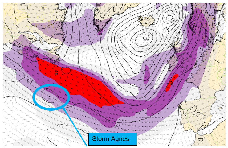
Over the next few hours and days this developing area of low pressure will be taken up by the jet stream and undergo rapid deepening.
Shown below is the jet stream prediction from the European Centre for Medium-Range Weather Forecast’s (ECMWF) model. Highlighted in blue is Storm Agnes modelled at 12Z today September the 25th.
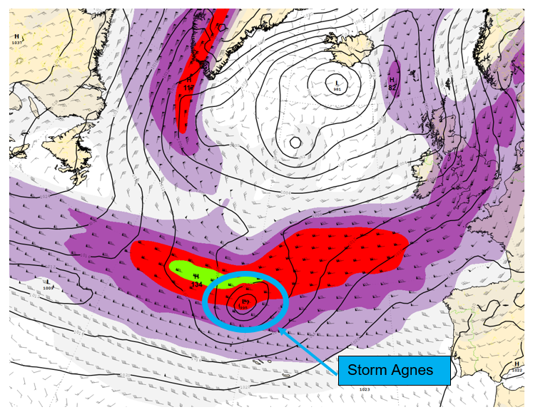
Moving on another 24 hrs to 12Z on Tuesday September the 26th we can see the low has moved across the Atlantic, being taken up by the jet stream. It has also been deepened significantly.
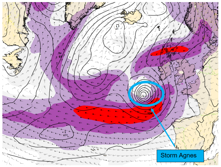
Looking ahead to 06Z on Wednesday the 27th of September, the day the storm will make landfall, we can see how the low pressure has transitioned to the northern side of the jet stream and undergone further deepening.
Storm Agnes is likely to make landfall late Wednesday morning and for now a number of weather warnings have been issued in response. These warnings are likely to be updated as further modelling data becomes available.
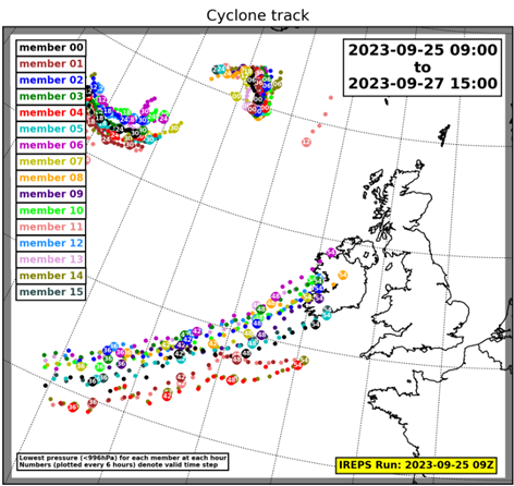
Currently, the strongest winds are forecast to impact the south and south-east of the country. However, the latest guidance from our high-resolution ensemble prediction system, IREPS, demonstrates the current uncertainty in the exact track of Storm Agnes.
Each dot in the image above shows where an individual forecast from IREPS has forecast the centre of the cyclone to track over Ireland. As we move closer to the event, IREPS will be able to give more certainty with regards to the exact track of Storm Agnes.
We are monitoring the development of this storm closely and further updates to our warnings will be issued in the next 24 to 48-hours. Please keep up to date with the latest warnings on https://www.met.ie/warnings.
That photo is Blackrock, Co Louth!
Anyone care to predict the warning level for Cork: Orange or perhaps Red?
I don’t think Red, but definitely orange at this stage’
Absolutely well if I get accepted onto the team I will be naming storms if its gonna hit here first
Ive a feeling it will be Orange given that there will also be heavy rain and the fact trees are still so full of leaves. Could well be a Red sea area forecast which would give the coastal fringes that extra bit of caution.
Think you misunderstood me i mean why didn't met eirrean name the storm first rather than Met Office, I know how the storm naming system goes
That's my exact feelings as well
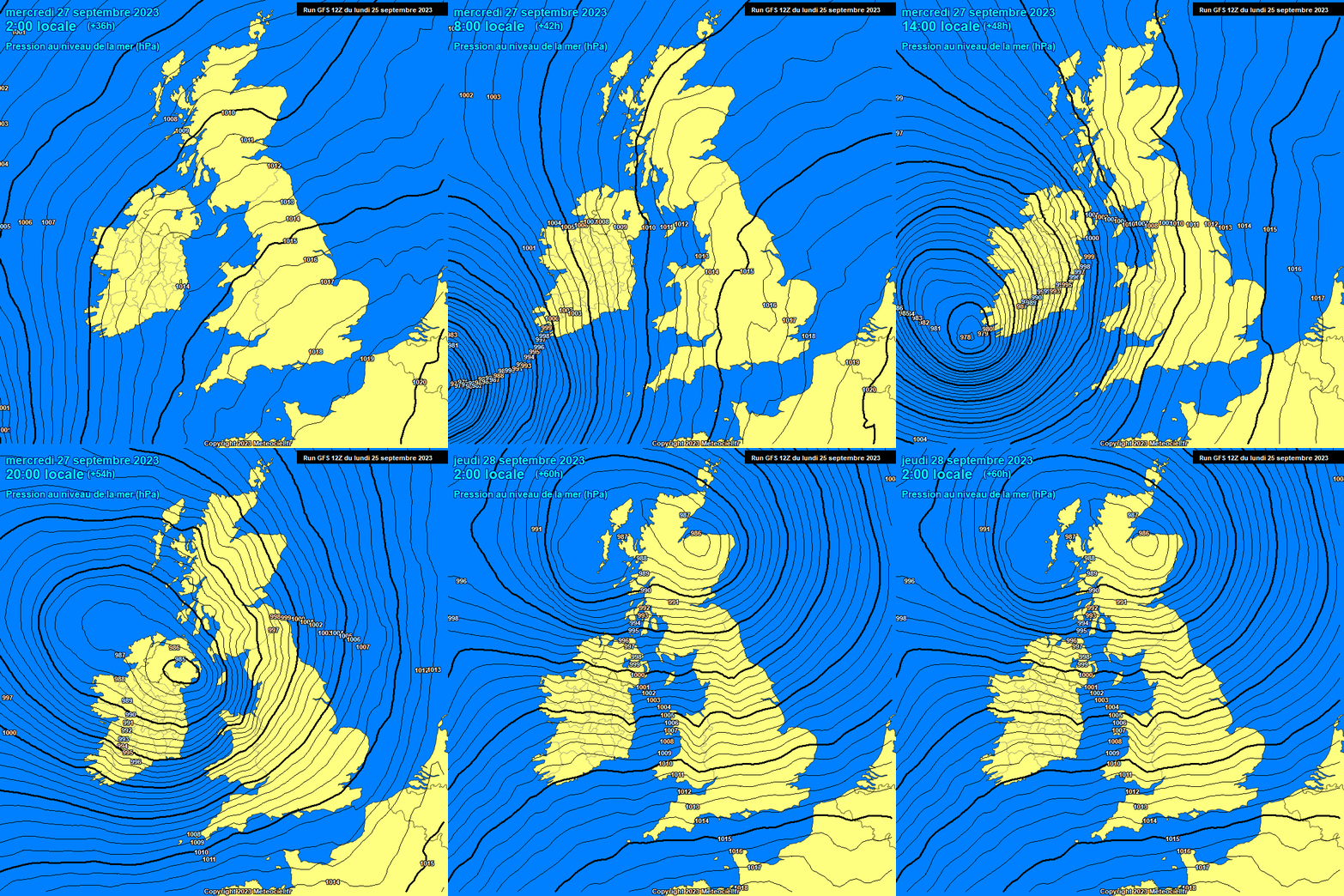
7pm on Wednesday Ukmo
There was 90mph winds in north scotland yesterday that wasn't even forecast...so there could still be a storm anytime despite the forecast 🙃
Maybe Orange level most ofMunster and Yellow most of the rest. Green Sligo?
Likely gusts would be 120kph in Roches Pt and Sherkin
110kph Cork , Valentia
100kph Shannon
80 to 90kph most of the rest of the stations in Munster in some in Leinster even Dublin
Latest ECMWf looks nasty enough. Time of year will be a player with trees in leaf
Is the general consensus that orange is the highest level it will go for kerry/ cork / Waterford or is there a chance it could go to red ?
Aren't these warnings more impact level now such as time of day etc? Hitting in the morning with kids at school etc surely must be a consideration.
Yes absolutely if it where during the night maybe yellow to orange but during the day orange to possible reds so timing is key as well as how bad the storm is well
I think for the South coast Orange is correct with am emphasis on high level impacts and an advisory to keep schools shut would be spot on.
Amazing amount of views on this already!
The timing on this storm, is as mentioned ,critical for schools etc. Not alone are trees still in leaf and the ground saturated, but the amount of dying roadside Ash trees is very dangerous and will become a massive problem from now on for travel.
Don’t schools only have a half day in the city on Wednesdays anyway?
I'm not sure, but late morning into lunchtime will be the peak of the storm (in Munster anyway).
ECM 12Z big change to the track joining the main pack now on the SW to NE track so pulling up stronger winds inland, much stronger than the last run, still not as strong as the UKMO but leaning that way a bit now bringing gusts 100 to 110km/h inland in the coastal counties of the SW, S, SE and E, widespread gusting 90km/h Munster / Leinster....that is a big upgrade from its meagre run this morning....more runs to go ......is this going to upgrade more ? Maybe the UKMO is not that much out on its own, will see if the others do some catching up.
Look here, if you suggest schools closing they will be. Will you stop this nonsense, its September
20 years ago you would be laughed out of it
Storm Debbie hit in September 1961 with some of the highest gusts ever recorded here. Don't insult the excellent volunteers on here.
P.s. Met Eireann issue warnings, not posters here.
Didn't think the wums would arrive this early🙄
Absolutely couldn't agree more
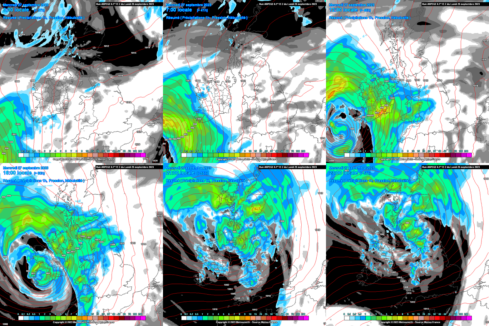
Interesting that the ECM is now the deepest at 11.00, deepening much closer to land before it fills crossing the country. Travelling at a rate of knots on approach, crossing the country from the SW to NE in around 9 or 10 hours
Look I think schools closing would be a great idea don't you ? Imagine all the stink met eirrean would get if they didn't advise communities so yes it would definitely be a great call and as mentioned before and I was gonna say it anyway our highest gusts happened in September with Debbie in 61 , if your looking to get a rise out of people on here it's not gonna work pet
I think the Department of Education leave it up to each school individually depending where located.
Can Weather forecasters still get it as badly wrong as Michael Fish did back in October 1987...










![Photo of [Deleted User]](https://www.boards.ie/applications/dashboard/design/images/banned.png)


