Does this look bad this far out?
Sure aren't the storm names all pre-determined now so as this is the first of the season, it's Agnes?
Agnes, Babet, Ciarán, Debi, Elin, Fergus, Gerrit, Henk, Isha, Jocelyn, Kathleen, Lilian, Minnie, Nicholas, Olga, Piet, Regina, Stuart, Tamiko, Vincent, Walid
Havent gone through the rest of the stread yet but there are still alot of leaves on the trees around here. Could see trees down
Exactly why I hate storms from August to October. I have some massive beech trees on my property that I can't get anyone to fell or prune so this time of year I really dread strong winds. Story for another thread though! Hopefully this one will continue to moderate as it gets closer.
We're definitely like two different countries North and south. Met eireann have warnings for wind in munster and Leinster (no mention of ulster) and the met Office have a storm name and possible significant disruption to Northern Ireland .
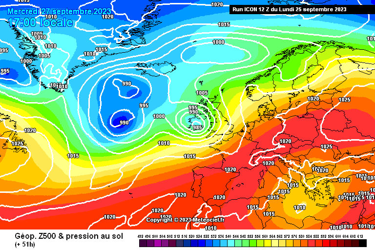
Latest ICON shows a filling system approaching the south coast Wednesday afternoon
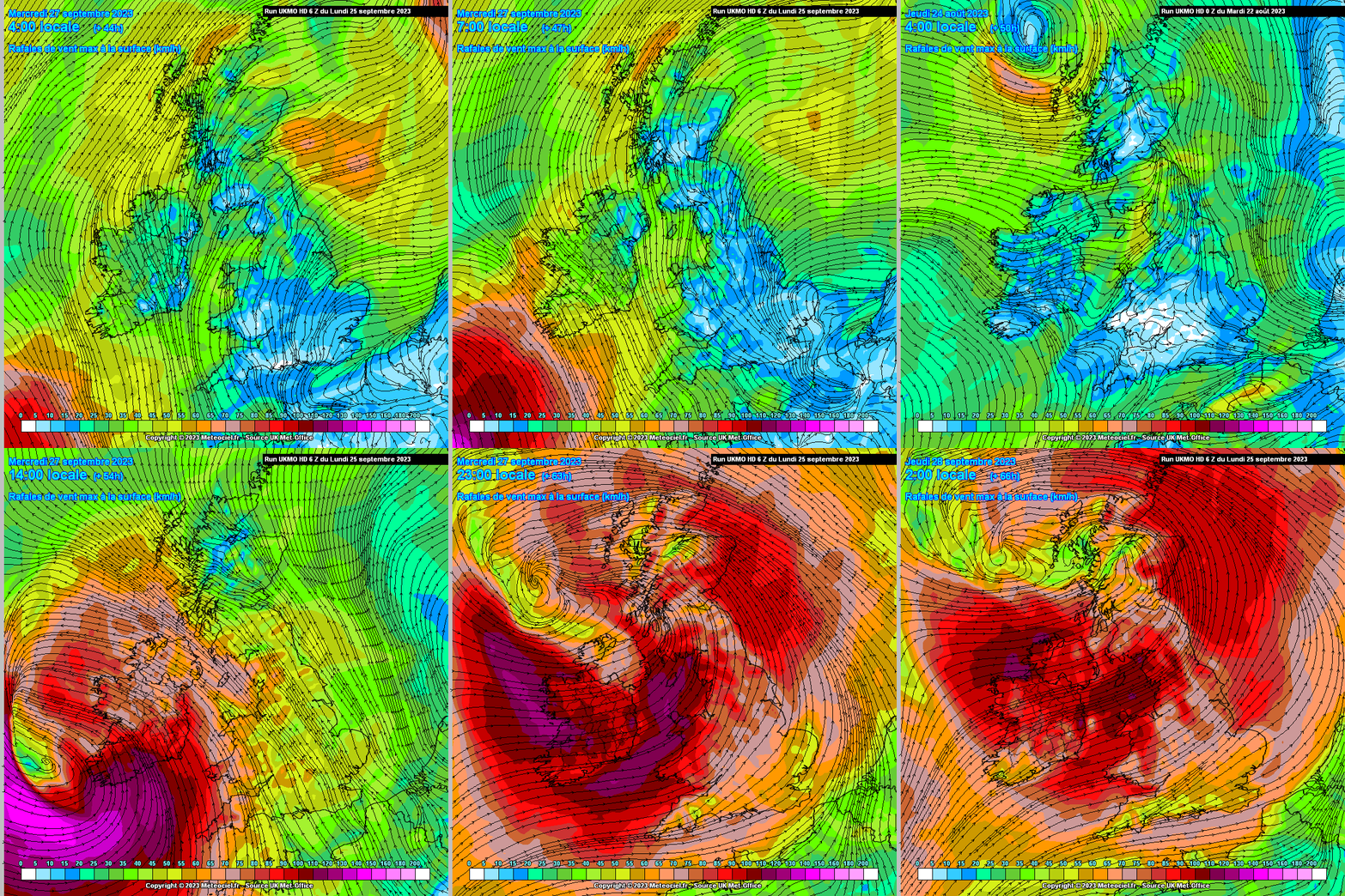
From UK Met office - #StormAgnes with their model bringing the centre in over Ireland
...
UKMO showing this way stronger than the ECM.
The UKMO HD run below still not fully out so jumping over and back but you can see what it is projecting. One model going to be wrong here, which one, Met Office not holding back.
Removed post - posted incorrect info
So IF the UKMO is correct will that mean a RED for certain parts of the country eg Cork etc?
Yes easily red for Cork kerry and Waterford I keep saying this I know it's probably annoying but that's based on current models also i think the west be in an orange as well if that keeps up
That's not correct it's every bit as strong and stronger before and after that timeframe. It's just the centre is crossing the South at 3pm which temporarily kills the wind. If anything I see the gfs as stronger than it's previous run
To me GFS looking a little more north this evening
Sorry you're right, I don't know what I was looking at but definitely showing a slight upgrade on the 6z, particularly in the SE.
Ukmo looks further North and deeper to my untrained eye! Game on
Will the storm be likely gone by Friday morning?
This storm will be gone by Wednesday night
Will be gone as we move into the early hours of Thursday, never mind Friday morning.
^^ (storm will be long gone by Friday) ^^
Storm Agnes looks capable of producing some coastal gusts to about 120 km/hr and inland southeast to 100 km/hr. UK track is a bit further north but similar intensity, would just spread potential slight damage a bit further inland if correct. Certainly a mid-range sort of event for that part of the country, will be mostly rainfall (locally 20-30 mm) as a concern north of track of low.
GEM 12z out now. GEM keeps with the southerly track and strongest winds off shore. Which model is the form horse in these scenarios overall?
With the UKMO so bullish I’d assume they’ve got this, this time round?
Was this not named Ophelia and if so why not keep that name like Ophelia 1? Just curious
jesus some models putting this at force 11/12 gusts in my neck of the woods, thats a bit concerning!
The ECM is usually king for this part of the world but it won't be long before hi res models have this. Tomorrow on anyway could be further changes north or south.
For the South Coast the main event for me is the strong Southerly which combines with torrential rain lunchtime Wednesday. A southeast strong Gale is a damaging one and also poor for flooding in Cork (backs up the tide). The wrap around Westerly afterwards looks tame enough. Warning wise I expect an orange in both wind and rain across the South Coast. The dangerous bit is it all happens mid afternoon when schools finish up etc. There's possibly an argument to keep schools closed for the day in Kerry, Cork and Waterford in conjunction with an orange. All just my opinion of course and I do like a ramp lol
yea seems very silly to have schools open on wednesday in those areas, way too many people on the move!
Managed to get a pic of this on bbc weather and love the fact they included Ireland in this but baffles me that met eirrean didn't name it
Yes but Evelyn has retired now and I'd say there's a hesitancy with the new crew. It is of course a storm that Met Eireann should have called first. The impacts here are much larger
I find them very slow to come out about how severe a storm can be they should be out of the blocks first better to have an early warning , fair play to all here who flagged this last week . No
Meant to be running a 5km with 450 students on Wednesday afternoon north Kildare. I’m guessing that’s not going to happen 🙈🤯
1st September 2023: Met Éireann, along with the national weather services of the UK (Met Office) and the Netherlands (KNMI), has released the list of new storm names for the 2023/2024 storm season, which starts on Friday 1st September.
It s all been coordinated beween UK, Irish and Dutch Met offices, no need for anyone to be baffled 😄 First name is Agnes