With Summer officially around the corner, let's hope for a decent spell of weather.
Personally hoping for fairly pleasant and consistent rather than long spells of rain and odd hot burst! I can hope...
The breakdown for the weekend looks to have been pushed back going off the latest model runs. The block may have been under estimated by the models. There will probably be another attempt later on, which will lead to similar conditions to this week. I still don't see any real sign of Atlantic domination anytime soon.
I know its too far ahead to know fully but what are the models currently showing for the early part of next week? (Monday/Tuesday 19th/20th)
We could do with a FI +120 post from Gonzo. Gonzooooooooo? :D
What a lovely evening here on the east coast. Barely a breeze and feels pleasantly warm.
Things may change on the next ECM run, but it's looking mainly dry and warm up until then.
Above the latest ecm accumulated rainfall over the next 10 days. Very dry in east ulster and parts of Leinster. A big shift compared to the previous ecm below which had more appreciable rain across the entire country.
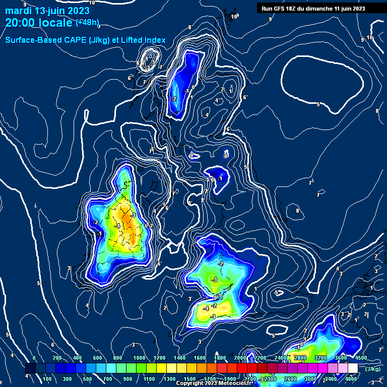
The midlands have a great chance of thunderstorms tomorrow night around 9pm onwards hopefully I get some after sundown in carrick
Now 15c in Sligo and 22c in the East. Coldest I've felt in June so far and mist too.
Wouldn't be surprised for it to MAX out at 17c in Sligo tomorrow but Met Eireann say 20 to 25c and theyr the experts
It actually feels warmer here in East tonight than Lanzorate at night, as not a whiff of a breeze, taking in my four loads of washing and sweating, trying to put it all away🤣
A beautiful day and evening here in Meath, warmth at last, reached 23C today easily the warmest day of the year so far.
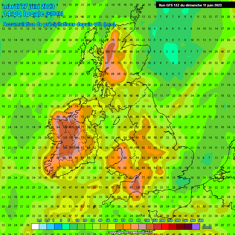
However things are about to become fairly unsettled with alot of rain predicted especially for the western 2/3s of the country with 100mm possible over the 1 to 2 weeks. The drought will be a distant memory soon enough.
Mid level cloud slow to break up today but eventually did in the afternoon giving a grand bright sunny evening. Got up 20.8C here near Tralee at my site, was up near the Shannon late afternoon and felt warmer. Feeling that bit cooler tonight, currently at 14.8C.
It's looking very warm and sunny here in the east for the rest of the week after tomorrow mornings showers clear westwards so it won't be very unsettled in the east
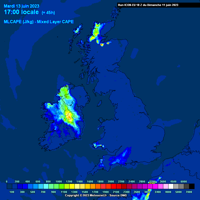
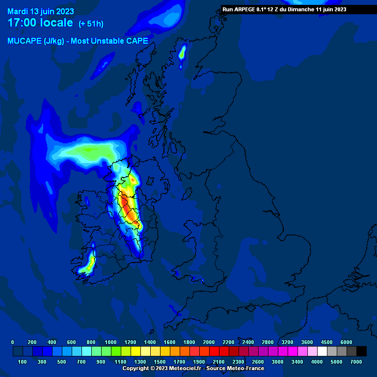
Tuesday looks very thundery across the midlands, this is likely to also cause some locally high rainfall totals and possible flooding.
WRF model has some thundery potential tomorrow evening in the midlands and the north-west.
Similar areas again on Tuesday.
Icon picking on Tuesday midlands storm event.
and so is the Arpege showing some possibly very beefy thunderstorms for the midlands/Cavan area
I'm working in Dublin tomorrow night but will be finished by late morning so I will be heading straight down to the house in Longford to be in with a chance of catching a good storm.
I love a storm but if I want one I'll have to jump into the car and head west which I might do ,I'm not expecting any storms in dublin just sunshine after tomorrow morning/ afternoon
Bring it on , I'm in the firing line 😎
As much as I would like a good storm, here in the East it's been chilly for ages and has finally warmed up, so I just want a continuation of dry conditions and warm temperatures and hopefully no more rain or showers for another few weeks.
I had forgotten that the east has been so cold especially at night , we've had it lucky here in the northwest temperatures still 16c and has been like that at night the past week but as for low to mid 20s we've had that the past 3 weeks
Seems to be cross model agreement now with things turning increasingly unsettled from later today and into next weekend and beyond, although decent levels of warmth is involved at the same time. June could end up being a very wet month indeed especially in western and northern areas.
Yup warm and thundery sounds good to me! Although the storms for now are going to be in the wrong areas
If the next 2 to 3 weeks ends up being unsettled hopefully we can get a nice big azores high sitting right over us during July for an extended period of time. We had plenty of sun recently but it was chilly, would be nice to get decent sunny days and proper warmth at the same time! Up to 3 days ago the models looked very dry and now it's the opposite so I'm hoping the models will start to trend dryer again soon so that the second half of June isn't going to be as unsettled as what the charts are currently modeling.
Knew it would happen. we have the dirty left overs from England’s huge storm passing over us today. Of course, skies clearing nicely over England again.
nothing worse than not getting storms but having to deal with the dirty muck leftovers!
Interesting rotation showing up on radar animation in that area of thunderstorm remnants in the Irish Sea. If you play radar animation you can see it rotating.
Back in cork and heard the last few days have been cloudy with mist. Cloudy again this morning unfortunately and looks to be the same for the rest of the week. Hard sleeping though, very sticky! About 17 degrees currently.
I would place money on similar happening to early this week with a slack, warm setup and risk of localised downpours because of all the energy in the atmosphere. The Biscay low looks to track closer for a temporary period of time before I would expect this to ease and pressure to build again. Little motion to change from this pattern.
Quite cold today relative to other days. NI still holding heat at 22c. Misty n cloudy here. Heatwave with wall to wall sun gone for a while. Might get some warm days but that great spell is over for the West and we do get our sunniest days in late May and early June this side.
I don't see any unsettled period lasting too long, a conveyor belt of lows from the Atlantic going west to east seems unlikely. The pattern seems to be a tooing and froing between a cut off low to the south west and high pressure further north this ties into the el nino pattern, so at times it will be thundery and humid before high pressure settles things down for a while. We could be in this rinse and repeat scenario for quite a while.
There looks to be a more organized line of developing rain in the Irish sea at the moment. It will be interesting to see how it develops as it pushes west over the country. Could spell the end of the drought for a lot of us today?
Let's hope so. The south west is bone dry.
Hot and humid again in Galway city. Fairly good sunshine for the last 2 hours despite alot of cloud around. Seems the sea breeze kicks it away.








![Photo of [Deleted User]](https://w0.vanillicon.com/v2/0e54e8024b002427df3ce2953d22b721.svg)
