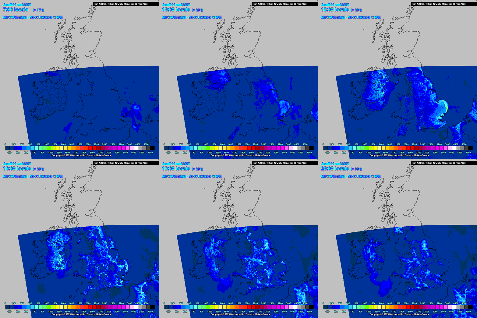
A new thread for Spring as there is a chance a few thunderstorms today and tomorrow.
I was on a GC last night in D22 wjen it came down, I was shocked by the amount of people continuing to play with their umbrellas up 🙃
Driving back to D24 in biblical rain I reckon I saw that bolt that struck that house in Springfield
Waited all day for it yesterday in south dublin. Got one bit of loud thunder. No lightning. Watch the radars and it seemed to skirt around us in wicklow and west / north dublin. I love a good storm
Which is based on what words you type most frequently.
Was incredible rain yesterday during the storm. Visibility was down to a minimum, I was driving along the seafront in Clontarf, down to 15kmph.
Tallaght yesterday evening, taken by a work colleague.
A couple of recent strikes in north Cork as band of showers starts to make progress across the country.
West Co Wexford about 45 mins ago beautiful fork in the sky, loud clap. But only one...😒
There must have been rolling thunder on ‘that night’ in July 1985 but from what I remember, it’s so long ago now, I would have been too terrified to notice it.
What I do remember was hearing strange sounds above the roof which I can only describe as the crack of a whip and at that stage I was hiding under the blanket just wishing it would all go away.
Distant thunder here in Kildare
Met E don't appear to be picking up strikes today?
Blitzortung showing recent strikes in south Meath/north Kildare and in Wexford.
Showing on the latest one, looks like Wexford seeing some decent action right now:
I don't have onlyfans lol 😆
Wexford is in a thunderstorm warning ⚠️
There was more thunder here about an hour ago, 4 or 5 very loud and long rumbles. Have had 4 thunder days over the past 2 weeks which has to be a record for this part of Meath.
There's something I didn't expect to see, a waterspout in Dublin Bay this afternoon. I was asleep for it and the few rumbles Dublin had.
The SE saw the most today, not as much as I thought the E would get.
Close call by MetWatch in the UK with another big thunderstorm day today.
Listen to this for an explosion!
Not surprised! I was keeping an eye out to sea about an hour ago as there was scud and some rotation. Half expected to see a water spout.
Friend sent this to me from England this evening, pretty impressive
Finally getting my pictures from the other day. This was towards Balbriggan
Just Off Howth
The one shot I got on the camera
2 strikes caught on video and slowed down. One Howth and the other Portmarnock
Thunder warning issued for Armagh, Antrim, Down, Fermanagh and Tyrone. Everywhere South of a line roughly from Castlederg to Belfast.
A few recent strikes off the coast of Mayo and Antrim.
Longwave upper trough, negatively tilted, upper low with very cold pool of air moving down over the E and SE during peak diurnal heating, Jet over the SW, some DLS over the SE, low level convergence, shortwave showery troughs, sunny spells between the showers, levels of upper vorticity all giving decent lapse rates, temps much down on previous days so lacking surface CAPE but still enough perhaps in the mid levels to produce some thunderstorms mainly in the SE quadrant of the country and perhaps taking in parts of Dublin Limerick and Cork. Probably short lived pulse like storms if they get going, one or two might travel a bit.. Heavy showers, hail possible I would reckon. Temps getting up to 14 /15C , maybe 16C in the far SE.
From Convective Weather
How likely is it for dublin to see a possible thunderstorm today?
Thanks for the update
Looks like 3-5 for Dublin the most likely then a bit later possibly the business end in Wexford, bleeding into Waterford, at 6 or so.
The view looking NW of Dublin at 12:05
Just heard a roll of thunder, north Drogheda (12.15pm)
Flash and a roll in D24. Thunder alley these days!
Ah balls waterford missed on the warnings. Pretty muggy here today with black clouds gathering