cooler than recently here in Meath after a foggy night, sun trying to break through and currently 20C.
The peak of the heatwave is passed now, today should be still very warm but temperatures generally a degree or two cooler than recent days.
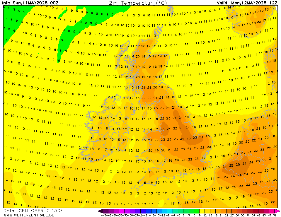
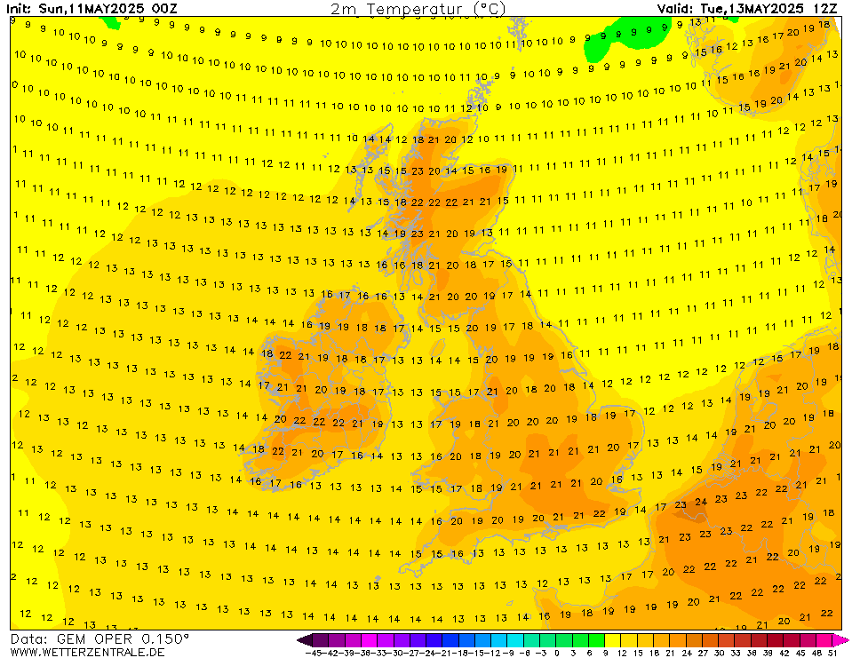
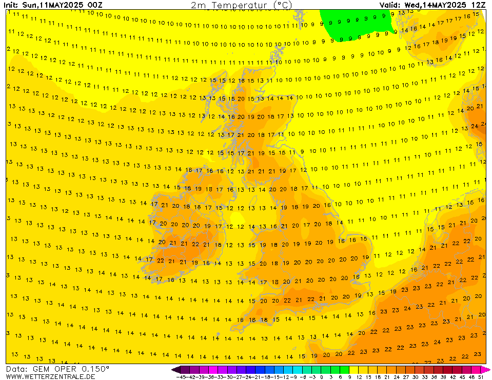
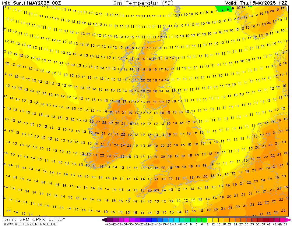
Looks warm up to Monday and then a big change to something much cooler and more unsettled. All models looks cool and unsettled from Tuesday and this lasts into the following week. Last few GFS runs is showing hints of things settling down and temperatures recovering during the 1st week of August. After the June dry and warm spell, the first 7 to 10 days of July weren't great so we're probably going to go through something similar next week and the week after that. I would love to see another 2 decent warm spells, one in August and another early to mid September.
Blue skies now appearing again in Dublin 5 and sun has burnt through the initial haze. 23 degrees
Clouding here now after blistering sun.
Butterflies hatching and revelling in drying their wings...
Donegal Airport 27°c at 11am, wow!
Cloud is building towards the south east, here north of Kilkenny City.
beautiful day in Meath. At 22c now in Navan, sun has come out to say hi. Happy friday all!
Yes, several times voted the most scenic approach in the world, it must be amazing up there this morning.
METAR EIDL 231030Z 15003KT 120V190 CAVOK 27/19 Q1017=
Belmullet is also on 27 °C (26.8 to be exact).
Sun getting stronger now, still a good bit of haze around. Temperature has jumped 4C in the past 20 minutes with more in the way of sunshine. Temperature now 24C.
Records of tropical nights and the term were kept by the UK Met Office starting in 2018. Ireland just happened to have little opportunity of such (despite some very mild nights in July 2019) until this heatwave so the term did not garner attention here.
If last night was indeed yet another tropical night at Valentia, July 2021 is only the second time that two tropical nights have been recorded in Ireland in one month with July 1983 being the other which was a month of a famous Irish heatwave.
The other mad thing about these tropical nights is the fact they occurred on two consecutive days so the last time Valentia fell below 20.0C was 5 a.m. on the 21st! Phenomenal for Ireland.
EDIT: Met Éireann confirmed it.
Oak Park has now reached a mean temperature of 18.0C. We have another 3 to 4 warm days to go before normal service resumes so I think by Tuesday Oak Park may be sitting at 18.4 or something like that. Once the cooler air arrives that will leave just 5 days for the mean to drop again back into the 17s and 16s in most other areas.
The cooler weather doesn't really begin until Tuesday so i'm hoping that the models are overcooking the cool potential and that by the beginning of next week I hope to see the charts not as cool as they look presently. I don't have big hopes for August but hopefully we can swing at least a week of dry and warm weather around mid to late August.
Those warm mornings and evenings have been one of the standout features for me of this current spell also.
I have made it my business to get to some of the beaches in Mayo and Sligo and have a swim over the last number of evenings and it has been glorious. I personally have loved that continental and balmy feel to the evenings that is usually quite rare in these parts.
Home again then, and time for a cold beer in the garden. Yes, the last few nights were a bit more difficult to sleep in but overall a great spell in my eyes. The past few evenings have been a stark contrast to many of those cold and raw evenings in May and a lot of the grey gloomy ones of the first part of the summer.
Some of the recent hazy high cloud and cirrus had made for some nice evening skies also. Below a few pics taken looking across Killala Bay from Enniscrone/Inishcrone, Co Sligo the evening before last.
Great stuff there Goldfinch, you can feel the heat in those photos.
As a keen photographer my self would you mind telling us what sort of gear you`re using there, and do you use RAW mode?
Odd, the very warm conditions seem to be extended every day on the Met forecast.
Seems to be a very nice setup for the weekend now, with Monday the return of rain and cooler temps.
Tomorrow will be a cooler day particularly in eastern and midland areas but still relatively warm.
Sunday will be warmer than Saturday, particularly over eastern areas compared to Saturday.
Monday we will be hanging onto the warmth by our fingertips with the Atlantic marine air making it's presence felt in western coastal areas.
Normal service resumes Tuesday.
Sun feels a lot stronger today here in Donegal, it was a bit hazy at times yesterday.
These videos from 1990 and 2001 show it in its present location and the site was grassy back then :)
https://www.armagh.space/weather/history/old-weather-readings-videos
Aside from the drop in temp what is the weather looking like for this day next week? I know we can't know for definite as it's beyond 5 days but once it's not too wet I'll be happy.
EDIT: Sorry Rikand, was just commenting on the first video where the equipment was beside buildings!! The other video is indeed the current spot. Changed my post.
Current site below. Looks as good as you can get. Some small patches of concrete (one right in front of the screen) but nothing major.
Hot day near Tralee out by the coast , 28.0C now after a brief low of 16.8C overnight.
Some nice lenticulars about, light breeze making it pleasant .
Improvising to keep some of the heat out 😃
Ooh ooh, what beaches out of curiosity?
I don’t know if you can. I’ve seen red skies like that in November!
Another cracker of a day here in South Cavan, slightly hazy with a bit more of a breeze than the past few days.
Pity its coming to an end this weekend, I'd take another few weeks of temps in the mid 20s.
Met Éireann Weather Warning
Thunderstorms in places this afternoon and evening with lightning, hail and heavy downpours resulting in localised flooding and hazardous driving conditions.
Counties most at risk are Wicklow, Kildare, Laois, Offaly, Tipperary, Clare, Galway, Mayo and Roscommon.
Valid: 13:13 Friday 23/07/2021 to 20:00 Friday 23/07/2021
Issued: 13:13 Friday 23/07/2021
Dewpoint is 20 °C at Derry Airport (temperature 25)...
METAR EGAE 231150Z 06007KT 9999 FEW030 25/20 Q1017=
...and it's 19 °C at Donegal Airport and Custume Barracks (Athlone), though temperature is higher at 27 °C.
METAR EIDL 231300Z 36008KT CAVOK 27/19 Q1016=
METAR EIAC 231230Z AUTO 05007KT 010V100 CAVOK 27/19 Q1015=
Another remarkable stat about past week. Dublin Airport had its sunniest 7-day period on record for July that I'm aware of with 99.3 hrs from 16-22 July. The overall record is held by 28 June-4 July 2018 with 107.4 hrs.
Here's a selection of the sunniest 7-day periods at the station that I could find from individual spells. July 2021 is highlighted in bold.
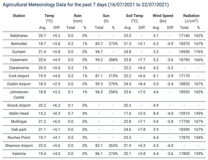
I wonder how others have fared in terms of their records. Might as well bank this 7-day agricultural report, all stations had at least 200% of their average sunshine for the week as well as mean temperatures 3 to almost 6C above average.
I will give an update on the daily maxima at Irish stations table probably tomorrow or early next week depending on how high the temperature gets at stations and when the heatwave will officially come to an end with no possibility of achieving 25C anywhere. I will also be comparing to the July 1983 heatwave which I think is the most comparable to this heatwave.
Thunder medium rumbles, Portlaoise.
That cell will be right over you soon. Enjoy!
Just looked at the radar! Surprised reports from Kildare posters not coming in.
Much breezier here today in Co.Antrim. Still hitting 27c but feels warm rather than hot with the breezes. Strong sunshine.
More like a windy day in Gran Canaria than a day in Majorca lol!
Would have loved a good evening or midnight TS before this spell is out. Alas it is not likely to be (in NI)