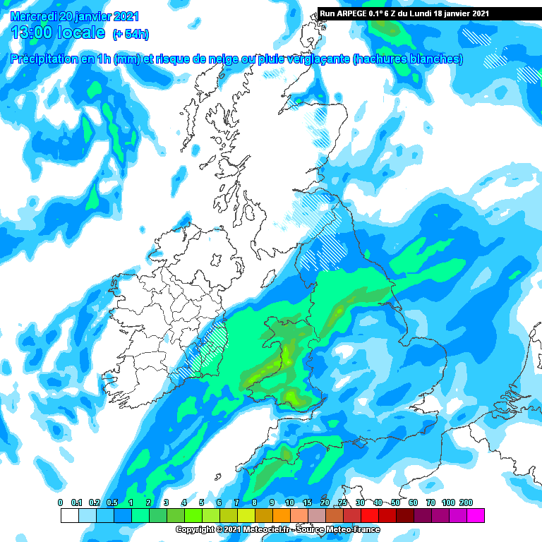
Kermit.de.frog wrote: » ... Surprised a thread wasn't started for the flood potential. Will update this OP in the morning. Interesting 48 hours to come from tonight to say the least.
Gaoth Laidir wrote: » Can't see any real snow potential with this at all, apart from mountains. There's just no cold out to our north. Sounding from as far north as Iceland and Jan Mayen, from where Wednesday's northerly will come, just don't give much hope.https://meteologix.com/ie/radiosonde-values/83-w-662-n/temperature/20210118-0000z.html
KingdomRushed wrote: » The 6Z GFS (parallel) has much more prolonged snowfall modelled for wednesday for much of eastern Ireland than the actual GFS run for same period. How do people rate that model in the short term
esposito wrote: » Very good question kingdom. Don’t you just wish there was one GFS model to ease the tension/uncertainty. Isn’t the parallel supposed to replace the old GFS very soon. If it is then surely it has to be taken seriously?
AuntySnow wrote: » Bbc 24 forecast for what it's worth has it turning to snow in kildare wenesday afternoon which would be meteogroup's opinion They're blending a few models presumably
Danno wrote: » The GFS PARA model is playing this out quite similar to the December 2017 event, however seems to be more snow getting into the east and southwest with this.
Gonzo wrote: » hopefully this proves further north and further west but at the moment i'm not expecting much if anything here in Meath unless there is an upgrade with the positioning. This could easily miss the entire country as well.
nacho libre wrote: » All I'll get is accumulations of rain. It's fantastic if you love rain , i suppose. Anyway good to see a forum tradition is being maintained this thread
Gonzo wrote: » no shortage of rain over the next 10 days either. A very wet 3 days to come, then dryer and next week is already starting to look like plenty of regular rain. January will definitely exceed 100mm in places by the end of the month.
Kermit.de.frog wrote: » Oh I dunno. Seems to be a dose of healthy scepticism that may yet turn out to be unhealthy in the end. If we look at the GFS (upcoming) this is exactly what we want to see. The snow level falling all the time. This is just one of a variety of outcomes but it's an example of what could well occur. The 6z ECM is actually a bit of an upgrade in terms of potential - just need a little bit more evolution from there. A tad more northwest and boom! I wouldn't be calling things either way. I think we have a good chance here but it depends ultimately on the location and orientation of those frontal zones. Long story short the further north the better and that's what i'll be looking for.
Supercell wrote: » The T+60 fax has the occlusion well south of us by midday, with a slack cool airflow, I really dont see anything but rain bar the usual high places in Wicklow mainly.


![Photo of [Deleted User]](https://wc.vanillicon.com/v2/c50f1c871638bccbbf9aa952593dd0cd.svg)