Pangea wrote: » The North West is Ireland too.
[Deleted User] wrote: » Tatranska, better batton down the greenhouse.
dulpit wrote: » At what point would it be clear how this will affect South of Ireland and particularly Cork Airport?
KingdomRushed wrote: » What interests me is whether even a direct hit from Lorenzo will equal a significant storm? Given all models showing it to be filling rapidly at that point. I will tell you something, since the public service brought in the ‘red warning means a day off’ rules, the interest in these storms has never been more palpable, a nation of clerks await the magic email.
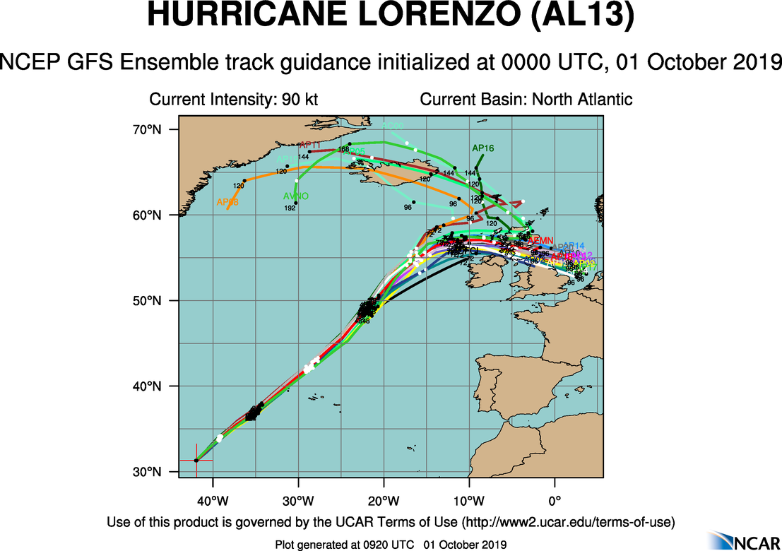
Villain wrote: » Latest ECMWF Ensemble chart: ]
DISCUSSION AND OUTLOOK At 500 AM AST (0900 UTC), the center of Hurricane Lorenzo was located near latitude 33.4 North, longitude 39.7 West. Lorenzo is moving toward the northeast near 22 mph (35 km/h). The hurricane should move in the same general direction but at a faster forward speed during the next few days. On the forecast track, the center of Lorenzo is expected to pass near the western Azores early on Wednesday. Maximum sustained winds are near 100 mph (155 km/h) with higher gusts. Only slow weakening is expected during the next 48 hours. Lorenzo is a very large tropical cyclone. Hurricane-force winds extend outward up to 90 miles (150 km) from the center and tropical-storm-force winds extend outward up to 345 miles (555 km). The estimated minimum central pressure is 962 mb (28.41 inches).
Hurricane Lorenzo Discussion Number 36 NWS National Hurricane Center Miami FL AL132019 500 AM AST Tue Oct 01 2019 Lorenzo's eye has become less distinct on satellite images over the past several hours, but the system remains very well organized with tightly curved convective bands. The upper-level outflow remains quite well-defined. The advisory intensity, 85 kt, is a blend of subjective Dvorak estimates from TAFB and SAB along with ADT values from UW-CIMSS. Sea-surface temperatures beneath the cyclone are likely to fall below 20 deg C within 36 hours, along with a large increase in vertical shear. Since Lorenzo has such a large circulation, it will probably be slow to weaken, however. In 48 hours or less, the global models show the system merging with a frontal zone, indicating the transition to an extratropical cyclone. The NHC intensity forecast is on the high side of the numerical guidance but still weakens the cyclone below hurricane strength when it nears Ireland and Great Britain. By 96 hours, the cyclone should dissipate over Europe. The hurricane continues to accelerate, and is now moving northeastward near 19 kt. Continued acceleration on the southeast and east side of a large mid-tropospheric trough over the central north Atlantic should occur over the next day or two. In 72 hours or so, the cyclone is expected to turn east-northeastward while moving in the westerly flow ahead of the north Atlantic trough. There is still significant track model divergence around this time, and the official 3-day forecast is somewhat southeast of the model consensus. This leans toward the latest ECMWF solution, which continues to be on the southeast side of the track guidance envelope. Lorenzo is producing huge seas over the north Atlantic. Full information on the High Seas Forecasts can be found at the Ocean Prediction Center under AWIPS header NFDHSFAT1, WMO header FZNT01 KWBC, and online at ocean.weather.gov/shtml/NFDHSFAT1.php. The UK Met Office also has information in High Seas Forecasts issued by under WMO header FQNT21 EGRR and on the web at
Villain wrote: » Latest NHC update:
pauldry wrote: » Not a damp squid squib yet
JanuarySnowstor wrote: » Direct hit on latest icon
Sleety_Rain wrote: » Not too much clarity this morning but certainly increased risk of Lorenzo coming close to Ireland bringing some impacts. Still high degree uncertainty where it will turn right and how fast it will decay once it moves way from the left exit of the jet-streak. Still all to play for at this point but must be stressed very minimal risk of a red level event. Also important to stress Lorenzo will be well ex-tropical when it hits the vicinity of Ireland and is infact only a possible danger due to typical cold cyclongenesis But still risk of Orange cat winds in parts.
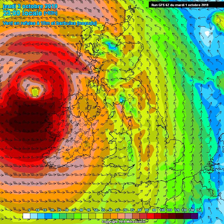
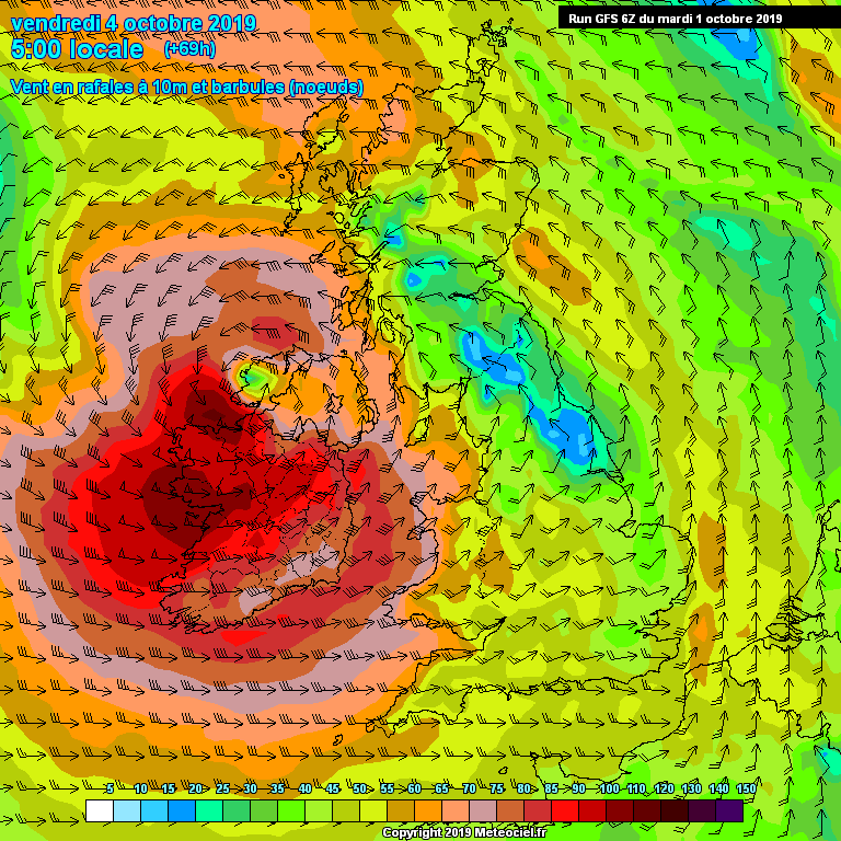
Sleety_Rain wrote: » GFS 6z brings the filling feature in over Ireland.
Gaoth Laidir wrote: » This article describes why Debbie was not tropical when it hit Ireland.https://irishweatheronline.wordpress.com/2015/10/28/blast-from-the-past-hurricane-debbie-1961/
TTTT wrote: » Is it possible that Lorenzo will interact the same way before it reaches us?