Farmer2017 wrote: » How far out is Spanish plume from happening ? Does Spanish plume bring much rain
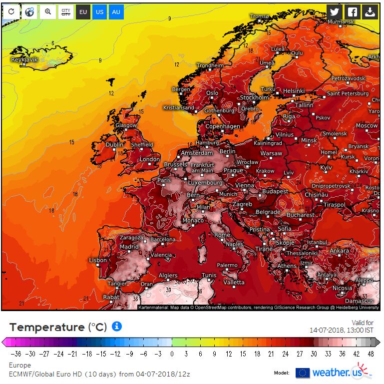
sdanseo wrote: » Last frame of the 12Z ECM (+10 days) is a full on Europe-Wide Heatwave. Whole countries at >30° What breakdown?
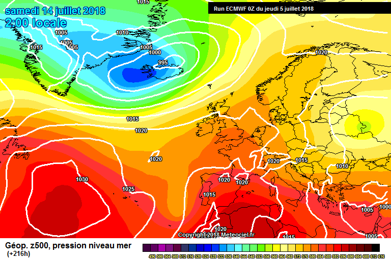
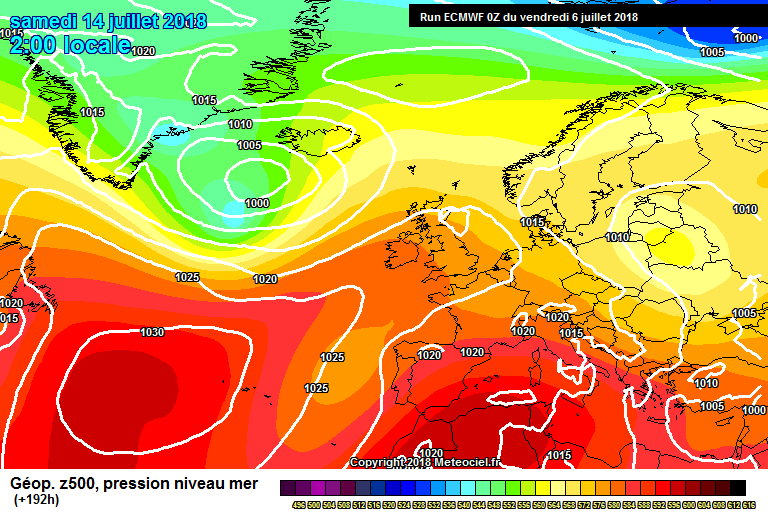
KingdomRushed wrote: » Am I looking at the same charts as everyone else? Both GFS and ECM op runs are now clearly signaling a decline in pressure over Ireland from around July 9th onward. The ridge for next week is weaker on every run. The northern hemispheric view is better to assess this trend than the Europe only charts.
compsys wrote: » Looks OK to me. You seem quite desperate for a return to bad weather?
KingdomRushed wrote: » No I’m only pointing out what is showing on the model output. 48 hours ago it looked like genuine heat wave conditions were returning from this weekend. This trend is dissolving on the models. And moreover the much vaunted Spanish plume has not just eroded but disappeared. There’s a change coming in my opinion, whether that’s good news (for some) or bad news (for others).
sryanbruen wrote: » 'Eh em..... the ECM charts clearly show what me and Villain are talking about. You told me here to use the northern hemispheric view. I see nothing different. Jet stream is way to the north with low pressure over Iceland and we have high pressure over us linking up with the Azores High and a high over Scandinavia.
KingdomRushed wrote: » I said the pressure begins to decline I didn’t say there wasn’t still high pressure over us, but it’s the same declining trend that is evident in later frames of GFS which runs longer. That is certainly not heatwave conditions at 216, and 240 is even less promising looking.
sryanbruen wrote: » I never suggested heatwave conditions ever either........ all I've been saying is settled. This Summer is more about persistence of warm and dry weather rather than extreme side of heat (besides 27th-29th June for Ireland). For what it's worth of your description, the GFS has forwarded the cool, unsettled phase this morning by a day or two compared to its backdating that it was doing yesterday. It also suggests a trade burst well into FI which it tends to overdo but going by outlooks, this heralds a change into August if you ask me. August, I can definitely see a change coming to something much more unsettled. Mid-June brought a cool and brief unsettled blip with the jet stream going on a bit of a southerly track similar to how the GFS is showing for the third week of July which was then followed by the heatwave or warm spell. In fact, looking at it now, maybe we're seeing something similar going on here? For sure, we weren't seeing a Spanish plume in early June on the model outlook but the way the ECM has the high pressure aligned (besides the Scandi High) is similar to that of how the models showed for Wednesday 13th June for a couple of days then was followed by storm Hector. Not doubting the weakening of the high or ridge at all by the way, the long range models such as the CFSv2 also show this for the third week of July but they then restrengthen it for week 4.
Villain wrote: » LOL at overnight runs, you say breakdown, models nah! Just keeps getting pushed back and back
sryanbruen wrote: » GEM is just high pressure fest throughout with no loss of strength in the high.