slowburner wrote: » The Geological Survey of Ireland made (some) LIDAR data sets available on the 24th of April. Over 200 'new' sites have already been identified by one enthusiast in one county. Hopefully more data sets will be added in future. The mapviewer is available here
12 element wrote: » Does this look like a new find: (circle in the middle!)
slowburner wrote: » Looks very much like a barrow. Worth notifying the NMS.
Love nor Money wrote: » Are the archaeological surveys done on behalf of developers done with as much rigour as "normal" ones?
forgottenhills wrote: » I often trek around Coillte woods in the Dublin/Wicklow mountains and keep my eyes open for anything unusual. Last month I was walking on a hillside looking down a slope to a river in a scenic area where there are various walking paths. At the top of the slope the rough overgrown field leading down to the river meets up with a wood and levels off. There are a lot of stones under the trees at the edge of this wood where it meets the field. There was one stone sticking up out of the ground at an angle that caught my eye. It is obviously an old carved stone with a round hole made all the way through it near the top of the stone. Now my first thought was that this is an old carved gate post as I have seen a few of these here and there up the Wicklow hills. But usually they occur in pairs and on this occasion I could only see one. Also their edges are usually sharper which might suggest that either the stone I came across is older and its edges have been rounded by age or was carved from a softer stone than other posts. Within 20 yards of this stone, almost completely hidden by the wood are old stone walls that are very roughly built and don’t look like the ruins of an old cottage or church (unless a very makeshift construction without windows), more like rough walls built to hold sheep or for some similar use. I don't see any archaeology marked on the maps in this exact area although there is something marked less than half a mile away. I have attached a link to 2 pics of this leaning stone. You can see the field boundary near to the stone with a bit of old netting wire under the stone. What do people think? Is this simply an old gate post? I don't have any great knowledge of archaeology but I have a vague memory of reading sometime that some standing stones have been recorded that had a hole through them like the one that I came across.https://imgur.com/a/aqxiVaD
slowburner wrote: » It’s quite definitely a gate post. They don’t necessarily have to occur in pairs. Often, one or both are re-used.
forgottenhills wrote: » It probably is just an old post but the curiosity I had about it was fueled by the following:the stone is in a highly scenic/strategic hillside area overlooking a river approx 100 metres below it seems to be located on a mound of stones it doesn't look to be in a natural place to be an opening to a field or a laneway unless these boundaries were very long ago and have long disappeared. Also it seems a little shorter than I would expect for a gate post. there is the curious cluster of roughly built stone walls close by in the shape of old shed or house walls, semi-collapsed but with no evidence of windows and or roofs. It was these that first drew my attention as I was walking on an ascending path in the woods close by and could see them half -hidden below me in the trees at the edge of the wood.
bogwalrus wrote: » This symbol is carved into a stone that is part of a very old stone building in the countryside of macroom. Across the road there is a dolmen in a field. Any ideas as to what the symbol is for and how old it might be? I'll try get a better pic when I am up there again.https://drive.google.com/file/d/1okUKVSnQ7BPhdlVnoz2lavWWtW_C0nSW/view?usp=drivesdk
slowburner wrote: » OS benchmarks were precise points recording height over datum (above the ordinary low water mark at sea level). They are still useful today. The accuracy of the two surveys is still remarkable and reliable. Most of the measurements were taken by two sappers laying out chains. Not much room for error there!
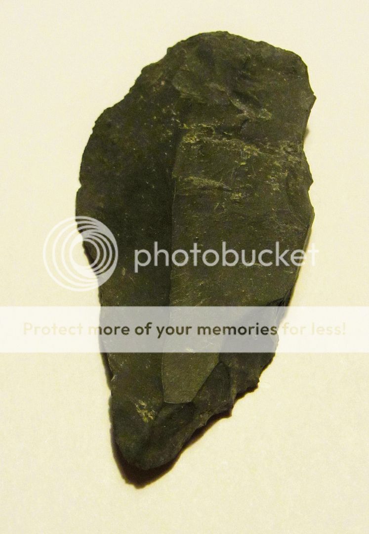
Coles wrote: » Some possibly Mesolithic tools found in Co. Wicklow.[IMG][/img]
slowburner wrote: » The lower two have some of the diagnostic elements of struck lithics but I would not be convinced. The upper two are more doubtful. What is the lithology and what are the dimensions?
Aelfric wrote: » At least three of these lithics are diagnostically late Mesolithic, so you should report the finds, and their location, to the Duty Officer at the National Museum of Ireland if you haven't done so already.