Shedbebreezy wrote: » Well to be fair he completely ruled out lowland snow for the slider last month and the last snow event we had when many low lying areas received lying snow and pics to support it. Let's wait and see.
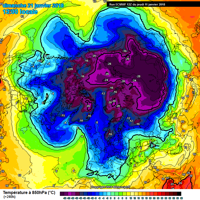
Captain Snow wrote: » Scandi High flooding cold into Europe. Possible February weather coming for Ireland.
mahoney_j wrote: » What’s February weather !!!!!!
gabeeg wrote: » The GFS ushers in a new ice-age, deep into FI
amandstu wrote: » Is there some kind of a regular pattern whereby weather systems seem to be centred on the South tip of Greenland ? Is it just these past few week s especially and just a coincidence? These strong winds almost seem to be continuously forming there and are really really strong there(Some people do live there ;what must it be like for them?)https://earth.nullschool.net/#2018/01/16/0600Z/wind/isobaric/1000hPa/orthographic=-27.01,52.49,2073/loc=-13.810,54.773
Elmer Blooker wrote: » .... and it goes on and on and on and on ...... Are we ever going to see a pattern change? Quite incredible! Here are some staggering climate stats that I just cannot get my head around. We all agree that the Azores high is a permanent fixture every winter and remains in situ for weeks/months on end, so here are the average rainfall amounts for Dublin and the Azores for the winter months, Dec-Feb. Dublin: 178mm or 7.12 ins. Azores: 328mm or 13 ins. How the hell can it rain twice as much there as it does where I am?https://en.wikipedia.org/wiki/Azores#Climate
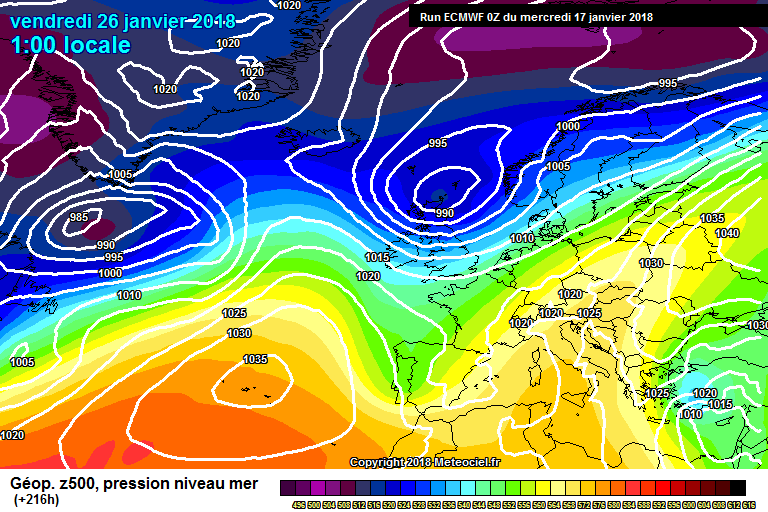
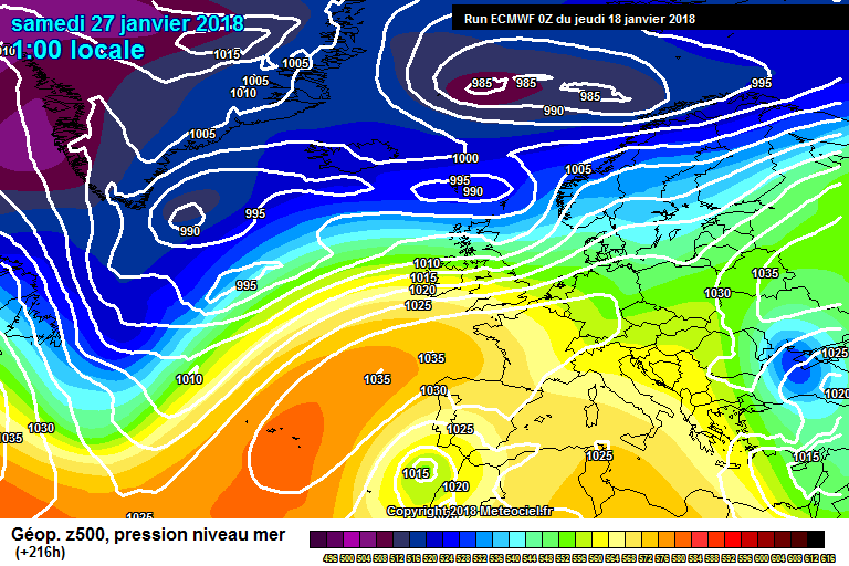
Elmer Blooker wrote: » The trend from all models at the moment is for the Azores to relocate to Europe. I'm seeing (not predicting!) an unusually mild February ahead similar to 1998.
sryanbruen wrote: » Hold on, hold on, hold on. I just want to explain myself here with the FI charts given what I've said in the Winter discussion thread which may have caused some confusion. Over my years of model watching since I began in 2014, usually once we get to the milder spell, the models start trying to find the next change in the pattern again. Therefore, I don't think this incoming mild spell is going to last as long as they're letting on. Also, it only takes a wave of amplification in the Atlantic or the Siberian High to show their hand more then the prospects from the models look completely different again. We've gone past what is the windiest spell of the entire Winter season on average, late December and early January. This means the Atlantic should be running out of steam into February, and especially given how the zonal winds are expected to take a plunge along with the Polar Vortex being dramatically disturbed. It all looks messy but we'll wait and see what Mother Nature has up her sleeve waiting for us in the foreseeable future and the rest of the Winter 2017/18 season into early Spring.