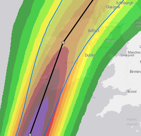
Meteorite58 wrote: » An idea of what gusts could be like tomorrow. Cant get any more of the map on this model.
Slimity wrote: » Based on the Arpege projections should more counties not be in the red warning? Wicklow, Dublin, Kildare?
DOCARCH wrote: » In time, I think they will end up with red warning.
Slimity wrote: » Hopefully they go red tonight then, as the morning will be too late for preparations.
Hurricane Ophelia Discussion Number 26 NWS National Hurricane Center Miami FL AL172017 1100 AM AST Sun Oct 15 2017 After displaying a distinct eye overnight, recent satellite imagery indicate that the cloud pattern of Ophelia has begun to deteriorate and the eye is no longer apparent. The deep convection is also weakening fast and consequently, Dvorak numbers have begun to decrease while analysts are trying to lower them as much as the technique allows. The best estimate of the initial intensity is 80 kt. Given the cold waters of about 20 deg C, and the strong shear, Ophelia is forecast to gradually weaken and become a post-tropical cyclone later today. Satellite fixes indicate that Ophelia is moving toward the north-northeast or 025 degrees at 33 kt, well embedded within the fast flow ahead of a large trough. This pattern is expected to persist, so no significant change in track is anticipated before dissipation. Guidance continues to be in remarkably good agreement and most of the models bring a weakened post-tropical Ophelia to the southern coast of Ireland Monday morning (AST or Miami time). Thereafter, the cyclone will continue over northern Great Britain until dissipation. Strong winds and rains associated with Post-Tropical Ophelia will arrive well in advance of the cyclone center. Residents in those locations should consult products from their local meteorological service for more information on local impacts. KEY MESSAGES: 1. Ophelia is expected to be a powerful extratropical cyclone with hurricane force winds while it moves near Ireland and the United Kingdom. Direct impacts from wind and heavy rain in portions of these areas are likely, along with dangerous marine conditions. For more details on the magnitude, timing, and location of impacts from post-tropical Ophelia, residents in Ireland should refer to products issued by Met Eireann, and residents in the United Kingdom should refer to products issued by the Met Office. FORECAST POSITIONS AND MAX WINDS INIT 15/1500Z 41.6N 16.0W 80 KT 90 MPH 12H 16/0000Z 46.0N 13.0W 75 KT 85 MPH...POST-TROP/EXTRATROP 24H 16/1200Z 51.5N 9.5W 65 KT 75 MPH...POST-TROP/EXTRATROP 36H 17/0000Z 57.0N 5.0W 50 KT 60 MPH...POST-TROP/EXTRATROP 48H 17/1200Z 60.5N 1.5W 35 KT 40 MPH...POST-TROP/EXTRATROP 72H 18/1200Z...DISSIPATED $$ Forecaster Avila
HAZARDS AFFECTING LAND WIND: Gale-force winds are expected to begin across southern Ireland by early Monday morning and gradually spread northward across the country during the day. Hurricane-force winds are expected to reach the southern portions of Ireland by Monday afternoon and spread inland across the country into Monday night.Preparations to protect lives and property should be rushed to completion by this afternoon. Wind speeds atop and on the windward sides of hills and mountains are often up to 30 percent stronger than the near-surface winds indicated in this advisory, and in some elevated locations could be even greater. RAINFALL: Ophelia is expected to produce rainfall amounts of 2 to 3 inches (50 mm to 75 mm) with isolated totals near 4 inches (100 mm) through Tuesday across western Ireland and Scotland. Across eastern Ireland, rainfall amounts will average around 1 inch (25 mm) or less. STORM SURGE: A dangerous storm surge is expected to produce significant coastal flooding near and to the east of where the center of the post-tropical cyclone makes landfall. Near the coast, the surge will be accompanied by large and destructive waves.
M.T. Cranium wrote: » Having reviewed a visible satellite loop I would say the storm is still tropical and the eye has reduced in diameter to about 5 miles (current position 40N 16W). It appears to be making the turn north in the last three hours. The waters ahead are not all that cold either, near 20 C in Biscay. And the strong southerly flow will bring a slight warming further north. This storm may continue to be a hybrid like Sandy up until landfall. Storm surge issues should be taken very seriously on this track (from SSW). You know the terrain better than me, but any coastal villages with exposure to the south or southwest may have inundations up to 3 metres above normal high tide and powerful waves could be bringing in debris from beaches.
thomasj wrote: » https://twitter.com/metofficestorms/status/919575455229009920
star gazer wrote: » That H coming into Ireland isn't something you see every day.
Hurricane Ophelia Discussion Number 26 NWS National Hurricane Center Miami FL AL172017 1100 AM AST Sun Oct 15 2017 After displaying a distinct eye overnight, recent satellite imagery indicate that the cloud pattern of Ophelia has begun to deteriorate and the eye is no longer apparent. The deep convection is also weakening fast and consequently, Dvorak numbers have begun to decrease while analysts are trying to lower them as much as the technique allows. The best estimate of the initial intensity is 80 kt. Given the cold waters of about 20 deg C, and the strong shear, Ophelia is forecast to gradually weaken and become a post-tropical cyclone later today.
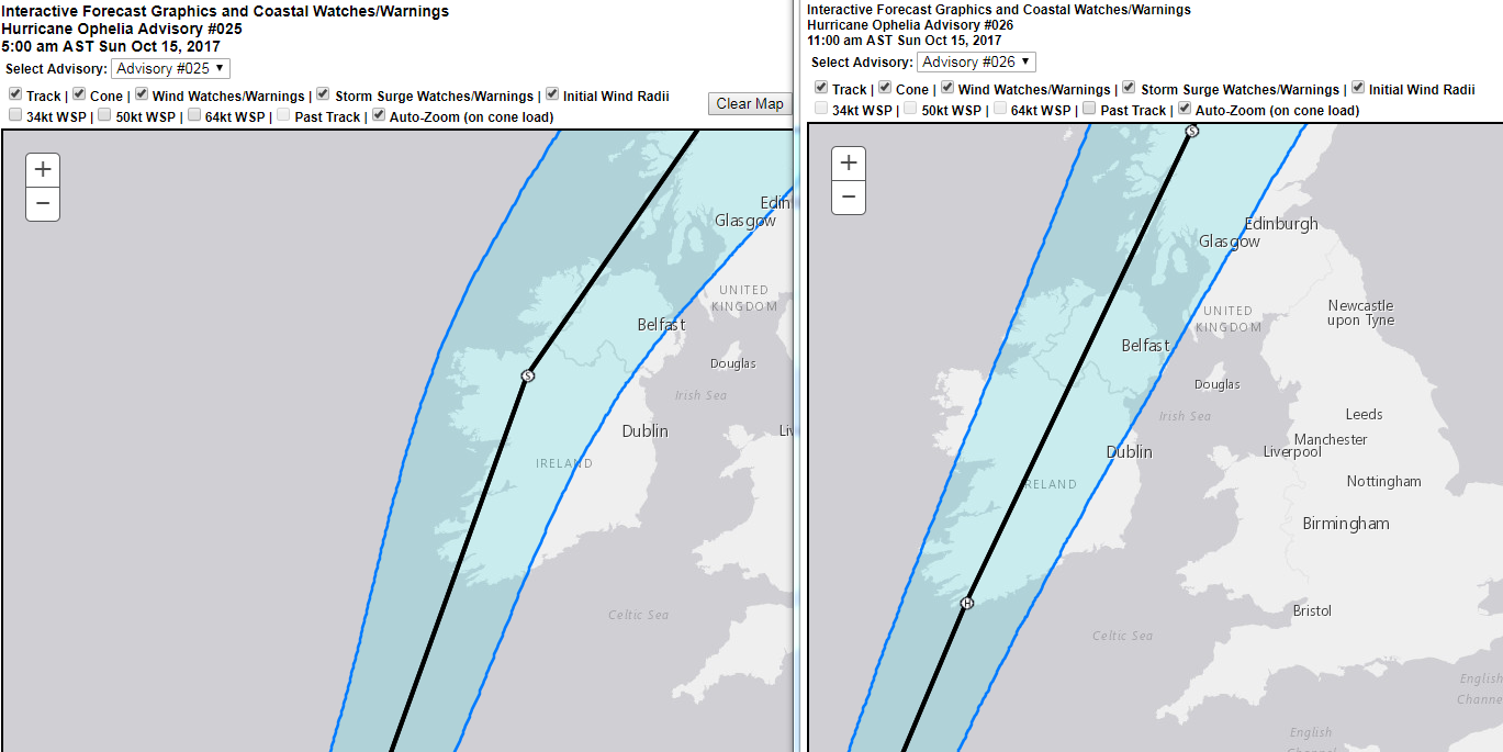
sdanseo wrote: » Track comparison 0900Z vs 1500Z
Gaoth Laidir wrote: » Today's 12Z Hirlam is a slight downgrade on the 06Z. Below shows chart for midday tomorrow (12Z left, 06Z right). Force 10-11 max sustained winds along the south coast with that.
hatrickpatrick wrote: » For anyone who doesn't usually follow hurricanes / tropical systems, remember that the cones on these charts are not the outer limits of the storm's effects - they're estimations as to where the eye of the storm is going to be. So in other words, the black line with the circular H symbol is the best guess for where the eye will go, but the shaded area on either side is the possible error in that forecast. Wind, rain and other effects will extent far beyond the cone - the cone refers only to the position of the storm's centre.
Xenji wrote: » Do you know why those isolated purple patches seem to be popping up around Mayo?
Gaoth Laidir wrote: » They're relatively calm winds. Look at the left of the scale on the bottom, that's them.
Bonzo Delaney wrote: » How far behind live is nullschool.net