Meteorite58 wrote: » Hi Res WRF-NMM 06Z Mean Gust
munsterlegend wrote: » That is again further east.
That is again further east.
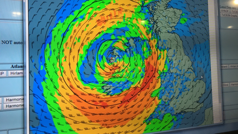
Full Marx wrote: » How is it looking on the east coast? Louth Meath and Dublin? I don't understand these charts at all I'm afraid. Is purple the worst?
amandstu wrote: Is it just a coincidence that the eye is forecast to go up the West coast? Does the landmass act as a kind of guide for its (the eye's) course?
Samaris wrote: » Gaoth Laidir - still getting my head around sting jets. Is that section just to the west of the eye protruding down from north roughly over Galway something along those lines or is it normal swirling winds around the lowest pressure area?
Gaoth Laidir wrote: » 06Z Hirlam, showing Force 11 sustained winds getting into southern Cork/Waterford from around 11 am tomorrow. Peaking at around 60 knots by lunchtime.
shmaupel wrote: » Are the purplish patches that develop around Sligo/South Donegal in the evening time sting jet related? Also, a general thank to all who are interpreting these charts for the rest of us. This board is a real gem, we're lucky to have it.
MJohnston wrote: » No - the colouring of those charts is really bad, those purple patches are actually at the very low end of the scale, so very low winds.
Paully D wrote: » Forgive my ignorance, but that image appears to show Ophelia heading more to the west, and not as much to the south-east as I have seen in other models, no?
WIND: Gale-force winds are expected to begin across southern Ireland by early Monday morning and gradually spread northward across the country during the day. Hurricane-force winds are expected to reach the southern portions of Ireland by Monday afternoon and spread inland across the country into Monday night. Preparations to protect lives and property should be rushed to completion by this afternoon. Wind speeds atop and on the windward sides of hills and mountains are often up to 30 percent stronger than the near-surface winds indicated in this advisory, and in some elevated locations could be even greater. RAINFALL: Ophelia is expected to produce rainfall amounts of 2 to 3 inches (50 mm to 75 mm) with isolated totals near 4 inches (100 mm) through Tuesday across western Ireland and Scotland. Across eastern Ireland, rainfall amounts will average around 1 inch (25 mm) or less. STORM SURGE: A dangerous storm surge is expected to produce significant coastal flooding near and to the east of where the center makes landfall. Near the coast, the surge will be accompanied by large and destructive waves.




![Photo of [Deleted User]](https://w2.vanillicon.com/v2/23cbe5e5e50cebb31e4a86160a77c62d.svg)


